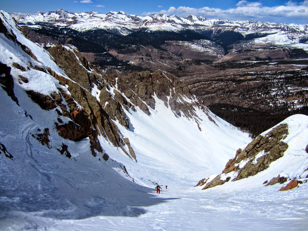
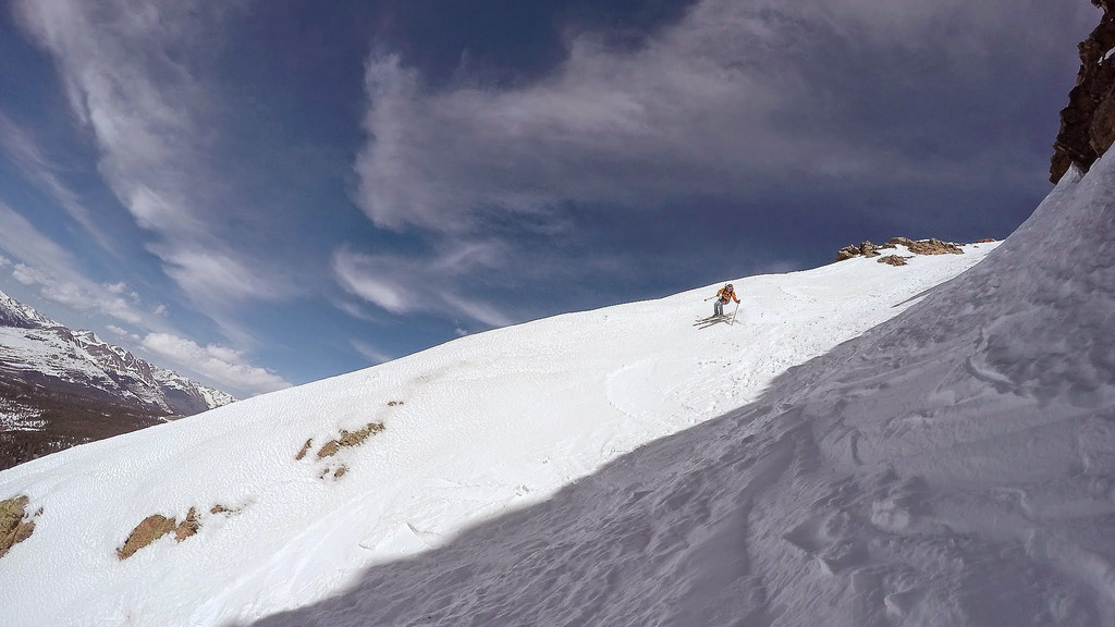
North Twilight’s 4th of July Couloir.
Peaks: Trico Peak (13,321′), Lookout Peak (13,661′) and North Twilight Peak (13,075′)
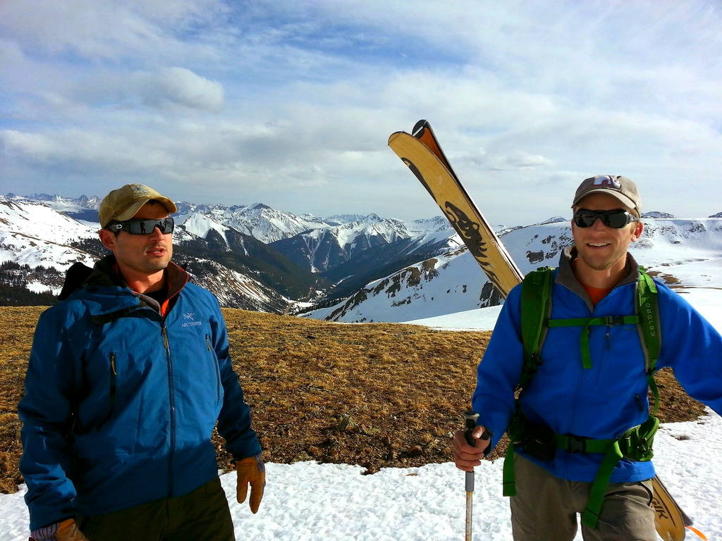
Homosapiens: Me, Rick and Ben
Resources: iPhone topo map app (very handy tool), Trails Illustrated 140 (Weminuche) and 141 (Tride/Silverton)
Food: Pringles, brats, tortolini, habanero mustard, Gatorade energy chews, toffee encrusted cashews, Perky Jerky, oatmeal cream pies, salt & pepper chips, sea salt & vinegar chips, La Cumbre – Ben calls it junk, I call it essential to the survival of the human race
Ben and I had been mulling over a return trip to the PNW this spring for some unfinished business on Adams and Hood. Well mother nature and the snow levels in Washington and Oregon put the kaibash on that idea real quick. Plan B were the Tetons, but we couldn’t find enough sane lines to combine for an extended trip – all of them seemed unreasonably dangerous and the snow seemed to just stop falling once the New Year rolled around. After a huge dump in late February down South, we decided to pull the trigger on the San Juans to hopefully replicate the success we experienced in 2013. Rick, fresh off a sweet heli-trip up north in the Canadian Rockies, rounded out the group at 3 and we were off.
We set off friday morning and as we drove further and further from Denver, I could feel the anxiety and daily rage I experience due to the increasing overcrowding problem flee from my soul. Of course there were a few hiccups along the way thanks to CDOT, but even the ever watchful eye of Sauron can’t keep a couple of fellas from enjoying a few spring descents in SW Colorado. We got to our usual spring spot at the Angel Creek Campground, and of course a massive tree had fallen across the road, blocking easy access. Mother nature loves her petty little tricks. I did say “easy access”, as there was an alternate off-road route just to the left, which we cleared of obvious obstacles and proceeded to find our spot. We quickly established basecamp and then headed out to Red Mountain Pass for some early evening turns to get the blood running after the long drive.
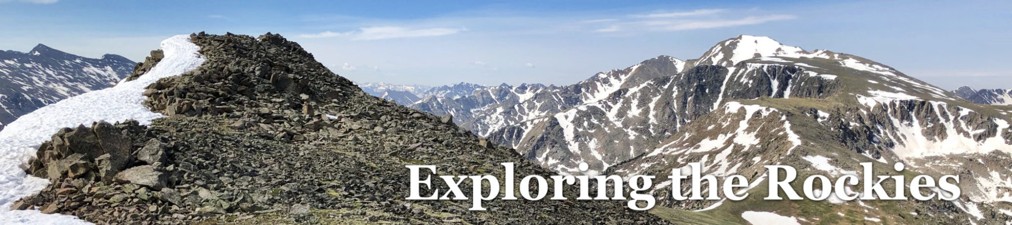
We planned to do Trico Peak, a 13er right off the west side of the pass, about 2.5 miles roundtrip and 2,300 feet. It was a perfect sunset ski.

Working our way up Trico’s East Ridge.
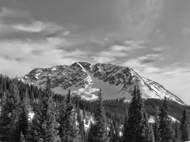
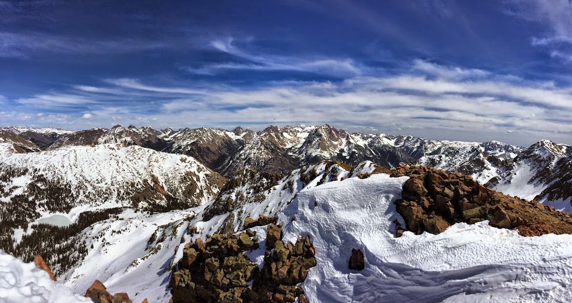
We reached the summit within 2 hours and admired the amazing views:
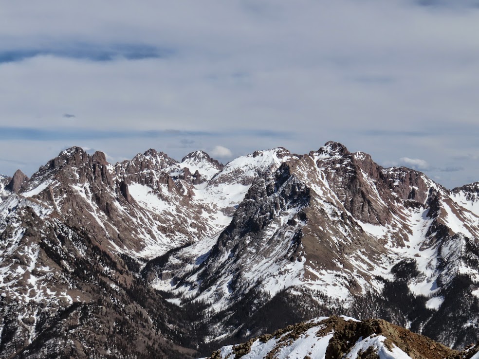
Grenadiers

Pigeon Group
Potosi at sunset
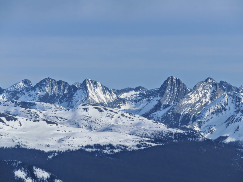
Black Bear Pass was immediately to the south dividing Mineral and Ingram Basins, and was still mostly covered in snow. Amazing many 13ers there are along the ridgelines coming off Trico. Upon first thought, one might think climbing all the 13ers could be feasible, but then you scroll down the page for 30 seconds and realize you looking at just one range. Kudos to anyone stubborn enough to pursue it!
We knew going in to this sunset ski the conditions would be crunchy and, well, they were. But that’s not the point of sunset skis anyway, so whatever. We were over 300 miles from the cluster f**k that is Denver and that’s all that mattered. Some shots of the ski:
Probably having a “lighthearted” conversation about illegal immigration, CDOT or cheap labor in China.

Rick with an inspiring backdrop.
We were able to ski all the way back to the car and made way to Angel Creek for some post-climb festivities, one of which included watching Rick’s whisper-lite going up in flames….

Notice there are 2 separate fires going on here….
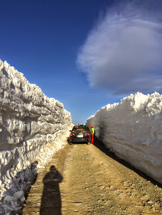
The road was gated 4 miles before the actual TH, so we began to discuss options for Saturday, as walking 4 miles on bone dry road was simply not an option. I’m not entirely sure what the deal is with that road. I’ve been down there, in April, with no issues with the road whatsoever on some years, and then you have years like this, where they gate it as the miners come and go. I have my theories, none of which really matter, but the most likely is a couple of clueless assholes that decided to block the road to the mine while they go gape out in Yankee Boy, forcing the mine to just shut the road down till the snow melts enough up the road. My opinions and assumptions on the matter are blatantly fueled by emotions, as Camp Bird was the scene of the crime when my old Subaru got vandalized and urinated in a couple springs back.
Anyways, a fine alternative was found eventually as we all agreed on Lookout Peak, as Ophir Pass was open on the east side all the way to the pass, there was snow reported recently on the southern slopes and it was a new peak and area for all of us.
As we were approaching the pass, the Rick recognized an old friend and requested a moment alone with the snowbank……
Snowbank to Rick: “Rick – I don’t have much longer. Pretty soon, I’ll be all melted out and this place will be overrun with gapers and their Jeeps, I’ll just be a puddle for them to run over. Give me one last reacharound before I succumb to this fate. When you are done giving me this golden shower, will you do this for me? Oh, one more thing Rick. If you enjoy smearing mud on your ass, then smear mud on your ass and just be honest about it”.
We backtracked to where the rest of the cars seemed to be parking these days (mainly for the nearby Opus Hut) and geared up.

Another old friend…
The day was supposed to be on the shorter side. The GPS said 3.5 miles and 2500 feet when all was said and one. This area was incredible……

Ophir Pass region with Pt.13,156 in the back.

Our route
Making our way up to the base of Lookout with South Lookout in the background.
The line to the summit ridge was probably around high 30’s and warming up quick. Unfortunately, by the time we reached the summit ridge, the blue sky disappeared and it was nothing but grey skies. We were hoping the surface temps would keep the snow from getting too crunchy. The top 150-200 feet were void of snow and some scrambling on loose rock was required to reach the summit. This chafed my ass a little, but the views made up for it…..

Looking down in to town of Ophir and the Wilson Group.
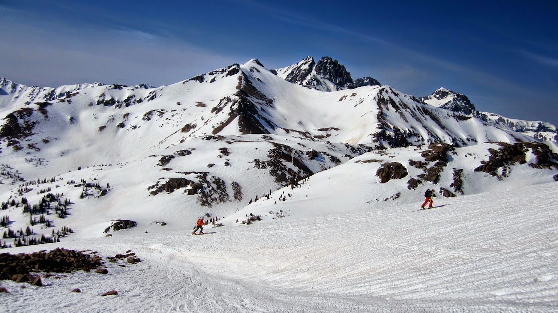
And the descent wasn’t too shabby…..

Classic San Juans.
We were able to ski back down to car again. This was a welcomed commodity, as Sunday’s objective – North Twilight – was going to be the opposite of straightforward. We enjoyed the mild weather, with the sun trying to pops it’s head through the clouds. That night, we soaked in the Ouray Hot Springs in anticipation of a LONG day. I savored every last moment of my time in there, as tomorrow was going to hurt.
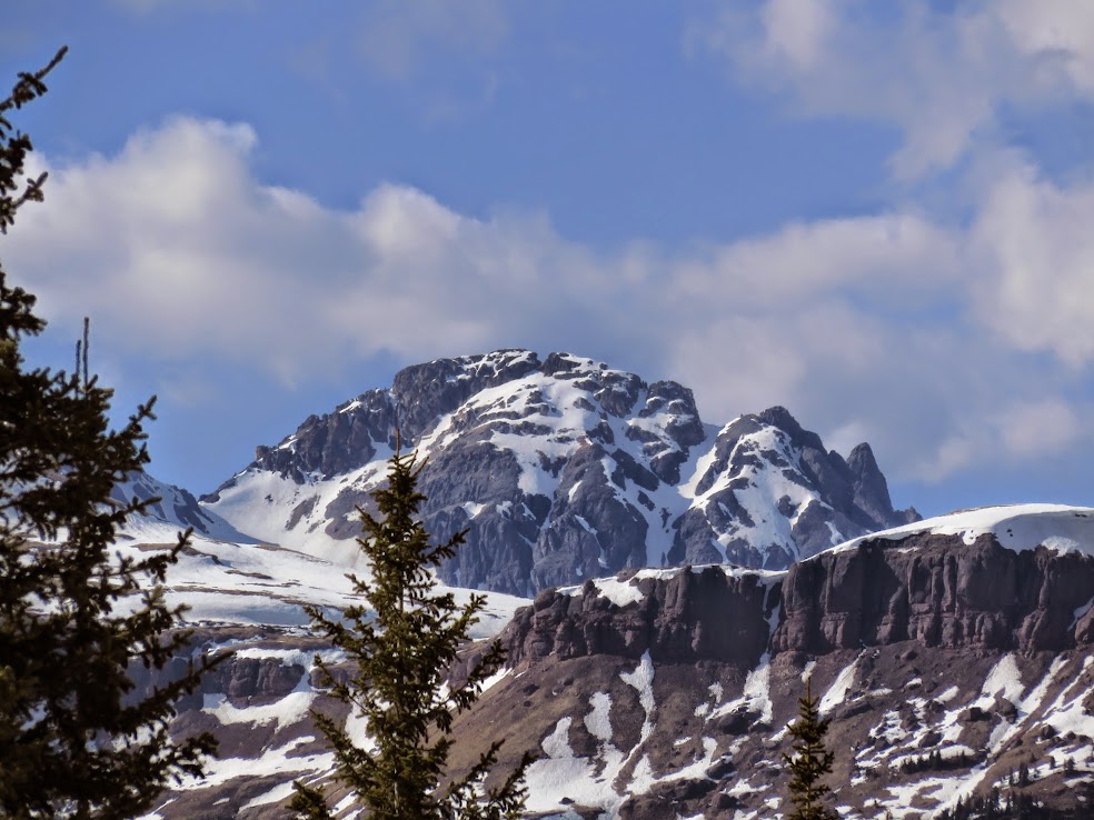
The drive over Molas Pass the next morning offered us up a real treat en route to the Andrew’s Lake TH:

Good morning San Juans!
We had to park right along 550, as the road was snow covered all the way to the highway (had to park across the street in a wide pull off as the Andrews entrance had no parking signage). It was a quick, flat skin to the lake, then the route finding began immediately. I’m not gonna even begin to try to describe this route in detail. All I can say is bring a GPS – either on your iPhone or a Garmin. Make sure its at full battery and use it religiously throughout the day. I used to stubbornly rely on map and compass and I can say with confidence we would’ve ended up in Durango without a GPS on this day. Also – prepare to skin uphill going in and out, prepare for annoying undulation throughout, prepare to skin 6 to 7 miles and gain barely 1000 feet – basically prepare for hell, but a one that is worth it in the end.

This view made the spirits soar.
During one of our food breaks, I noticed something wrong with my Freerides, which I was forced to use on this day since the Dynafit compatible boots murdered my feet. The toe piece of my left ski was completely missing the back 2 screws and were held on by the front 2. At this point, we were too far in to just give up and turn around, so we decided to just soldier on and hope for the best. Didn’t instill a lot of confidence though.

Now I know why they make you sign that liability waiver. So when they forget to drill 2 standard screws in the toe and you go yard saling down a 2000 foot couloir 8 miles from civilization – the joke is on you. Brilliant! I guess its time to add a lightweight DeWalt on future outings.
Miraculously, despite the Freerides sounding like a creaking saloon door from 1885, they held out. On a side note, word of advice. Instead of trying to follow the summer trail all the way to Crater Lake, the most efficient way to get to the base of 4th of July Couloir is, when you traverse around that annoying ridge that sticks out west from Snowden and you have North Twilight in your view, continue to follow the summer trail through the open meadow, and just as the trail leads you in to the trees, make a traverse between the 11,200 to 11,400 contours basically on a beeline straight south to the base of the line. It’ll save you a lot of heart ache, headache and time.
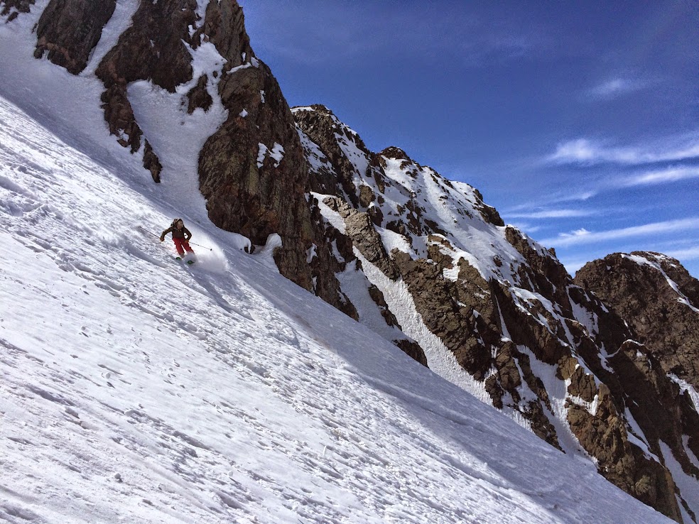
Some shots of the climb, the summit and the ski – no use trying to put words to this outing:

Engineer Mountain

In the meadow with Twilight in view before re-entering trees.
I was f’ing far behind the herd on this day.
Nearing the top.

Tough to find a finer view than this.
Name all the peaks and get a La Cumbre!
Ruby Basin
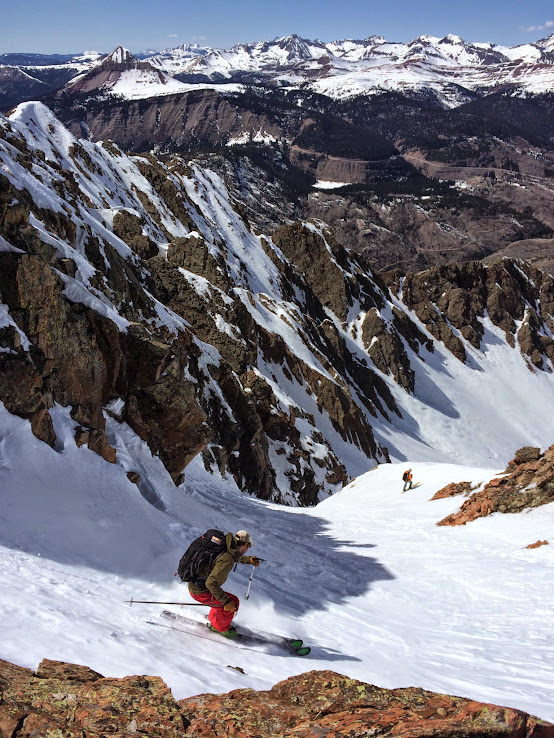
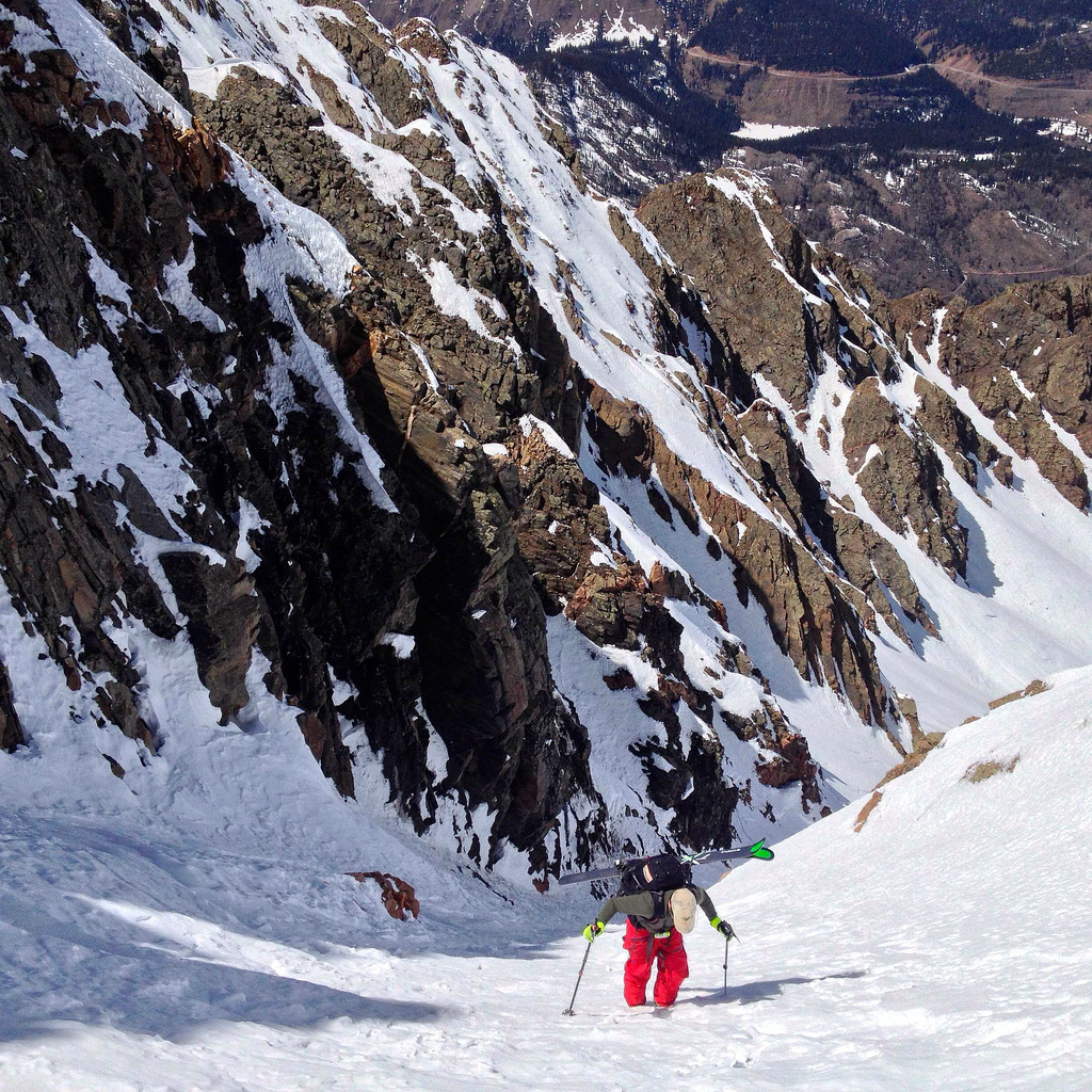
Dropping in from the top.
Ben working through variable snow conditions.

Finding corn in the sun.
Powder down low.
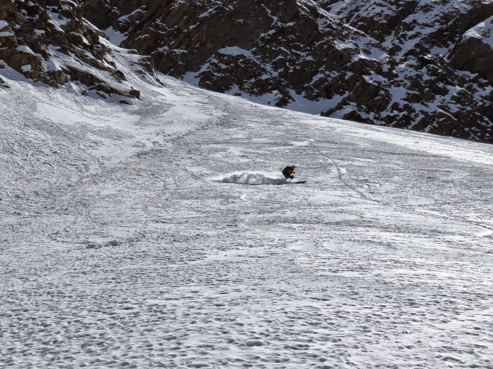
…and powder all the way down to the apron.
The dreaded skin out was now upon us. We had to don skins immediately after skiing the line, entered the woods from a meadow below North Twilight, skinned towards another brief meadow before getting in to thicker trees, maintaining an approximate 11,200-11,400 elevation, crossing Crater Creek and rejoining our skin track from earlier in the day in the meadow around 11,400 which led us to the promised land (well, eventually). Got a glimpse of this guy over yonder on the way out, amidst the blood, sweat, tears and 4-letter words….
Ulysses S Grant
All in all – a solid weekend that we kind of pieced together as the weekend progressed. What we ended up skiing was vastly different from what we originally had in mind, but the spontaneity was what made the trip interesting – always has, always will. Can’t say the snow was top notch, but it didn’t suck either and its melting FAST. Not a bad life camping out, feasting, skiing peaks, soaking in hot springs and leaving your responsibilities behind for a couple days. A couple new things I learned about the 550 corridor:
1) Cavallo’s in Ouray is a solid place to get a breakfast. Rock f’ing solid.
2) Its good to maybe have a couple saws in your trunk this time of year, if you plan on using unmanned campgrounds
3) Never realized Ophir Pass was such a playground. Big, long lines galore and it gets plowed.
4) Camp Bird is an enigma. On lower snow years in the San Juans, you have to be real motivated to hit lines in YBB with an additional 4 miles walking on dry road. Who knows why this is the way it is, but it’s something to consider when planning your exploits down there
5) Ouralehouse is still around – right next to Maggie’s Kitchen on Main St. Was tough to find.
6) In case you didn’t notice – Ben skied North Twilight in jeans.
Thanks for reading.

A general overview of our route on N.Twilight. The line is in red – for blood!
La Cumbre is junk, blasphemy! Looks like a solid trip with great weather.
That snowbank is pretty damn funny.
A lot of wit in this one Helmut – whisperlite explosions, and Ben skiing in denim??? I didn’t realize that N. Twilight was the 4th of July couli. Kind of cool that I got it on 7/4/11, then. So many options down there and I hear there is a Naked Lady in that area that may be of better service than Rick’s snowbank.
Beautiful pics!
wow – 7 miles and you gained 1000 feet – now that is a trek – great pictures and a great trip TJ
Nice write up B. Fun weekend gents, let’s do it again soon!
And Scot, that snow bank is a giver!
Damn fine weekend down south, fellas! Ben, jeans, buddy? Dude, you are my hero. I love it!
Nice recap of the weekend Colonel. A few things…
1. That shot of Slate Creek/Box Car is sweet! Probably the best I’ve seen and it really shows the nature of that route well and how the couloir connects the upper-cirque to the lower-cirque.
2. That shot of Ruby Basin from the top of Twilight is incredible and that entire line off the west side of Pigeon down into North Pigeon Creek is visible. Next year or the year after we should hit that and West Needle from the train stop. I’d pay for the train again to make that happen.
3. Scot/Brandon, post hot springs the night before Twilight I was in such a tired and relaxed stupor I managed to leave my ski pants in the locker I was using to change at the hot springs. The rest is history, but I must say, with a pair of thermal underwear on underneath, the jeans did a fine job. Wouldn’t want to get caught in a storm with them though. I’m not sure how Detterline has dealt with that.
Glad we were able to put this trip together Rick and Brian. Twilight was a long time coming!
Nice job gentlemen! Glad to see you guys got out there and had a great trip. So much potential in the San Juans, hopefully the snow hangs on long enough to get some descents this year myself.