
Peaks: Mt. Silverthorne (aka Willow Benchmark – 13,357 ft) & “East Thorn” Peak (13,333 ft)
Date: 9/1/14
Distance: 14.5 miles
Elevation Gain: 5,200 ft
Climbers: Zambo & Benners
Mt. Silverthorne to “East Thorn” Peak
Every now and then you have one of those days where just about everything goes perfect. It maybe happens only a few times a year, but when it does, it makes for a great day. One of those days where all your plans, schedules, weather, conditions, routes, partners and peaks come together in harmony. Or, to steal an old saying from Benners, the day is just totally “stress free” and you hit the car feeling “refreshed” instead of beat.
Labor Day in the Gores was one of these days for Ben and I – easily one of the best days we have had in the hills this summer. A good reminder of why we do this stuff at all.
Leading up to this trip, we each had separate plans for the Labor Day Weekend, but as circumstances changed for whatever reasons, we both found ourselves looking for something a bit closer to home. Wanting to avoid the inevitable hordes of a beautiful holiday weekend, as well as stay close to home, we decided to head up Mt. Silverthorne and its lower neighbor, “East Thorn” Peak. Plus, these two peaks are in the Gore Range, which made it a no-brainer. Ben is already a borderline Gore-fanatic, and I am only too happy to plow ahead full-steam in that direction.
Choosing to block out any and all fears of a cataclysmic I-70 traffic apocalypse on the drive home, we left Denver at 5:00. We both bagged over 7 hours of sleep the night before, which frankly, might be the single most underrated thing in all of climbing. Either that, or I am usually just too young and stupid to fully appreciate a good night’s rest before a climb – something that is rapidly changing as I get older.
We parked at the Gore Creek TH in East Vail shortly after dawn. We saddled up with light gear, wanting to move quickly and tackle the long approach as smoothly as we could. The drainage coming down from Red Buffalo pass was about as good as can be expected; we made quick work of the 4 miles and 1,400 vertical feet thanks to the excellent trails. Unlike a lot of the rest of the Gores I have seen this summer, there was no deadfall on the Gore Creek Trail – looks like they have done some work this summer. We took our first break at the turn off to Gore Lake and site of the Recen Brothers’ grave.
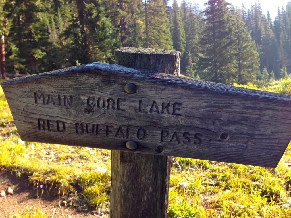
At the turn off to Gore Lake. (Zambo)
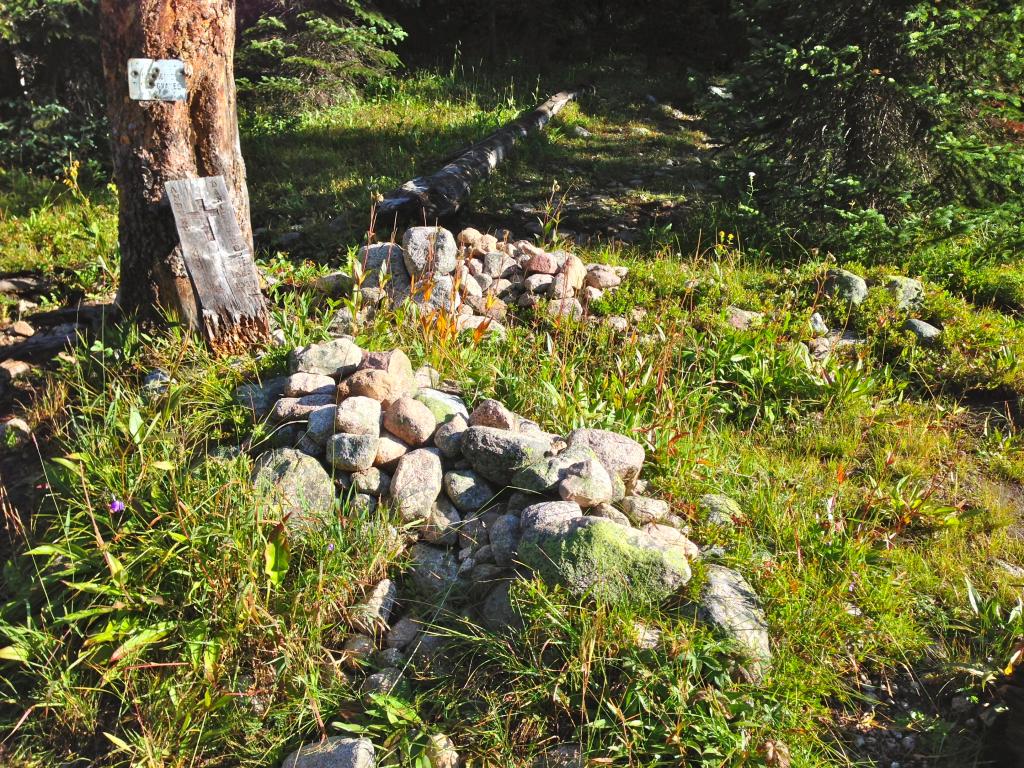
The Recen Brothers’ graves. The sign reads: “ANDREW RECEN: BORN 1842 SWEDEN, DIED 1912 GORE. DANIEL A RECEN: BORN 1832 SWEDEN, DIED 1917 GORE.” (Zambo)
Ben and I were both fairly intrigued by this spot. We had not really done too good of homework before this climb, so we were both pretty surprised to not only see a sign marking the burial spot, but two actual built-up graves. I don’t think either of us had ever seen a grave quite as pronounced as these two, right in the middle of a wilderness area.
I love history. My curiosity got the better of me and I did some light researching on the brothers when I got home. It turns out they were both prospectors who helped found the nearby Colorado towns of Kokomo and Recen. Both of these are now ghost towns – a product of the inevitable boom-and-bust cycles of Colorado’s early mining days. But I was able to find this interesting anecdote about the brothers:
“America’s streets were paved with silver for two young Swedes, Daniel and Andrew Recen, who emigrated to Colorado in 1876. Dan promptly discovered the dazzling Queen of the West mine on Jacque Peak near Vail Pass. Andrew struck silver at the adjoining Enterprise Lode. Soon the brothers tarried with 1880’s silver magnates such as H. A. W. Tabor and celebrities such as songbird Jenny Lind. The Recens hired private rail cars for bachelor parties and consumed champagne and oysters with extravagant regularity. After the 1893 silver crash, the Recens found themselves almost penniless. They hunted and trapped all through the Gores till their deaths in 1912 and 1917 (It is not clear here who died in which year). Their graves lie near their longtime cabin site on Gore Creek. The brothers, who lived and died here, left a legacy in Colorado. When Dan died, his nephew from Frisco transported the body up here for burial. A fierce October blizzard struck en-route and the nephew, after digging the grave, waded through drifts all the way back to Frisco. Half-frozen and exhausted on arrival, he was cared for at Frisco’s Excelsior mine till the weather permitted his return home.”
Source: http://www.evld.org/sites/default/files/Gore_Creek_Graves1.pdf
Whatever their stories were in this life, the brothers certainly found a beautiful spot to be remembered as they passed on into the next… (Zambo)
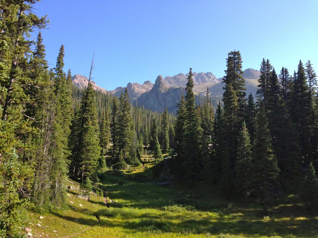
Anyway, Ben and I got set again and trudged on for approximately another mile on the excellent trail. The grade noticeably steepened at this point on, but it bothered us little as the relatively flat approach had been a good chanced to get warmed up.
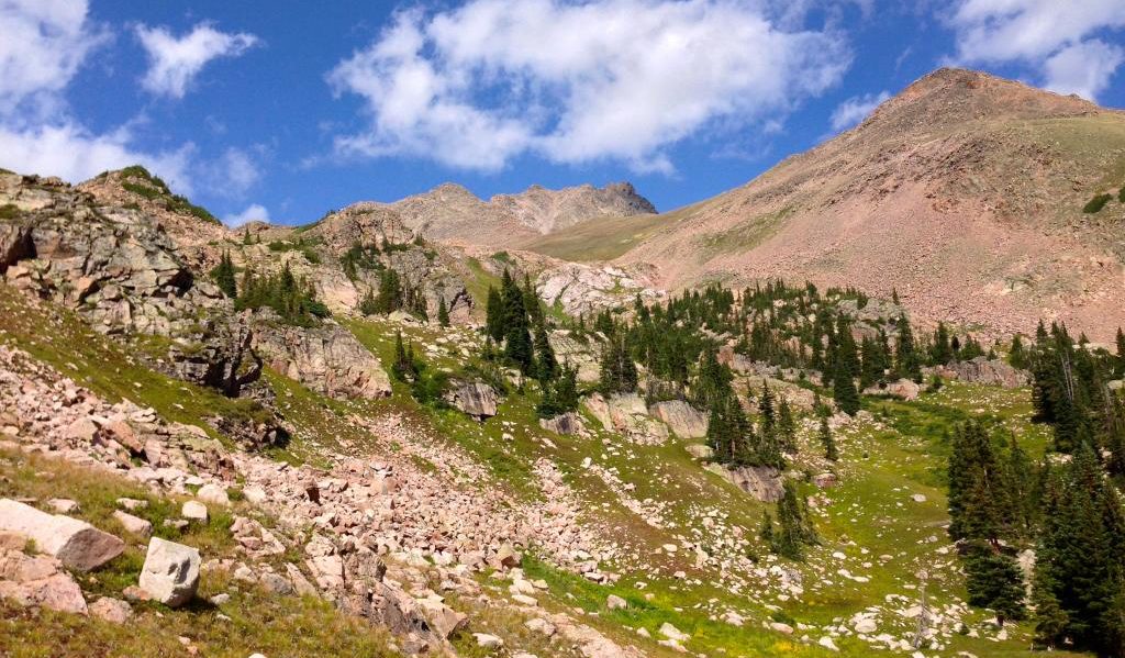
We paused again to survey the route near the open meadow at 11,000 ft. We knew from reading an old TR of Furthermore’s that we needed to leave the trail in this area if we wanted to ascend Silverthorne’s gentle South Slopes, as opposed to a nasty gulley further up the valley. We could see a cliff band that ran south to north that blocked passage apart from turning now. Fearing an infamous Gore bushwhack, we left the trail as close to the cliffs as possible, trending northeast beneath the lower boulders to avoid any scrambling. Much to our surprise, while the terrain was steep, it actually went through very well with minimal bogs, fallen trees, wet grass, mosquitoes, or any other concoction that Lord Gore so often likes to throw at climbers. We broke the trees soon thereafter and got the first solid look at the peaks above.
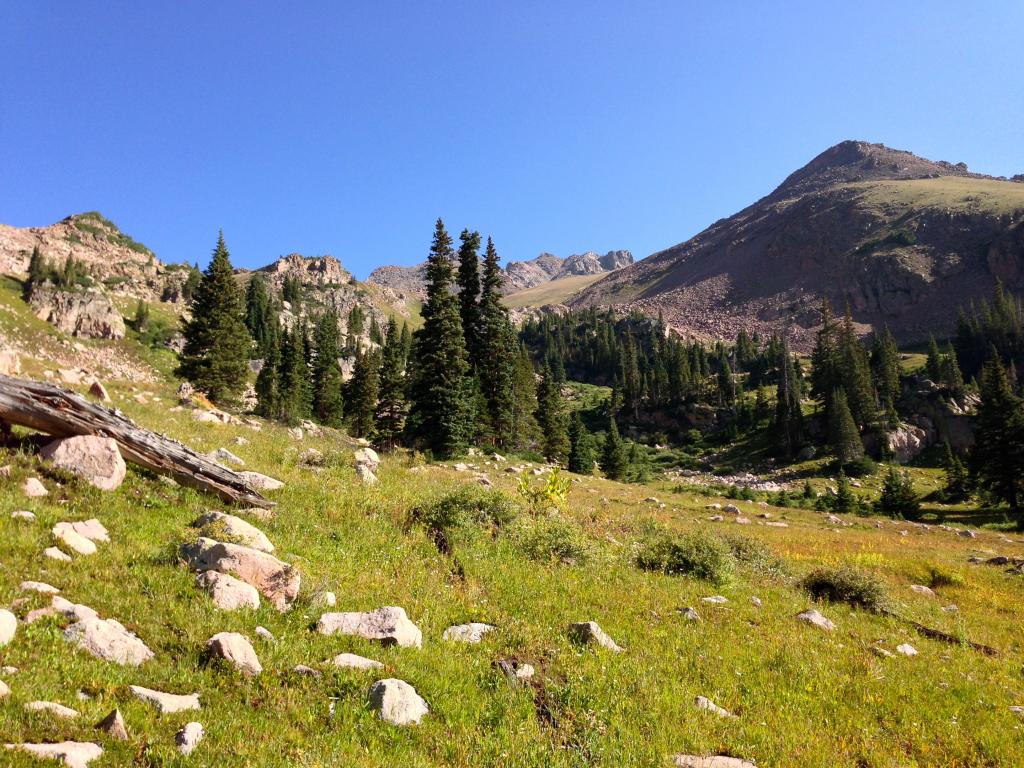
Breaking the trees and looking up at Mt. Silverthorne’s south slopes. These gentle, grassy hills made for a very comfortable and quick ascent. (Zambo)
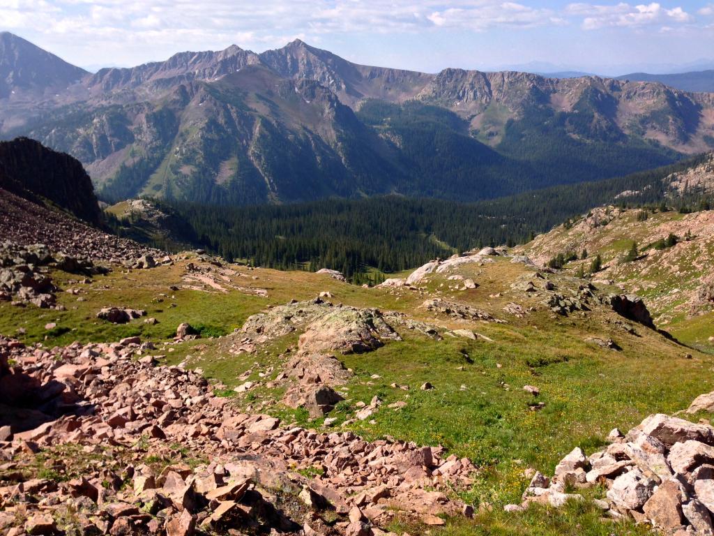
A bit higher now, looking back down towards the approach and the 12ers guarding the southern end of the range. (Zambo)
The grass made for fast passage as we scurried up to the low saddle between Silverthorne’s South Ridge and Zodiac View (12,505′). With the wind down, the sun out, and the temps warming, this was a great chance to take in the amazing views from this spot.
Looking east, left to right, towards Snow Peak (13,024′), Mt. Valhala (13,180′- summit hidden), and Hail Peak (12,904′). (Zambo)
Snow Peak. (Benners)
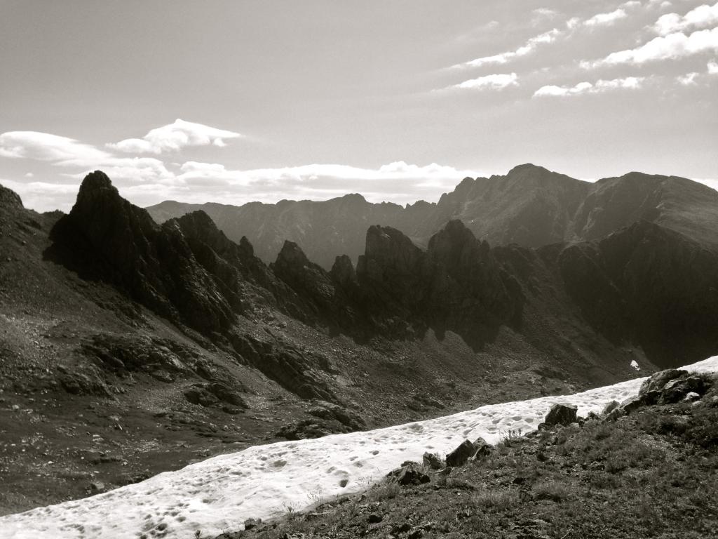
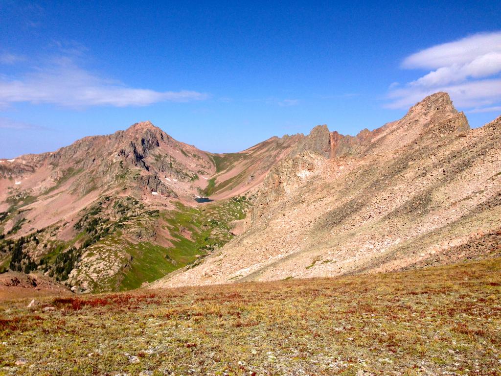
The Zodiac Ridge connecting Red Peak to Mt. Silverthorne. Wow. (Zambo)
The views from the saddle are good in every direction, but looking over to the Zodiac Ridge is the real treat here. This short, yet intense spine of towers, cliffs, and rock looks to be about as challenging as anything you could find in Colorado. The complexities and challenges of climbing this ridge were saved for another day for us, but the intrigue remains. For anyone curious, Brandon Chalk and J Weingast put up an excellent TR detailing some of the challenges and complexities of the ridge from 2013. It is worth the read for any Gore and/or scrambling enthusiasts out there.
For Ben and I, the journey up Silverthorne continued.
To this point everything had been going very well. Looking up and ahead, we had little reason to believe that would change. The last 800 feet or so from the saddle looked straightforward enough. We had one more grassy slope to cover before hopping on to what appeared some nasty talus. The true summit of the peak was hidden beyond the jagged south rim.
A view of the route (more or less) up final 800 feet. The ridge is a potential option, but the gullies went straightforward enough with almost zero actual class 3. (Zambo)
A bit closer now, with the south-facing gully coming into view. (Zambo)
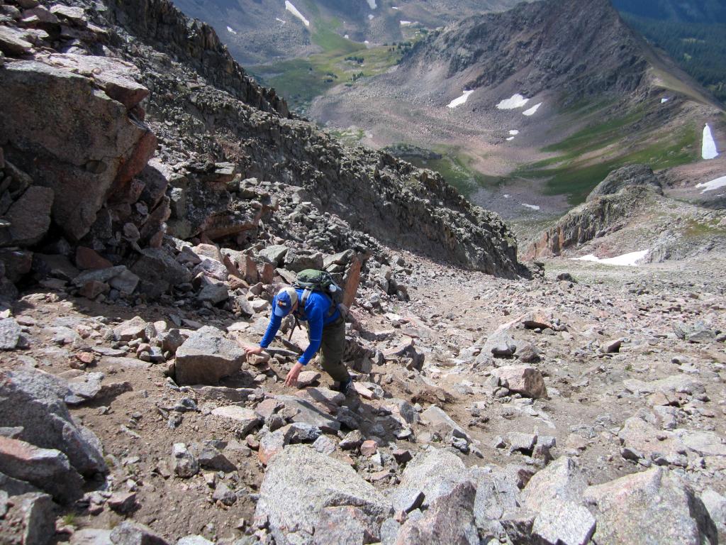
The gully was about as expected: a combination of loose choss, shaky boulders, with a bunch of kitty-litter mixed in between: ‘Class 2 Suck’ as I like to call it. There probably are easier/more straight forward options on the solid rock surrounding this, but the angle was relaxed enough that we just decided to go for it. (Benners)
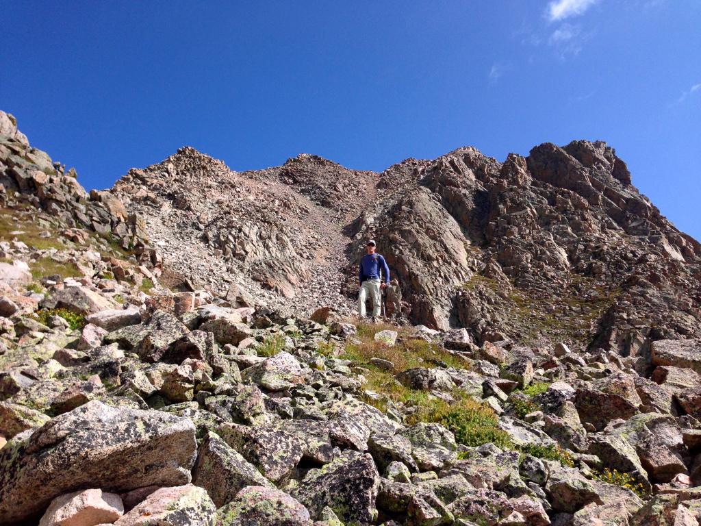
The true summit of Silverthorne is hiding behind a low sub-summit just off the top, rounding the corner, we were very pleased at how relatively straightforward and simple it had been to gain this 4,500 vert for a spectacular Gore Peak. Some low clouds threatened, but not enough to spoil the fun of being up there.
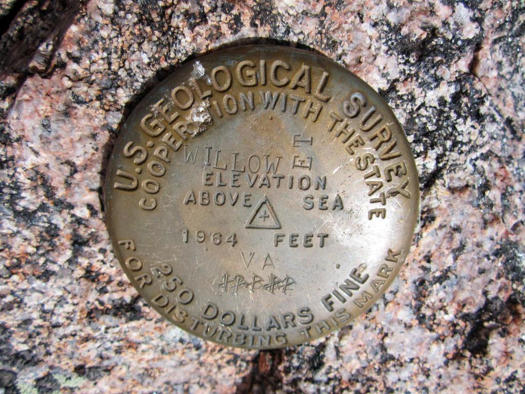
No register was to be found, but “Willow” is stamped on the USGS marker. As an aside, I always wondered how they would enforce the $250 fine up here. (Benners)
Looking north to Rain Peak (13,130′) from the summit. (Benners)
Looking north into the heart of the Gores. (Benners)
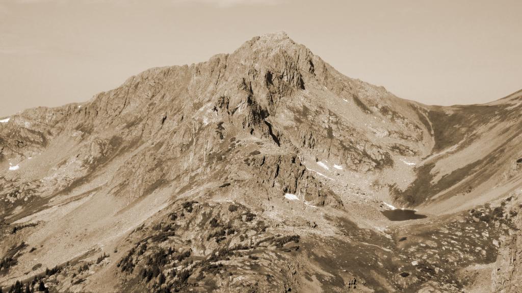
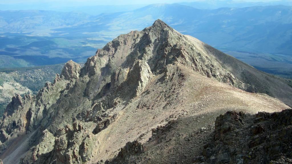
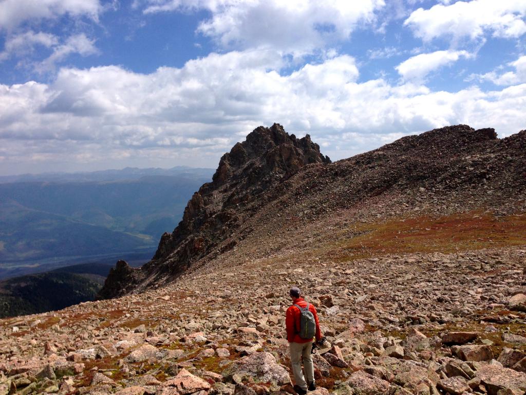
With some low clouds building, we decided to get a move on and hoof it over to “East Thorn” Peak, Silverthorne’s slightly shorter, unranked neighbor. However, what East Thorn lacks in relief, it makes up for in ruggedness. This was the only part of the day which had really given me any pause, as East Thorn looks fairly ferocious from my typical vantage point of the town of Silverthorne. The view from 13,300 feet and to the West is no less stunning. East Thorn is a fairly uniform pyramid with a maze of jagged and pointy spires all around the summit. We thought it was possible to climb without finding too hair of terrain, but we were not entirely sure. From Silverthorne’s summit, it certainly looked like we had spied a reasonable route, but there was only one way to find out.
Looking East towards East Thorn from the summit of Silverthorne. (Zambo)
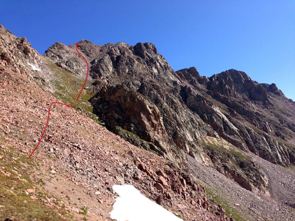
The distance between the two peaks is only a half mile, and it actually goes very quick. The first 3/4 is all just class 2 saddle until reaching the base of East Thorn’s final tower. (Zambo)
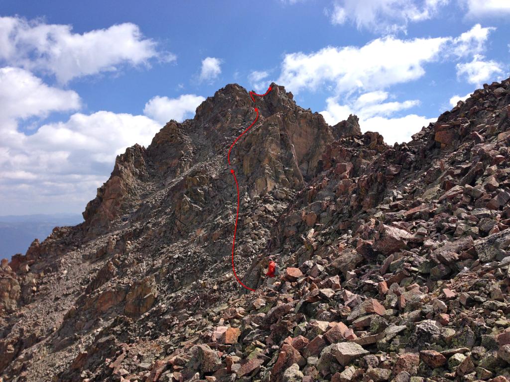
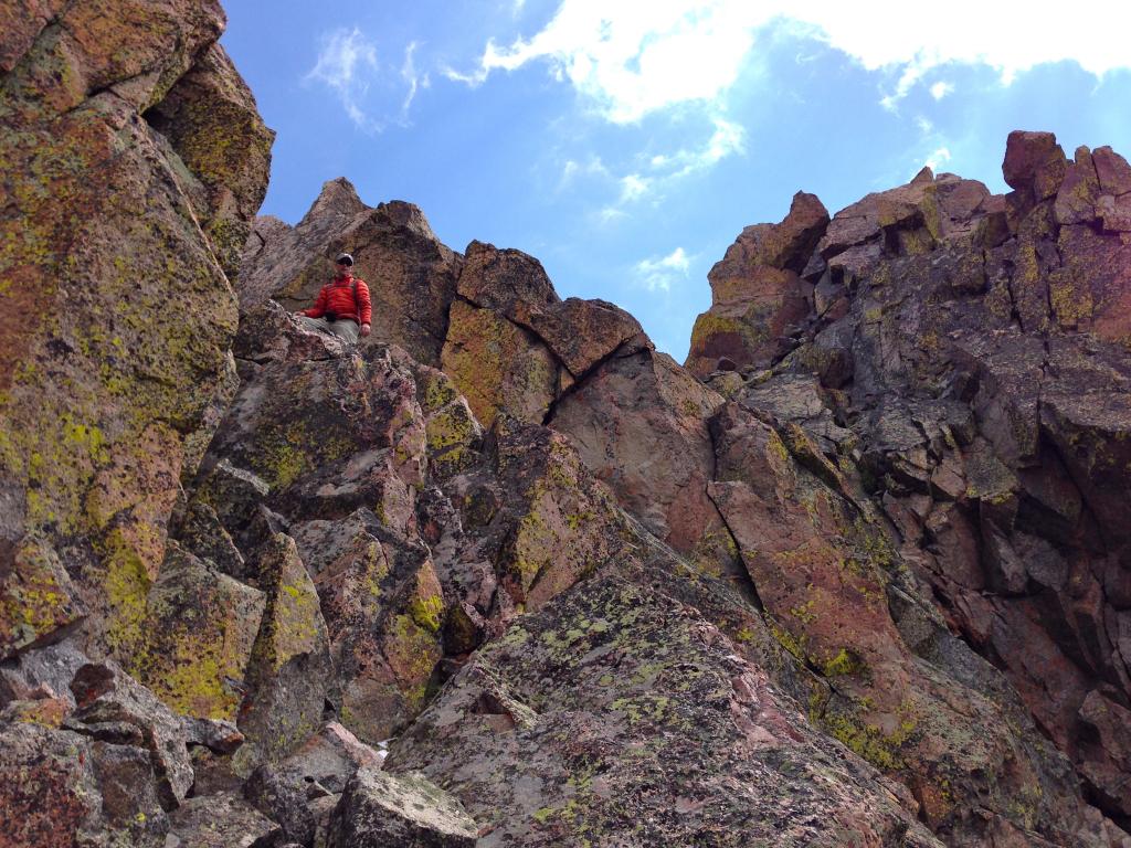
Benners nearing the latter difficulties, with a rough outline of our route drawn in. (Zambo)
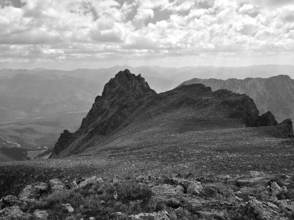
Looking back on Silverthorne from the East Thorn saddle. (Benners)
The majority of the traverse over was very straightforward. Easy talus hopping led us beneath some cliff bands on the north side of the ride as we dropped some 50-100 feet below the saddle. As we started to gain again, we soon realized it was really only a matter of ascending some 200 feet up class 3/4 terrain. The early portion of the climb presented several options, while the closer we got to the summit, the choices narrowed until a series of final, exposed class 4 moves to the true summit. An interesting final boulder move forced us to lean out over some hefty exposure to the southwest; it reminded me of the last move to reach the top of Mt. Wilson.
Overall, the final pitches involved plenty of class 3 &4, with perhaps a very low class 5 move or two thrown in between. But despite that, we felt it all to be quite manageable. This sporty finish makes for a great summit on a fine peak. The dozen or so names which had signed in on the register in 2014, confirmed the solitude of this place.
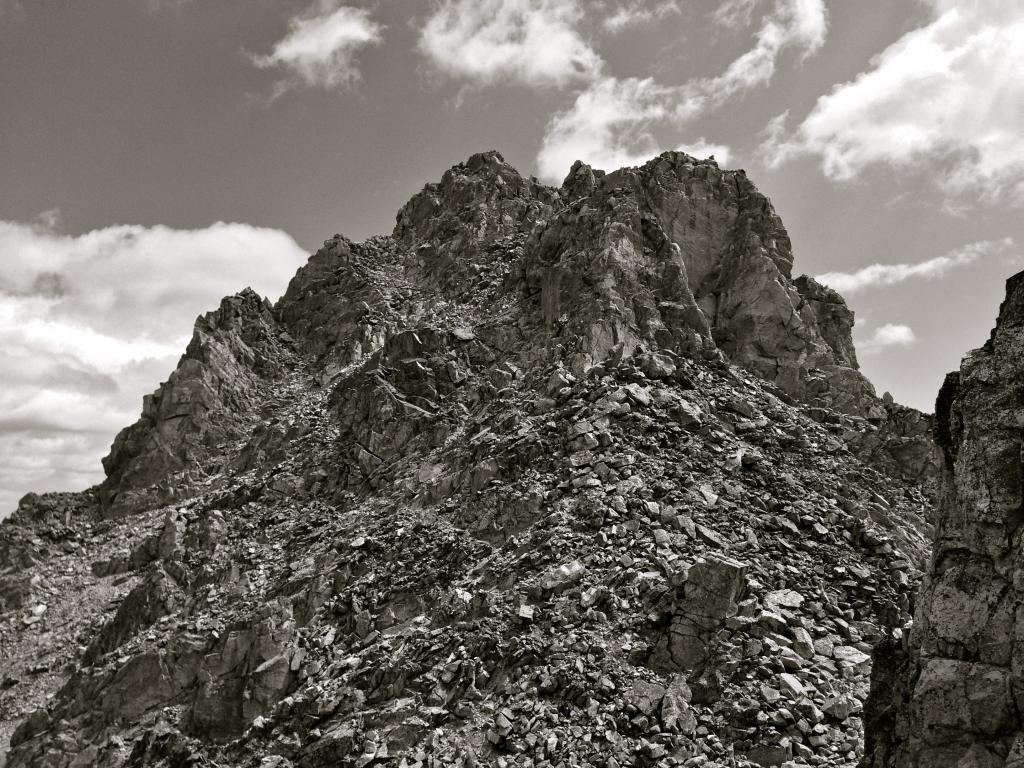
As usual, it looks much scarier than it is. (Zambo)
The final moves of the peak. Lots of fun to be had in here. (Zambo)
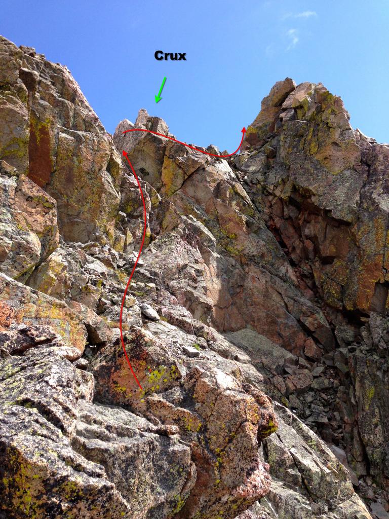
Zoomed out a bit, with our approximate route drawn in. (Zambo)
The summit of East Thorn was a fun one for me. My family has a cabin near the Willowbrook neighborhood of Silverthorne and the views are dominated by East Thorn and Rain Peak. There is just something extra fun about reaching a peak you have stared at for years on end. And of course, the views from the top were not too bad either.
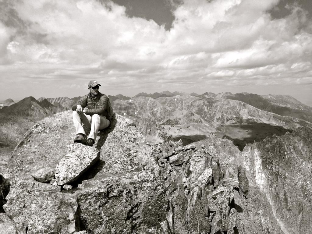
Benny taking it all in. (Zambo)
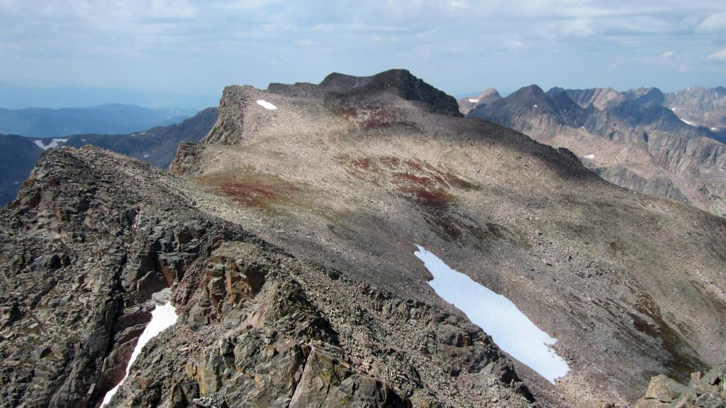
Looking over towards Rain. Nothing but snowless graupel left in the Graupel Gully. (Zambo)
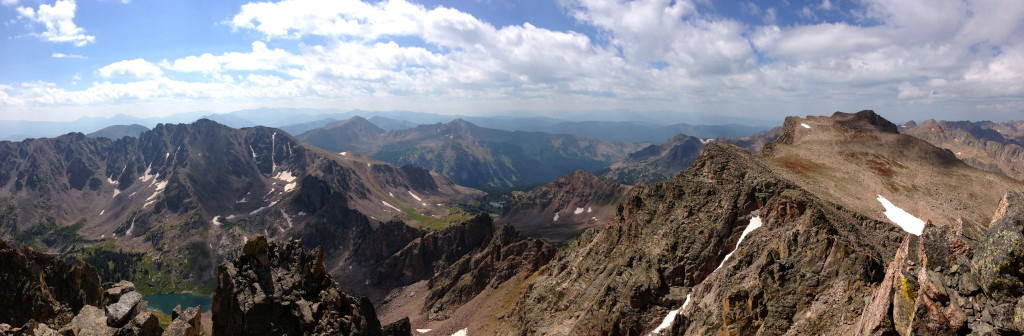
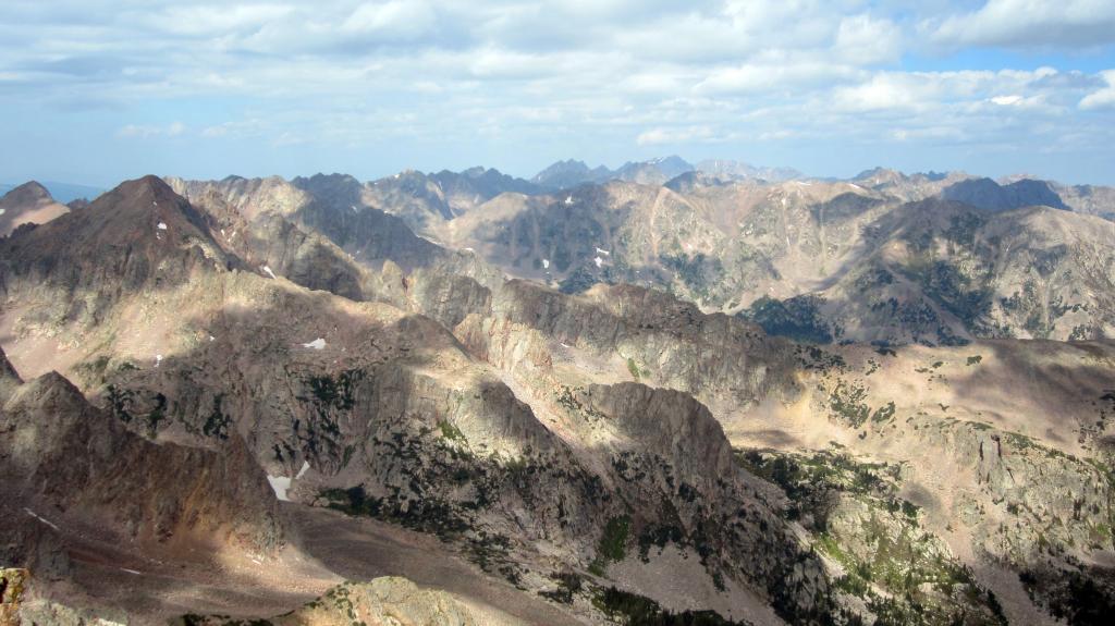
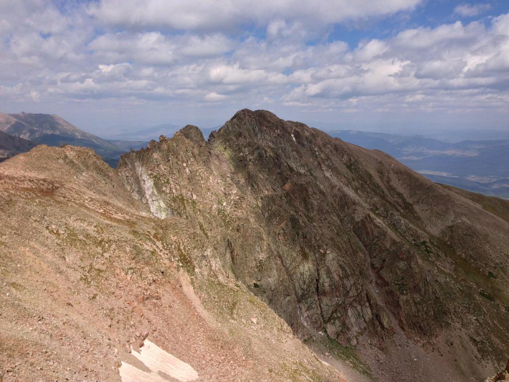
Stunning panoramas from the summit of Red Peak, Zodiac Ridge, and Mt. Silverthorne. (Zambo)
The down climb off of East Thorn went by in a flash and we were soon over on Silverthorne’s summit again, except this time the clouds had broken the day was shaping up to be nothing but spectacular. We had some mixed discussion about heading over for nearby 12er Hail Peak, but a waiting BBQ in East Vail and a lazy summit lounge sounded more appealing. Instead, we we took a full hour just to relax and enjoy the top.
The way out was as easy and straightforward as we could have asked for. To be honest, it was probably the best time of the whole day. Ben and I got a chance to just debrief on all kinds of stuff happening in our lives. We’ve had a number of tough life situations happen over the past few months involving mutual friends, and it was just really good to take some time out to reconnect on all of it. Few things forge or reveal friendship like the mountains. It was good to use the time to talk and process together.
With the last few miles approaching rapidly, we actually decided to jog it out, much to the chagrin on many out-of town gapers enjoying the first mile or so of Gore Creek. (My favorite question from the parking lot: “Hey, do you guys know anything about the famous scenic drive near Vail??” After a few confusing minutes, we realized they were talking about Loveland Pass….)
Anyways, when we hit the cars, the most appropriate word for the day seemed to be “refreshed”. Despite the 14.5 mile, 10 hour trek (it could have been faster but we opted for plenty of lazy breaks) we felt as energized as ever. I guess the combination of a summer’s worth of hiking and the distraction of good conversation did us good.
So, another fine Gore summit in the books. Until next time, Happy Climbing!
Post Script: A route overview for those interested.
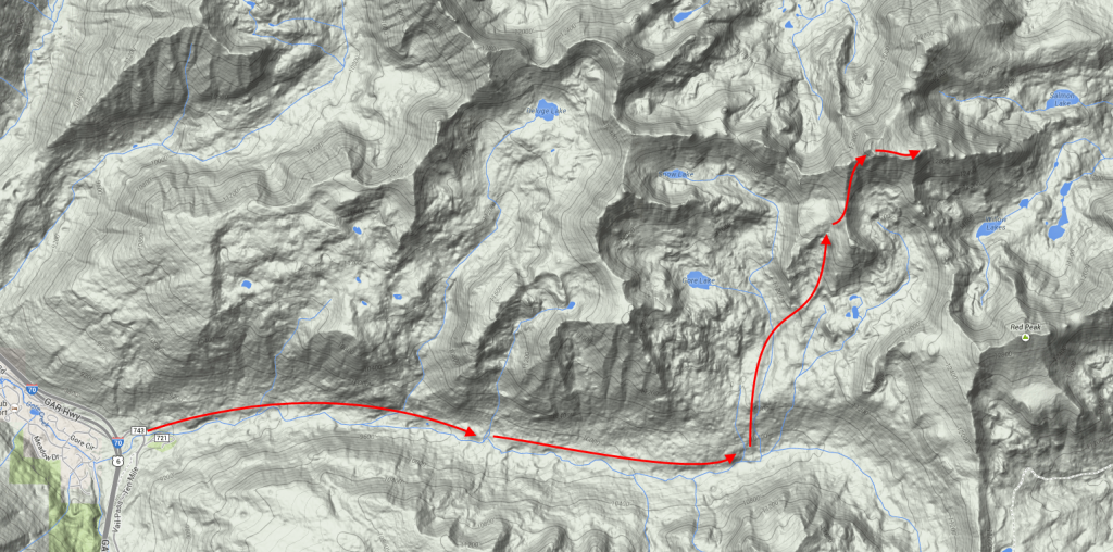
Route Overview.
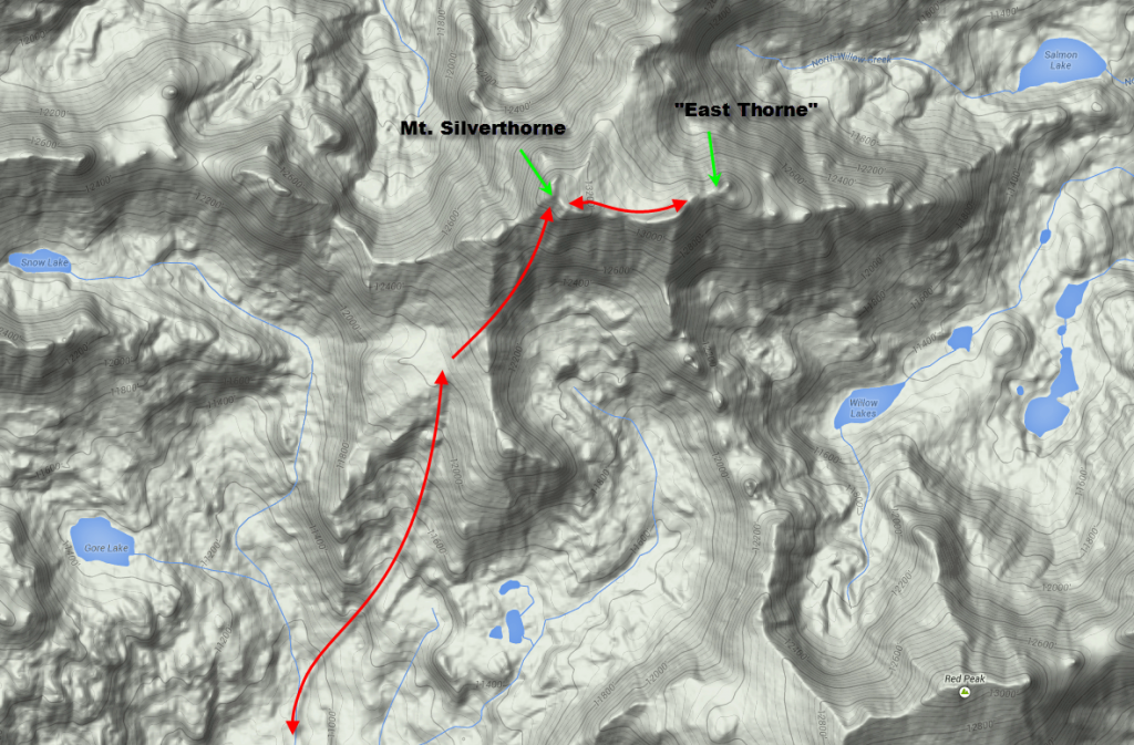
Close up of the upper portions of the climb.
What a great report man! Written in classic Zambarino style. Those Gores never seem to disappoint and that gravesite is interesting indeed, that’s for sure! Some sick shots in here too. Looks like a couple of well earned summits fellers! “Few things forge or reveal friendships like mountains.” That’s a lot to do with why we do what we do buddy. Well done as always on the TR. Hard to believe summer is almost in the bag already. It’s almost time for some snowshoe nerd-raging!
Thanks buddy! I’m glad to have style. 🙂 And yes bro, the flakes are coming. Have you bought your AT set up yet? Only 6 months until spring!
Zambo!
I absolutely love this report, buddy! Well done to you & Ben! What a great two peaks and a solid Gore outing for sure. Thanks for the history on the Recen bros – I had no idea, but so very interesting. Great writing as always and phenomenal pics by you & Ben. I just got down from a trail ruin this morning in that same area up Hail Peak (I had never been up to that summit) and was graupeled/hailed on en route down from the summit. Only appropriate, I guess 🙂 But, reminds me of why I do love them southern Gores. Are you becoming a Gore-fanatic? I hope so.
Cheers, dude.
Brandon
Thanks for all the kind words my man! Too funny that you were up that way right after us. Pretty great trail for a run, eh? How terrible was that slog up Hail tho? That was part of the reason we opted to skip it – looked nasty as could be. Probably only worse with the weather, huh? Not sure I’ve earned the ‘fanatic’ title yet, but what I do know is that the more I hit this range, the more I like it!
Great recap of the day man! I’ve been out of the TR writing game for awhile now so I’m glad you were able to get some photos and text up there for this day. Definitely one of my overall favorite days of the summer. I’m glad we went in from the Vail side for sure :).
Indeed man. Now….time for the next adventure. Jacques, Jackson, Mummies…..so much fun left to be had.
I remember reading about those Recen Brothers in Kramarsic’s college syllabus guidebook on the Gores. Very interesting. This looks like a very cool region of the Gores, always wondered about it when heading all those times to Deluge. So much to explore in such a packed range! Great TR Zambo!
Amen to that Brian! I am just scratching the surface, but even so I somehow managed to find an area you (aka Lord Mini Gore) haven’t even been to yet! Packed indeed.
Oh also, thanks for the beta from your TR on this 3 pack from a while back. Was very useful in knowing the ridge from S to ET was even possible. Good stuff.
Forging and revealing friendships…. Excellent TR Zambo of a place I need to get back to in the not-so-distant future. I had Silverthorne pegged for a climb with my daughter but your loose scree ascent has me backing off a bit. Is the ridge any more solid?
Thanks Scott! As for the scree….it might be possible depending on how she does with that sort of thing. She might be small enough that much of it would stay in place and it is really only 500 ft or so of it. On the other hand, if she does not enjoy it, could be worth the wait a few years. The ridge didn’t look much better. Pretty blocky and potentially scrambly at points.
On the other hand, it looked like Snow might be easily accessible via Gore Lake, which would be a sweet camp spot. Kind of a far approach, but thankfully not too steep. Something to keep in mind maybe….
Great writeup, I really enjoyed reading it. I was on West Partner Peak the same day. Especially like the lounging on top for an hour and just soaking it all in. Gotta take those times when you can, conditions don’t always allow.
What a fantastic write-up. I look at Mt. Silverthorne and East Thorne from my home whenever I am here and have always wondered how it would be to climb them. I am probably too old and have lived in the flatlands too long to climb but thoroughly enjoyed living it vicariously through your report. Cheers!
Thanks for the comment. They are indeed pretty awesome peaks. Glad you enjoyed!