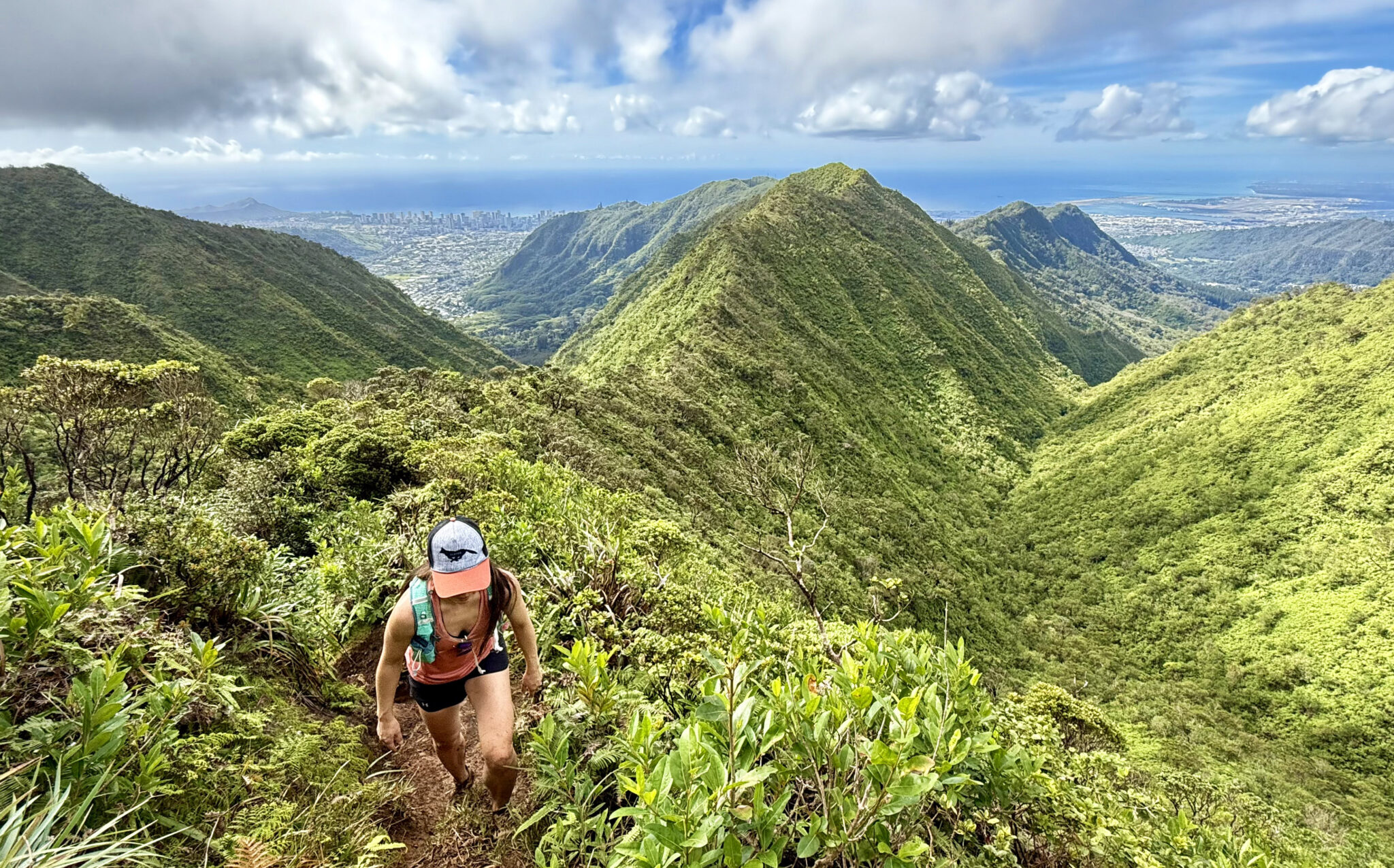
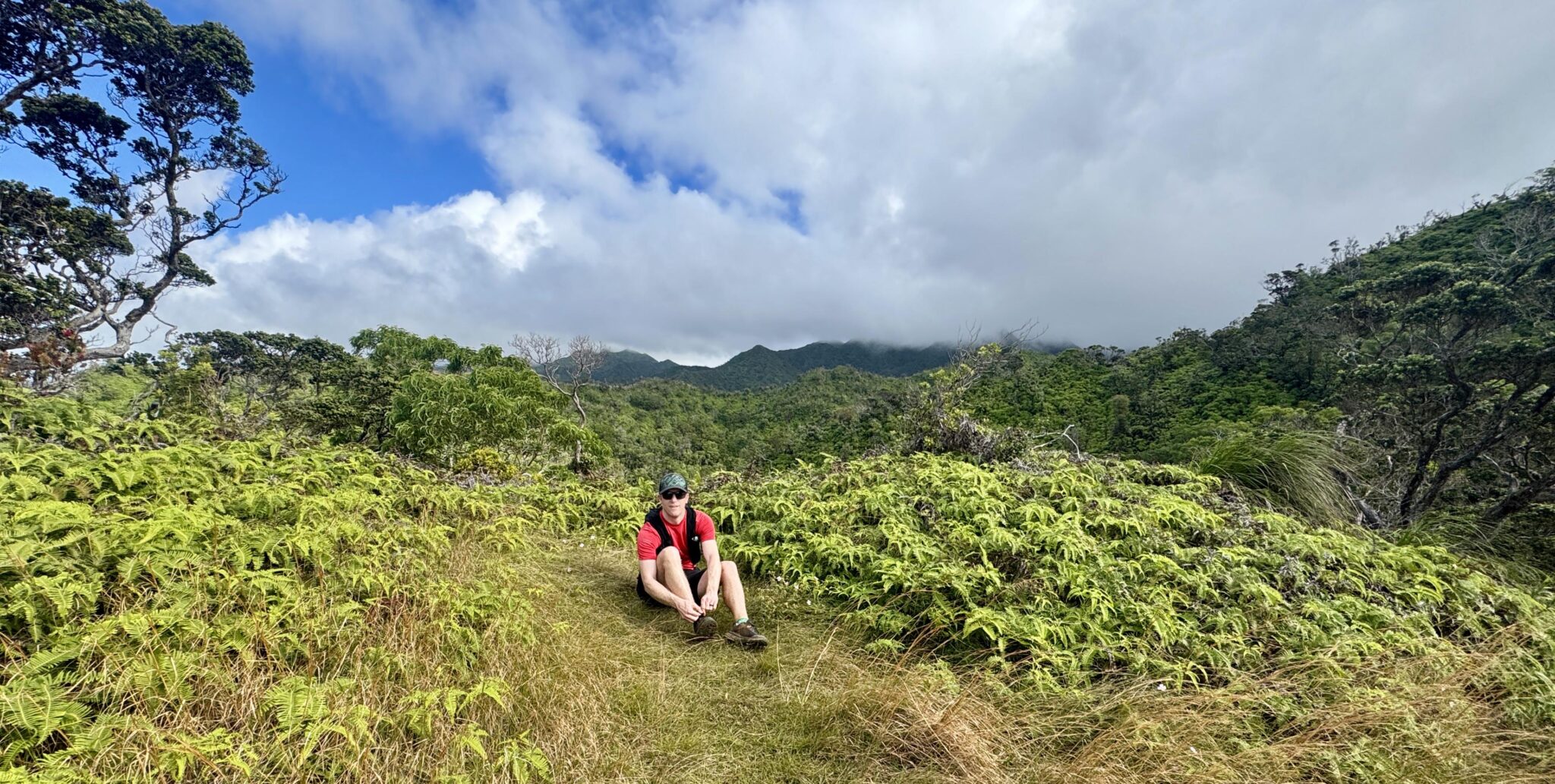
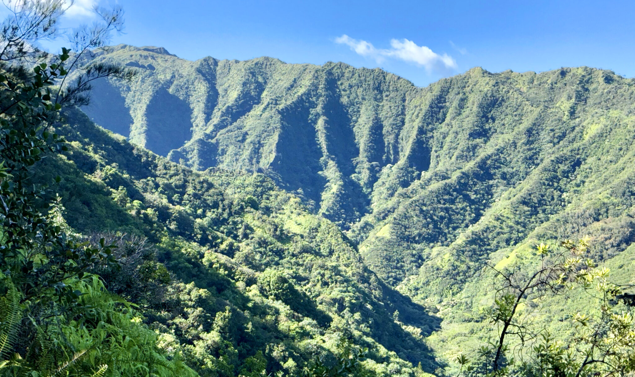
Hiking the Kalawahine Trail to “Konahuanui 2”, Oahu.
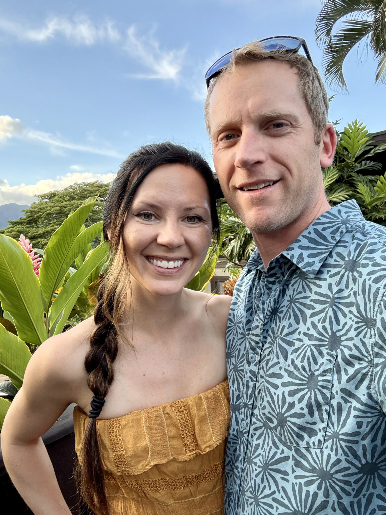
For about a decade now Anna-Lisa and I have been slowly ticking off each of the main four Hawaiian islands together. To us, Hawaii is the perfect place for a tropical getaway as relaxation and beach time are very much a priority, but unlike many other beach destinations, there are also active things to do. Thanks to Hawaii’s mountainous inland terrain, each island boasts anywhere from dozens to literally hundreds of hiking trails and trail running opportunities. We’ve done our best to explore them over the years, with Oahu being the last island we’d yet to visit.
In 2016 we spent 12 days on Maui and did a circle tour of the island including driving to Hana and hiking the Haleakala crater. Two years later we spent a week on Kauai hiking down to the edge of the Napali coast via various trails and exploring Wiamea Canyon. In 2021 we hit the Big Island and climbed Mauna Kea at sunrise, in addition to an 18-mile trail run along the Muliwai Trail from the Waipi’o Gap. Despite the islands being similar, the hiking and topography on each are surprisingly unique, and Oahu turned out to be no different.
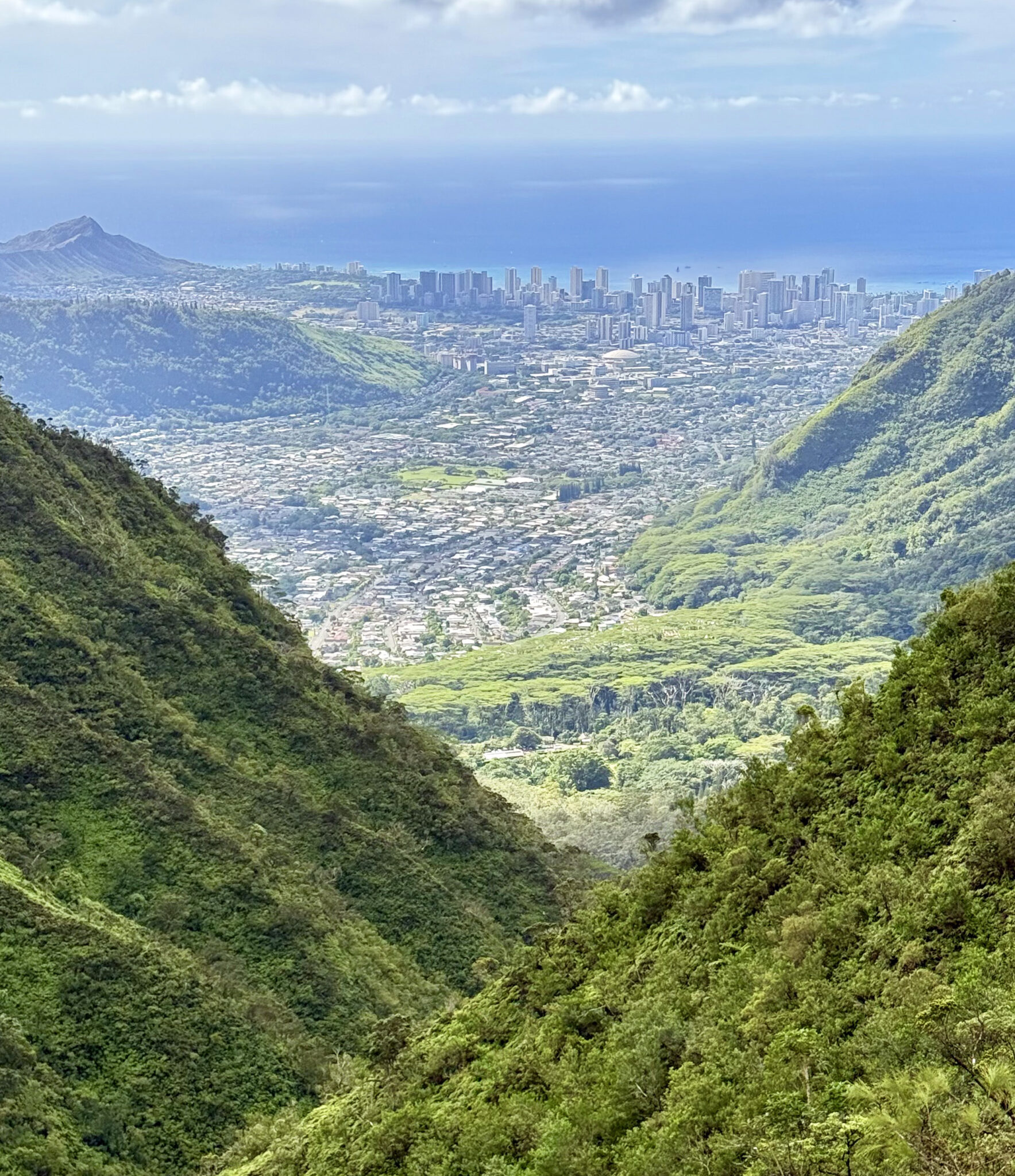
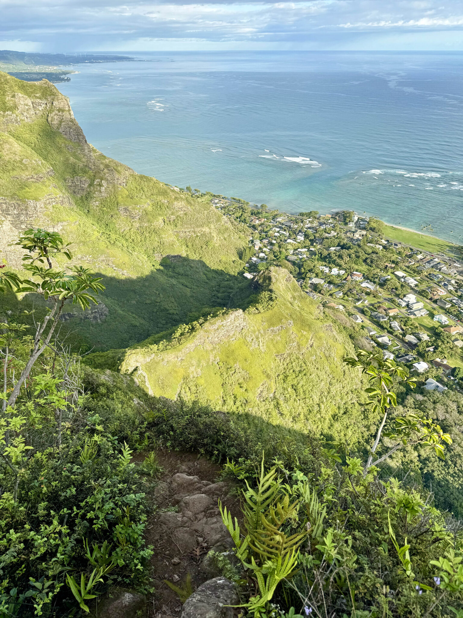
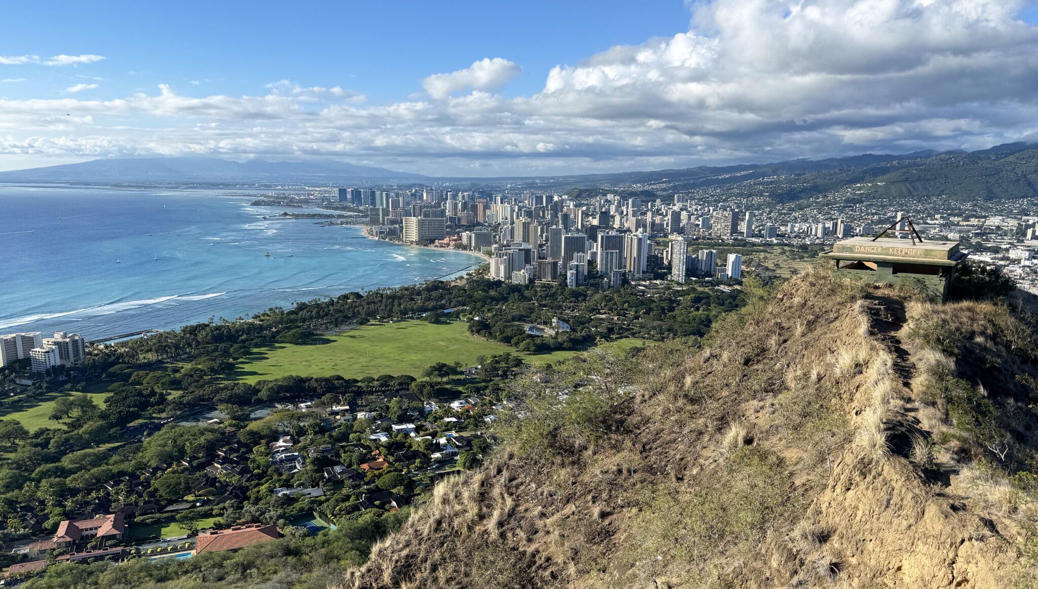
Looking down on Honolulu, the capital city of Hawaii, from the Kalawahine Trail.
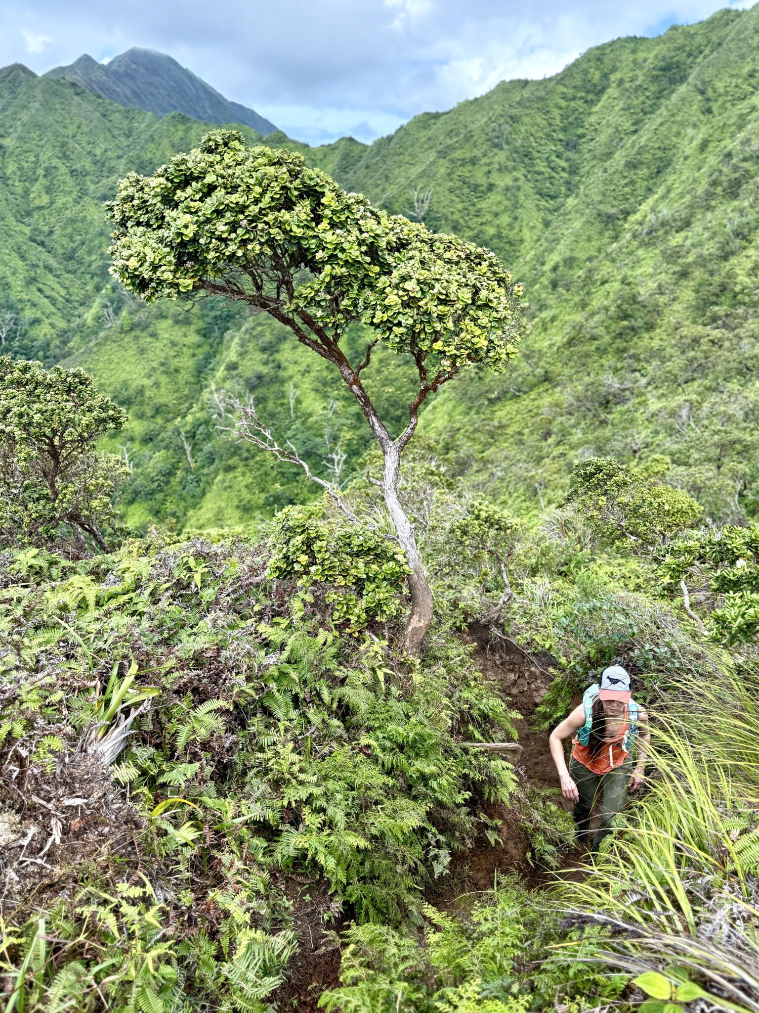
Oahu’s trails we found to be the steepest and most exposed of any of the four islands. The island’s two mountain ranges – the Waiʻanae range to the west and the Koʻolau range to the east – are comprised of many narrow ridge lines with oftentimes lots of exposure off each side.
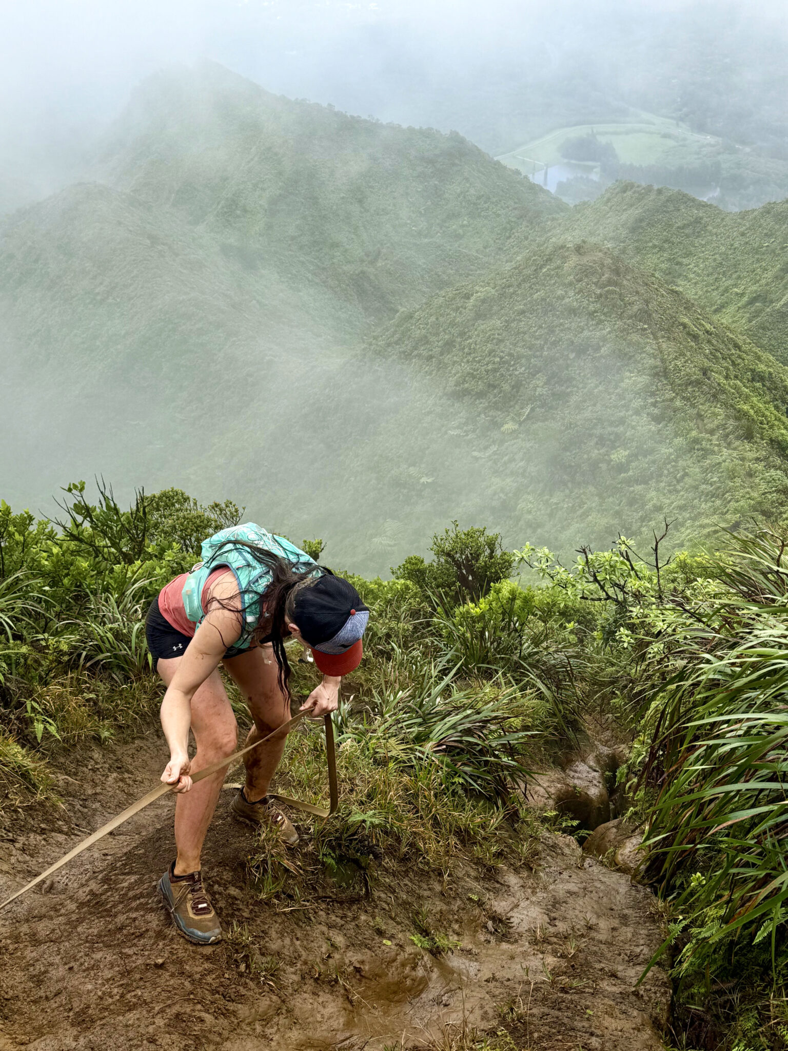
A steep, muddy drop off below the summit of K2.
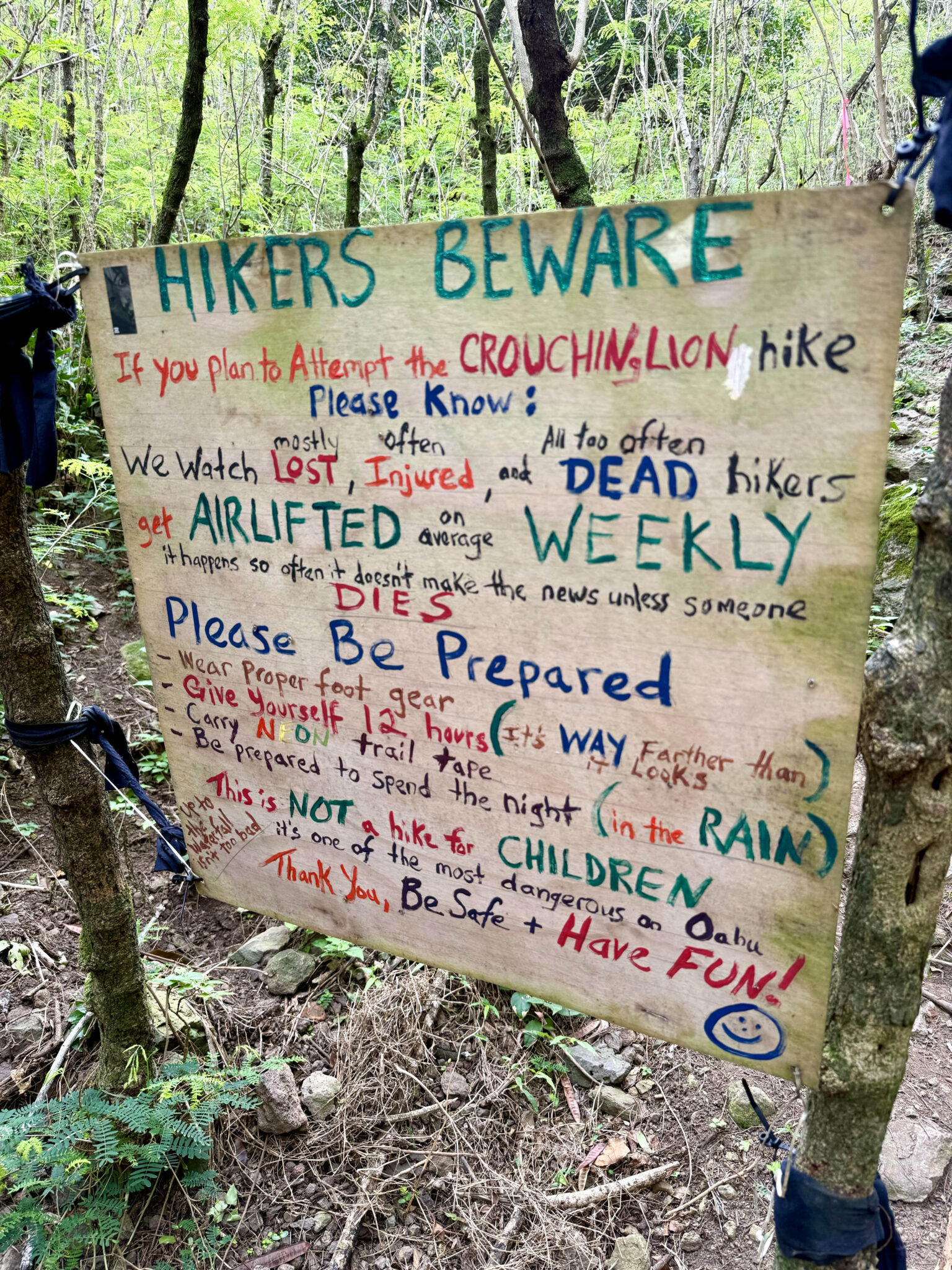
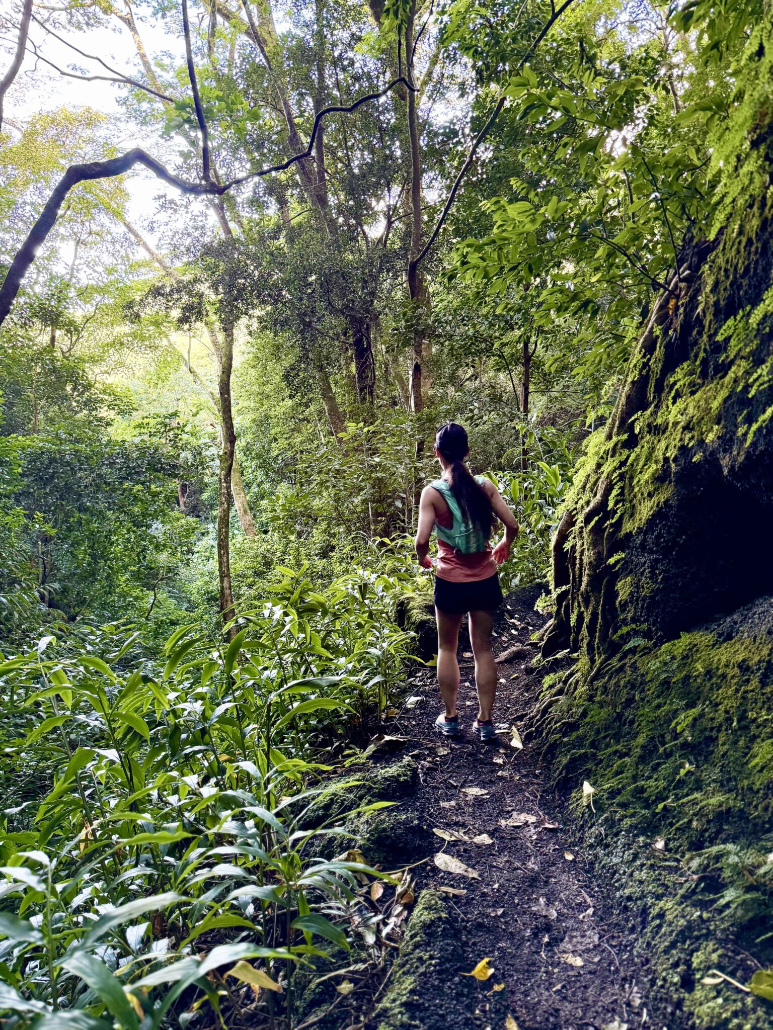
First up we decided to check out the Kalawahine Trail which begins in a neighborhood northeast of Honolulu and climbs to the second highest peak in the range (K2). Though the morning began hot, sunny and muggy, a few hours in we found ourselves engulfed in fog and then rain soon after. The steep trail started to turn to mud so we called it a day about 400 vertical feet from the summit and just focused on getting back down safely. We then decided to prolong the day by taking a detour over to Manoa Falls.
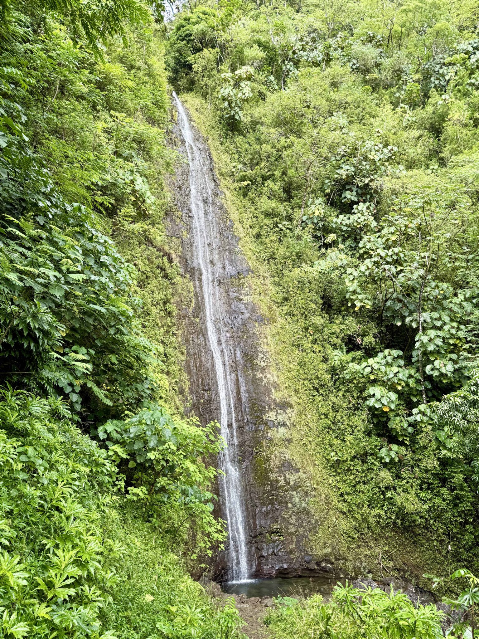
Manoa Falls, a sweet spot.
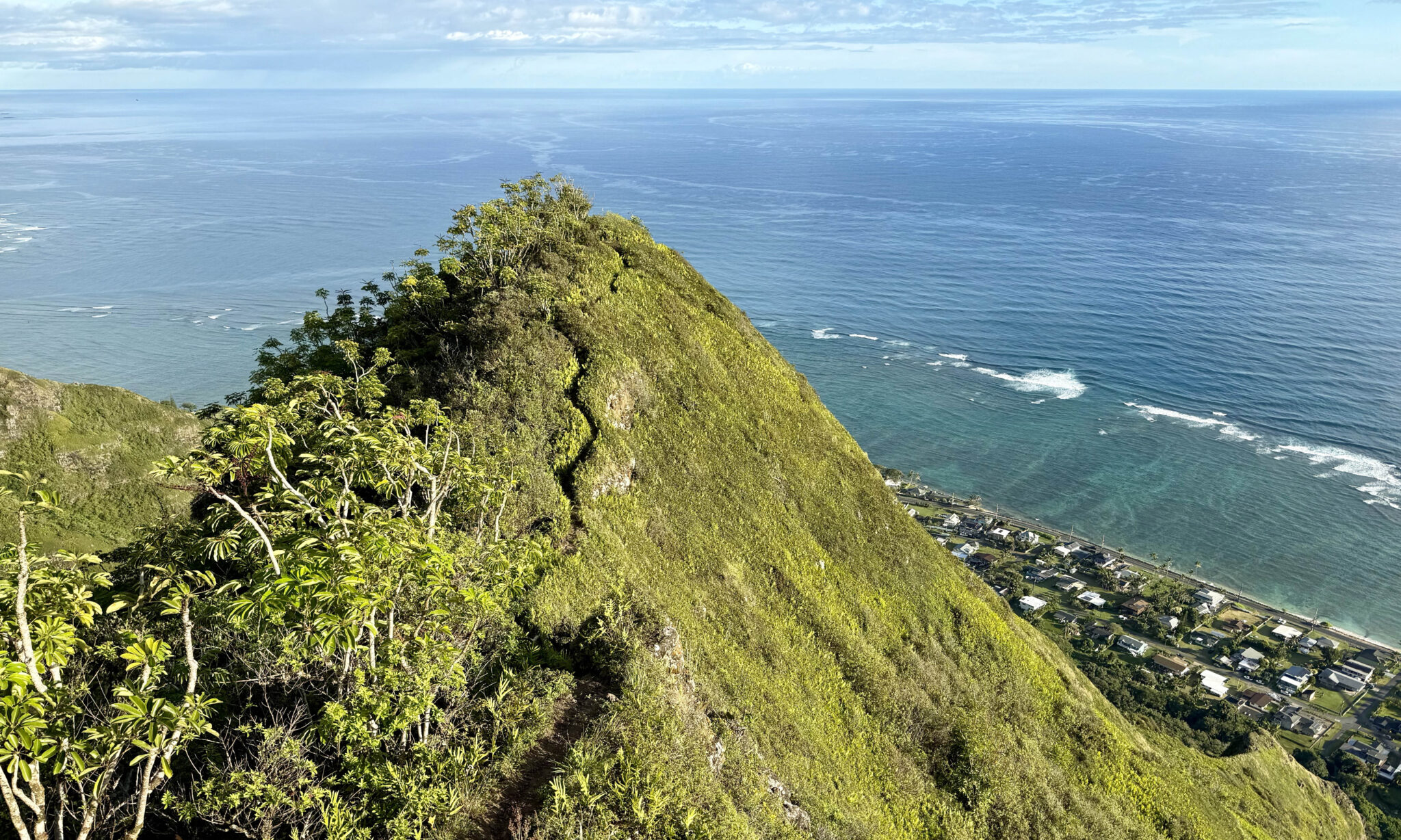
A few days later I got out for a sunrise solo up the Kahekili Trail, an exposed climb necessitating some scrambling along the way capped off by a wet bushwhack to the trail’s high point. Some of the sections are not for the faint of heart.
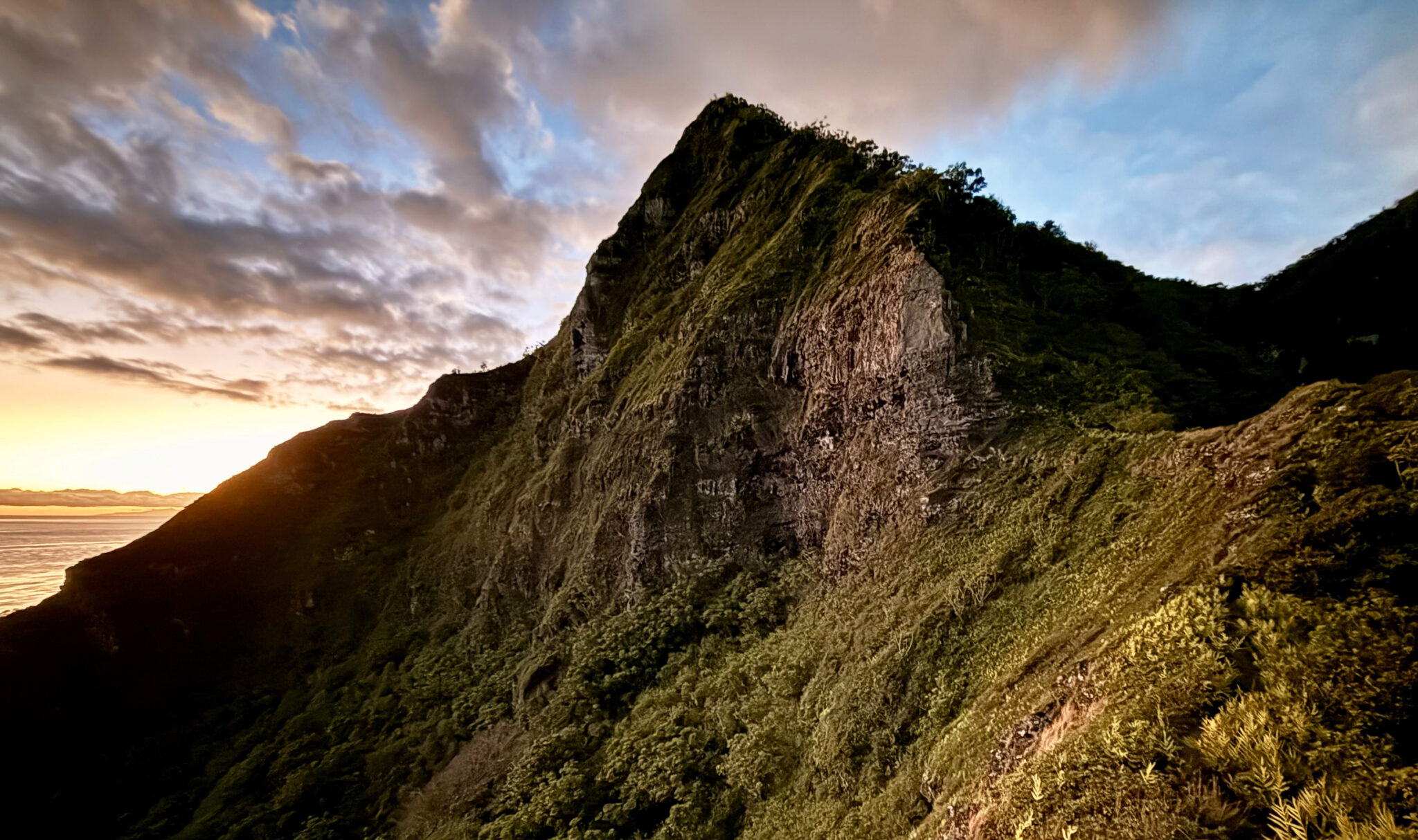
A Kahekili Sunrise. The route climbs up and around the prominent rock formation ahead.
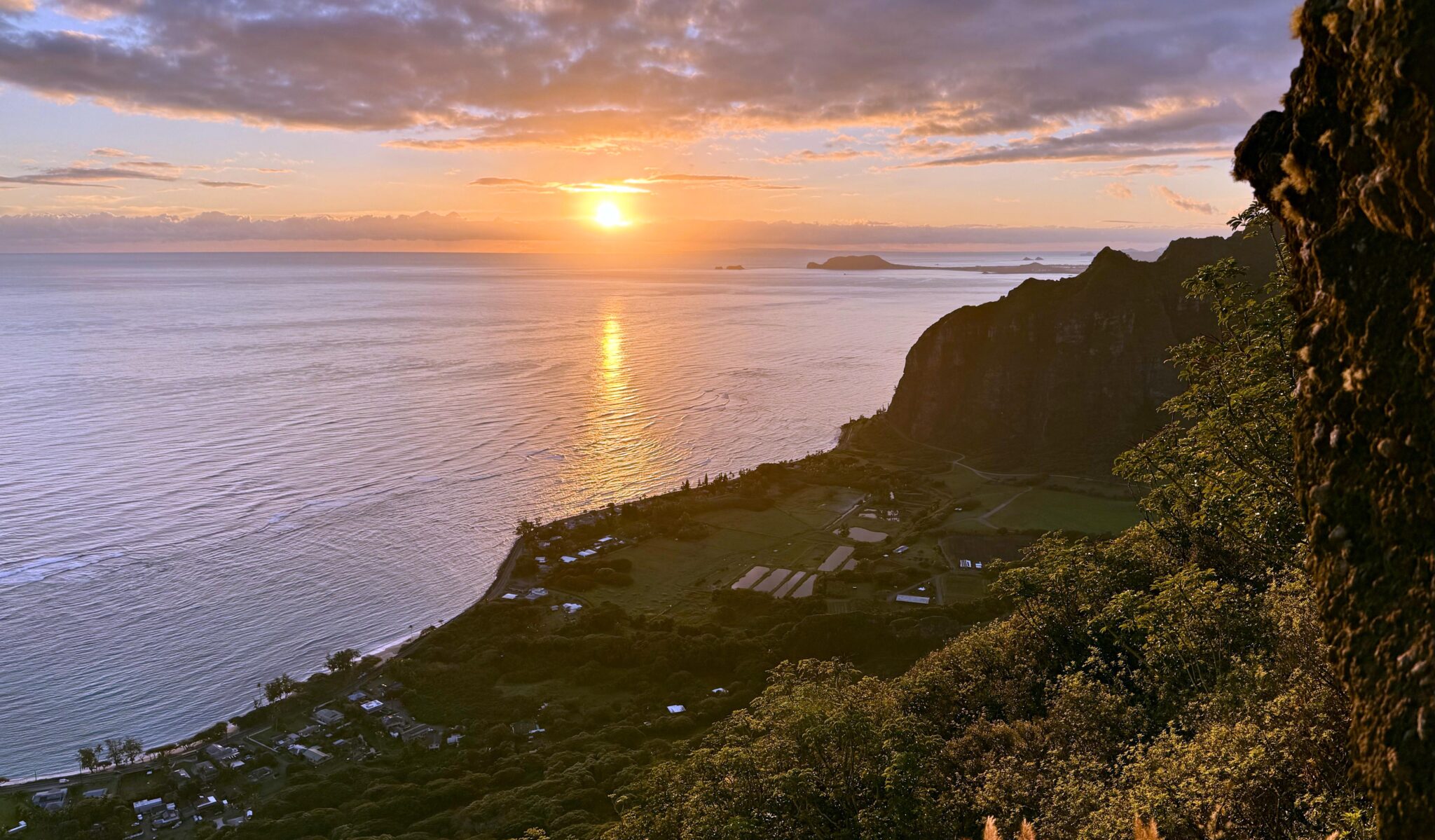
An awesome spot to watch the sun come up over the Pacific.

At the summit/turnaround point with Mauna Loa nuts for breakfast hitting the spot.
Descending back down the part I did in the dark.
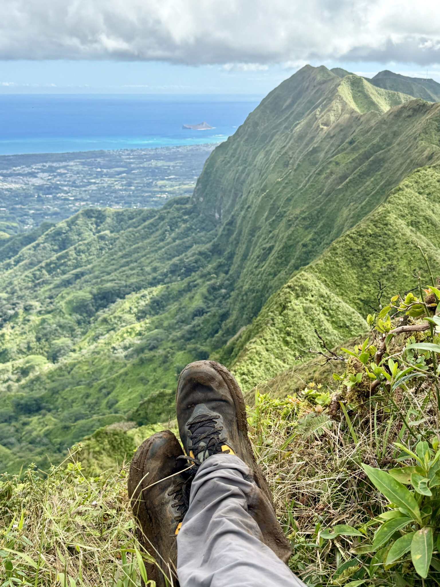
One of the exposed scramble sections. If you look hard you can barely see the trail cutting across the knife edge ridge down below.
The sign at the start of the trail. Definitely missed this in the dark too. 12 hours though? Seems a tad dramatic…
Later, we drove around to the west end of Honolulu and ran the Manana Ridge Trail until we felt like turning around. As with many Oahu trails, it started off strong and then slowly but surely became more of a bushwhack until we decided the beach and Mai Tais sounded more fun than getting covered in thorns and scratches.
Starting out.
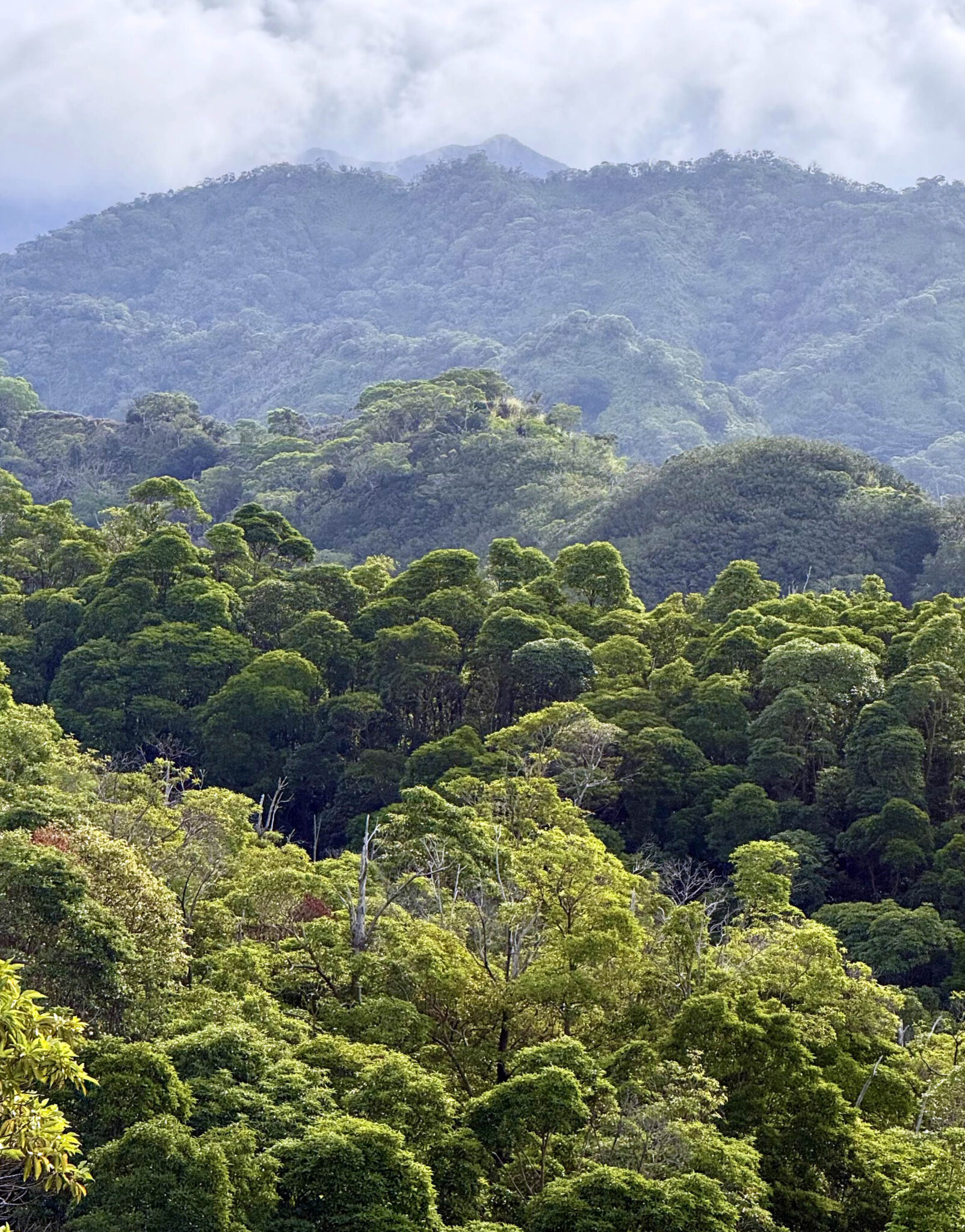
Dense jungle as far as the eye can see.
Our turnaround point for the day.
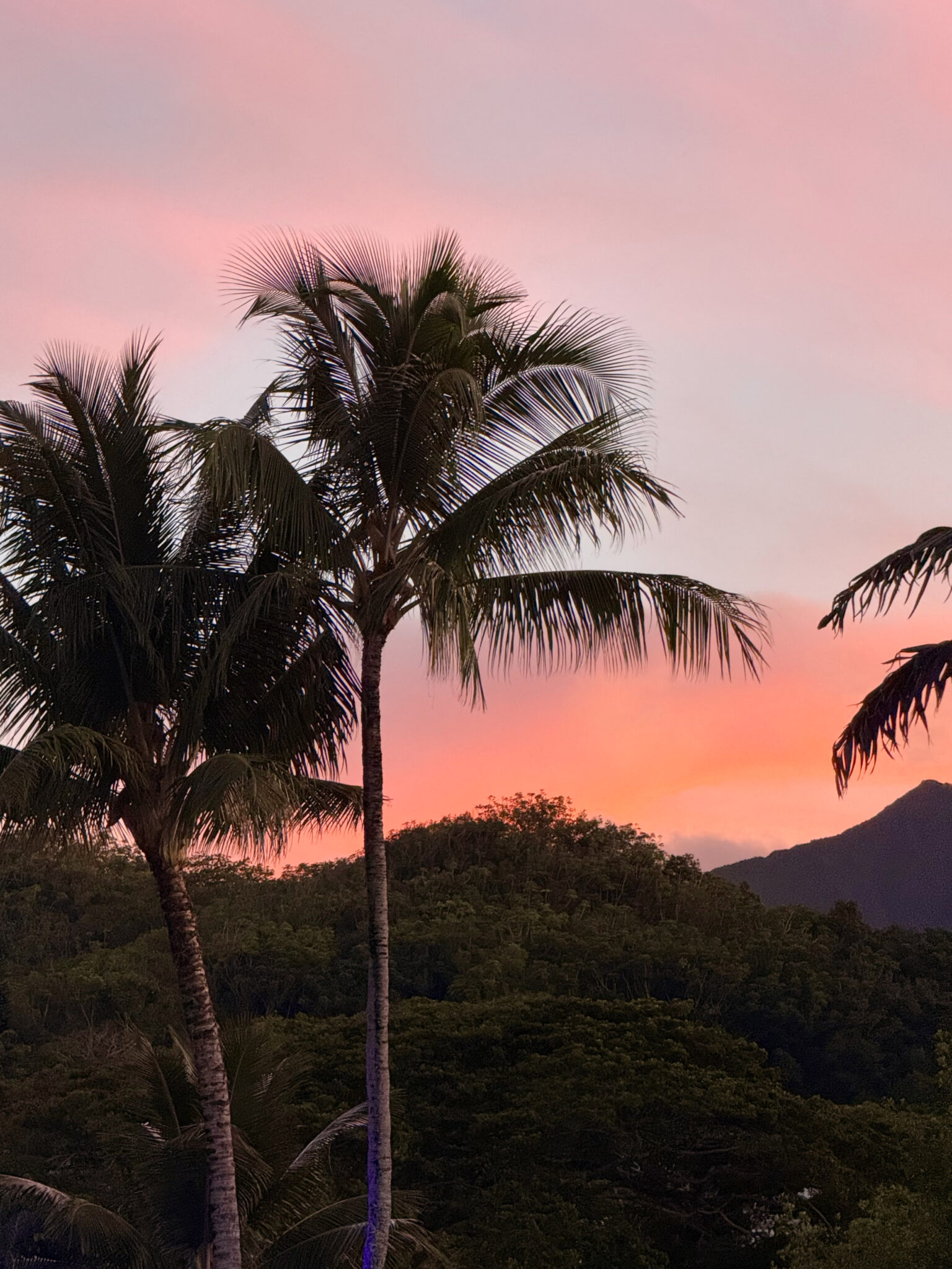
Sunset from the Paradise Bay Resort on Oahu’s east shore.
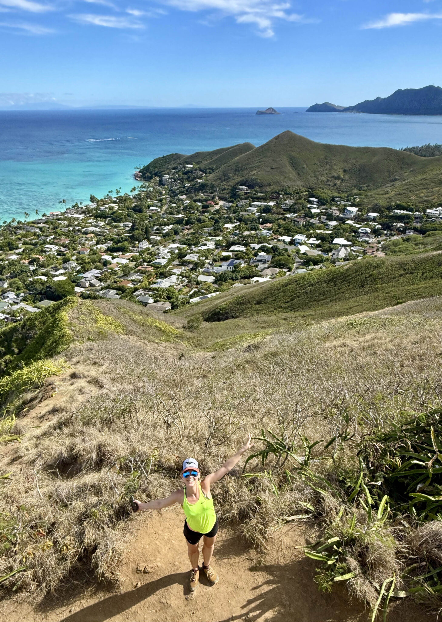
With good weather and feeling like another summit hike, we decided to check out the fairly popular Mount Olympus trail (aka ‘Awa’awaloa). Like K2, the trail starts in a neighborhood north of Honolulu and climbs up a series of narrow ridge lines to the summit of the peak. This time around, with dry trails, we made the summit.
Routefinding a few miles in.
On the summit, looking north towards Kailua.
After cleaning up and heading to dinner.
The next day we ran up to the Lanikai Pillbox east of Kailua, then found a trail that makes for a loop back down to the coast where we had a bag with towels stashed on the beach.
At the pillbox with Lanikai Beach in back.
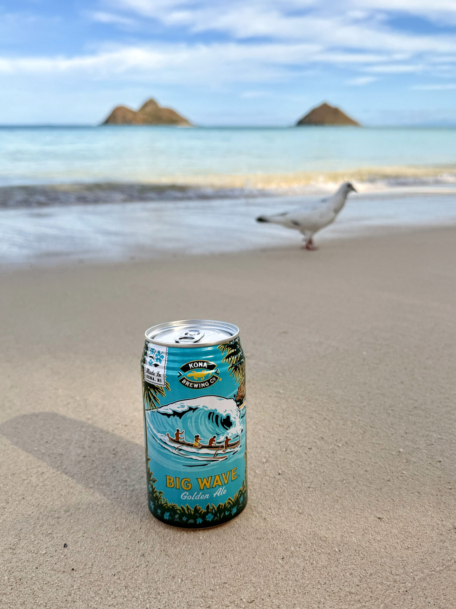
Time for a beer.
After moving 30 minutes up the coastline to a new hotel, we decided to drive around the north shore to the west side of the island and check out the Kealia Trail. Being the drier side, the vegetation and overall feel of the landscape was different from the east side, but still beautiful in a different way.
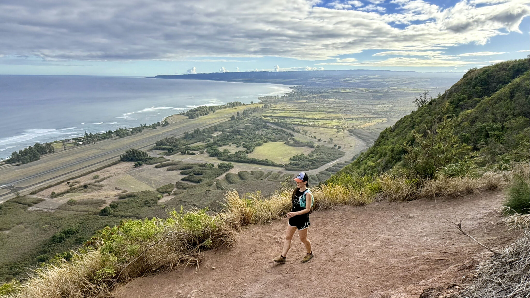
After the initial climb before the trail turns inland. The hike starts just outside of Dillingham Airfield.
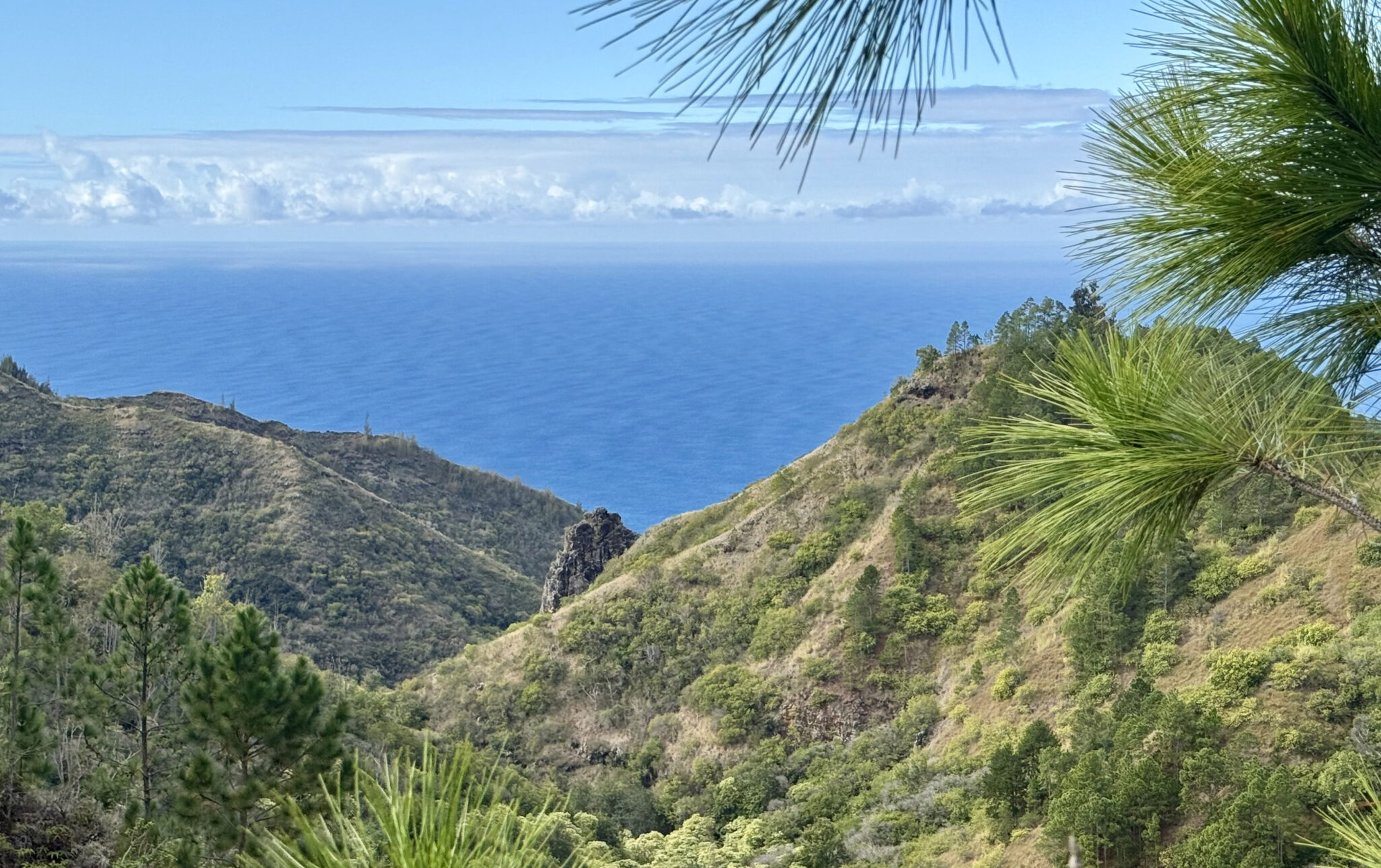
After several miles, we finally made it to the Makua Valley with views down to the southern coast.
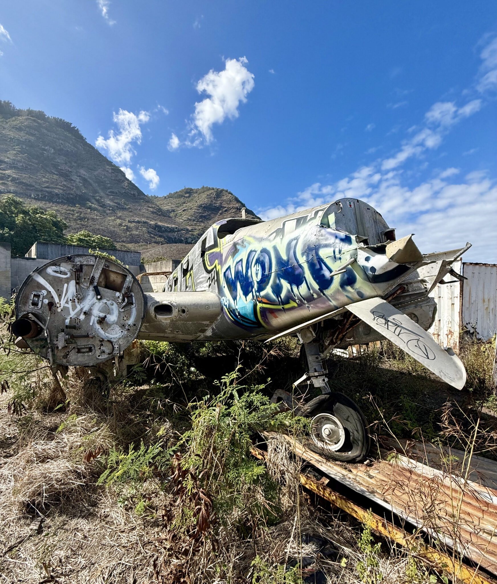
An old wrecked plane near the airfield.
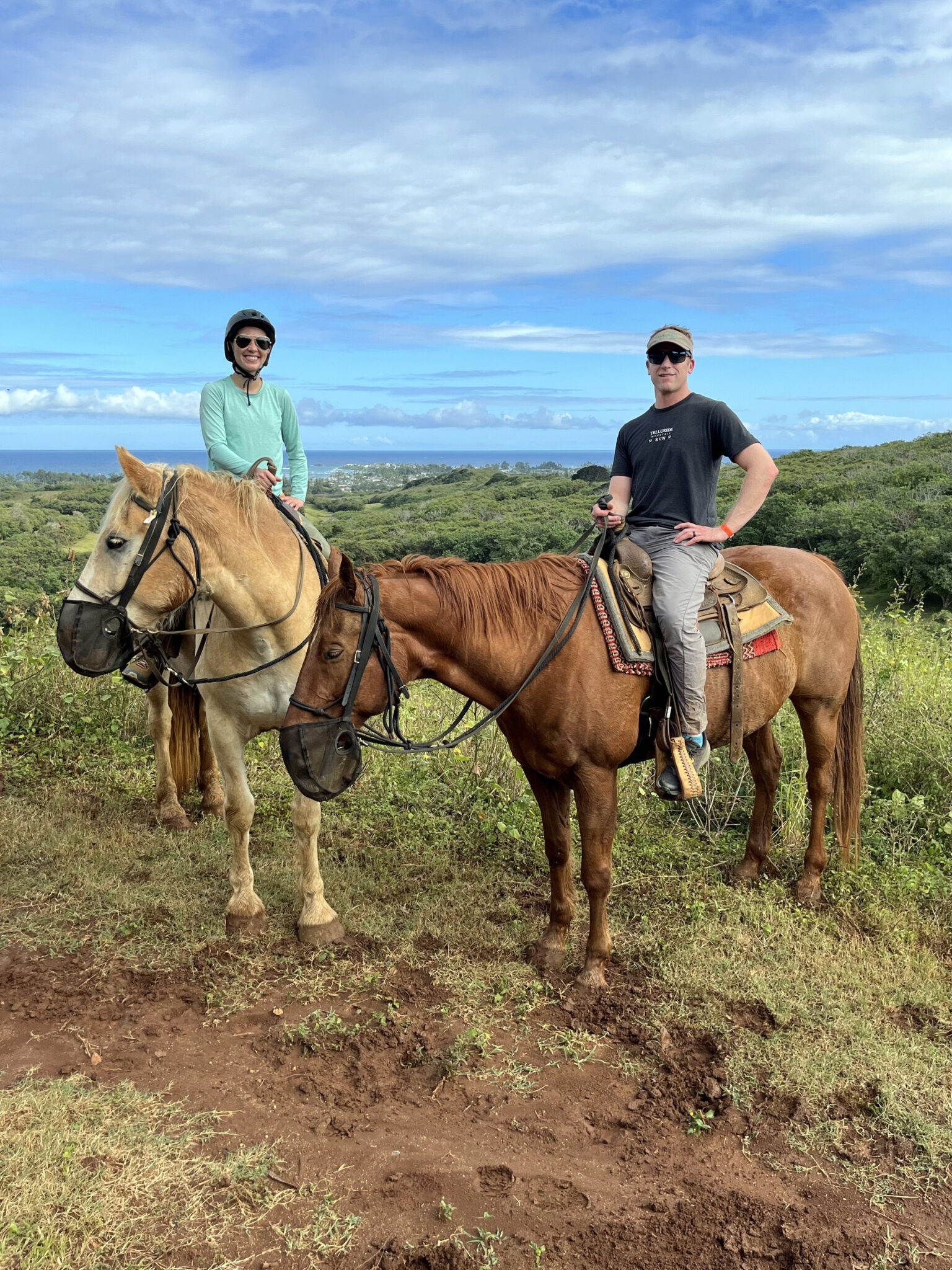
Not all hikes have to be human-powered right?
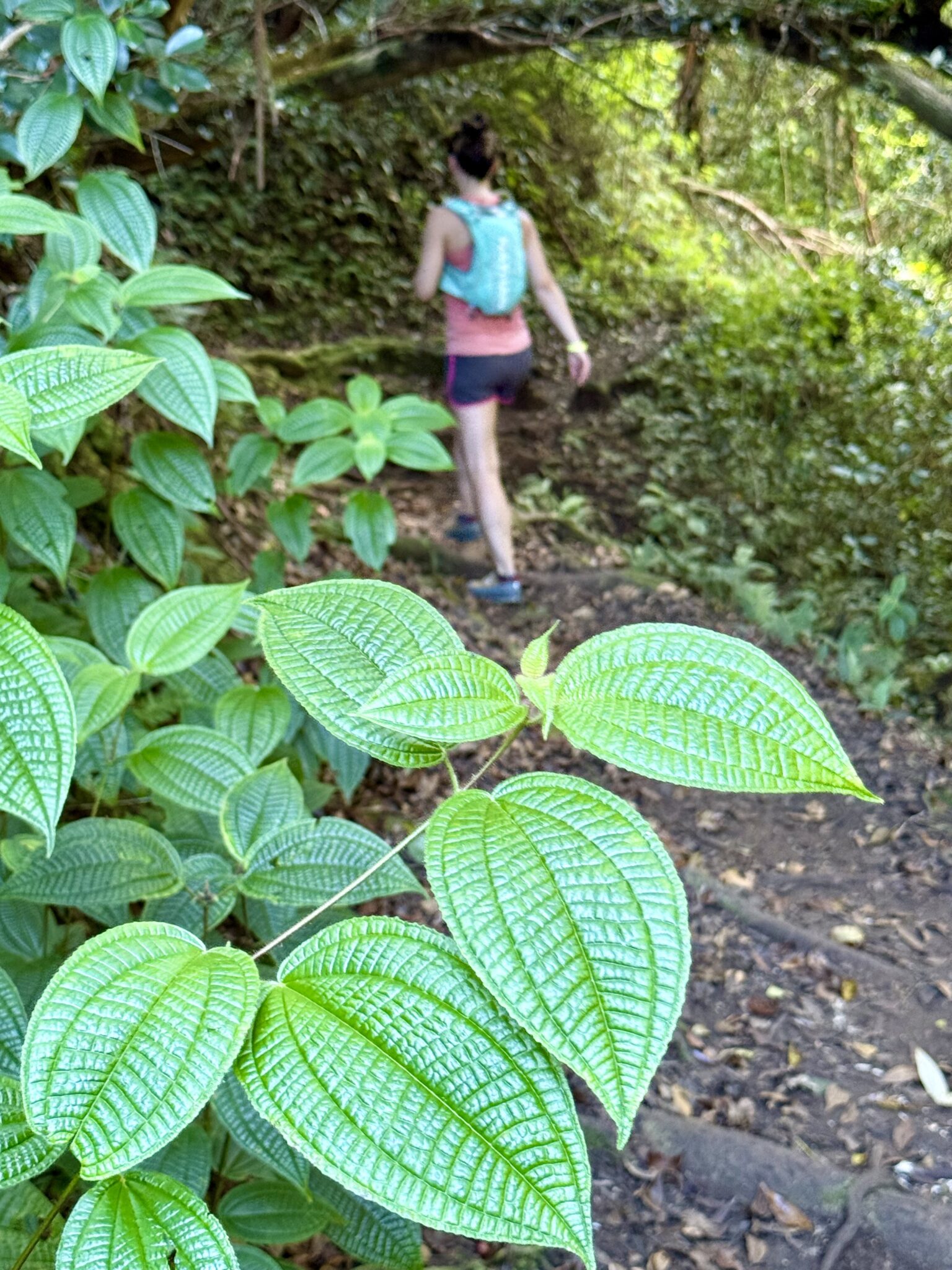
A few days later hiking the Hau’ula Loop near Laie.
Sweet views south into the Hau’ula Forest Reserve.
All in all we hiked around 56 miles and 16,000 vertical feet of trails on Oahu in the 10 days we were there. After hearing all kinds of disappointing reviews of the island in general, we were struck with just how much hiking there is and how awesome it is. I might even go so far as to say, based on my experience, Oahu is the best island for hiking of the main four. Not only that, but it’s almost all accessible with a 2WD vehicle and no trailhead is more than an hour away from wherever you happen to be staying. Granted we did not stay in Honolulu, this is assuming you spend most of your time not in the city and opt for hotels on the less crowded sides of the island. To put it simply, Oahu is awesome in my opinion and shouldn’t be overlooked.
And now for the epilogue and one of the coolest parts about this entire trip…
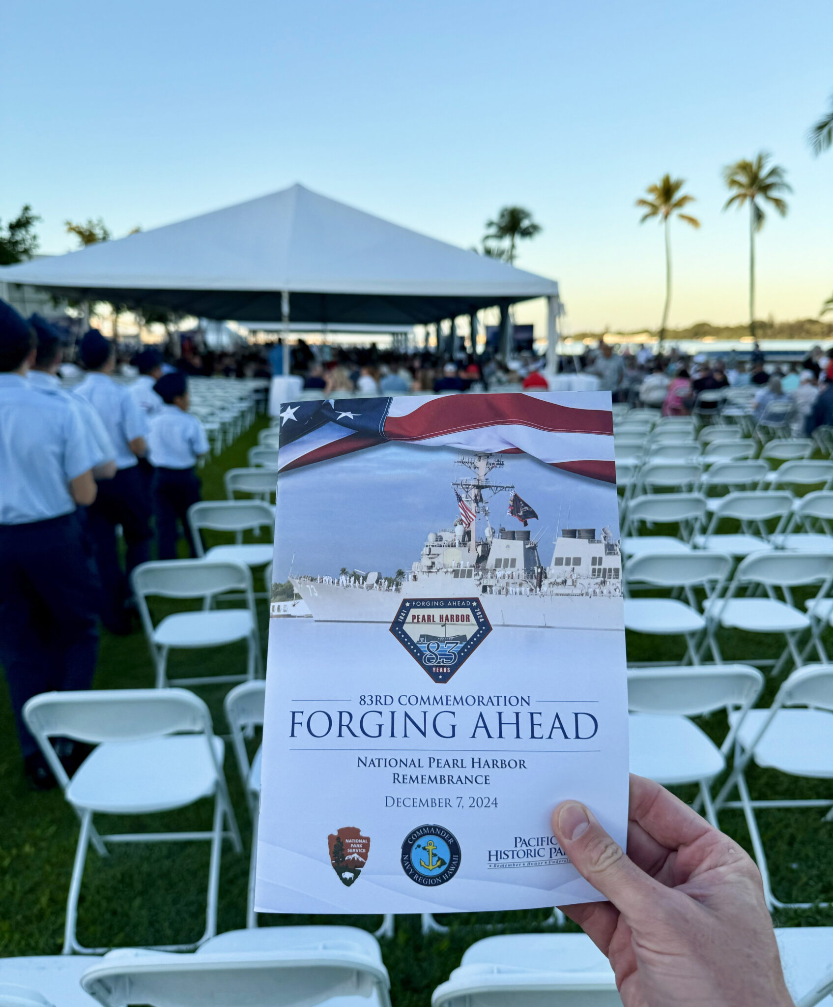
December 7th, 2024, the 83rd anniversary of the attacks on Pearl Harbor.
One of the things I did want to do in Honolulu was visit Pearl Harbor. We hadn’t put much thought into which day would make the most sense to do so, until we realized our flight back to Colorado didn’t depart the city until 10pm on December 7th. Low and behold, and I’m amazed at how many know the significance of this date off the top of their head when I didn’t, December 7th is Pearl Harbor Day. So then it all just fell into place, and we found ourselves at the 83rd National Pearl Harbor Remembrance Day.
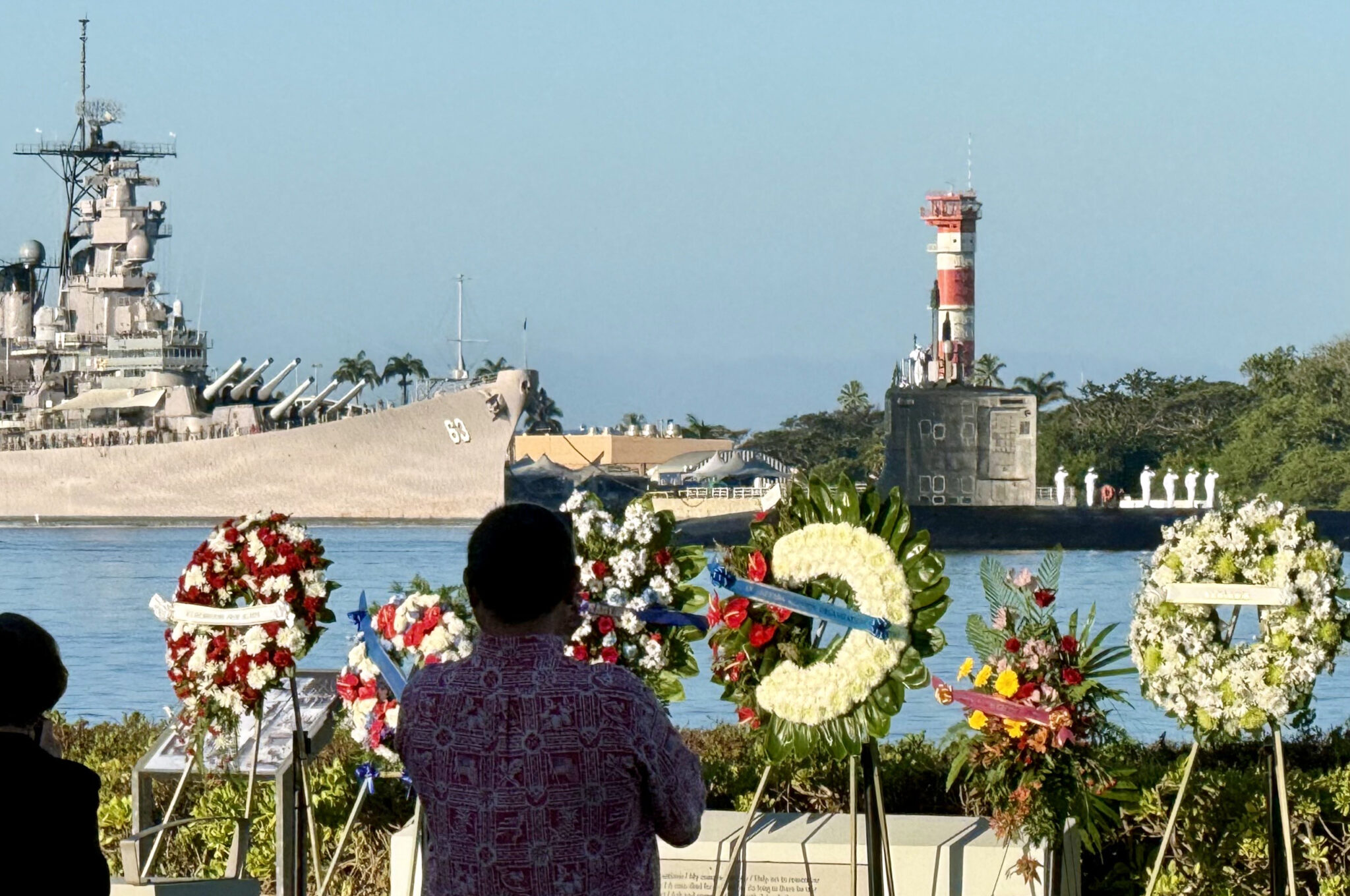
The harbor.
At 7:55am, the USS Arizona bell was rung, followed by a squadron of F22s flying over the harbor in “Lost Man” formation. Then a pair of battleships and a submarine sailed through the harbor with all hands on deck in salute. After that, the Commander of the US Pacific Fleet and the Governor of Hawaii gave speeches, in addition to several surviving WW2 vets and descendants of men and women who died in the attack in 1941. The whole thing was just incredibly powerful to witness.

Later we took the ferry out to the USS Arizona wreck site. Here’s the memorial along with the names of all the personnel who lost their lives that day. As it happens, the last USS Arizona survivor was Louis “Lou” Conter, who passed away on April 1, 2024, at the age of 102.
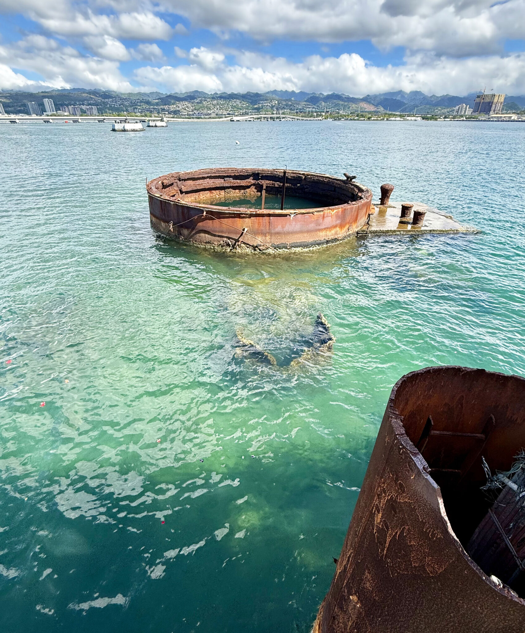
The wreck.
After leaving Pearl Harbor and grabbing some lunch, we couldn’t resist one last hike up to the top of the Diamond Head crater east of the city. It’s a crowded one and a bit of a circus, but the views from the top are pretty cool.
Diamond Head summit.
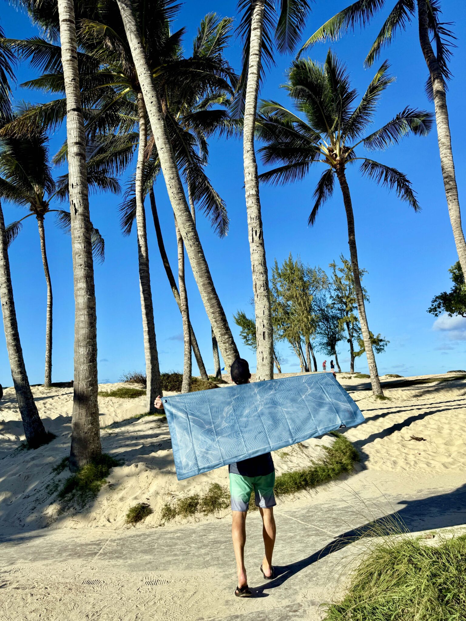
Last but not least, if you’re in the market for packable “adventure towels” be sure to check out Laek out of California. We took two of their towels to Hawaii and used them literally every day either to dry off after a hike and/or as beach towels. They pack down super small, dry quickly and are super soft and comfortable to use.
Until next time, Hawaii…
Big props for making sure a good time out of Oahu. Between all the sweet hikes and the Pearl Harbor day this was quite the memorable trip.
Oahu had the best hiking of all 4 Islands – who would have thought that ? and you wind up with a late flight on Peral Harbor Day – what a treat.!!!!!!! Great Picts and great hikes – thanks for sharing .
You belong on Mythbusters! I had subscribed to the commonly shared view Maui and Kauai are the best for hiking. Now I know! Looks like you two had an incredible vacation!