Snowy summit views from the top of Mauna Kea – 13,804′.
- Peak: Mauna Kea (13,804′)
- Route: Humu’ula Trail (south slopes)
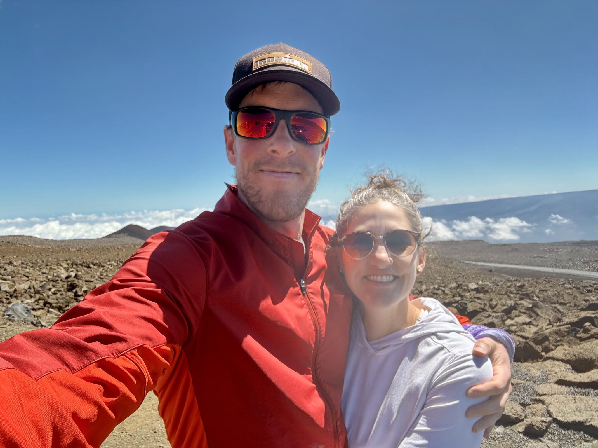
- Climbers: Zambo (+Katie summit pickup!)
- Distance: 6.65 miles (uphill only)
- Vertical Gain: 4,977 feet
- Date: 2/28/25
- Strava Track: https://www.strava.com/activities/13754080639
Almost 20 years ago I took a family vacation to the Big Island. I love my memories from that trip. The Big Island is a very, very unique place. Between its scale, oceans, beaches, resorts, rainforests, culture, history, mountains, and active volcanoes, it has almost everything you could ever want in terms of both relaxation and adventures. I had always wanted to go back.
The chance came early this year thanks to some killer direct flight deals from Denver to Kona. The prospect of a week away sans children (something that’s literally never happened since we had kids) in Hawaii sounded pretty dang great to Katie and I.
At the top of the adventure list was a trek up Mauna Kea. There is a lot to love about this remarkable mountain:
- It is a (somewhat) active volcano.
- It dominates the entire island of Hawaii.
- It is a state high point.
- It has some of the clearest skies in the entire world.
- It has a number of ultra high-tech telescopes and research facilities on its summit.
- It is a sacred peak in the Hawaiian religion.
- It has one of the highest lakes in America, which also just so happens to be the mythical birthplace of Hawaii itself.
- It has a road all the way to the top.
- It is one of the few tropical destinations in the world where you can find snow (and even ski if the conditions are right) as “Mauna Kea” means the “White Mountain” in Hawaiian.
And as if all that wasn’t enough, Mauna Kea also holds all kinds of interesting prominence distinctions, as Ben mentioned on his trip report a number of years ago. Probably the most interesting of those is that Mauna Kea’s dry prominence (that is, the height from it’s underwater base to its summit) makes it the tallest peak in the entire world at over 30,000 feet!
All of this made for an absolute no-brainer objective for me during our trip. I was eager to give it a trail run.
Our timing worked perfectly as we would be driving right past Mauna Kea on the fourth day of our trip. In the span of an hour we ascended 9,000+ feet straight up from the sea to the very interesting alpine visitor center at the base of the access road. We got out and explored a bit here before I headed over to check-in with the rangers. Unlike most park rangers I’ve ever encountered (most of whom seem dead set on their primary objective of ruining everyone’s fun), these guys were as chill and helpful as can be. The gave me all the requisite information, beta, and warnings before heading up. They were a huge help before I set off.
I then said goodbye to Katie (who graciously offered to drive the road and pick me up at the summit) before asking one last question of one of the rangers.
“How long you think this will take to run??, ” I asked. The signage estimated 8-15 hours round trip, which felt nutty to me, so I was curious to get his take.
“Mmmm….I’ve seen it done in three hours,” he replied. Sounded like a worthy goal to me.
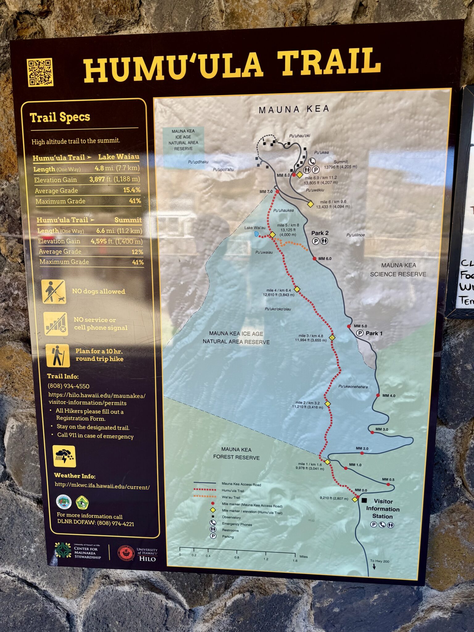
A look at the complete route up Mauna Kea’s south slopes via the Humu’ula Trail. The massive vertical relief, unique setting, and moonscape to come made this trail run about as unique and sublime as they get.
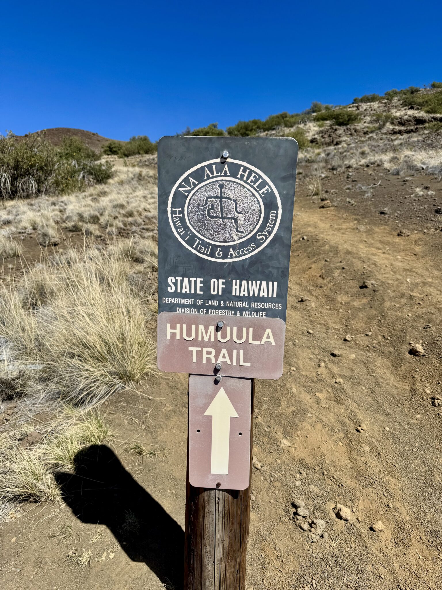
After a quick jaunt up the road I banged a left hand turn to get onto the Humu’ula Trail.
The first few miles of the excellent trail were the most steep and challenging. I wasn’t sure how I would feel with the altitude after four days lazing by the beach. Thankfully my body adjusted very quickly. In spite of the myriad warnings and cautions at the visitor center, this basically felt like any classic class 2 ascent back in Colorado. At least difficulty and altitude-wise.
The trail took a very clear cut route more or less straight up the massive slopes. It also paralleled the road which was comforting as there were (surprisingly) very few other parties out and about. As I ascended higher and higher, I got more and more excited about the position. Trail running (or mostly fast hiking these lower sections) at 10k+ feet in the middle of the ocean is about as unique and cool as it gets.

As happy as can be!
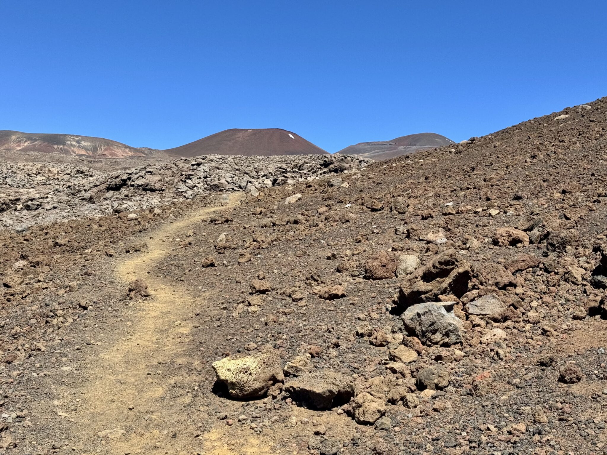
A nice shot of the typical conditions and makeup of the Humu’ula Trail. The bump ahead is the Pu’uhaukea crater, screening the true summit beyond.
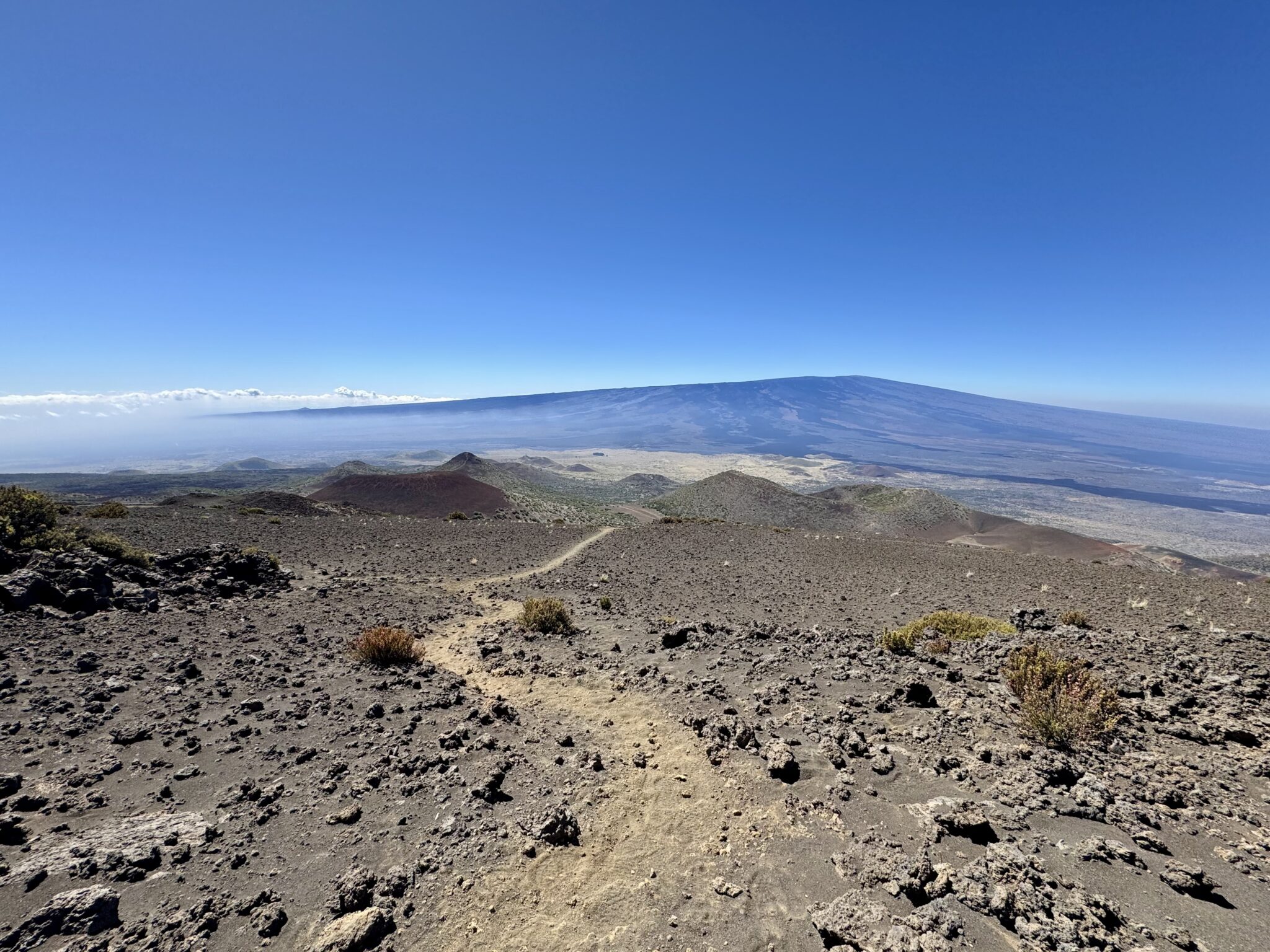
Looking back towards Mauna Loa. This peak is just 125 feet shorter than Mauna Kea. But what it lacks in elevation it makes up for in sheer mass. It is one of the most massive mountains on earth (again, as measured from it’s sea floor base). It dominates the entire Big Island.
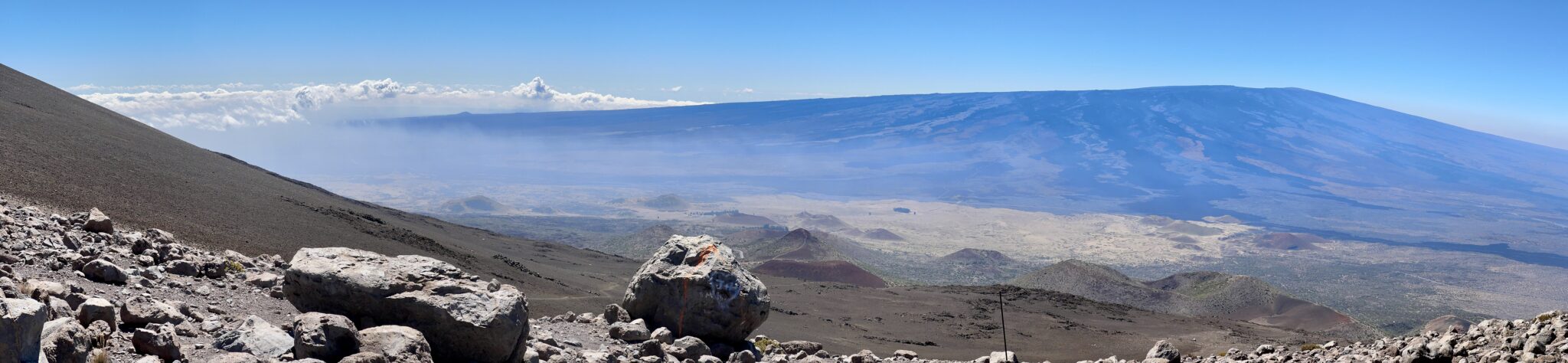
Another pano shot of Mauna Loa (click to enlarge). The haze drifting in the valley is volcanic vog produced from yet another active volcano on the Big Island – Kilauea. Kilauea is the single most active volcano on earth. It was spewing all kinds of steam and gas this day, blanketing much of the lower elevations as trade winds carried the vog eastwards towards Kona. Thankfully, way up here the skies were as bluebird as they come. Apparently the air on the summit is not only very clear, but also, it has some of the least turbulence on the planet. All that makes for the perfect conditions for peeping at the stars via the telescopes.
After huffing and puffing up the initial couple of very steep miles, the pitch relented a bit and I was able to transition into something resembling a jog. I was loving the isolation (in many senses of the word) as I trudged over the seemingly endless fields of barren lava scape. I only passed one party all day, which was fine by me. The quiet, calm atmosphere of the peak really did make it feel like a sacred place. Later on the rangers told us all about the legends and myths surrounding the upper reaches of the mountain which make it so.
One of their more interesting anecdotes was about how ancient Hawaiians used to climb all the way to near the top to find a special type of rock here. Apparently some of the rocks went through a cooling process which makes them the hardest on all the islands. These ultra durable stones were good for tools and weapons. As such, the ancients would trek up here to quarry the stones to sell and barter far below or to the neighboring islands. Who knew Hawaii had a mining history just like so many other mountain areas?
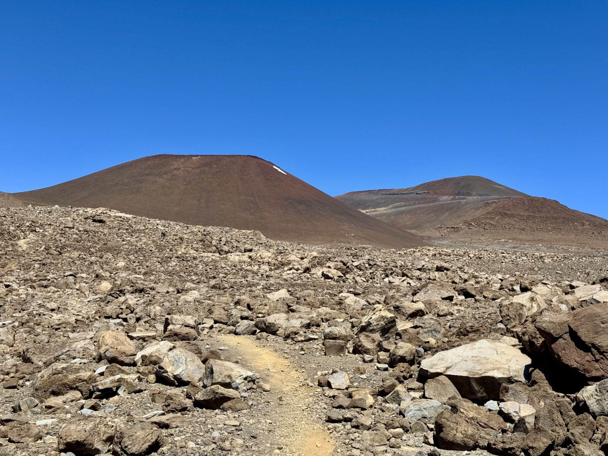
Getting a bit closer now as some of the summit cones came more fully into view.
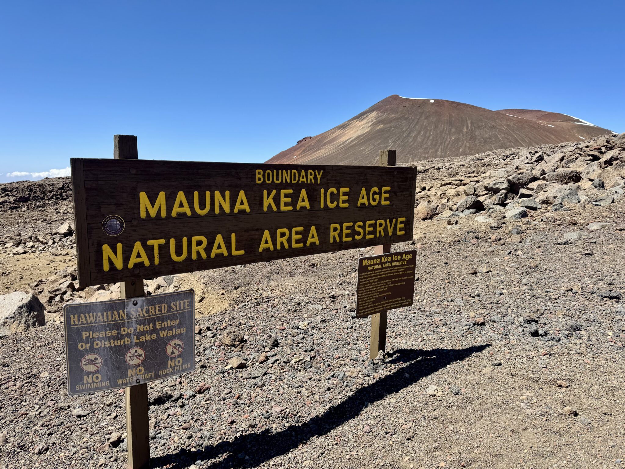
The entire lower portion of the trail was on an ice age reserve. They do all all kinds of ice-related studies and research here. Apparently there is still a permafrost ice core 30 feet below the surface near the summit.
After about 5 miles I came to my first junction. A very short side trip led to Lake Wai’au. At 13,020′, this is one of the highest alpine lakes in the entire country (it is NOT, however THE highest as that distinction goes to Colorado’s own, Pacific Tarn – 13,420′). I took the quick jaunt over to check out this cool little spot.
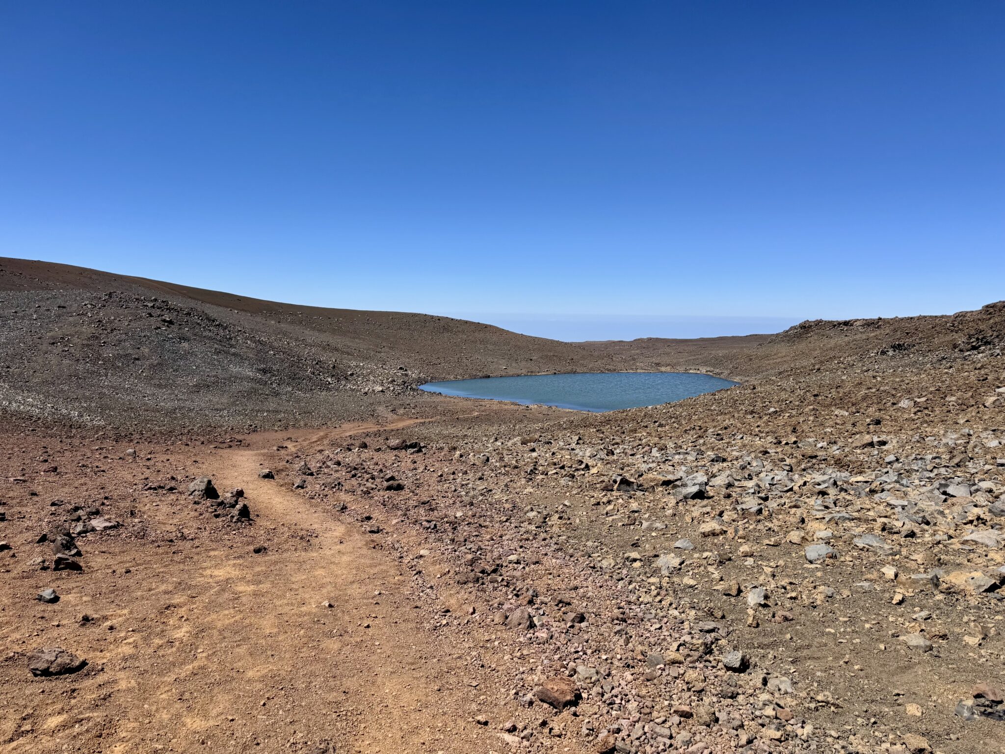
Lake Wai’au from above.
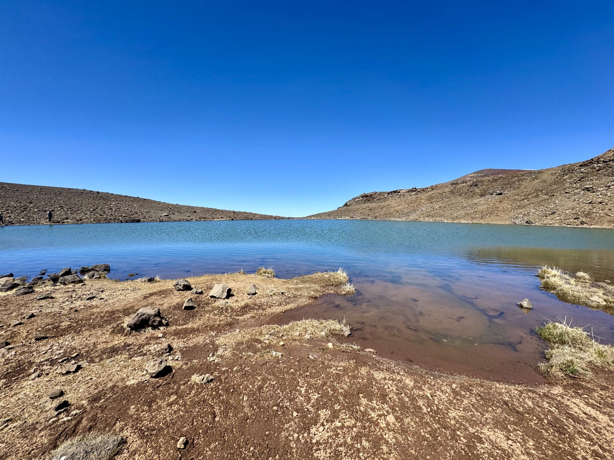
Up close and personal with the lake now. Later on the ranger asked me what I thought of the lake and I responded (probably like a moron) that I thought it was, “A bit underwhelming.” He laughed and the explained to me it is considered the birthplace of the entire Hawaiian islands. It is a sacred site and some Hawaiians (including this very ranger) take their children’s umbilical cords up there to be buried in a ceremony of respect. I felt like a proper haole asshole after learning all this, wishing I had been more educated on my way up. Thankfully, they were very kind about it…
Beyond the lake it was just a mile and a half or so up to the summit, with much of it on the paved service road. I was feeling great overall. The altitude was a non-issue and I was invigorated by the incredible setting.
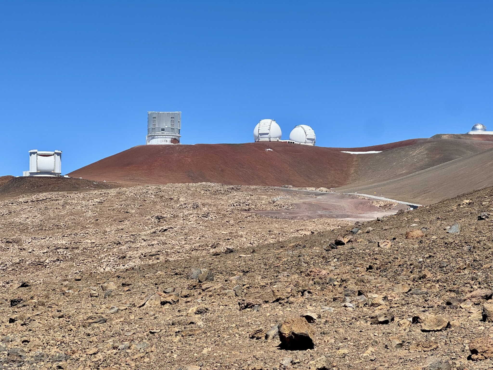
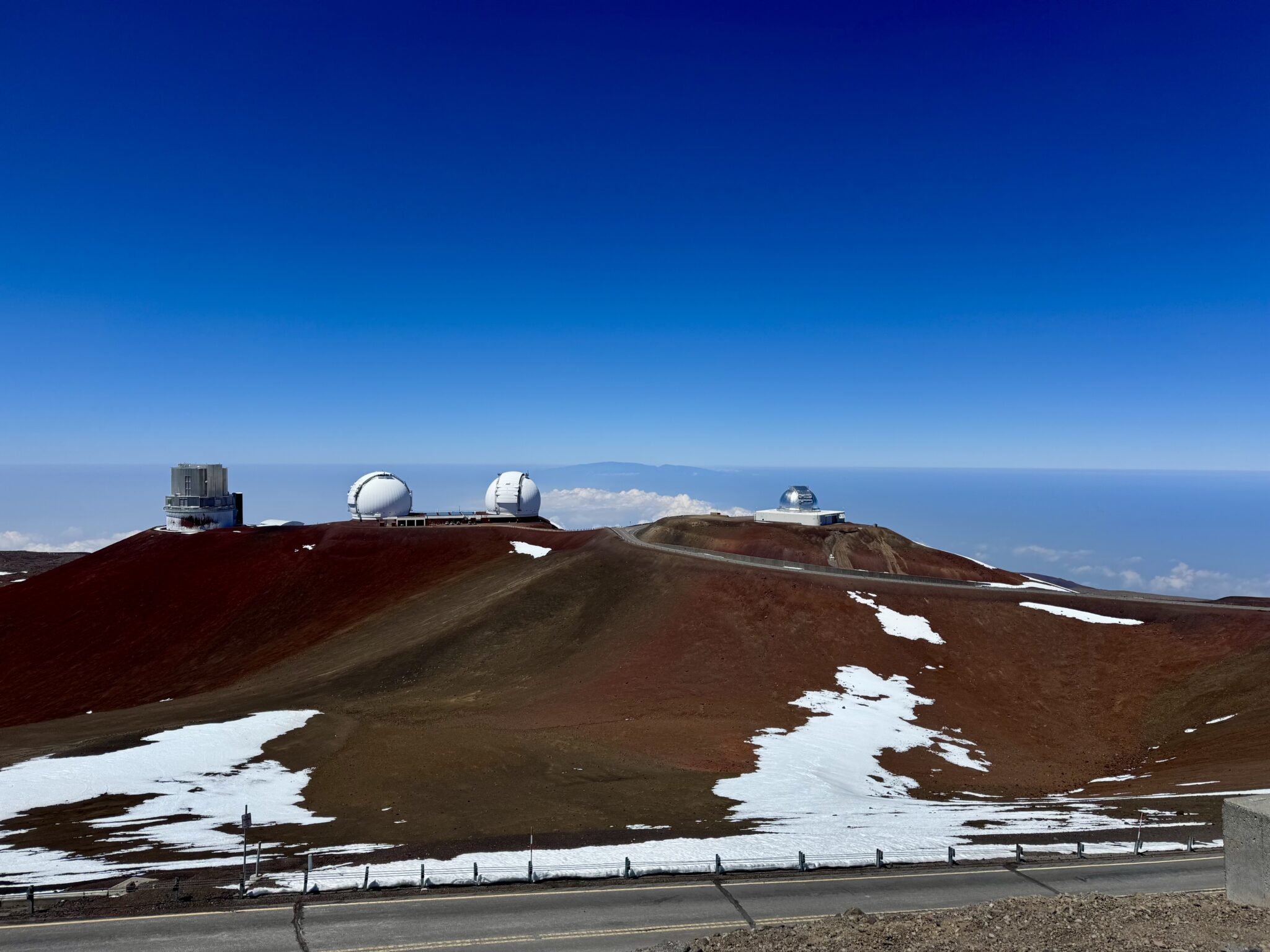
Beyond the lake the summit cluster of telescopes finally came into view.
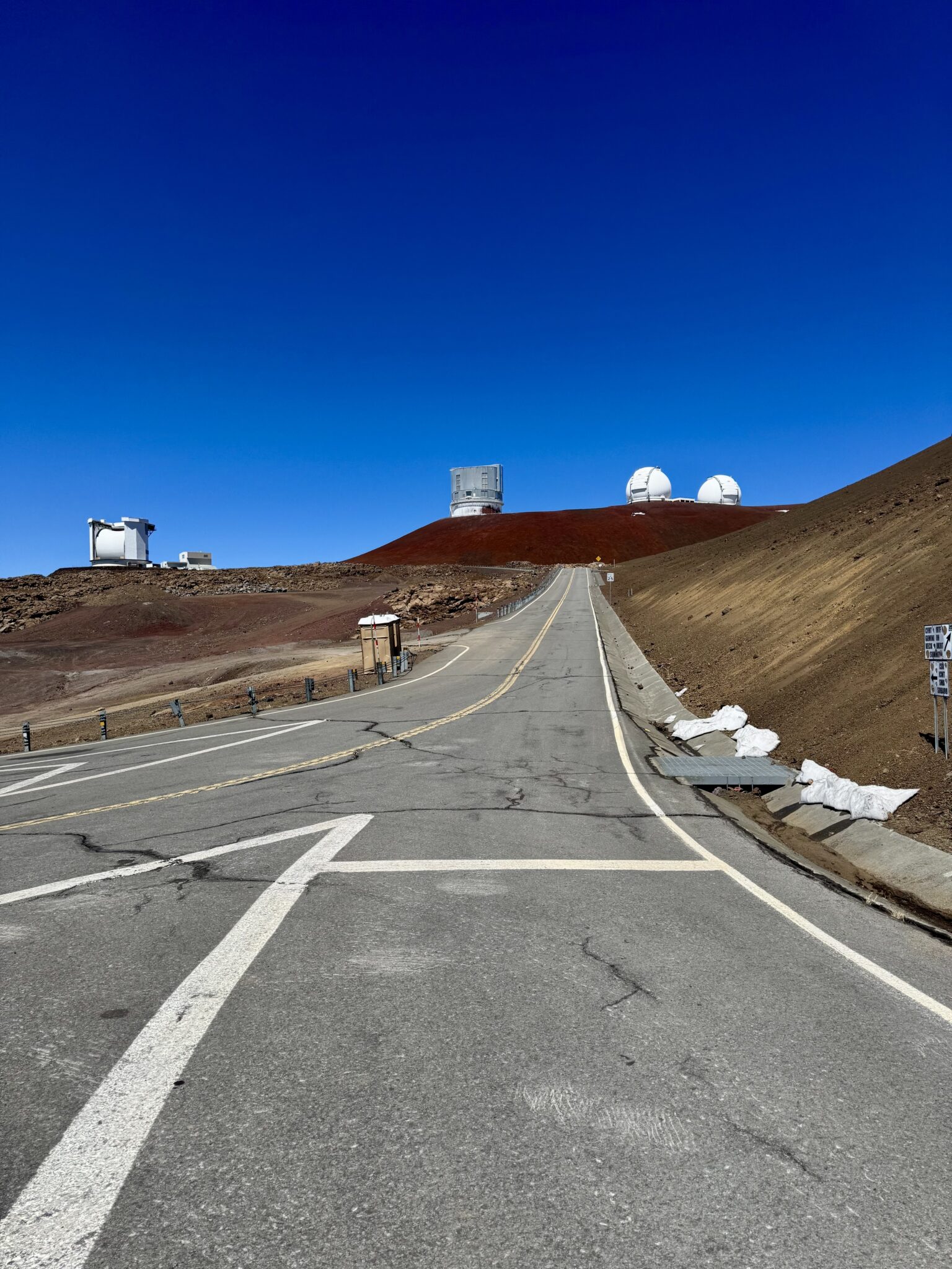
Looking up one of the service roads towards a group of scopes. These are managed by the University of Hawaii. They represent universities and institutions from all over the world. They were much bigger than I expected. They are basically the equivalent of multi-story buildings all over the place up there. Super cool stuff.

Looking down at the winding access road and cloud cover above the town of Hilo 13,000+ feet below. The planning and management of this entire road is directly modeled after the Pikes Peak Highway. They even have a brake check station half way down.
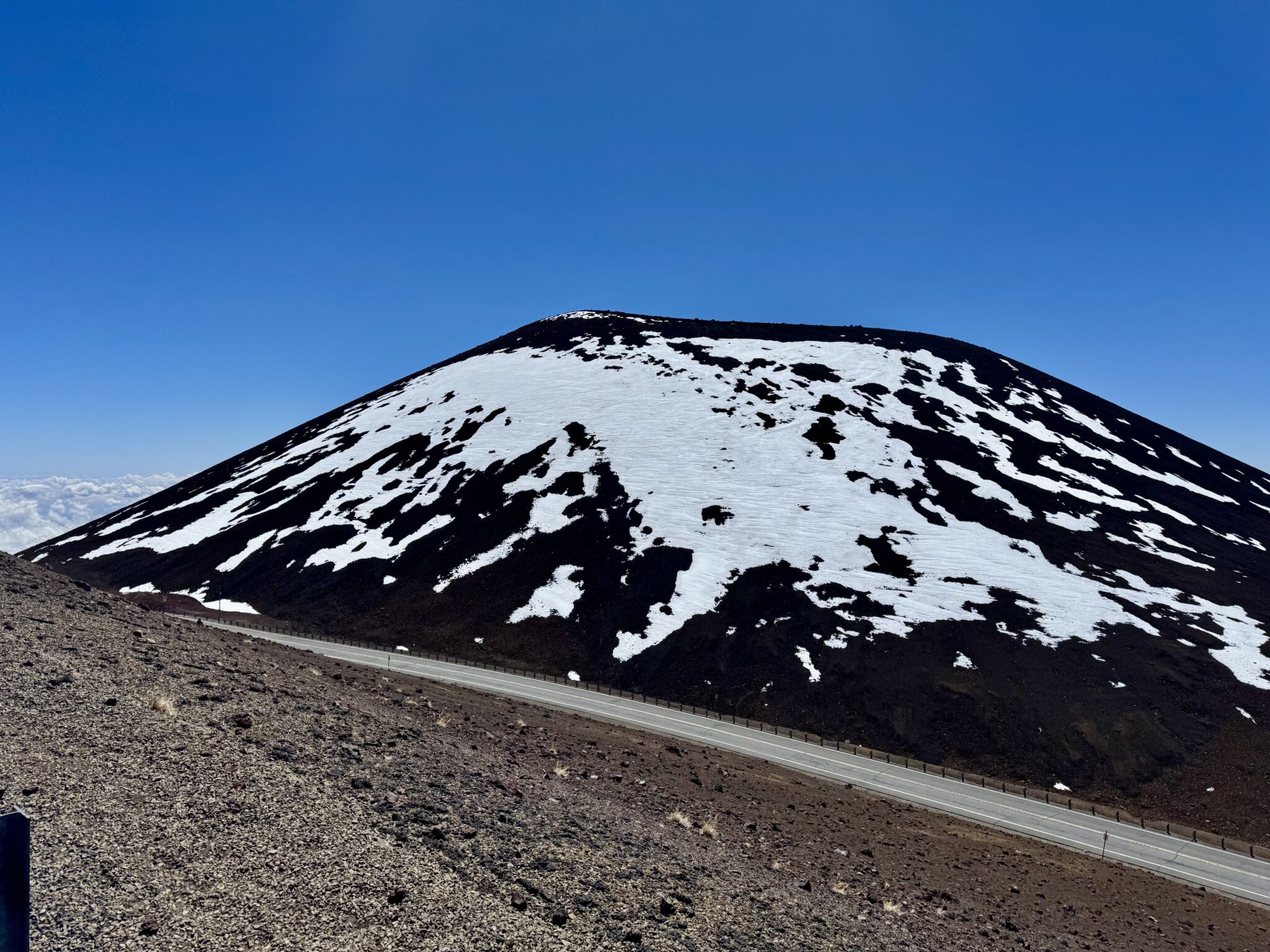
The island was in a dry spell during our visit, sadly, so only a bit of snow remained near the summit. When it does snow big up here it is quite the event. Local come up in droves to skis, sled, and slide down the slopes in any way possible. Some even load their pickups with snow and take it back down to lower elevations to use for a cookout in their homes, which sounds awesome to me. This is in keeping with an ancient Hawaiian ‘triathlon’ tradition. A long time ago runners would supposedly climb to the top, gather as much snow as they could, and then race down to the water as fast as they could go. If they had enough snow by the time they reached the ocean to form a snowball, they won!
After the steepness of the lower trail, the final mile on the road felt relatively easy. In fact, I made such good time to the top that I beat Katie (who had been busy with a bit of lower hiking of her own). But this was no matter as the day was beautiful and the views fantastic. I felt great. So, I took the opportunity to poke around a bit and enjoy the summit (mostly) to myself.
I skipped the actual summit out of respect to the locals as it is a sacred space. While it’s not technically illegal to go to the top, they ask that hikers refrain from doing so. I really didn’t feel like I missed anything by skipping out. The sub-summit was essentially the same height and views. Besides, sometimes it just feels better to intentionally skip the LOJ/peak bagging/summit fever for a change. There was plenty to ‘count’ about this mountain aside from touching the proper high point. And it felt nice to deliberately skip a high point in favor of a greater good.
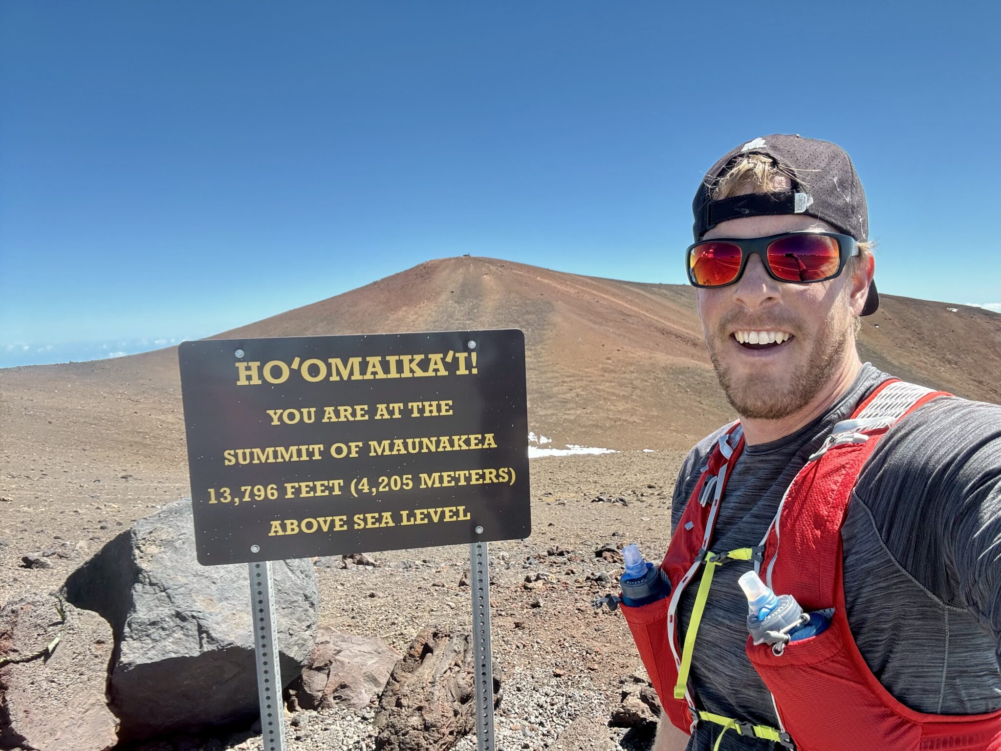
Made it to the ‘top’ of Mauna Kea, with the true summit beyond. They request visitors refrain from visiting it, which I was all too happy to respect.
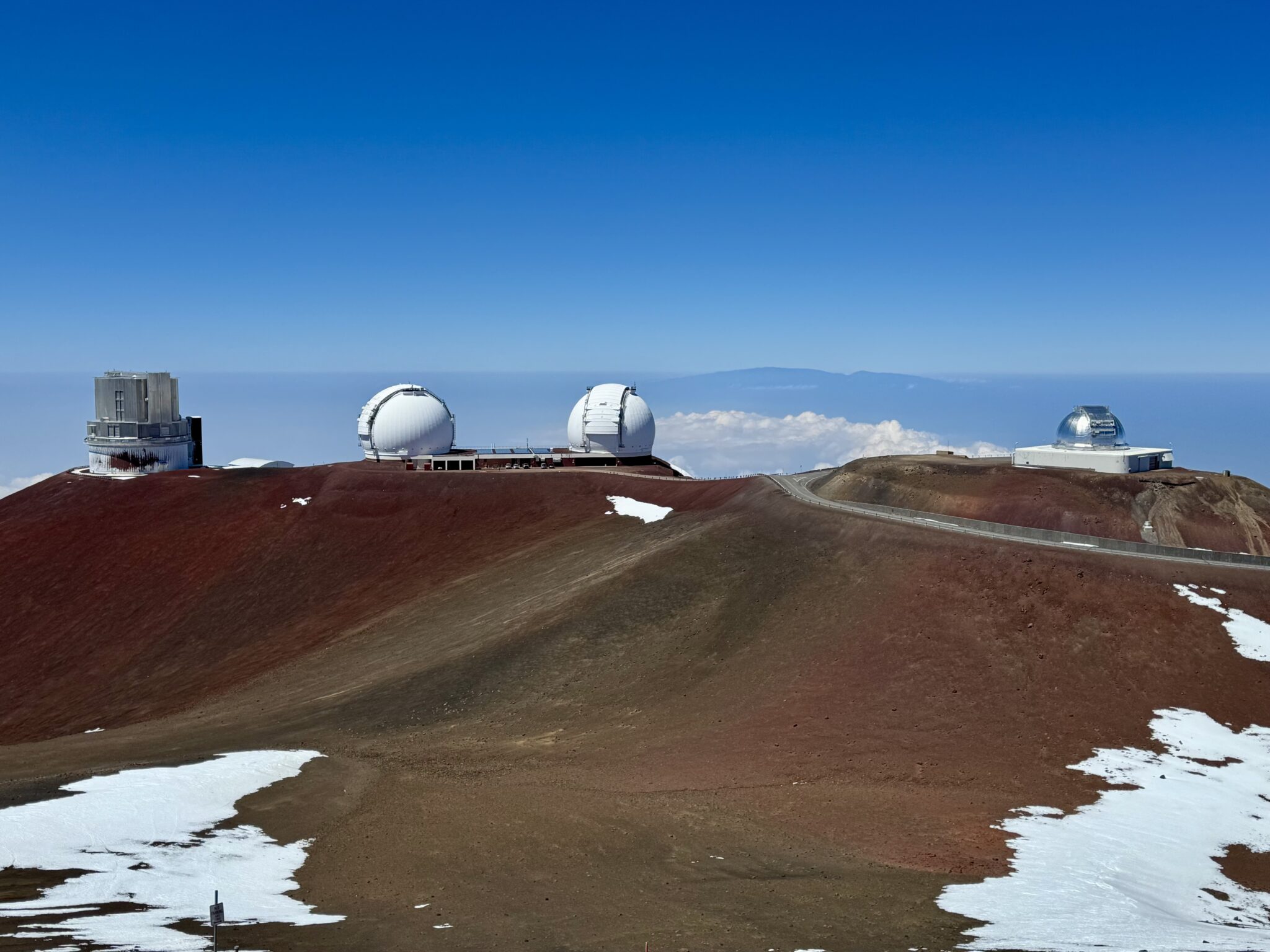
A view of some of the infrastructure around the top.
After a short while Katie rendezvoused with me via the road for our trip down. I was actually somewhat disappointed as I think the soft surface of the trail would have made an excellent descent, but driving the road was a unique experience all unto itself. Running up and driving down made for an excellent tour-de-Mauna Kea.
After taking it nice and slow down the road (note to any readers: the low gear on Ford Bronco sports are absolutely terrible) we checked back in with rangers.
“What was the time?” my friend from earlier eagerly asked.
“2:20 on the way up.” I replied proudly.
“Daaaamn…that’s pretty good, bruh!” He said.
I felt very pleased to get props from a proper Hawaiian. Of course, looking at Strava times later I realized (like always) that there are plenty of folks who have done this way faster. But we won’t think about that too much. I was quite content with my effort.
Anyway, we talked to the rangers for probably a half hour or so as they gave us all kinds of cool facts, stories, and information about the mountain. I think they appreciated a willing, eager audience. And that we were. As with any mountain, the more I learned about it, the more I came to respect and care for Mauna Kea. I think it’s kind of easy to take it for granted or miss it on a trip to the Big Island (after all, there are a LOT of very interesting things here). But I for one am sure glad we didn’t skip it. Striding up this peak was easily a trip highlight. And I’ll be very surprised if I do a cooler mountain all year long.
Having said that, there are tons of other cool hikes and adventures to be found on the Big island as well. Now, I’m fully aware that looking through other people’s vacation photos is usually a chore best avoided. But just the same, here are just a few other fun shots from our incredible stay on Hawaii.
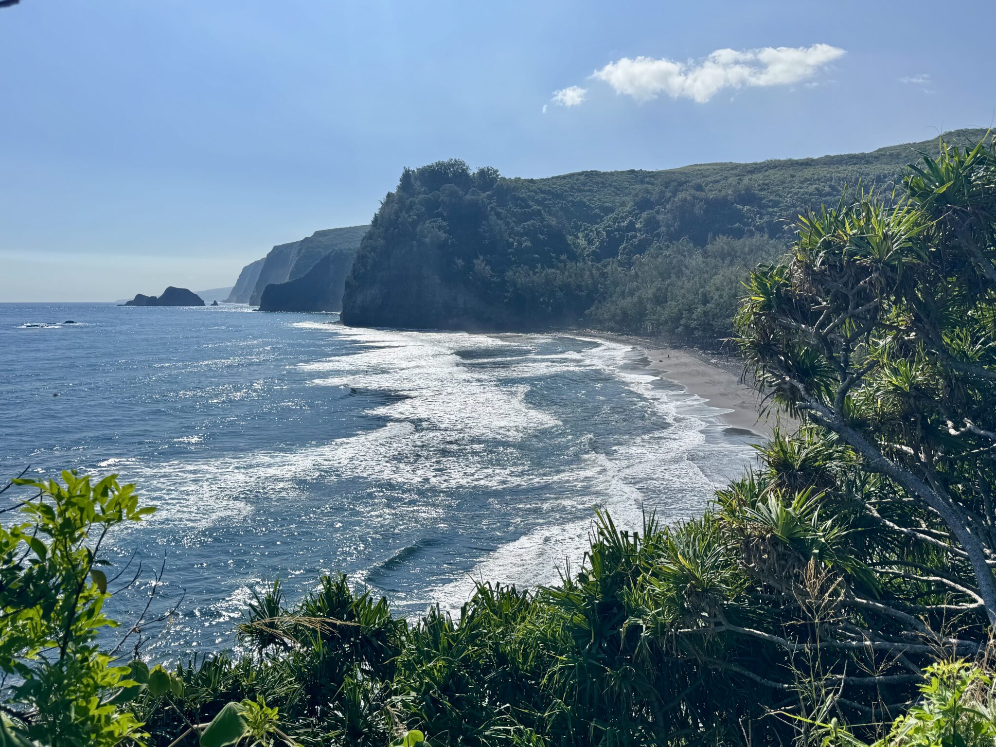
Views down into the Pololū Valley. It’s hard to say what was better about this day: hiking down into yet another sacred Hawaiian site and it’s magnificent beach, or watching the hippie camp on the beach get broken up by the rangers!

The beautiful freshwater lake at the exit from the Pololū Valley.
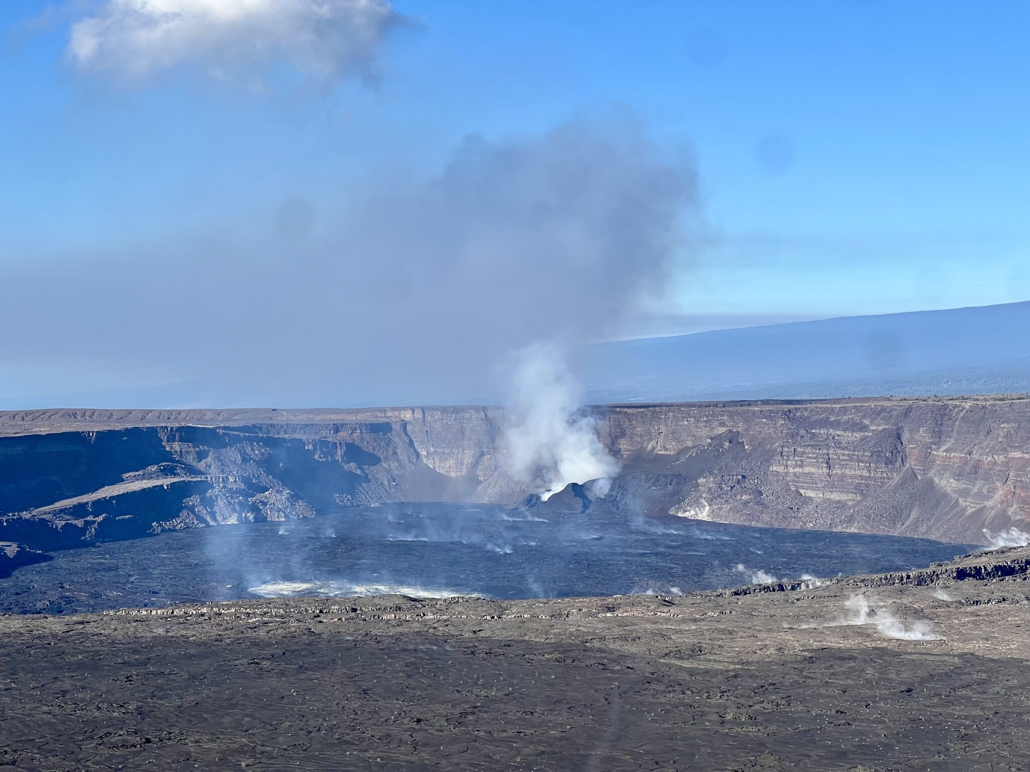
Views of a steaming Kilauea within Hawaii Volcanoes National Park.
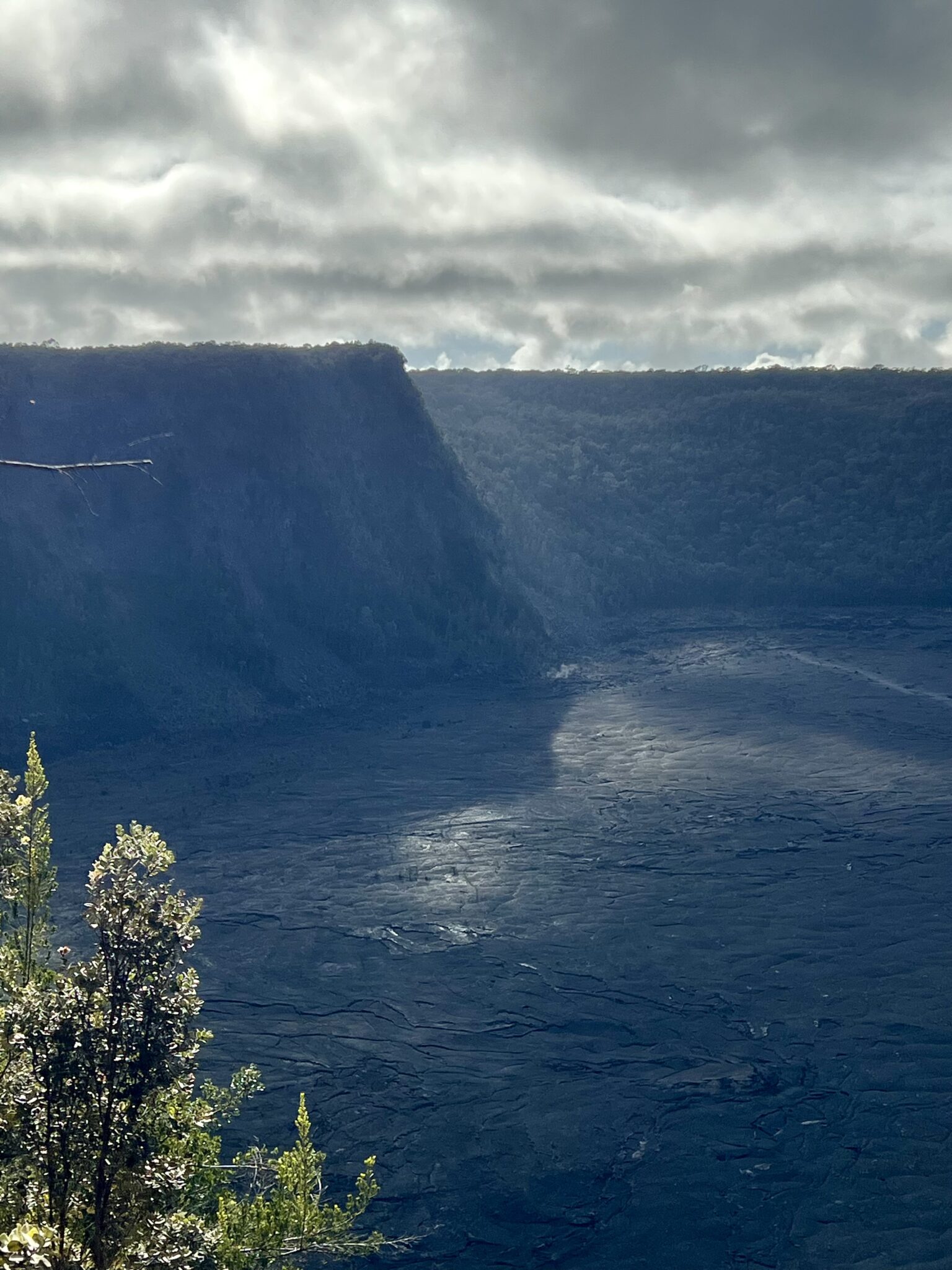
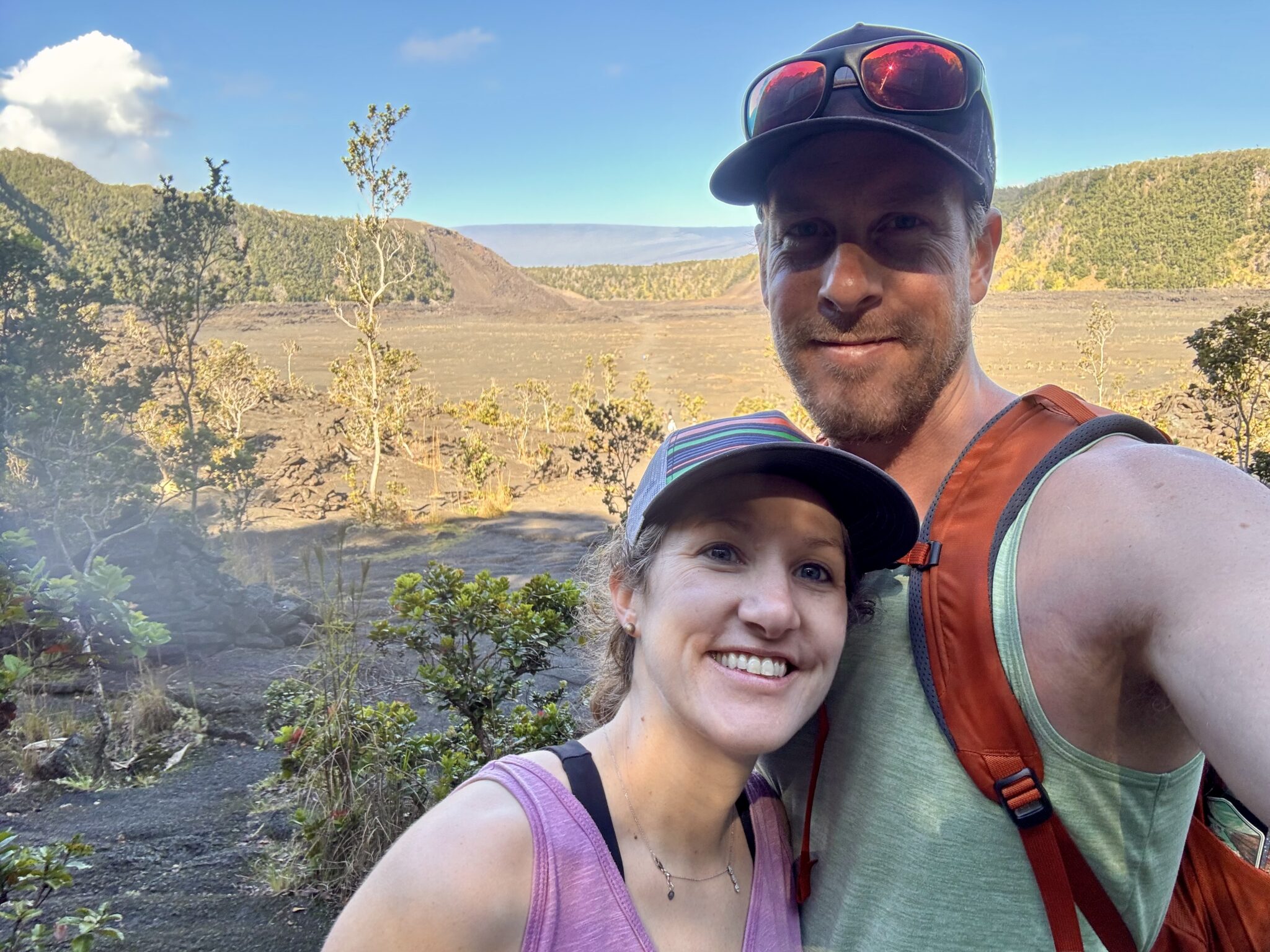
We did a big circuit hike around Volcanoes National Park, highlighted by a trek across the surreal Kilauea Iki Crater. Back in 1959 this crater was filled with molten lava 414 feet deep.
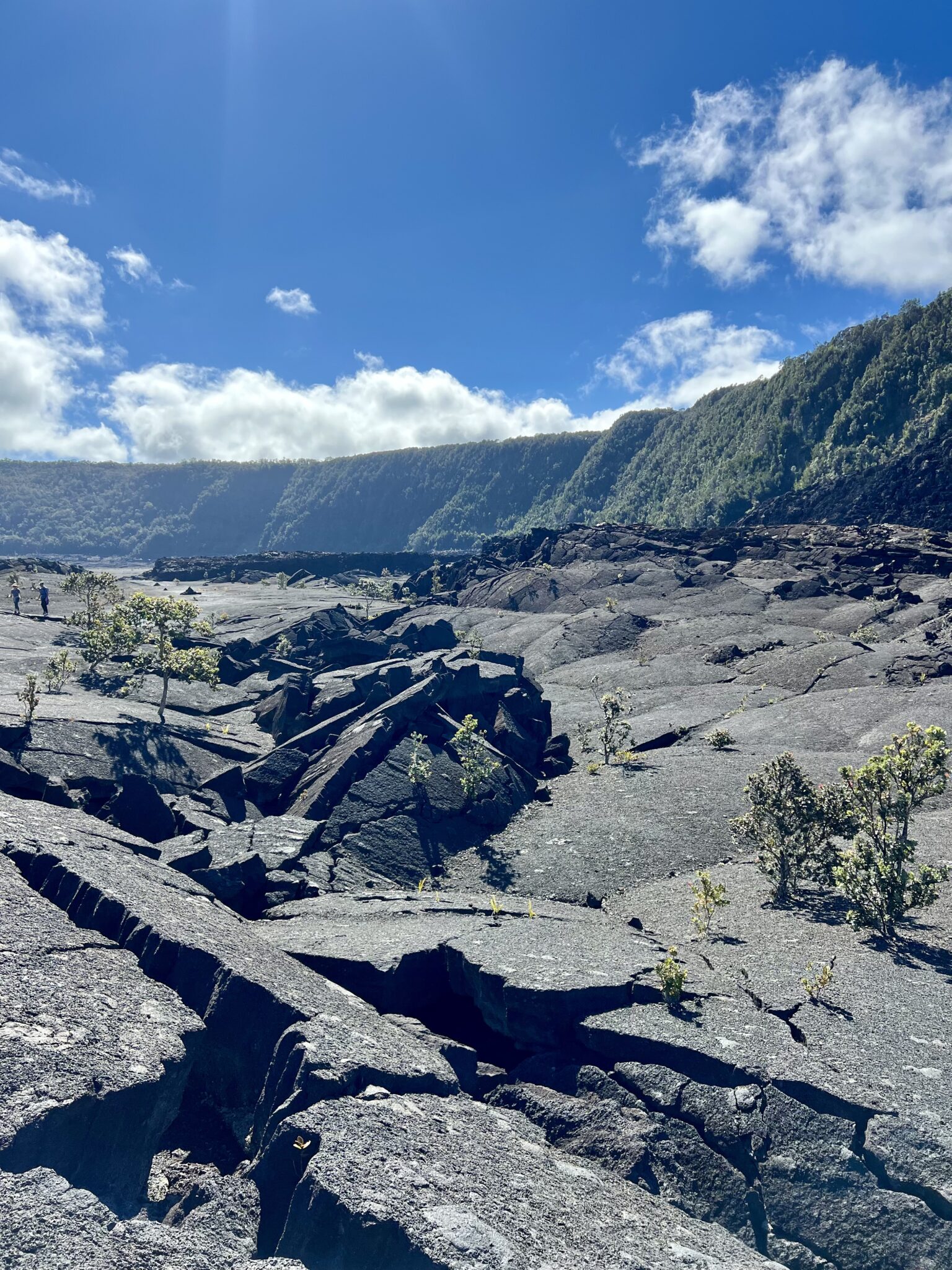
Views from the floor of the Kilauea Iki Crater. Lava fields below; rainforest above.
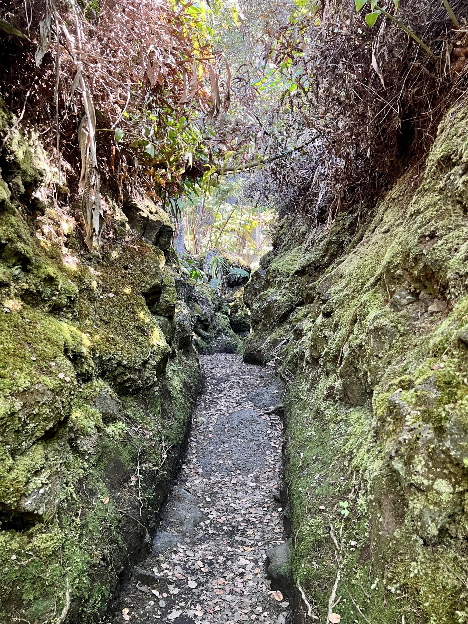
Views of said rainforest from the Halema’uma’u Trail.
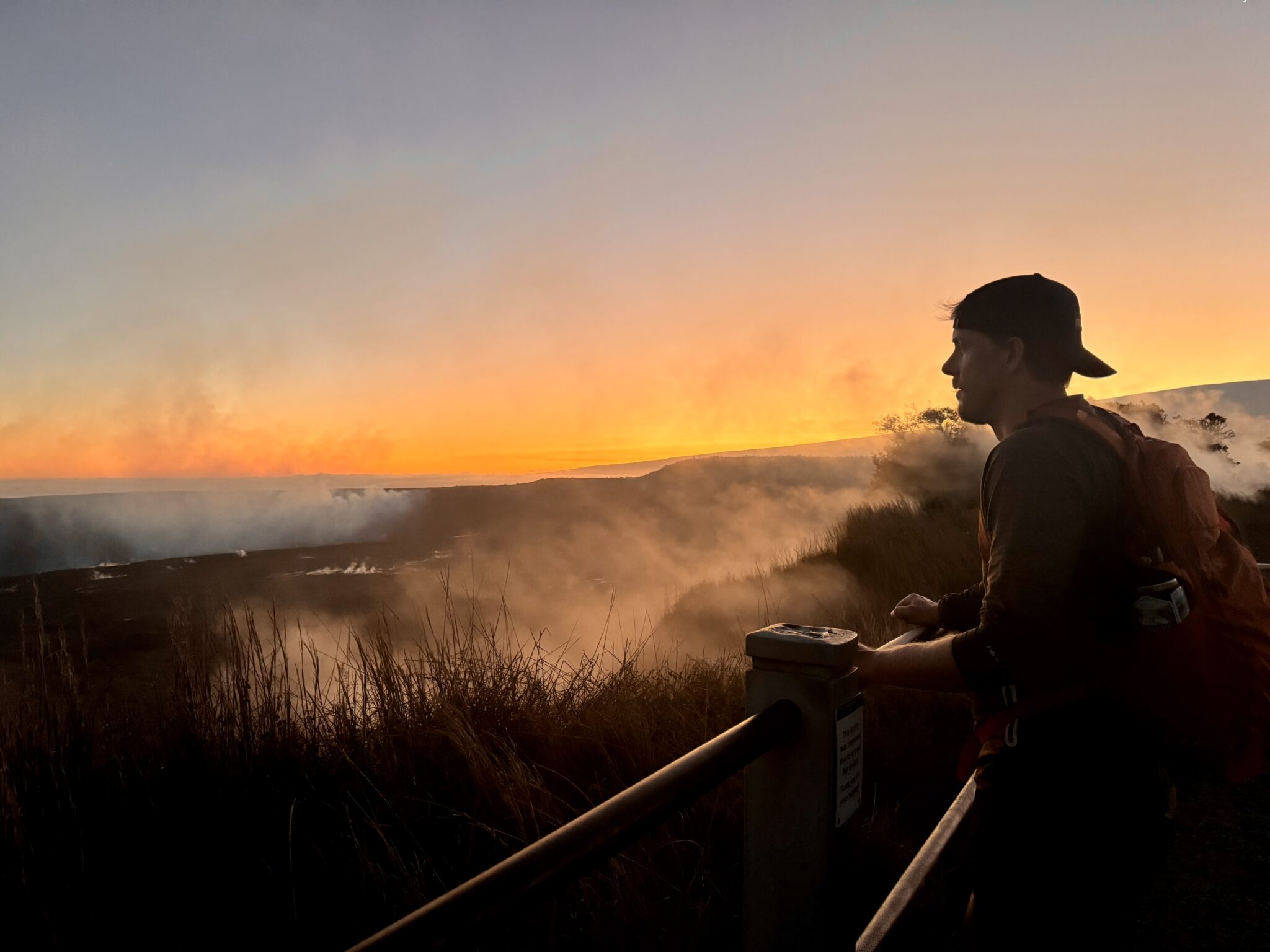
Steam vents spouting off on a sunset stroll along the appropriately named Sulfur Banks Trail in the park.
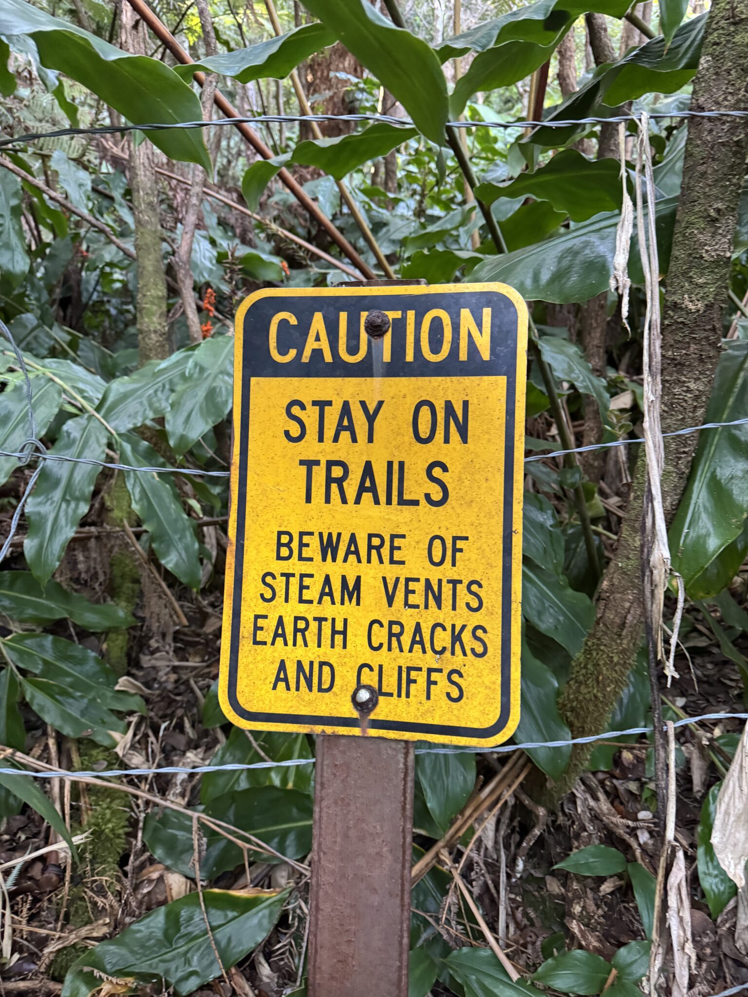
Classic Hawaiian trekking hazards.
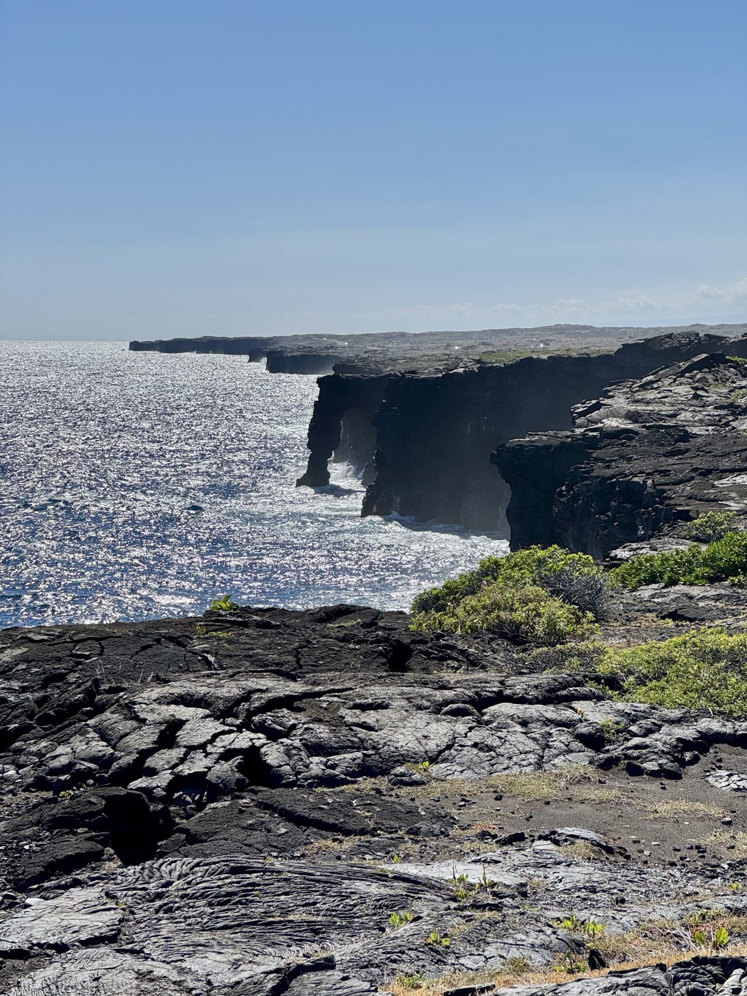
Hōlei Sea Arch. I stood on top of this during my first trip to the Big Island. But, in typical ranger fashion, they closed the near access to this, necessitating a much further (and far inferior) view today.
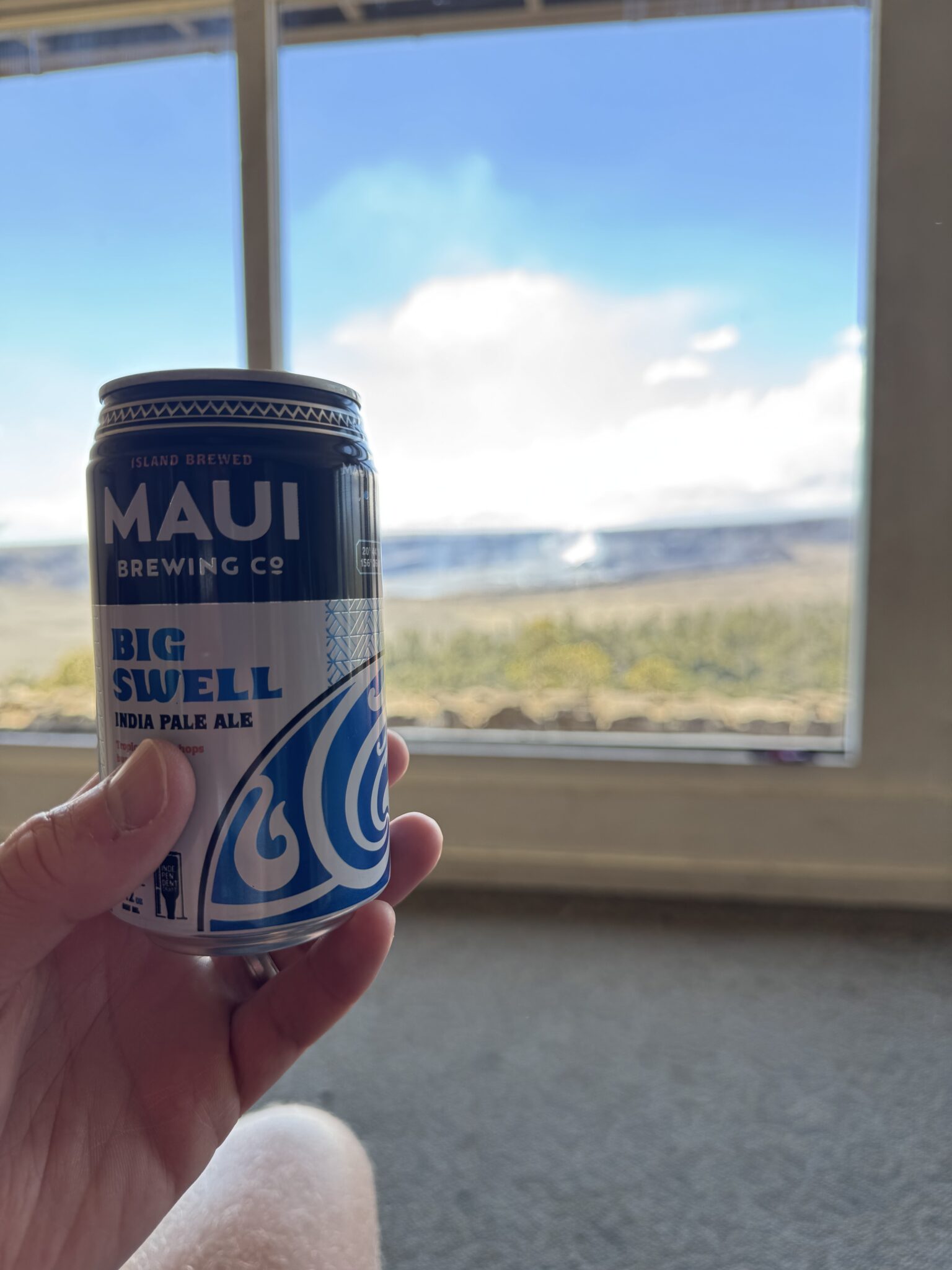
I challenge anyone to find a better view in a national park lodge than the one out the main lobby window from Volcano House. Perfect place to enjoy an island brew and watch Kilauea do her thing for hours on end.
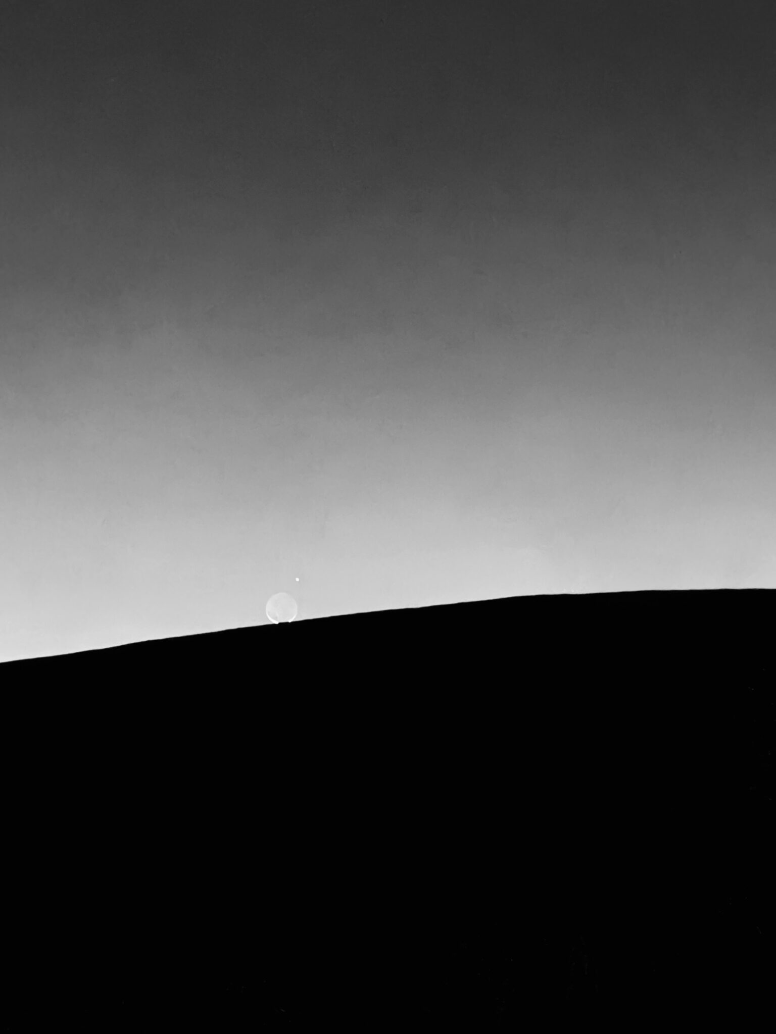
Venus looks on as the moon slips behind the massive flanks of Mauna Loa.
xoxo
Thanks for reading if you did. Happy climbing!
Looks like a fun vacation! Crazy to be on such an expansive, bleak landscape above all the lushness of Hawaii’s lower elevations. Great report.
Thanks, Steve. Ya, it sure changes quickly up there. Pretty wild.
Thanks for a great write-up. You’ve got me interested in making this a trail run must-do when I get to the Big Island. Funny, as soon as I read your sentence about Lake Wai’au being the highest tarn, my mind quickly said…”wait a sec…it’s Pacific Ta…” oh, ok, next sentence, you called it out.
Might want to fix the elevation on Pacific Tarn to 13,420′ 🙂
Thanks, John. Definitely a must-do for any runners headed over there. And that’s funny about Pacific Tarn. I actually kept this fact close to the vest while there as a lot of the signage was claiming Lake Wai’au as the tallest. But probably best to only disrespect the lake myself in only one way, haha.
And thanks for the typo catch on the elevation!
Great report! Mahalo.
Here’s to hoping you were able to put down a few celebratory malasadas post-run.
We missed those – dang. But I did singlehandedly support Maui Brewing Company while we were there, which was nice!