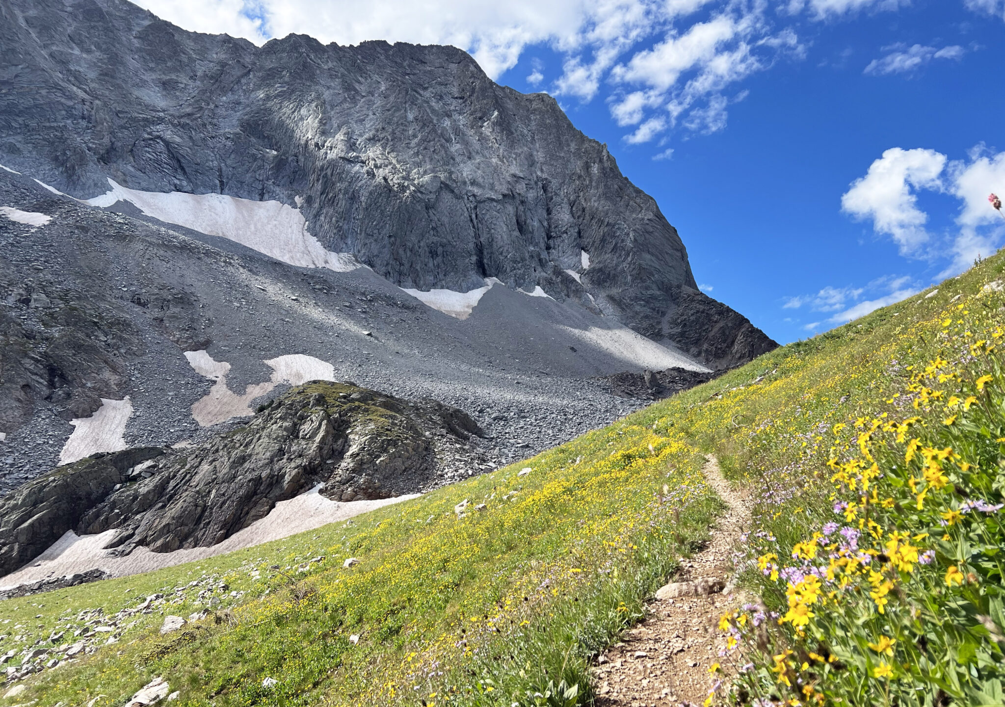
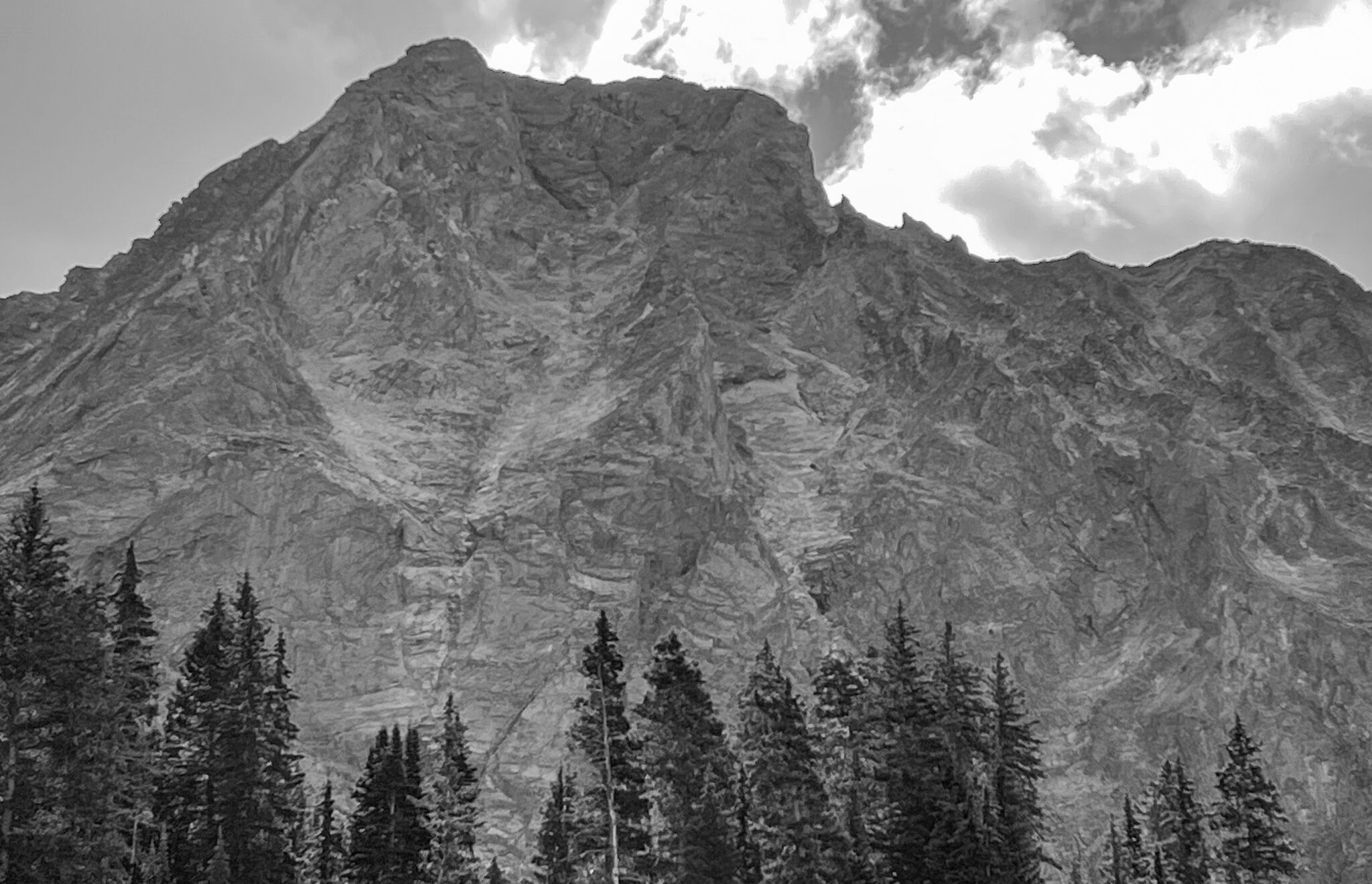
Capitol Peak’s north face from high on the Capital Creek Trail.
Long runs have been tough to come by for me this summer for a variety of reasons. But with only a few weeks left until the Grand Traverse dual sport races, it was now or never to try to get a substantive training run in.
For several summers now I’ve headed over to the Elks and pieced together a big wilderness loop of some kind. I’ve always felt if you’re gonna spend all day on your feet whether it’s for training purposes or not, you might as well look for something unique in a cool area to make things more interesting. With its vast network of trails, there are lots of options for these kinds of big days in the Maroon Bells-Snowmass Wilderness. So I decided to check out another loop in the Capitol Peak area of the northern-Elks which had long been on my wish list.
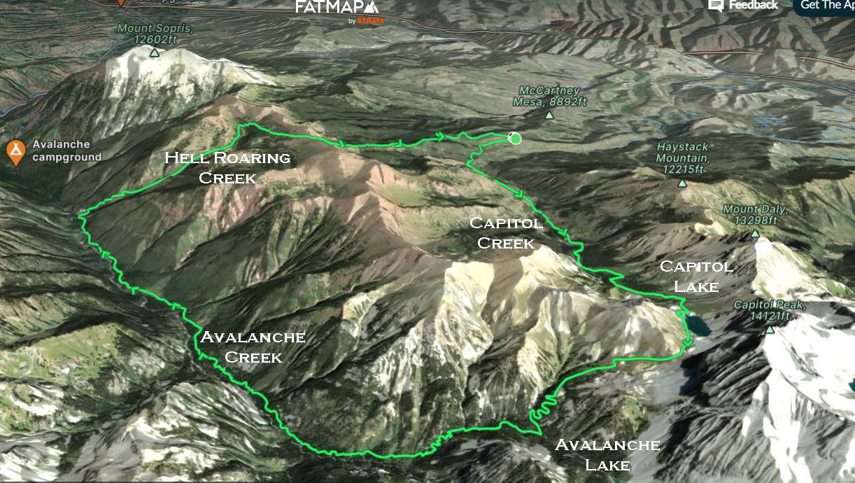
A map of the loop, looking from south to north. Click to enlarge.
This one is a tad on the obscure side in that I haven’t noticed too many people mention it or run it over the years. One or two trip reports from over a decade ago can be found online, but generally speaking, this linkup doesn’t seem to get as much traffic as some of its more popular siblings (Four Pass, Three Pass, etc).
The route goes like this… start at the Capitol Creek TH and follow the ditch trail up to Capitol Lake. Continue up and over the pass north of Capitol Peak, descend into Avalanche Creek, then head north for 8 miles to the junction for Hell Roaring Creek. From there a 4,000 foot climb up the Hell Roaring drainage leads to the top of a ridgeline south of Mt. Sopris, and the loop is capped off by a descent back to Capitol Creek.
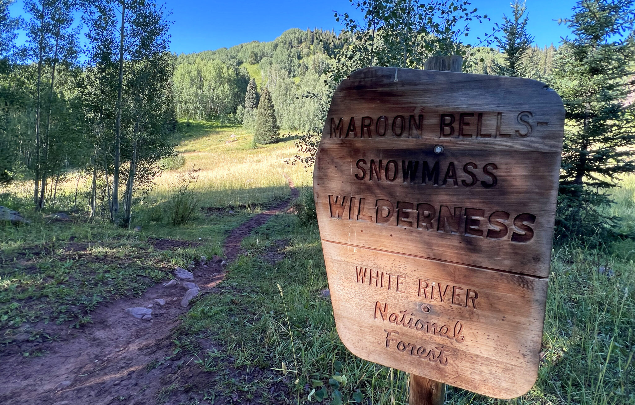
Entering the wilderness, where bicycles cannot go. This is why I’ll always be a hiker/runner, in some capacity.
I got the day rolling at 8am and hit Capitol Lake about an hour and a half in. The initial mileage went quickly thanks to the cruisier 14er trail that’s only gotten more curated as the years have passed by.
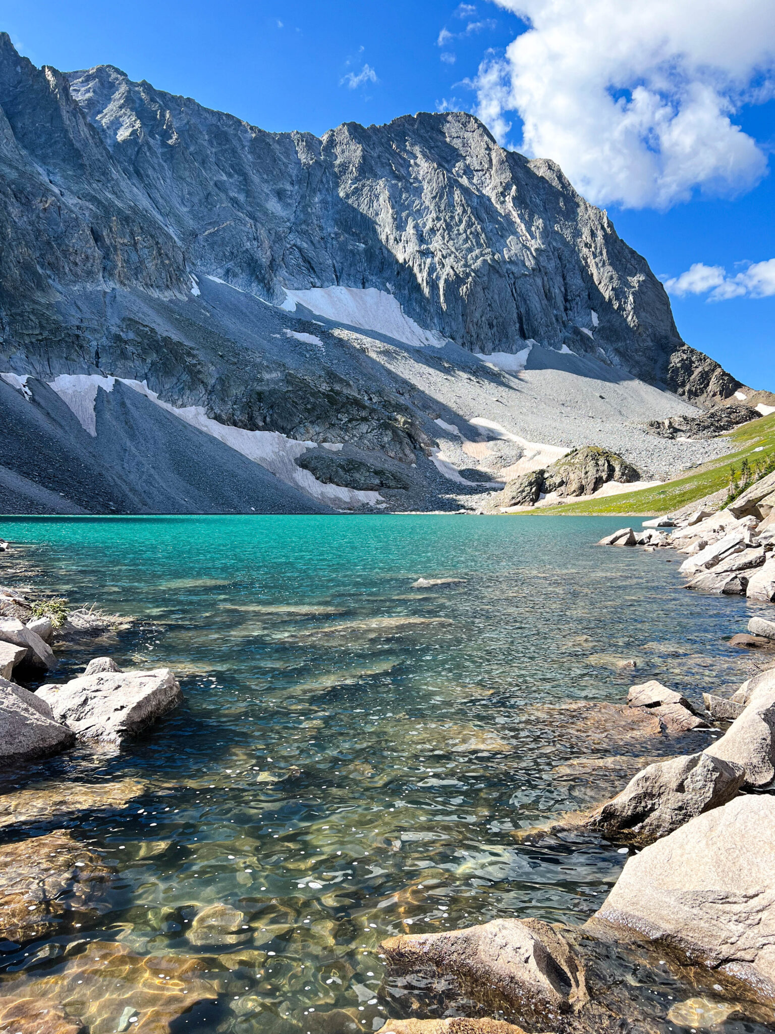
Good morning Capitol Lake.
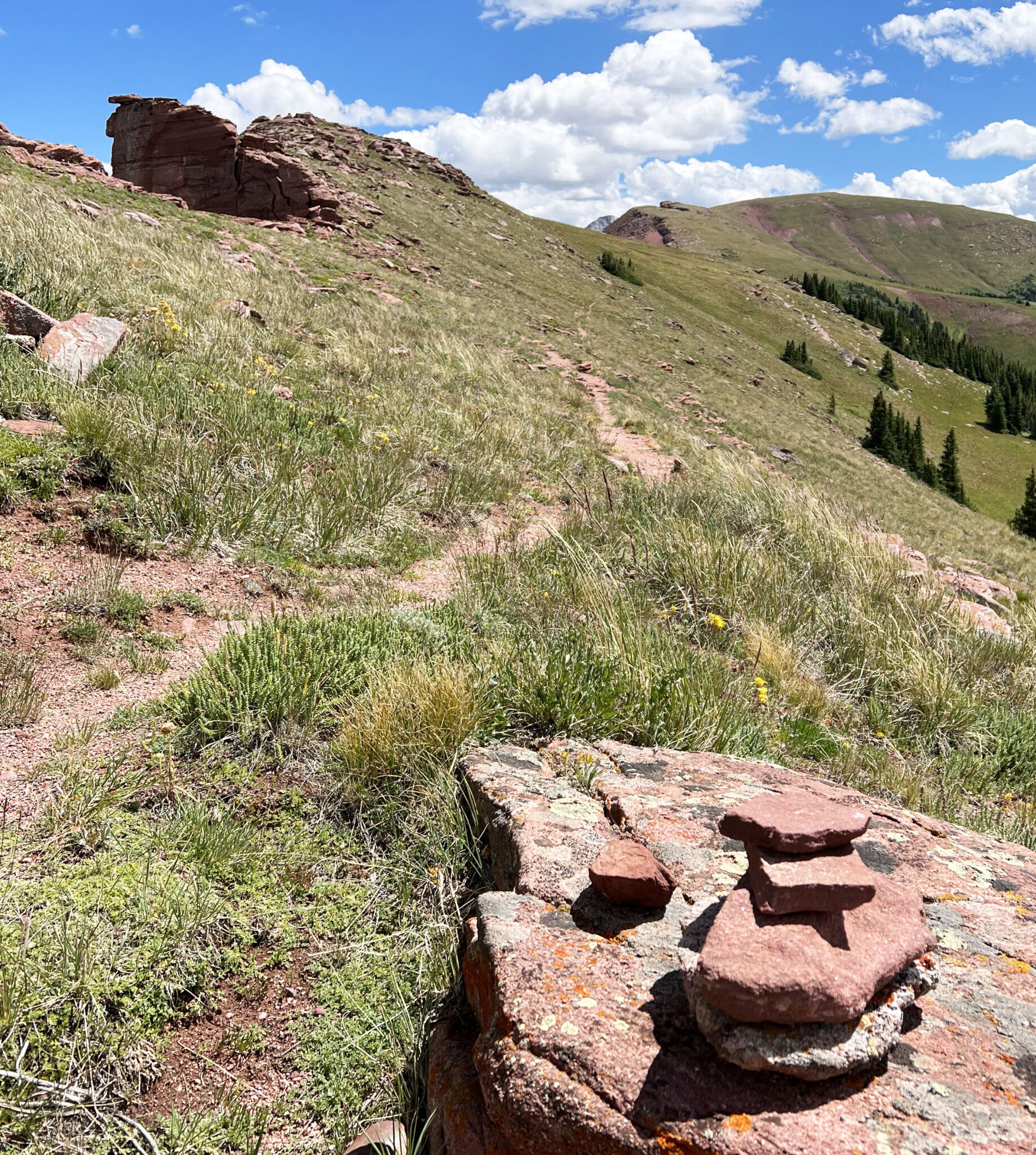
From the lake, a defined trail climbs southwest through flower meadows before the unnamed pass directly north of Capitol’s north face is gained.
Looking back at the lake and Mt. Daly. Pretty cool spot.
On the descent into the much more remote Avalanche Creek drainage.
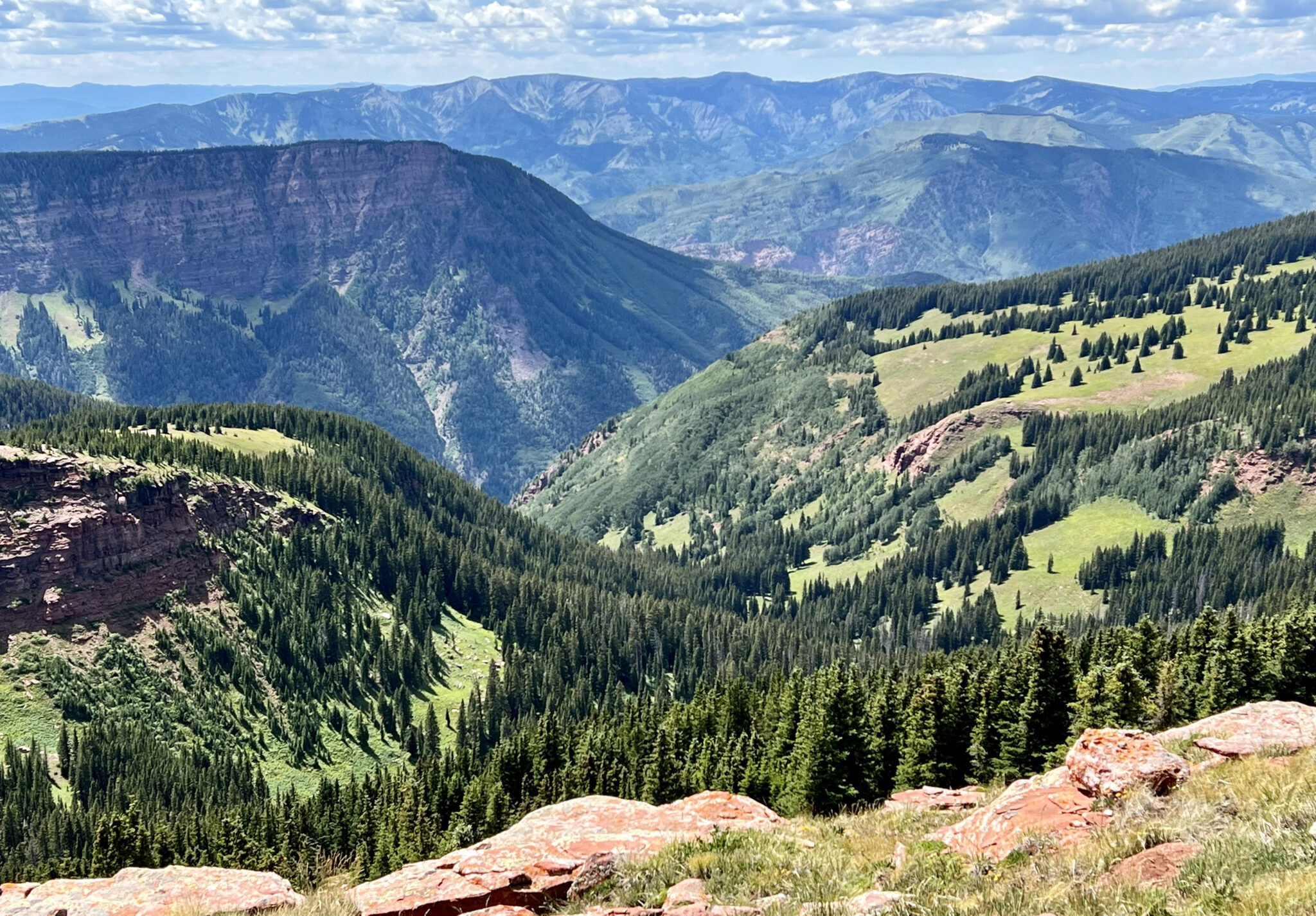
From the pass, it’s a long descent down into the bottom of Avalanche Creek. Pretty quickly the route turns from feeling familiar and well-traveled to very remote and isolated. Though the Avalanche Creek trail is more heavily traveled in the first few miles south from Redstone or between Marble and Avalanche Pass, the middle section of the trail is so far from any starting point it sees little traffic.
The backside of Cap.
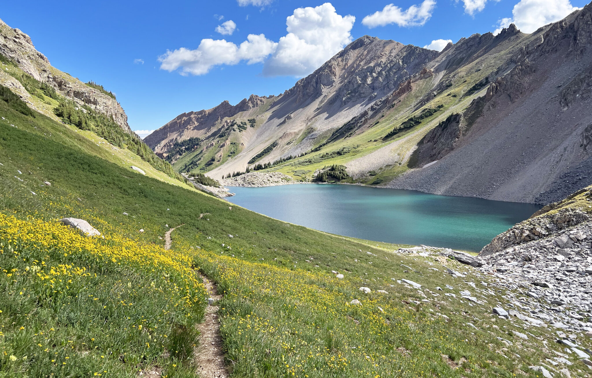
Soon after the turnoff for Avalanche Lake, the trail is very overgrown and difficult to follow in places. Again it just doesn’t see enough foot traffic to round it out. After knocking off a few miles, further north up the drainage things open up a bit more. There isn’t much elevation gain through here so when the trail is defined, it’s easy to keep up a run/jog.
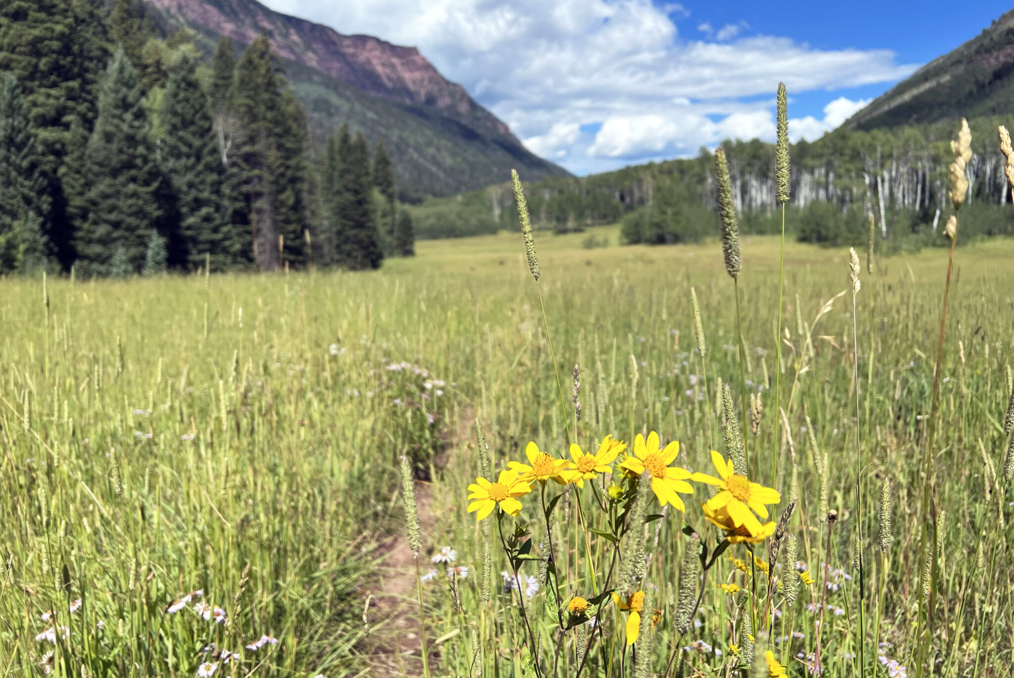
Meadow skipping in Avalanche Creek.
After what felt like a really long time I finally came upon the junction for Hell Roaring Creek (it’s ~10 miles from the pass below Capitol to this junction). The bridge over the creek is currently being rebuilt after it was washed away in the raging spring melt off of 2019.
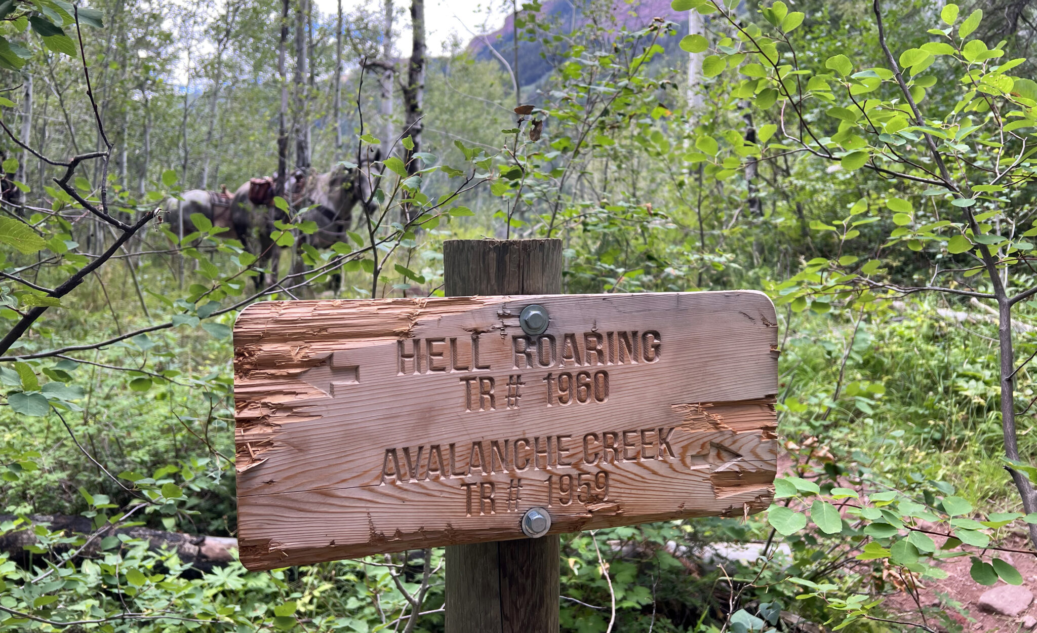
The turn that can’t be missed if you want to make it back to Capitol Creek.
The crux of the route is pretty clearly the climb up Hell Roaring Creek. It’s 4,000 feet from the valley floor to the ridge top, which must be gained before you can descend back to the Capitol Creek TH. If you hit this point in the day and don’t have much left in the tank, you don’t really have many good options for getting back to your car, so plan accordingly.
The Hell Roaring trail starts off strong but then slowly peters out further up in the drainage, to the point where it pretty much disappears entirely and there are intermittent cairns marking the general route up to the ridge crest. To put it bluntly it’s just a big damn climb up one of the more remote drainages you’ll find in the Elk Range.
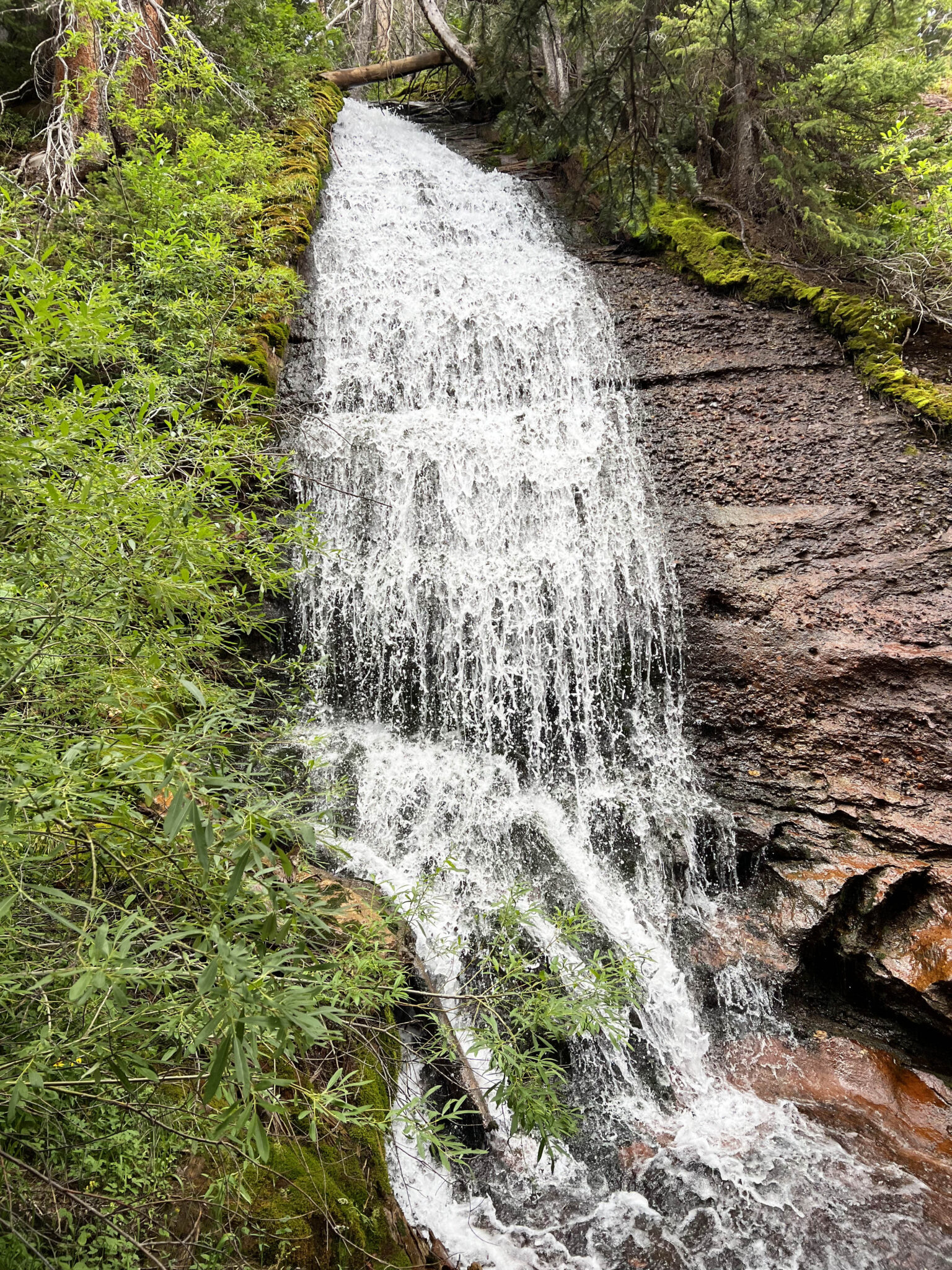
A waterfall along the way. The drainage was supposedly named after the roaring creek that plunges down its steep embankments, particularly in spring.
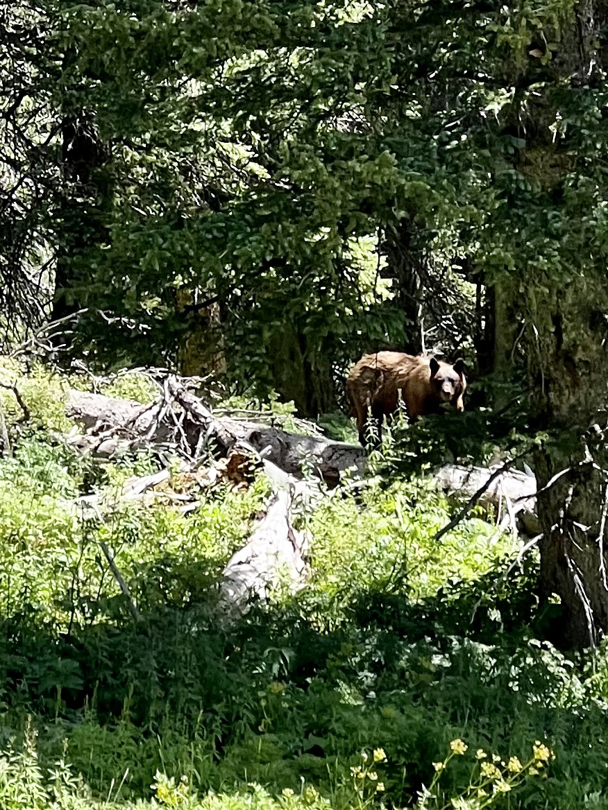
Bear!
After knocking off about 3,500 feet of climbing I rounded the corner into a meadow and came face to face with a mama bear and her cub. They were just as startled as I was and the cub ran up a tree with mom positioning herself between us, sizing me up. I apologized for trespassing in their meadow and slowly backed away up the slope behind me. Once I was farther away, mom seemed to calm down a bit and it was pretty awesome to just sit for a moment and appreciate the encounter.
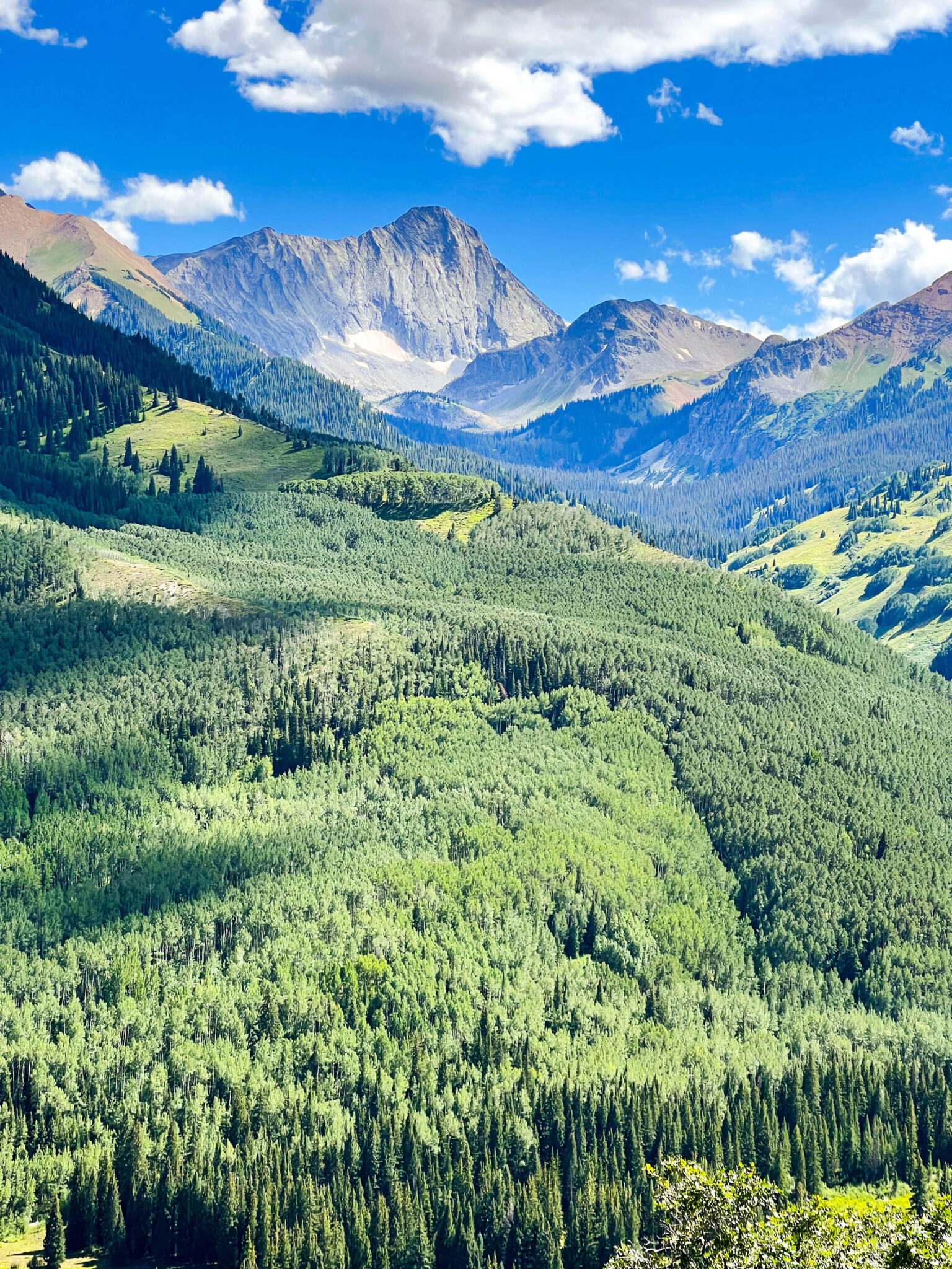
The ridge crest, at long last.
A few hundred more feet of climbing and I finally reached the ridgecrest. Mt. Sopris’ dual summits look so close from here it’s almost tempting to run out and tag them.
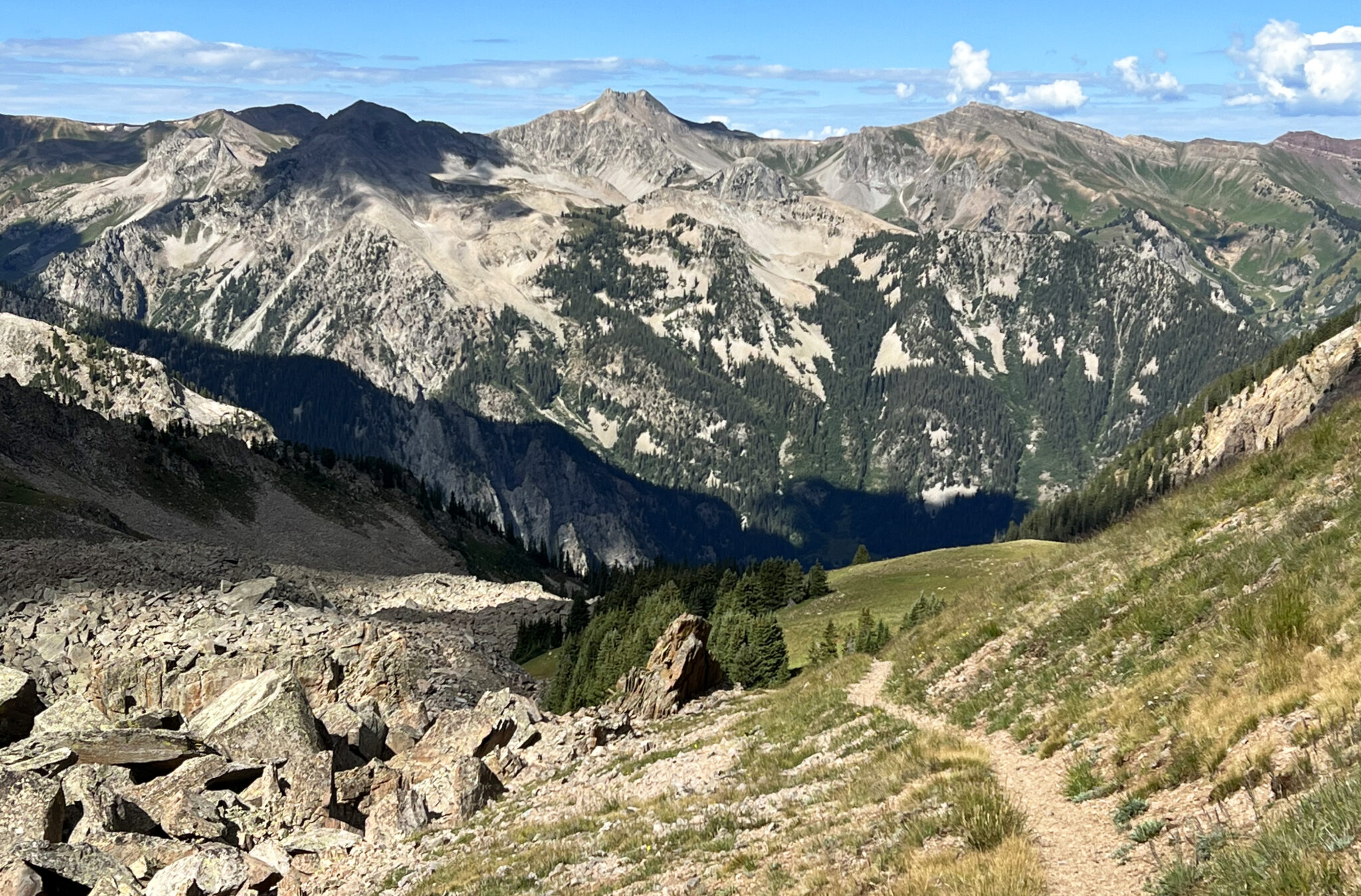
Looking back down the Hell Roaring drainage. What a wild place.
From the ridge it’s almost entirely downhill on a pretty strong trail. I get the sense this section sees a decent amount of traffic from people hiking up from the Capitol Creek TH, either intentionally or accidentally.
Done.
The loop clocks in at ~25 miles and 7,500 feet. It honestly feels a bit bigger than that as several sections of the day are pretty hard-earned. Overall a loop worth checking out though if you like long adventure days into lesser known areas. My one piece of advice… bring bear spray 🙂
Cheers
…and happy trails.
Dang, hell of a loop! Crazy encounter with the bears!
Yeah, first time running into a bear out solo.
Nice work, Ben. This is a sweet link up. You’re great at finding these. Glad you made it out safe!
Thanks Dave! So many good loops in that area.
benners!!!! Was so glad to see that you still post here when I found the link on 14ers in your profile!
Still here, trying to keep the ol blog going!