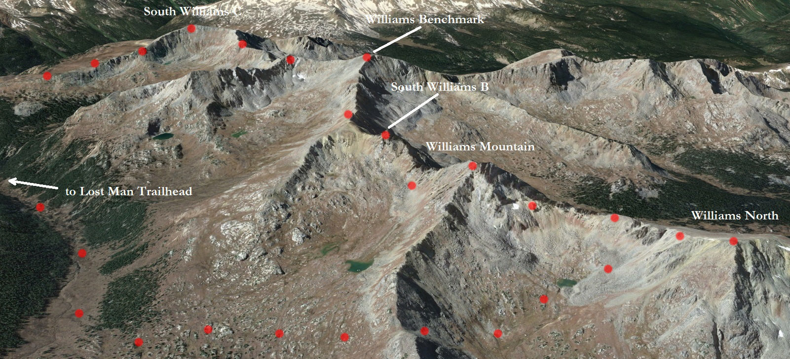
The Williams Mountains are a nice set of peaks on the west side of Independence Pass in the Hunter-Fryingpan Wilderness. Together they form the high points of a long north-south ridge line that separates the Lost Man and Hunter Creek drainages. Spread out along the ridge are five ranked thirteeners, which are often strung together in a single push from Lost Man TH in what has colloquially become known as the “Billy Traverse”.
I had been intrigued by this traverse for some time, having looked at it over the years from most of the higher summits in the area. Well, last week I finally got around to checking it out and it didn’t disappoint.

Looking south at sunrise from the Midway Pass trail. A nice morning to be in the northern-Sawatch for sure.
With a nice trail from the parking lot all the way to 12,300 ft I was able to make quick work of the approach to the base of the first Williams Mountain. Not long after coming upon the small lake in the photo above, it was time to leave the trail and head up easy tundra slopes to “South Williams C” at 13,033 ft.
I didn’t stay long on the first summit, as the morning was still quite brisk and I knew I had a lot of terrain to cover. The stretch from South Williams C to Williams Benchmark went quickly, and by the time I crested the summit, the sun was out and beginning to warm things up nicely.

Williams Benchmark, also known as South Williams A, 13, 312 ft.

Wildflowers on the east slope of Williams Benchmark.
The next stretch of ridge held the first scrambling of the day, necessitated by a set of towers preventing easy access to the sub-summit of South Williams B. A nice ledge on the north side of the ridge, followed by a short class 3 downclimb led to the saddle, after which I jumped over to the south side of the ridge and skirted my way around the sub-summit. A short scramble then led to the summit of South Williams B.

That’s where I’m hoping to wind up in a few hours. The towers I mentioned can be seen lower right, with the sub-summit of South Williams B, South Williams B proper, and Williams Mountain to the right (south) of North Williams, which I’m pointing at.

Taking a breather on the summit of South Williams B with Williams Mountain in the distance.
Here’s where the real fun started. Though Williams Mountain isn’t far away, the crux of the entire traverse is getting over to it from South Williams B. I wasn’t exactly sure what other parties had done and was sort of just winging it.
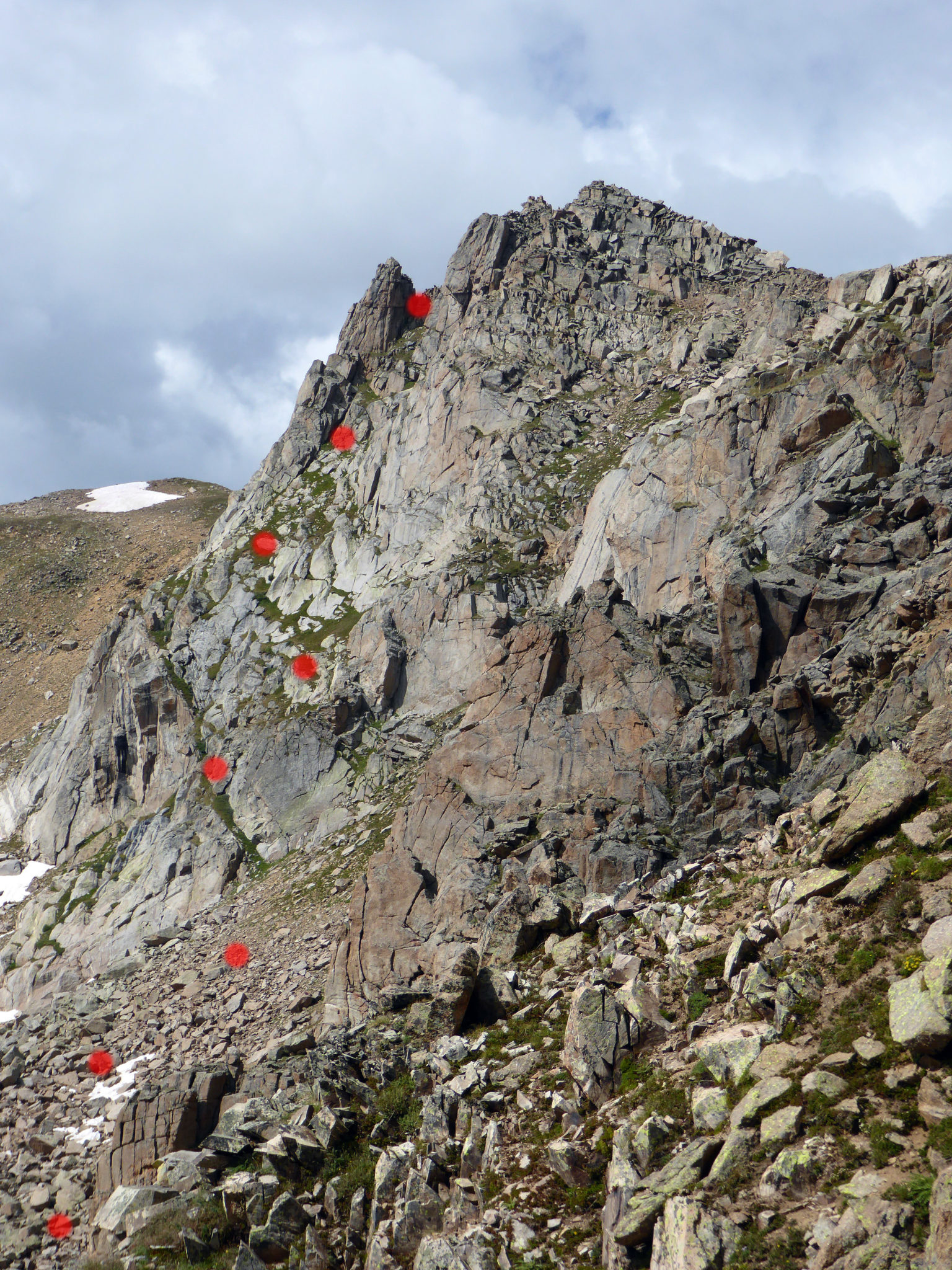
Right off the summit of South Williams B I climbed down a protected class 3/4 chimney, which led to a steep grass slope studded with slab rocks running several hundred feet down the east side of the peak. The grass slope appeared to terminate in a massive cliff, so I made sure to take my time on the way down. Just when I thought I was going to get cliffed out, a nice little weakness in the rock band presented itself. I was at the low-point between the two peaks less than ten minutes later.

Looking back at South Williams B on the way up Williams Mountain, with my descent route dotted.
With the toughest part of the day in the rearview it was easy work up Williams Mountain via a few short class 3 pitches on solid rock.

The final summit climb up Williams Mountain. It’s easier than it looks.
With some dark clouds forming I wasn’t about to be denied the fifth and final summit along the traverse, so I didn’t stay on Williams long. Thankfully the terrain from Williams to North Williams went pretty quickly. A straightforward descent down to the saddle, some skirting, and then an easy tundra stroll and I was on top.

Cool register going back 27 years.
From Williams North, the best route back to the Lost Man trail requires dropping down to the small tarn to the west of Deadman Lake and then re-ascending 500 ft or so up to a notch in Williams Mountain’s east ridge, then descending to the trail from there. Of course I managed to get to treeline just as the menacing clouds softened their tune down to big white puffs of nothing. Once on the trail I made good time down the drainage and back to the TH.

Last look back up the Lost Man trail.
TH to TH I came in right at 8.5 hours, which I was pretty happy with (stats on the day were in the vicinity of 13.5 miles and 6,100 ft).
A turkey avocado and a glass of 60 Minute at the Tennessee Pass Cafe in Leadville rounded out the Wednesday quite nicely. Here’s hoping for more days like this in September and October.
Thanks for reading 🙂


Nice report, Ben! Your photos have great color and clarity. What strikes me in all of them is the clouds (!); I am glad that the threatened storm never unleashed! When Brian and I did that jaunt two years ago, we got a downpour in the afternoon. I love your shot at the midway pass. We surprised some elk hunters there and I marveled at the view, but my pictures of that pond are very poor, compared to yours.
Thanks Steve! I was running from the same downpour all day. Didn’t run into the hunters though. Thanks for the beta on this one 🙂
Great job and as usual very nice pictures. Really want to do those soon!!
Vadim, thanks man! It’s a nice outing for sure. Hope to see you in the hills again soon…