Crew
Brian Miller
Elliot Halverson
Brian Calcatera
Ben Conners
Ski descents of
Stoney Mountain, Northwest Couloir (All)
Cirque Mountain, South Face (All)
Gilpin Peak, Northeast Couloir (Ben, Brian M.)
Teakettle Mountain, South Face/South Couloir (All)
Potosi Peak, North Couloir w/ exit out of Weehawken Creek (Ben, Brian M.)
Mount Sneffels, South Face “Birthday Chutes” (Brian C., Elliot)
With several feet of new snow falling up north and the ensuing avalanche issues still fresh in our minds, our group decided to head down south to ski in Yankee Boy this past weekend. With good coverage and a low CAIC rating, the excellent weather forecast is what put us over the edge. The San Juans are indeed a commitment to drive to from Denver, but with a combination of factors as perfect as we had, pulling the trigger was an easy call.
For years Brian and I have looked forward to skiing some of the lesser-known lines in the basin. Sneffels is the target on most people’s radar, but there are so many other worthy objectives in the area you could literally ski in Yankee Boy for years and not hit them all. The plan was to head down there with an open mind and check out what seemed logical. Partners for this trip would be Elliot and his buddy Brian (Calc) with whom we had skied a few peaks in the area earlier in the season. Living in Summit County, they were just as excited as we were to get back down to the San Juans.
We met up at the Angel Creek Campground (which is now dry) off Camp Bird Road and established a camp Thursday evening before heading up the road for an evening skin. What ultimately ensued was an incredible powder ski of Stoney’s Northwest Couloir at sunset. Descried in further detail in Elliot’s TR, Stoney was probably our favorite line of the entire weekend (though a few others came close). The next morning we headed back up the road to check out Cirque’s South Face. With the gate open and the road plowed to 10,600 feet, the morning skin access could not have been easier. Within an hour we were working our way up the base of Cirque.
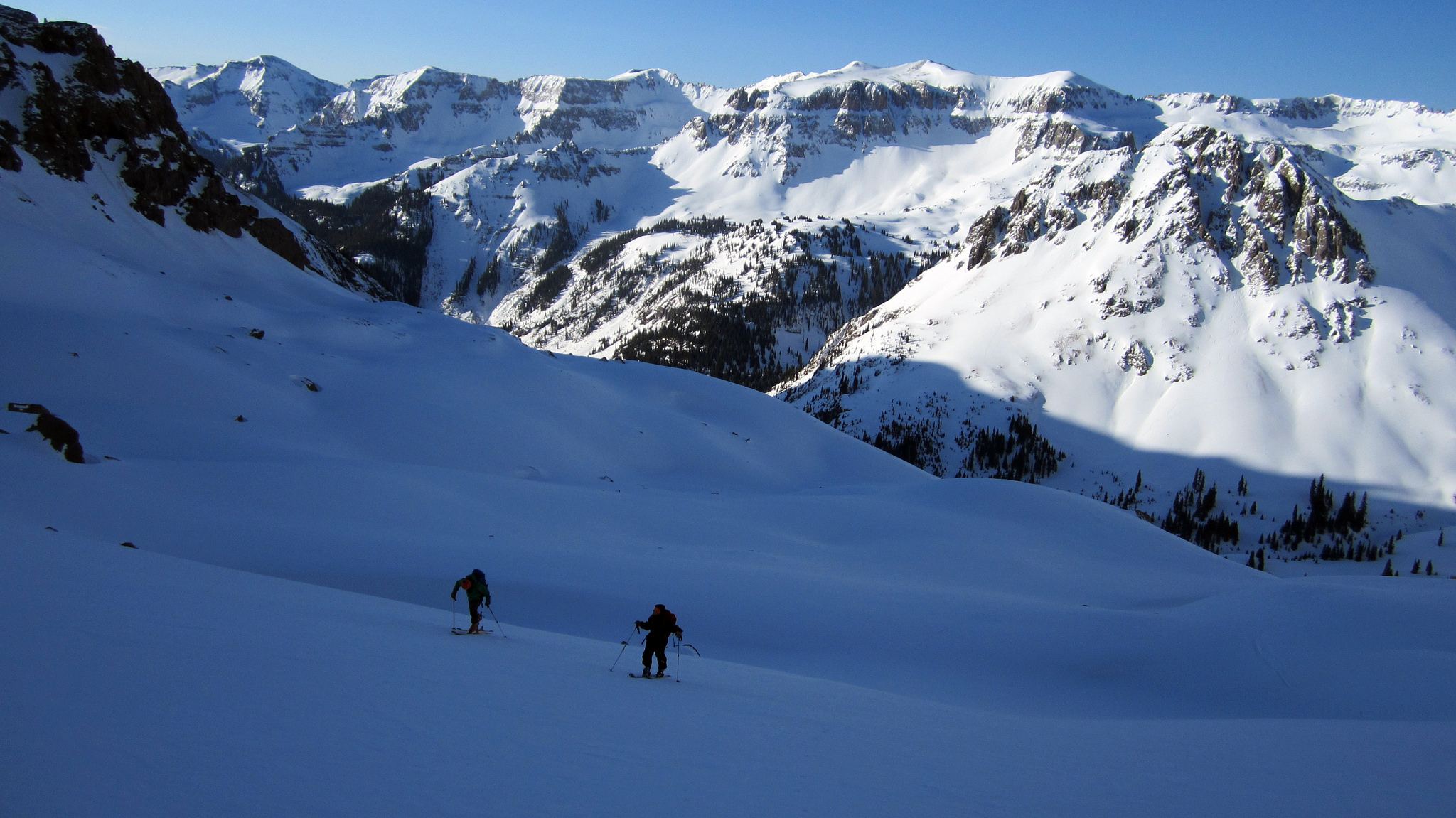
Working our way up the lower slopes of Cirque Mountain on a fine spring morning, April 26th. Thankfully the dust layer was well covered and the snow that fell on it had bonded nicely.
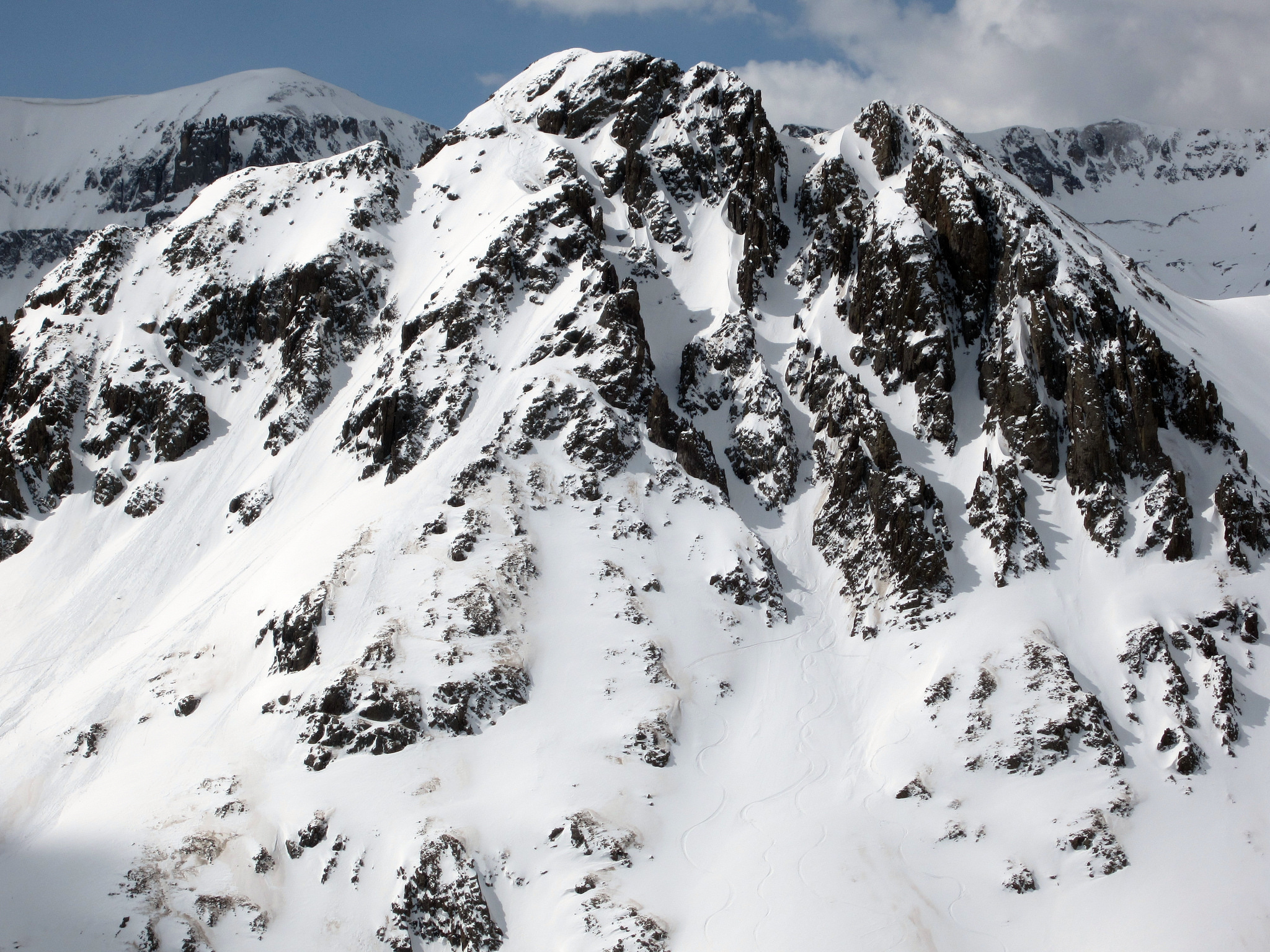
A look at the aesthetic and hidden line we skied the evening prior on Stoney. You can barely make out our tracks in this photo. Taken from around 12,500 feet on Cirque.
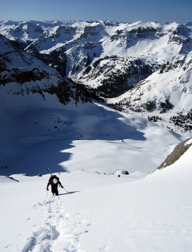
Booting up the South Face staircase (courtesy of Brennan and crew).
Climbing Cirque was really pretty straightforward, especially with a booter in place. This was definitely the most attainable line we skied all weekend. Basically just a giant face ski in a spectacular setting. Getting to the true summit is a tad hairy this time of year, though I’m not convinced the west summit is actually higher than the east (and according to the summit register I’m not alone in that opinion). After waiting on the summit for thirty minutes for the sun to come out, we clicked in and skied off the top.
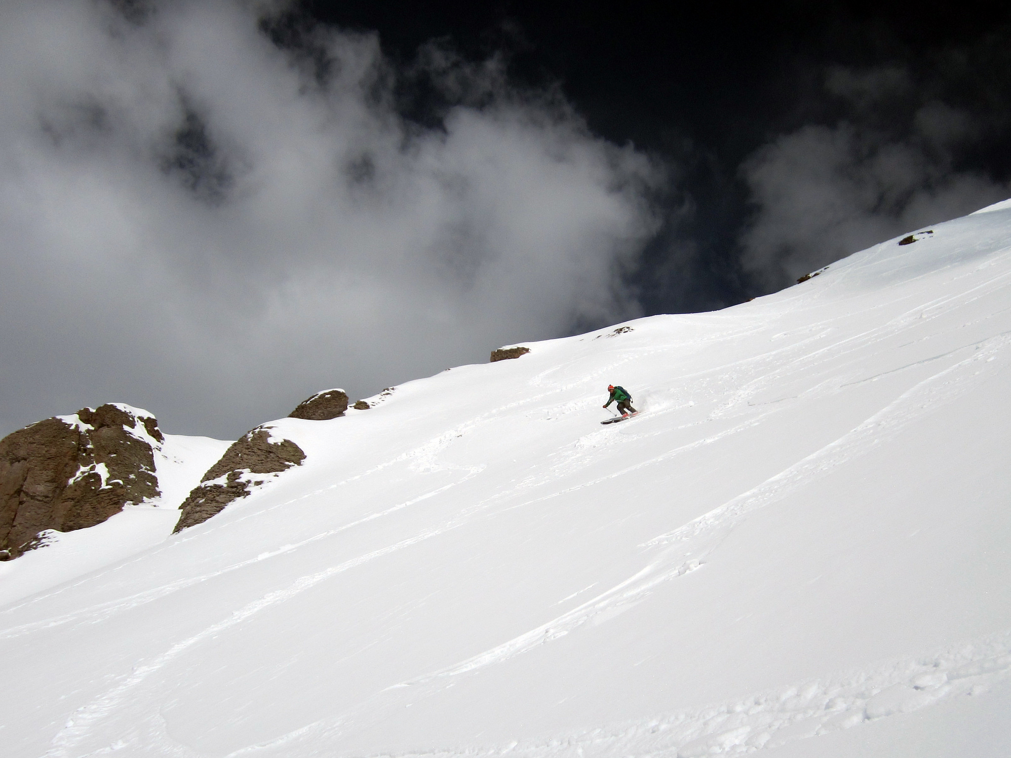
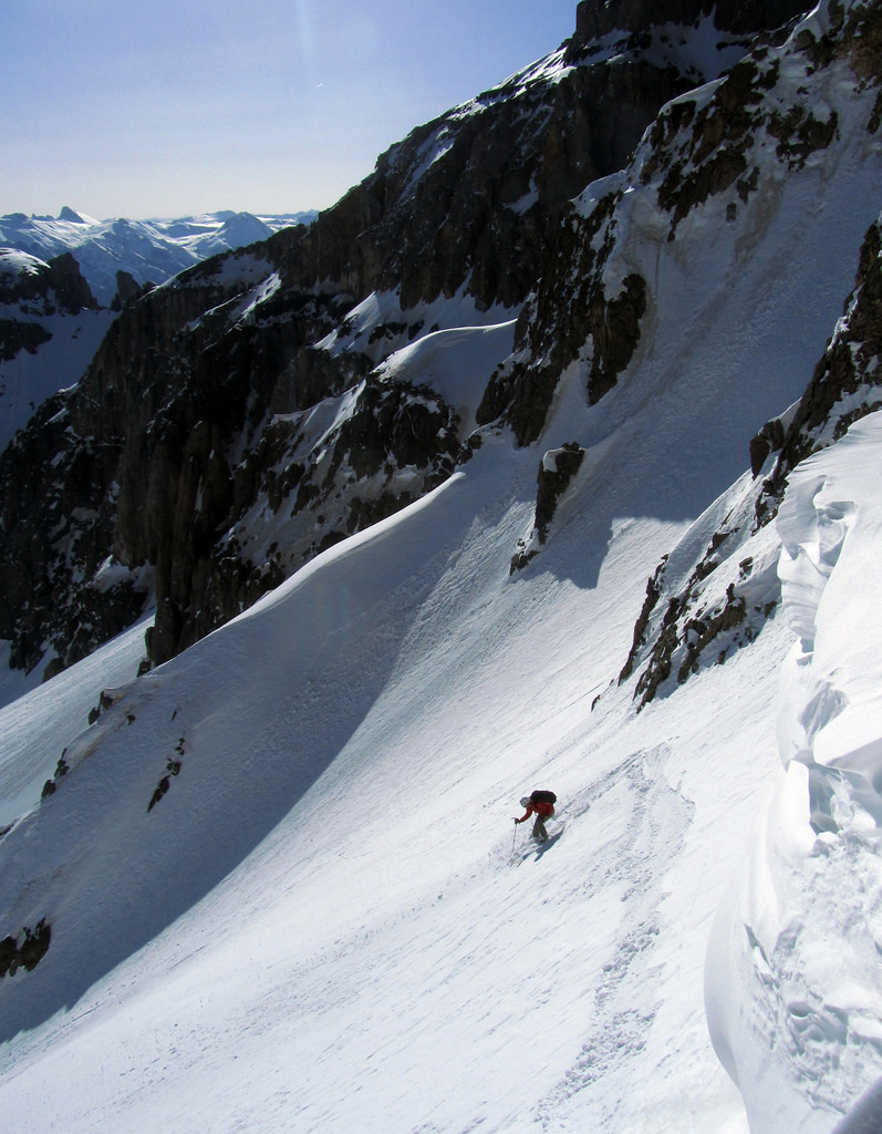
Brian making turns down the upper-South Face after a nice lounge at the summit. The snow near the summit was good, towards the bottom it got a tad crusty.
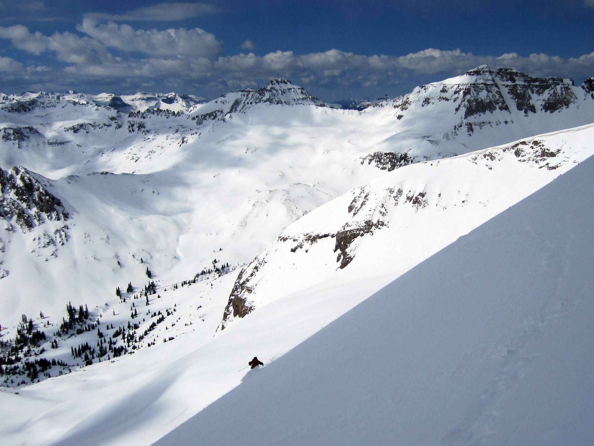
Elliot lower down with Emma and Gilpin in the background.
Brian and I decided it was early enough in the day to make an attempt on Gilpin. We parted ways with Elliot and Calc and traversed to the west, saying as high in the basin as we could. Eventually we skinned up and hiked southwest to the base of the Northeast Couloir on Gilpin’s North Face (this couloir is not the North Couloir, but a more mellow option on the far west side of the peak).
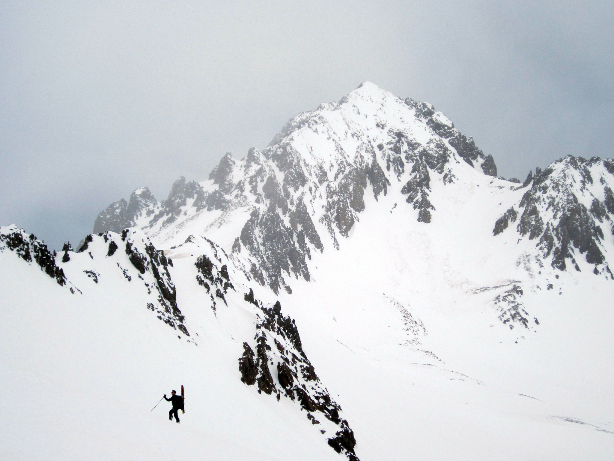
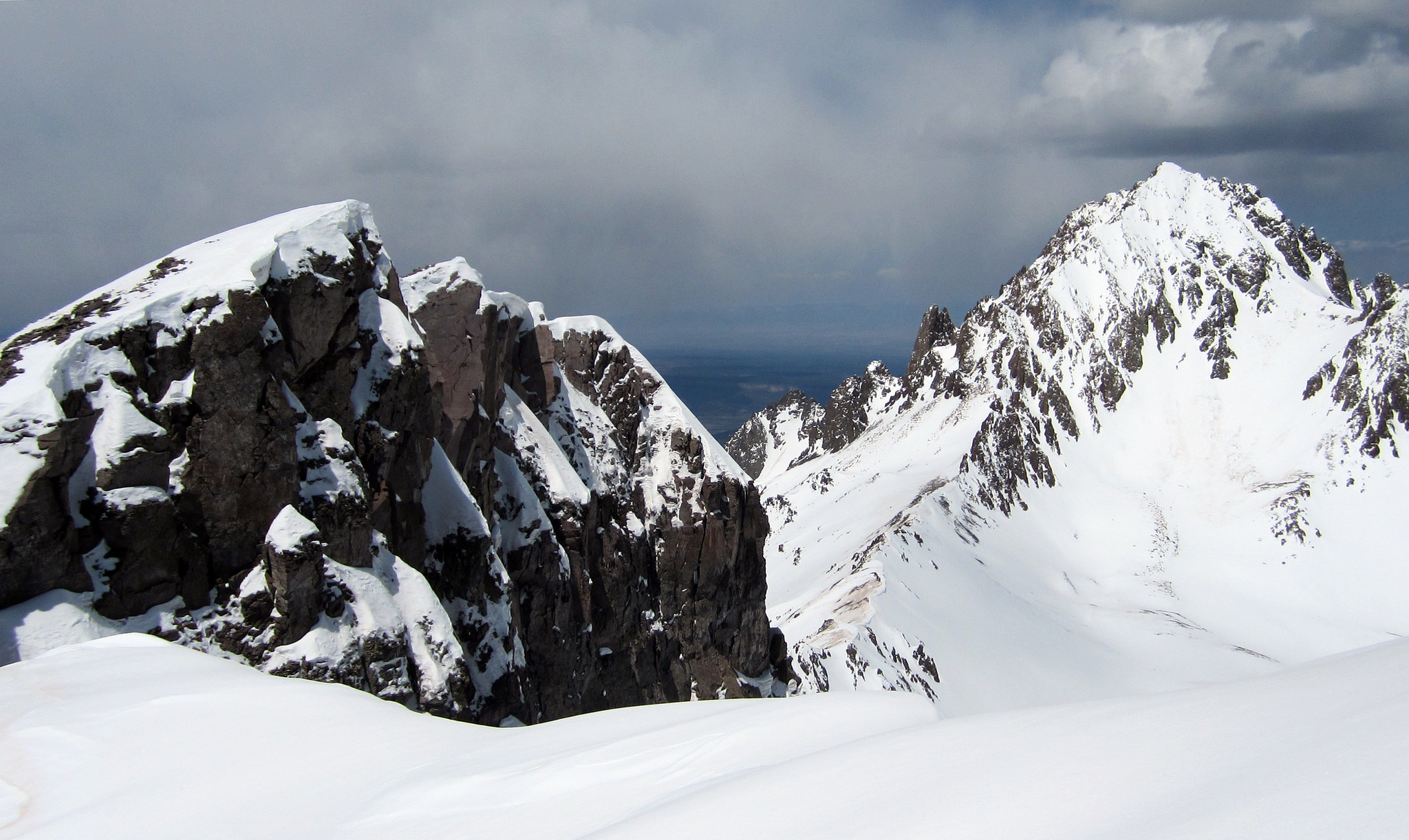
Brian with a gloomy Sneffels behind him.
Some nice clouds rolled in and kept things cool for us while we climbed. The Northeast Couloir runs for about a thousand feet before meeting up with Gilpin’s summit ridge. The very top of the couloir was steep; well over fifty degrees. Once above the steep pitch and on the ridge we dropped our skis and strolled east along the ridge line to the summit.
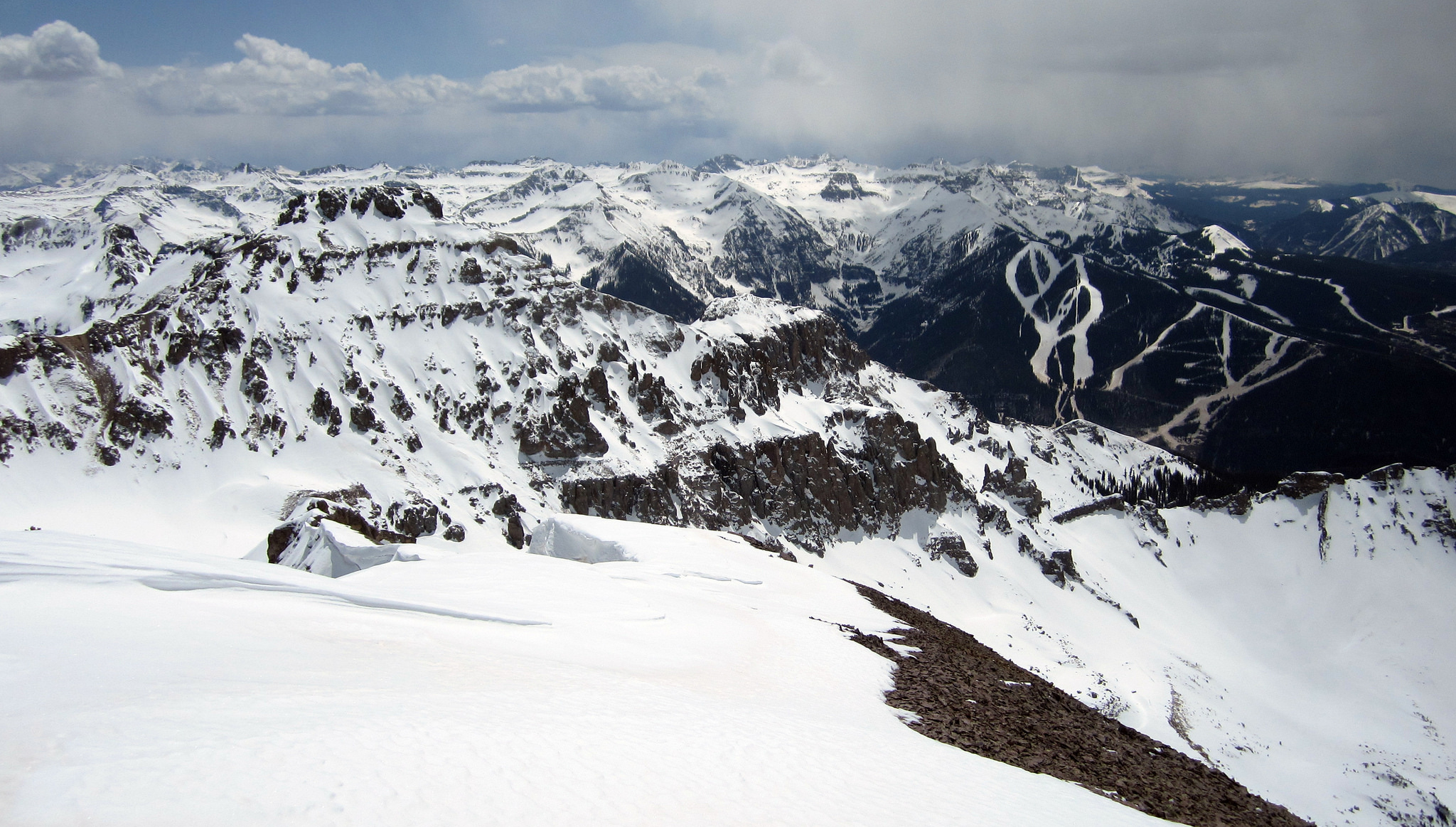
Emma and the Telluride ski resort, seen from Gilpin’s summit.
Some random ski-related thoughts on Gilpin: I’ve talked with people in the past about the idea of rapping into Gilpin’s North Couloir and then skiing out from the low point of the rap. Upon arriving at the top of the North Couloir this didn’t even seem like it would be a feasible option to us. The couloir was heavily corniced and there were minimal rap anchors along the ridge. Short of piling together a bunch of choss and throwing a long loop of webbing around it I’m not sure what you’d tie off on. Maybe with less snow/cornicing an anchor would make itself apparent, or else it would be possible to ski into the couloir without a rope altogether, but you’d have to find it in just the right condition to do so. Needless to say we skied the northeast line after hiking back to our skis.
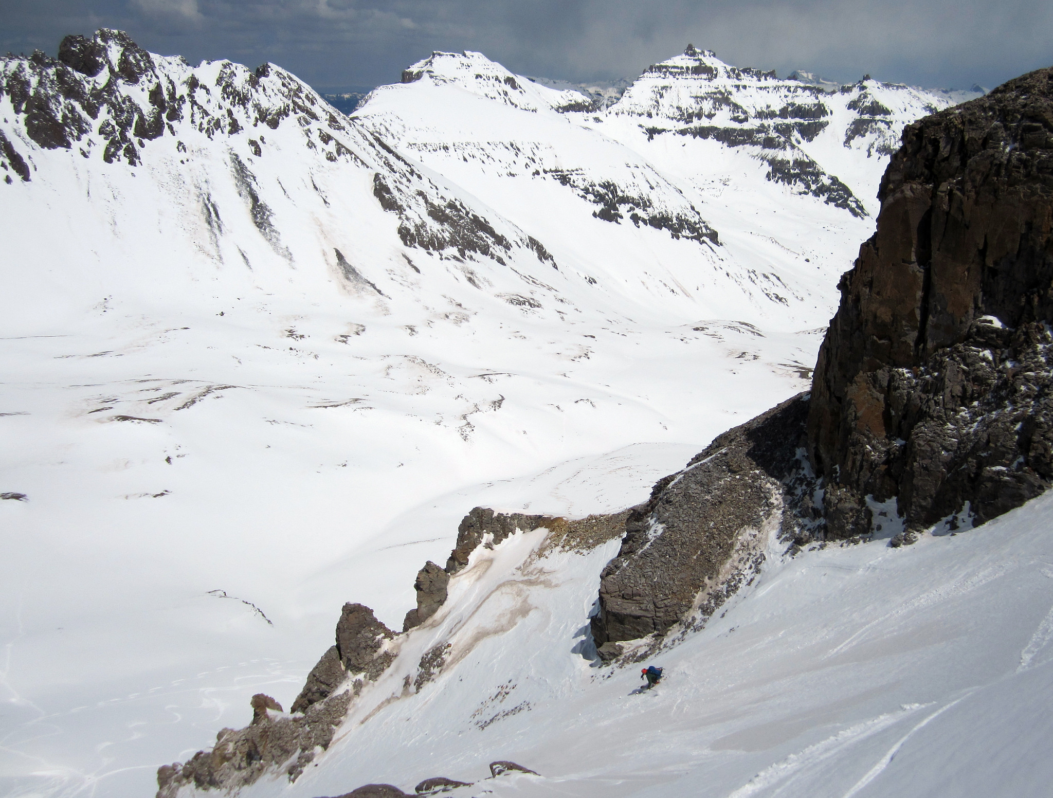
Brian skiing out the northeast aspect of Gilpin after we returned to our skis. The pitch to get off the ridge was very steep.
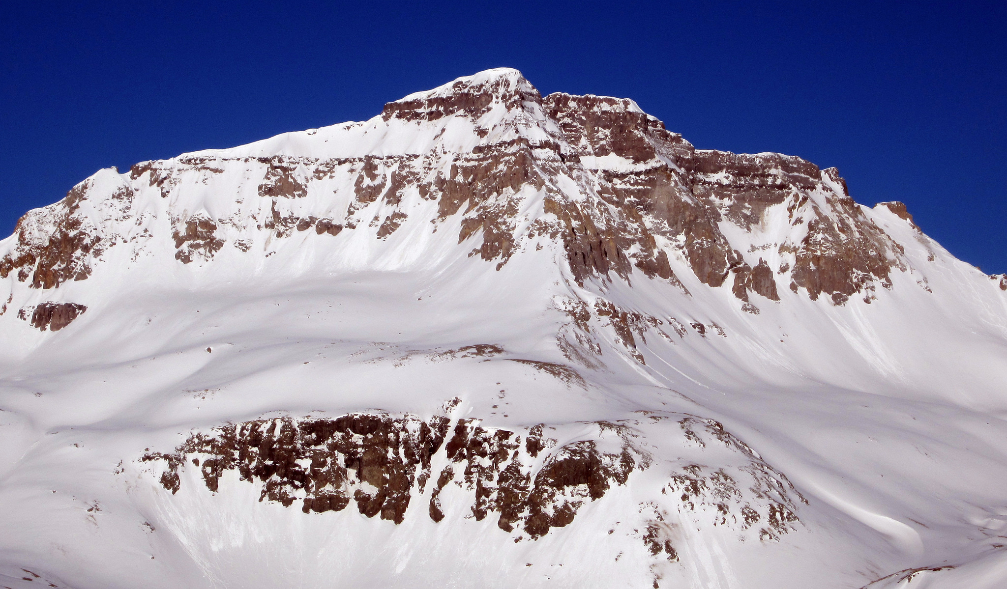
Gilpin Peak seen from Teakettle’s South Face on April 27th. The line we skied is far looker’s right nestled up against Blue Lakes Pass.
We skied from the base of Gilpin back to the car just as the snow was getting soupy enough to inhibit travel. Back at camp we shared a few choice bombers before heading down to the Ouray Hot Springs for a much needed soak. Afterwards we returned to camp and enjoyed the warmth of a fire before trading it in. Given the correct combination of access and conditions, Yankee Boy can be a great place to set up a car camp below treeline and drive high every morning to get your skiing done. This is what we were able to do all weekend which enabled us to camp in relative comfort and head into town to visit some restaurants and hot springs on our off time throughout the trip.
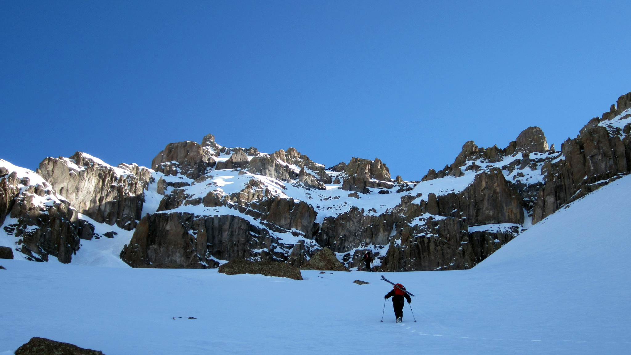
The next morning we headed back up the road early and set off for Teakettle. Personally speaking, this was my most anticipated objective as I was unable to find a shred of information online about skiing Teakettle and climbing reports of the South Couloir are hard to come by. We relied on some of the info from Mad Mike’s TR from a few years back as well as Brian’s firsthand knowledge of the peak from his hike in the summer. From the summit of Stoney a few days prior we were able to make out a continuous line on Teakettle’s South Face that took the couloir to around 13,000 feet and then headed climber’s right above the cliffs. From there the line climbed up a hanging snowfield and then wrapped back to the west to the base of Teakettle’s summit tower. This is the route we wound up skiing and it worked out great.
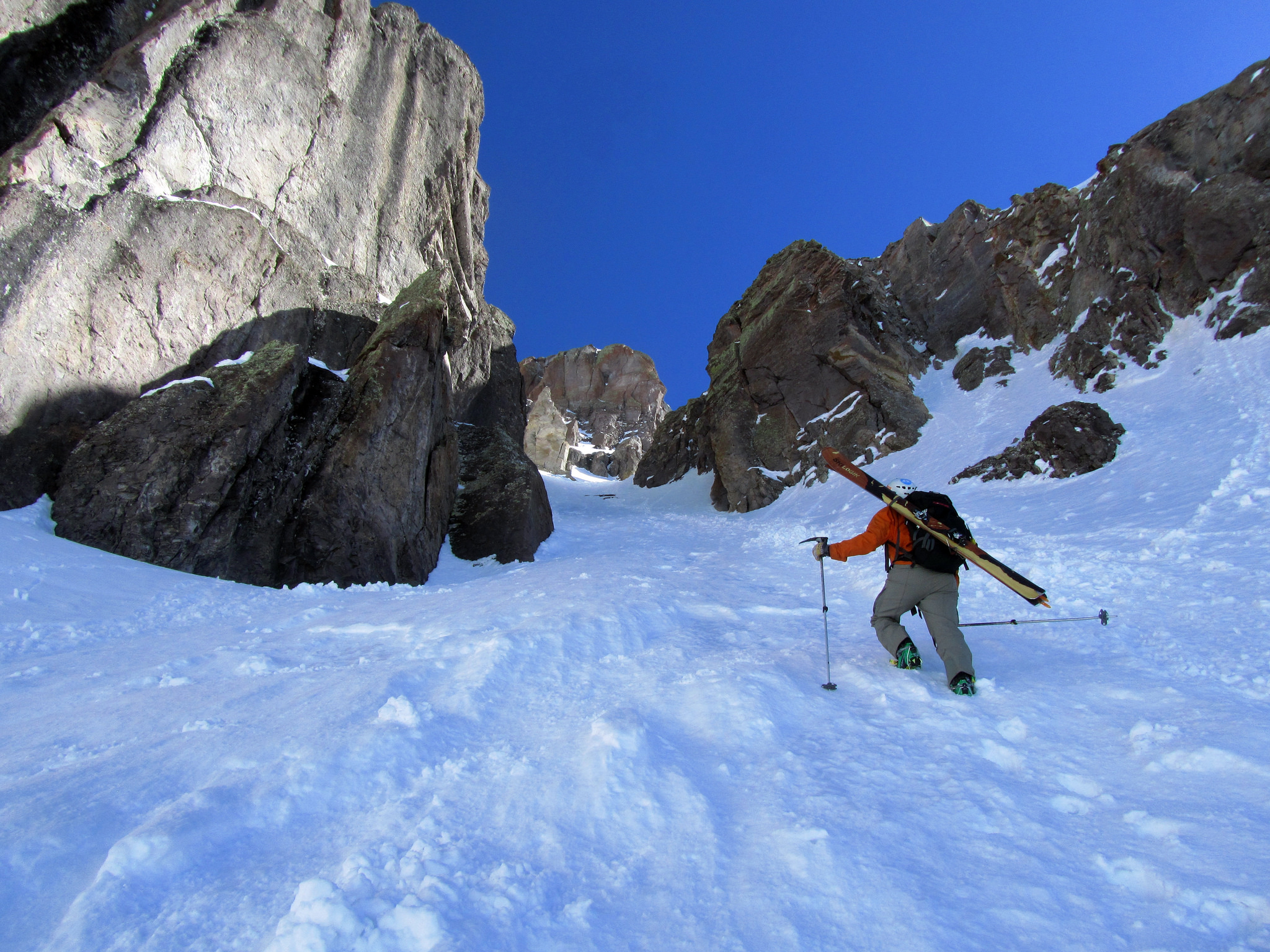
Entering the mouth of the South Couloir. Lots of wet slide point releases from warming rocks above had filled the couloir with debris. Photo by Brian.
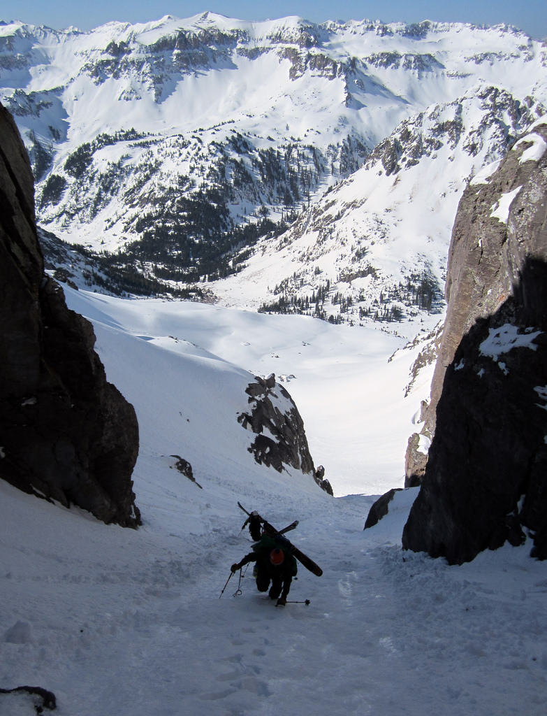
Entering the mouth of the South Couloir. Lots of wet slide point releases from warming rocks above had filled the couloir with debris. Photo by Brian.
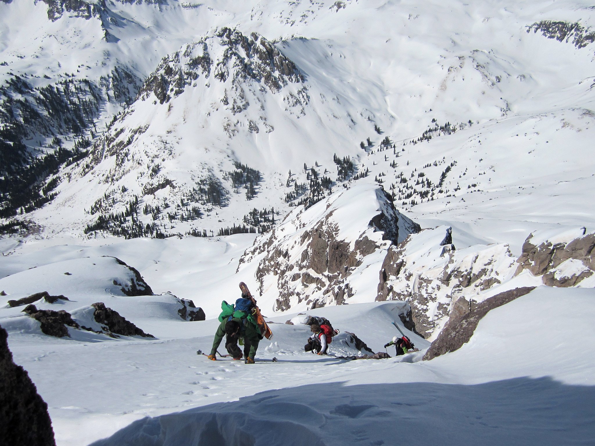
Above the couloir we traversed climber’s right across the top of the cliff bands.
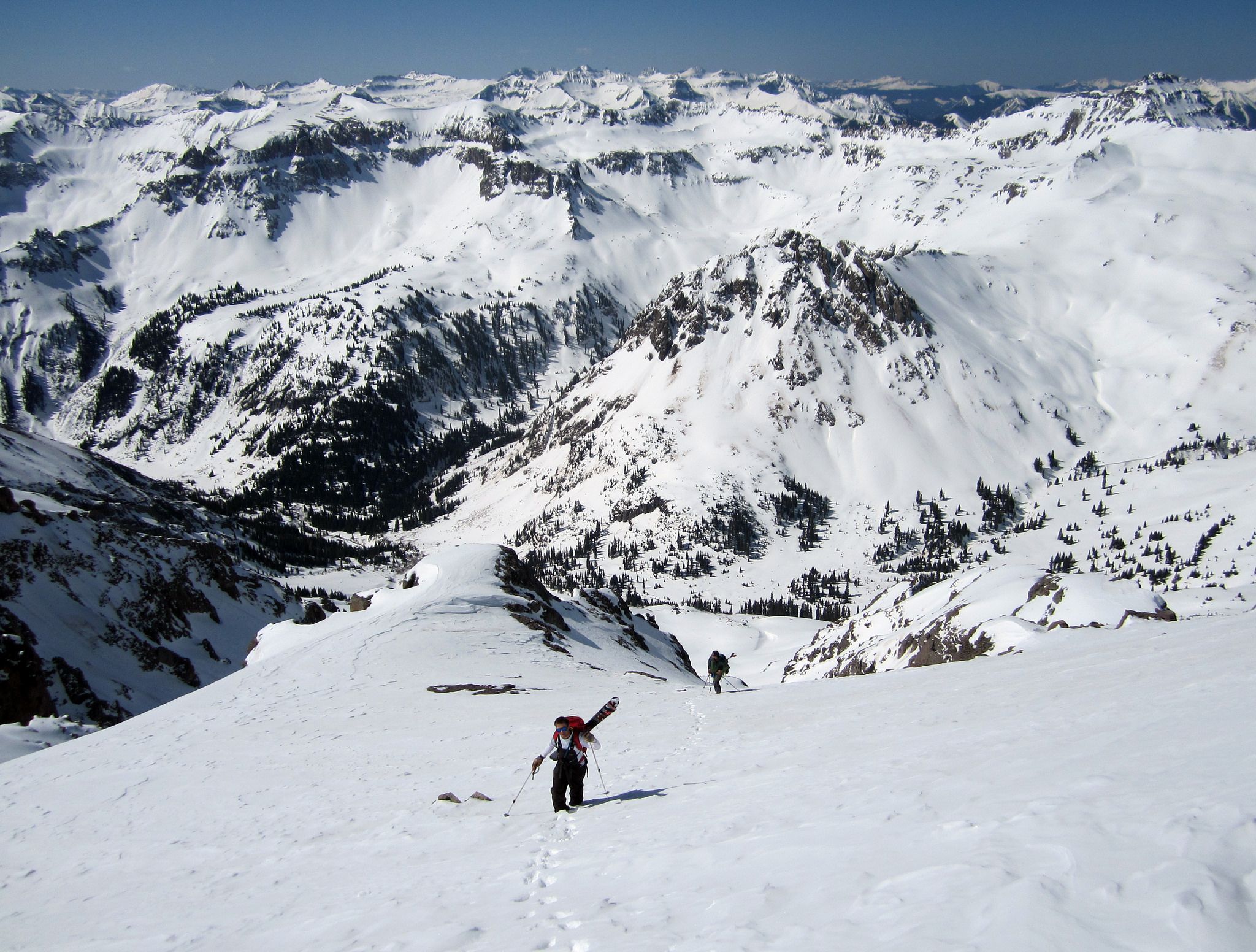
Higher up the terrain flattened out, after which we trended climber’s left to the base of the summit tower.
One thing that I am certain of is there is no direct summit ski descent option on Teakettle short of rapping down rock with your skis on and calling it a summit descent, or else side hucking thirty feet onto exposed ground and breaking both of your femurs in the process. For this reason Elliot and Calc had little interest in continuing on up as their climb generally ends where the ski ends (a principle I’m hoping I can adopt someday).
Since Brian had already summited this peak he had little interest in a mixed rock and ice climb, so I was on my own. I traded ski boots for rock shoes and headed up a the prominent crack that drops down to the base of the tower. Some wet, icy rock moves ensued, and I found myself about ten feet off the ground with no easy way back down. After collecting myself I wound up continuing up the crack, making a few extremely awkward moves while the rest of the crew waited patiently for me to complete this summit climb ridiculousness.
Eventually after a good bout of frazzled nerves I was able to get on top and then army crawl across the pool table-sized summit to the rappel anchor. A short rap had me back down in one piece and rushing to get my ski boots on before the face warmed up too much. Not the most “laid back” way to climb Teakettle but I’ll take it!
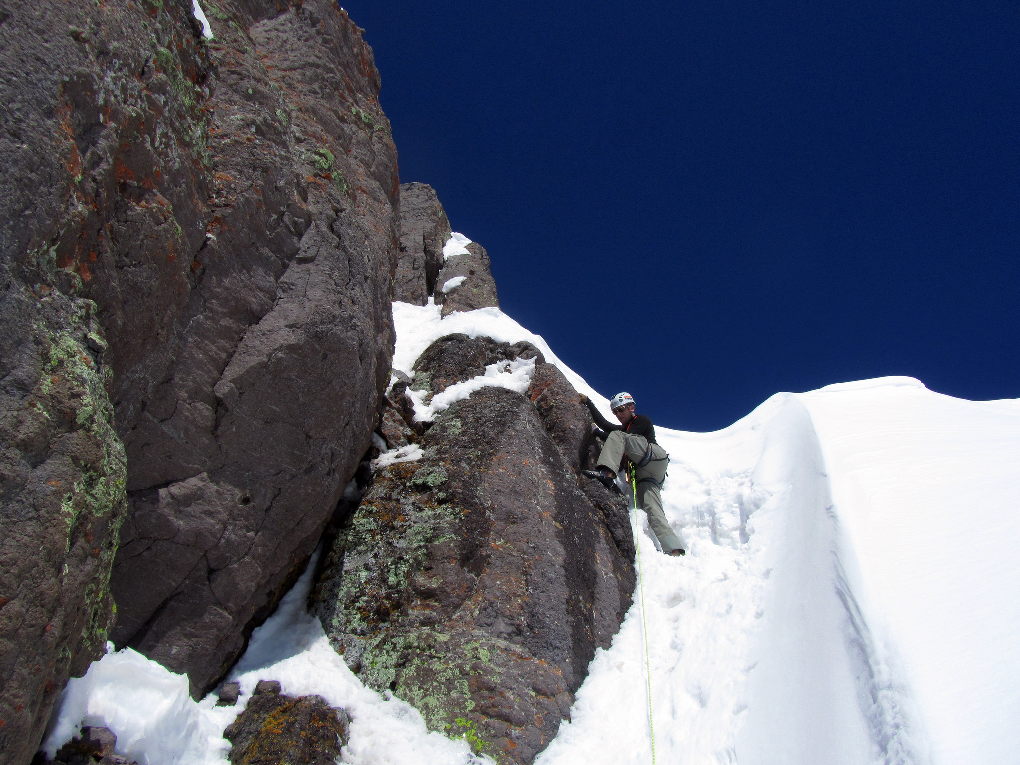
With ski boots traded for rock shoes, it was time to get up to the summit.
We all clicked in and skied down around the corner following our ascent route, except for Calc who had a different ski option in mind…
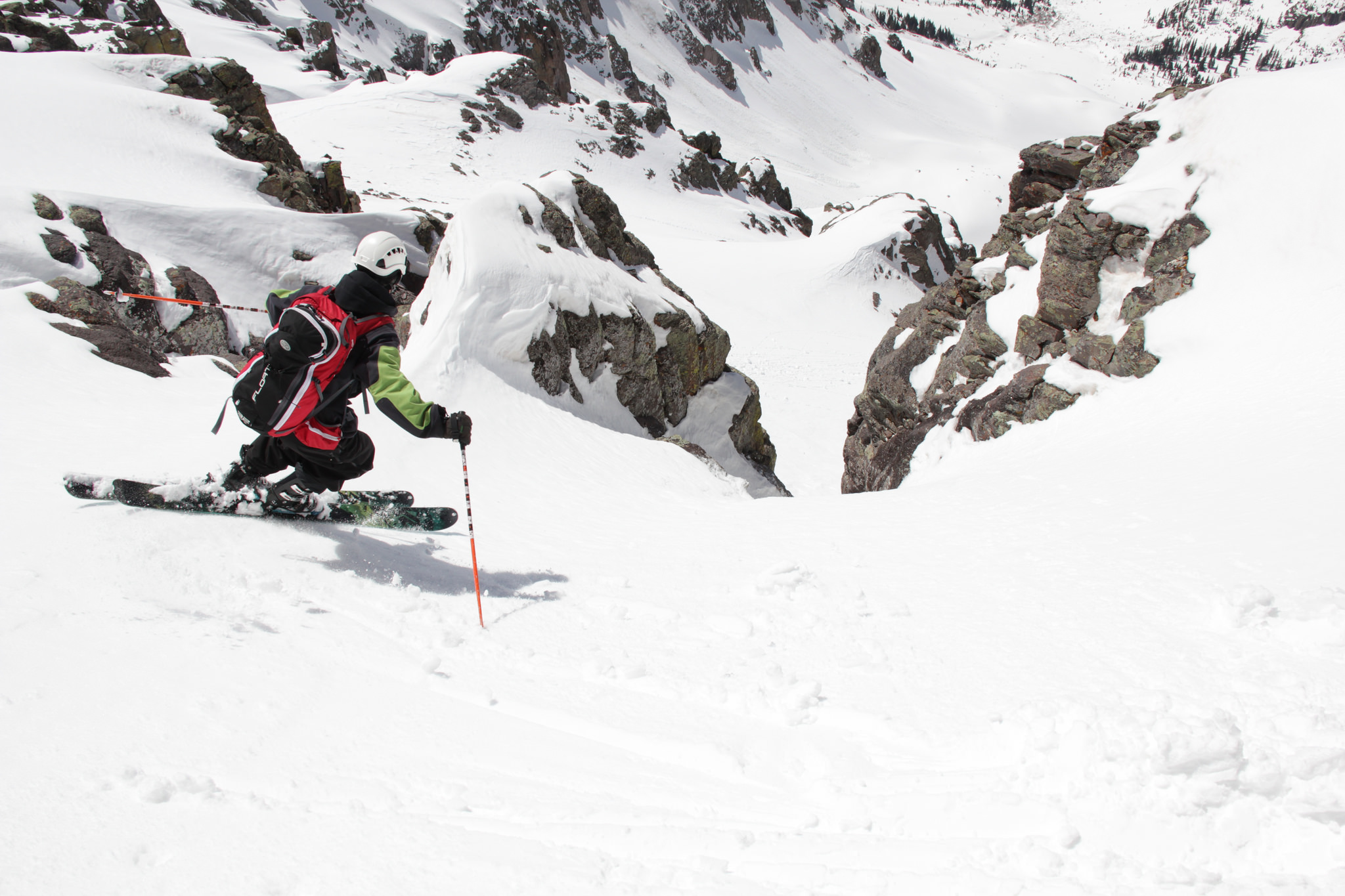
From the base of the summit block Calc straightlined for twenty-five feet through a narrow choke down to the lower summit snowfields. He is perhaps the strongest skier I’ve ever skied with. Photo by Elliot.
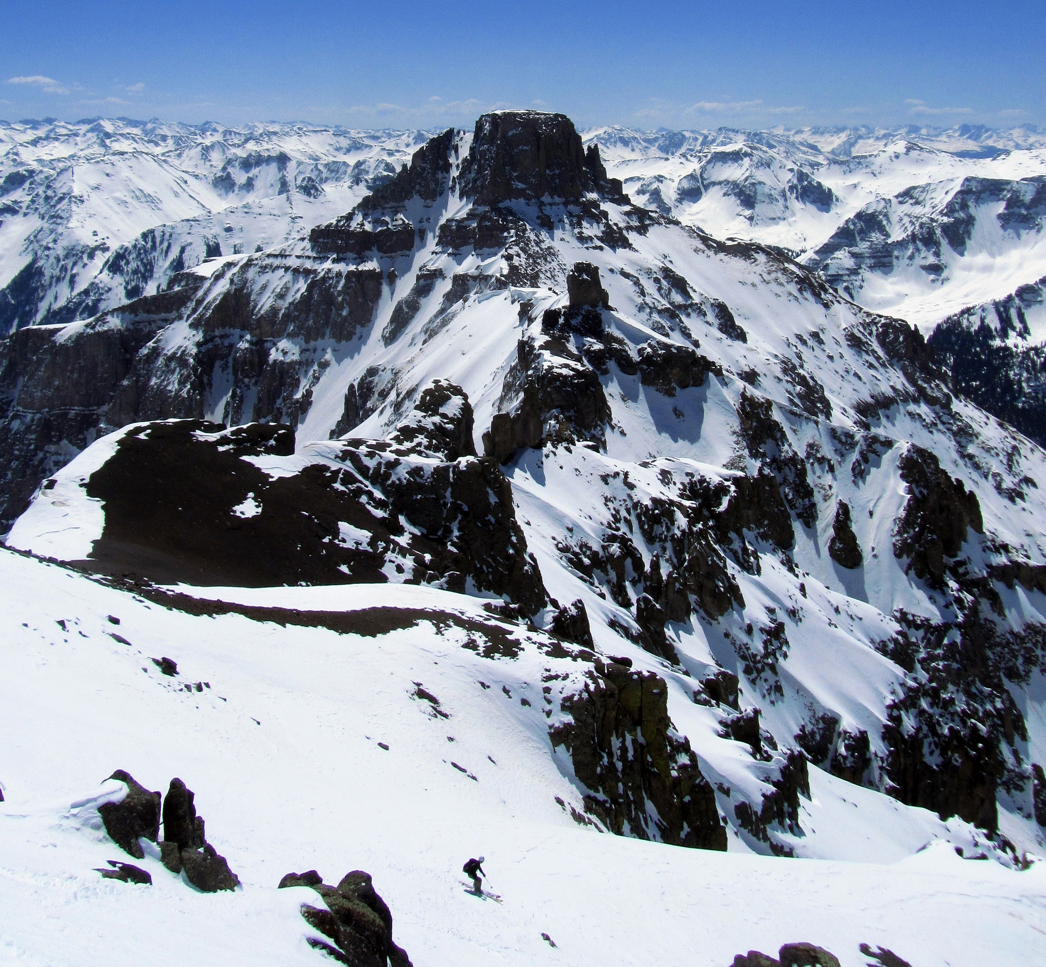
The rest of us mere mortals took the lower angled snowfields around the corner with tomorrow’s objective, Potosi’s North Couloir, dominating the view to the east.
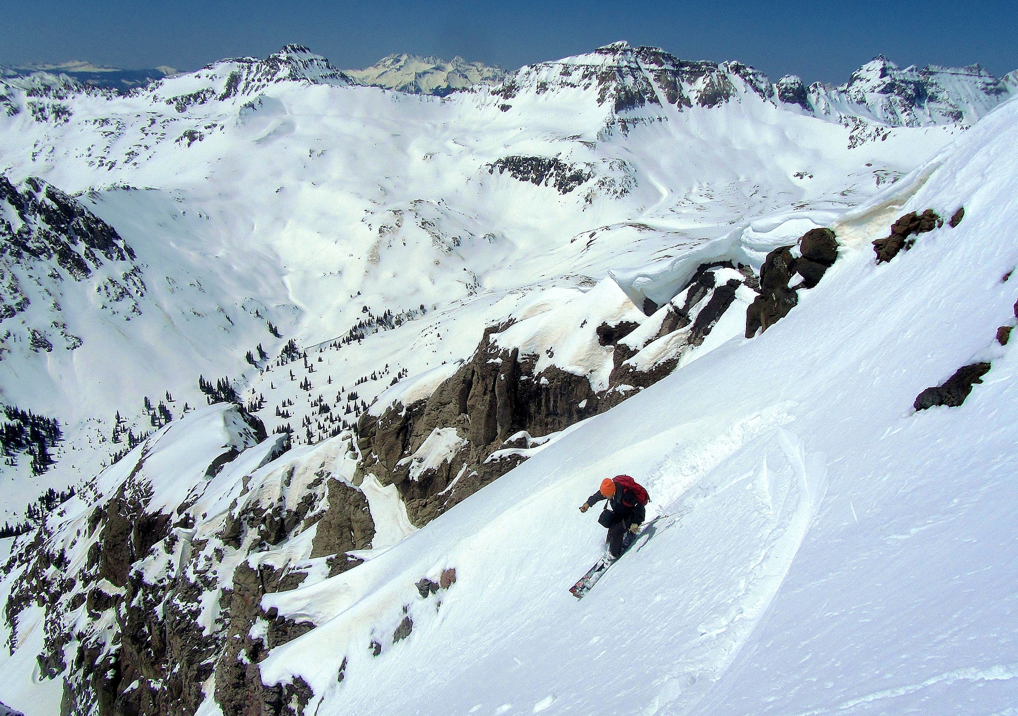
Elliot making turns lower down. Photo by Brian.
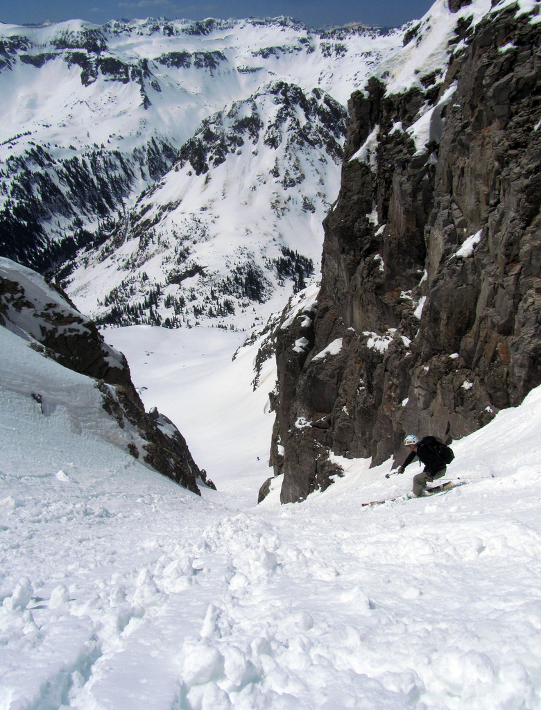
In the couloir with Calc waiting below. Photo by Brian.
Once out of the bottom of the couloir a set of superb corn turns led us back to the car, sandals, and more beer. After that is was off to the Wiesbaden Vapor Caves in town which has become a San Juan staple of ours in the past few years.
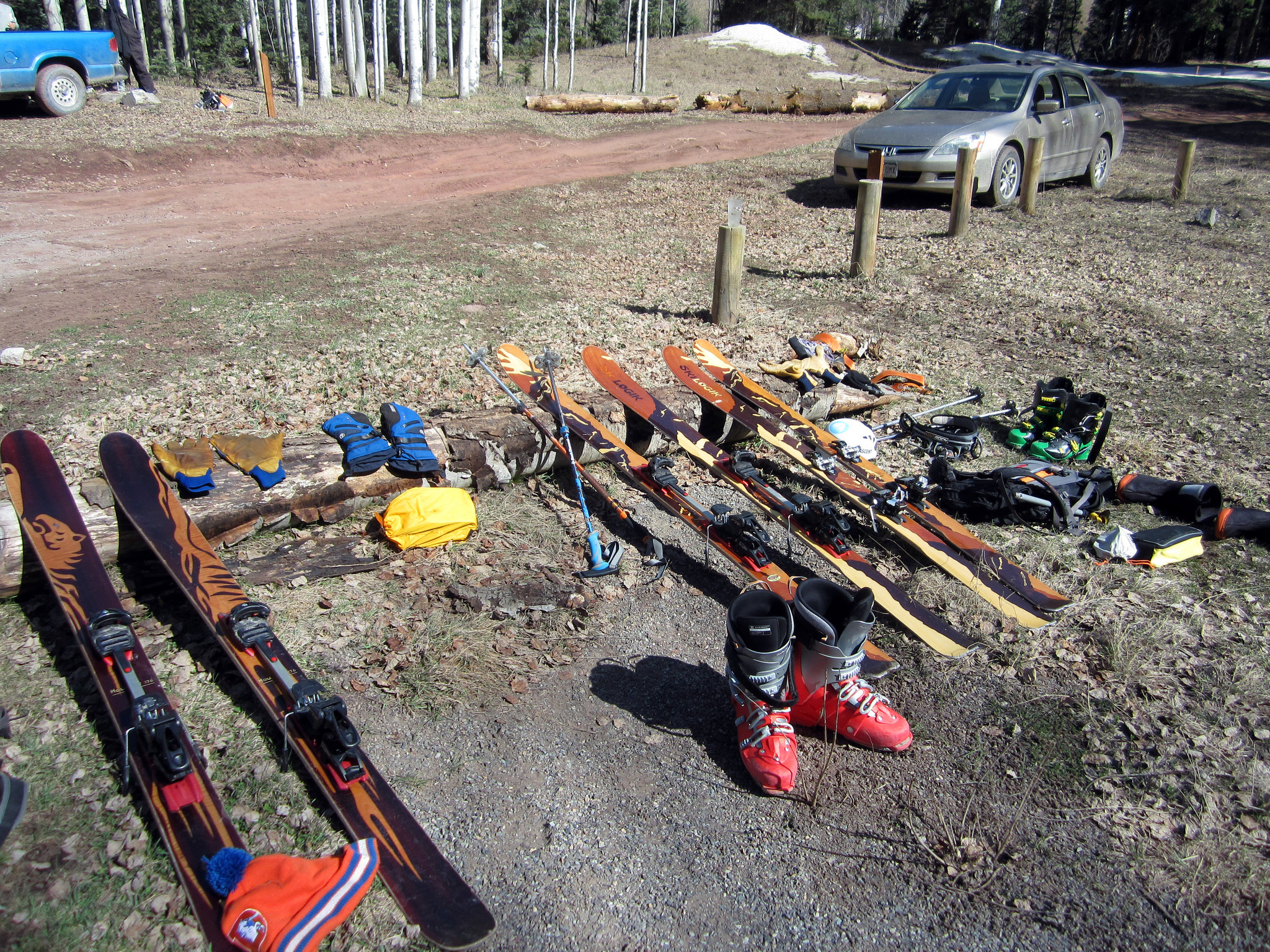
Gear drying back at camp. The Angel Creek Campground makes for an excellent base of operations for Yankeey Boy missions.
The following morning we split up the group as Elliot and Calc had a keen interest in skiing Sneffels before we left the area. The South Face “Birthday Chutes” were on their radar, which they would end up getting in great condition.
Brian and I had a different objective in mind; to make an attempt at Potosi’s North Couloir with an interesting twist. Over beers the previous night Brian convinced me that we should use Weehawken Creek as our exit as opposed to climbing back over the Potosi/Coffee Pot saddle. This would enable us to ski every foot of vert off Potosi as well as explore a seldom-visited basin. After he showed me an article from Dave Cooper’s column in the Denver Post I admitted it sounded like an intriguing idea. Cooper writes:
Yankee Boy Basin, surrounded by the rugged peaks of Mount Sneffels, Potosi Peak, Teakettle Mountain and Gilpin Peak and home to perhaps the best wildflower display in the state, is one of the most popular tourist destinations in the San Juan Mountains. Neighboring Weehawken Creek Basin, on the other hand, sees little foot traffic in its upper reaches. I’ve been fascinated by the Weehawken drainage ever since crossing the saddle between Potosi Peak and Teakettle Mountain to access the north couloir on Potosi Peak. On that occasion we only descended a few hundred feet into the basin in order to reach the start of the couloir, but the spectacular terrain surrounding this remote basin demanded a return trip.
The rest of the article can be found here.
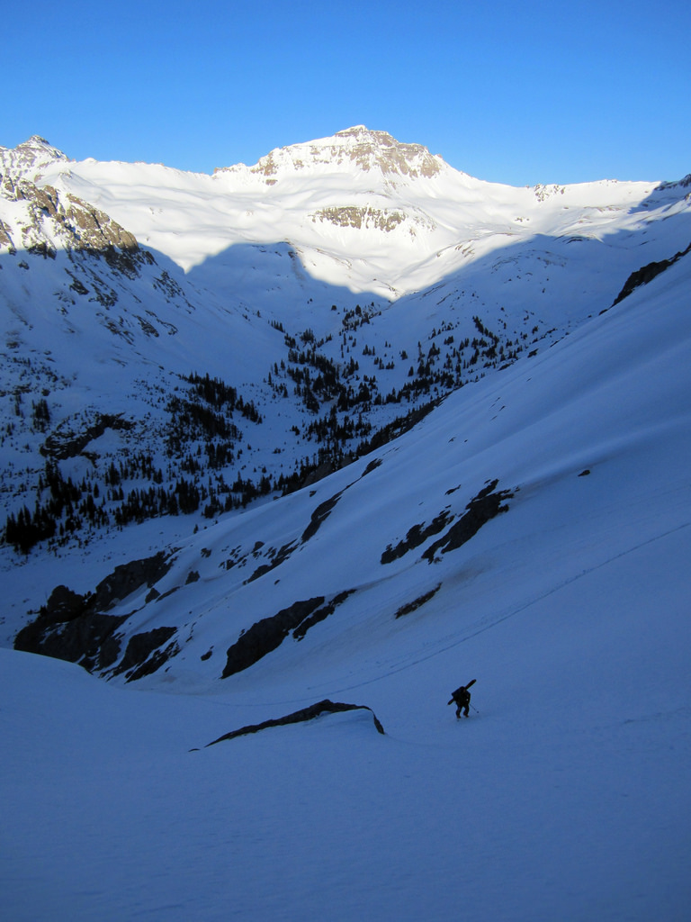
Brian cramponing up a well-frozen crust en route to the Potosi/Coffee pot saddle, April 28th.
After the two thousand foot ascent to the saddle we dropped off the back and skied to the base of Potosi’s North Couloir. Photo by Brian.
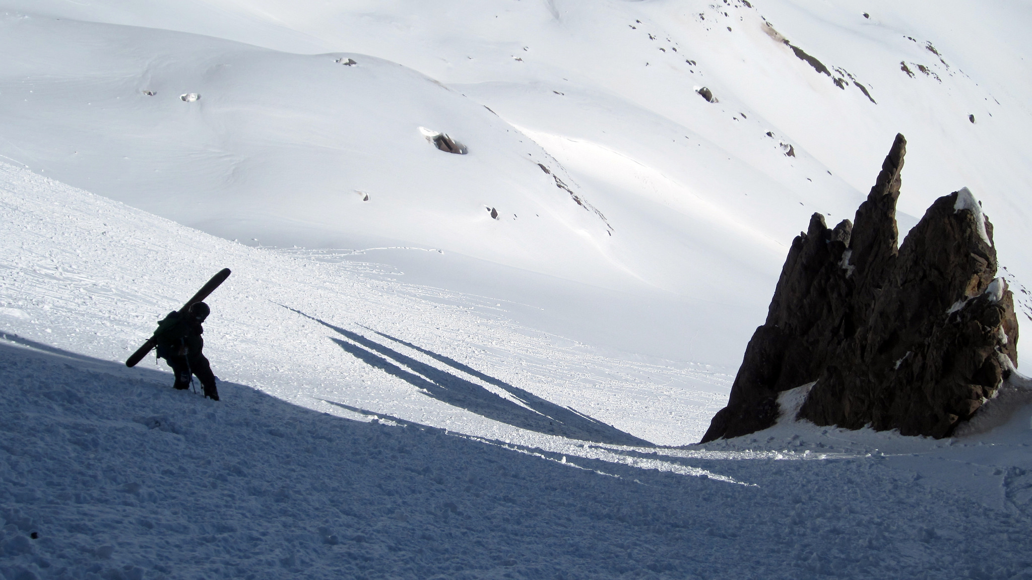
Brian on the apron. Lots of point release activity littered the lower slopes.
The snow in the couloir made for some strenuous booting but we knew it would ski phenomenally on the way down. After what seemed like a long grunt we topped out on the col. From there we got our axes out and climbed up and over a steep cornice that guarded the summit. We strolled onto the flat summit of Potosi around 10:30am.
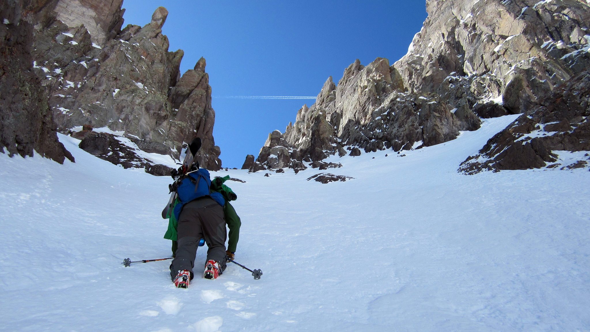
3/4ths of the way up the North Couloir. Here we found chalky powder on top of a solid base.
Looking out across the basin at the peaks coated in white under yet another bluebird sky, we realized how fortunate we were to have such great weather and conditions on this trip. These are the kind of trips you look forward to for years and when they finally come together you can only hope the stuff that’s out of your control works out. On this trip, it all did.
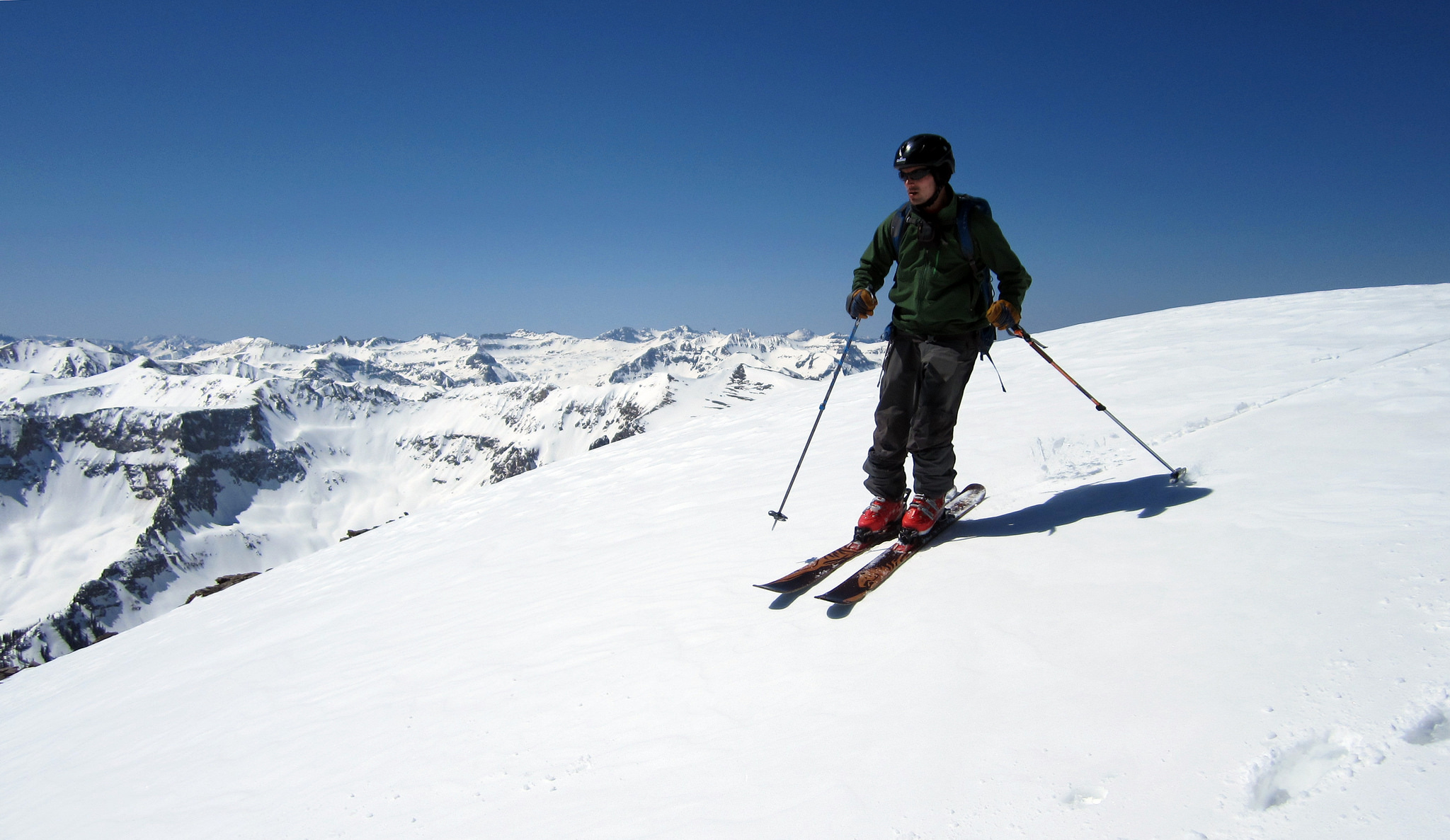
Making turns off Potosi’s flat summit.
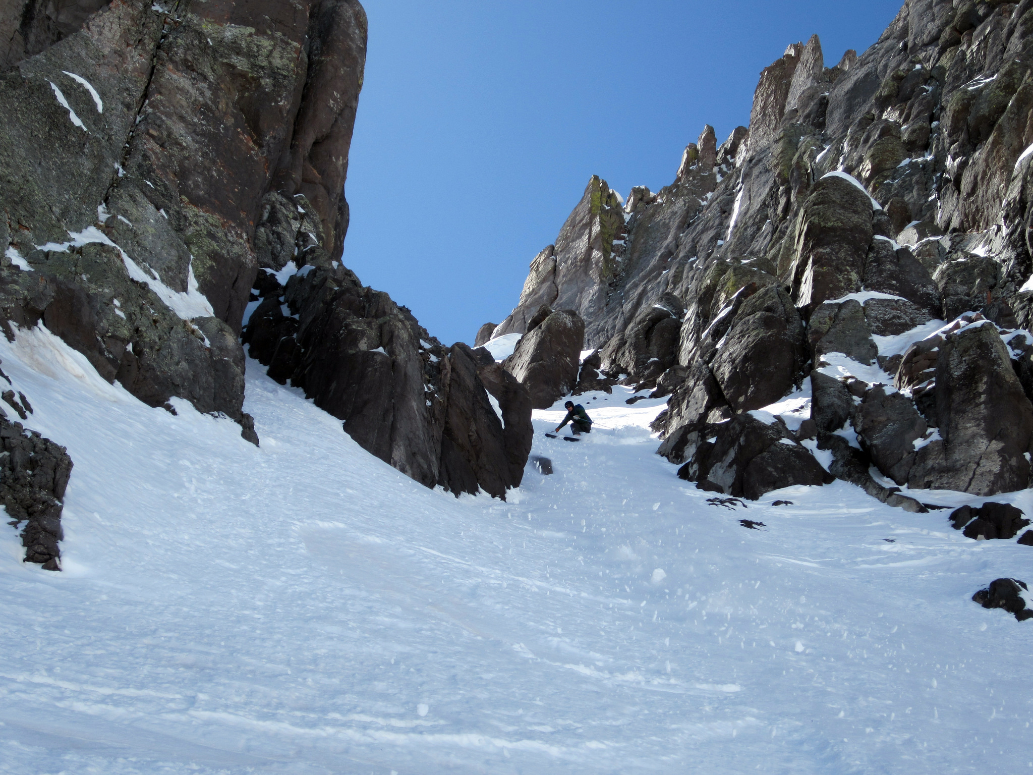
Brian heading through the choke once in the couloir proper. Some rocks lurking just underneath the snow had us on guard through here.
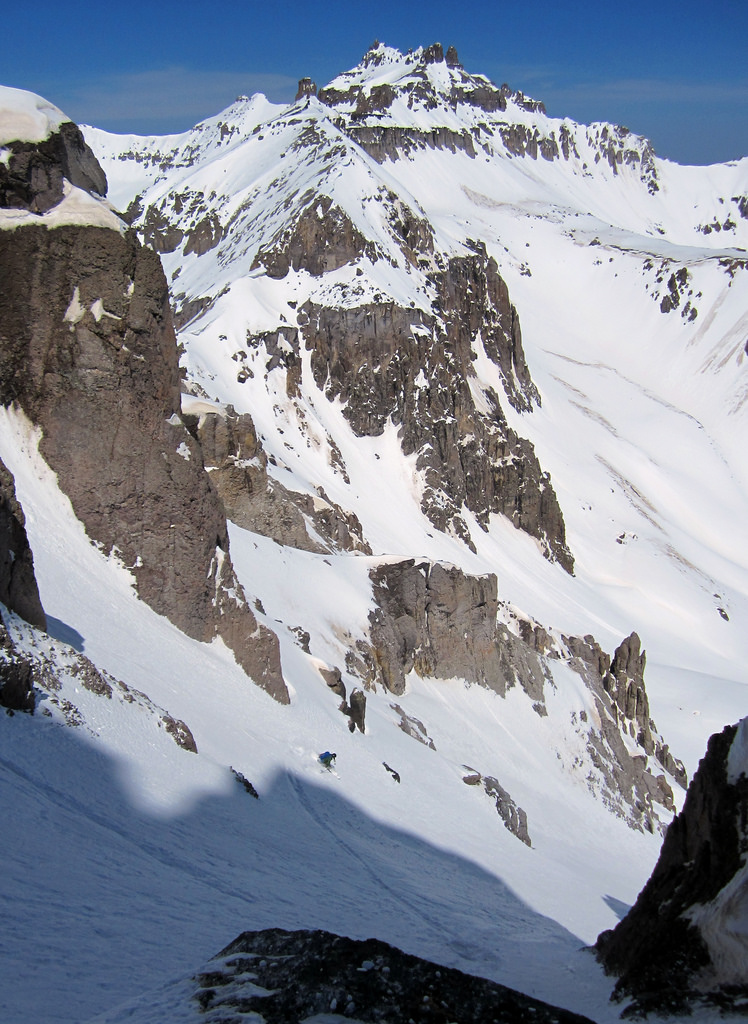
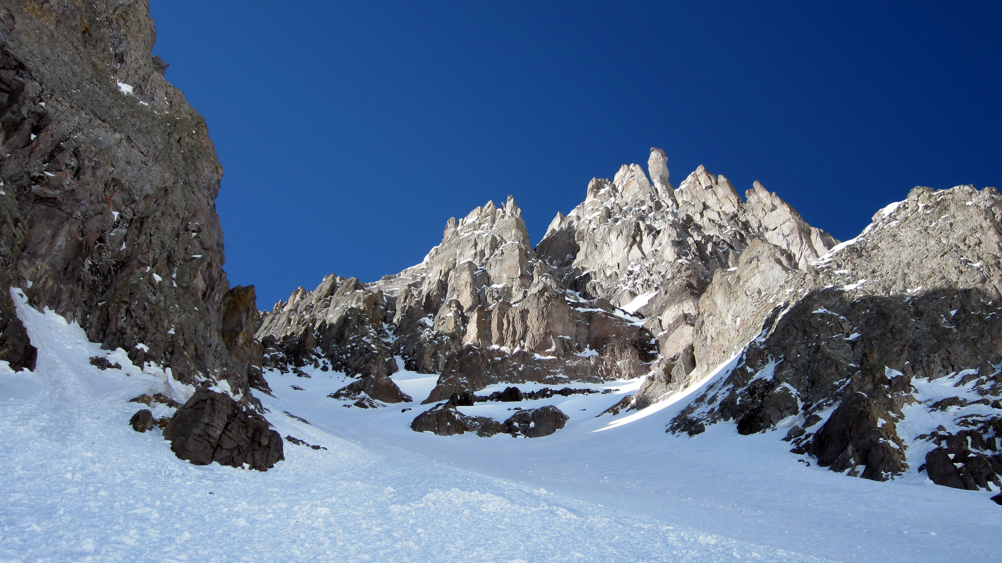
Brian lower down. The North Couloir boasts some spectacular walls to either side.
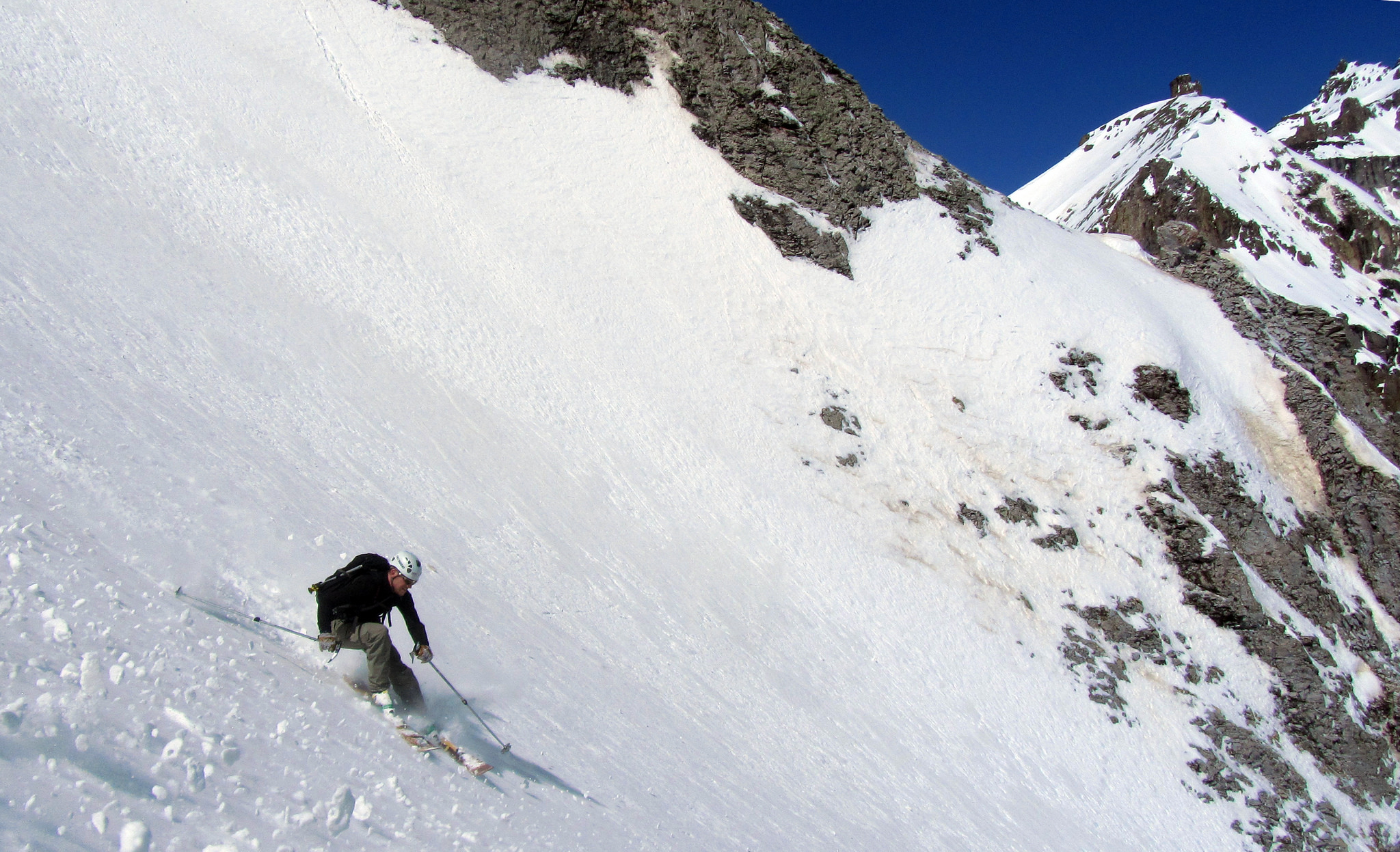
Making turns lower down. Photo by Brian.
After skiing the length of the couloir in chalk pow conditions which transitioned into almost perfect corn, we headed down into the relative unknown…
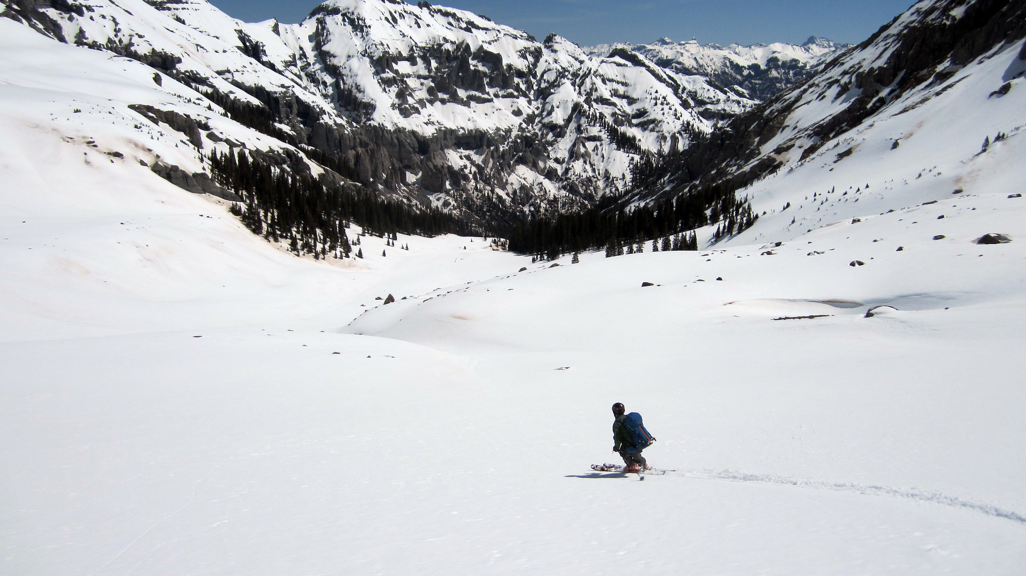
Brian skiing down into the reclusive Weehawken drainage. We weren’t sure what this canyon held in store for us.
I don’t want to ruin anyone’s perspective on Weehawken. In the summer I bet this is one beautiful drainage and a great way to hike area thirteeners Whitehouse and Ridgeway. In spring however, with skis, it is a nightmare. We spent no less than four and a half hours bushwhacking through dense foliage, getting cliffed out atop massive unforeseen canyons and gorges, and transitioning between skiing, skinning, and booting no less than twenty five times. We had to constantly fight the urge to head down into the inviting creek bed as we knew lower down near the road that decision would become problematic.
Trying to stay high on the trail held it’s share of difficulties as it was covered by intermittent snow drifts, which resulted in us losing track of it numerous times. One thing I will say though is the basin was stunning, particularly the sheer and jagged terrain on either side. Again, in summer, I bet it’d be a real treat. As we finally arrived below snow line, tired and beaten down, we were able to throw our skis on our packs and hike down switchbacks the final few miles to the car.
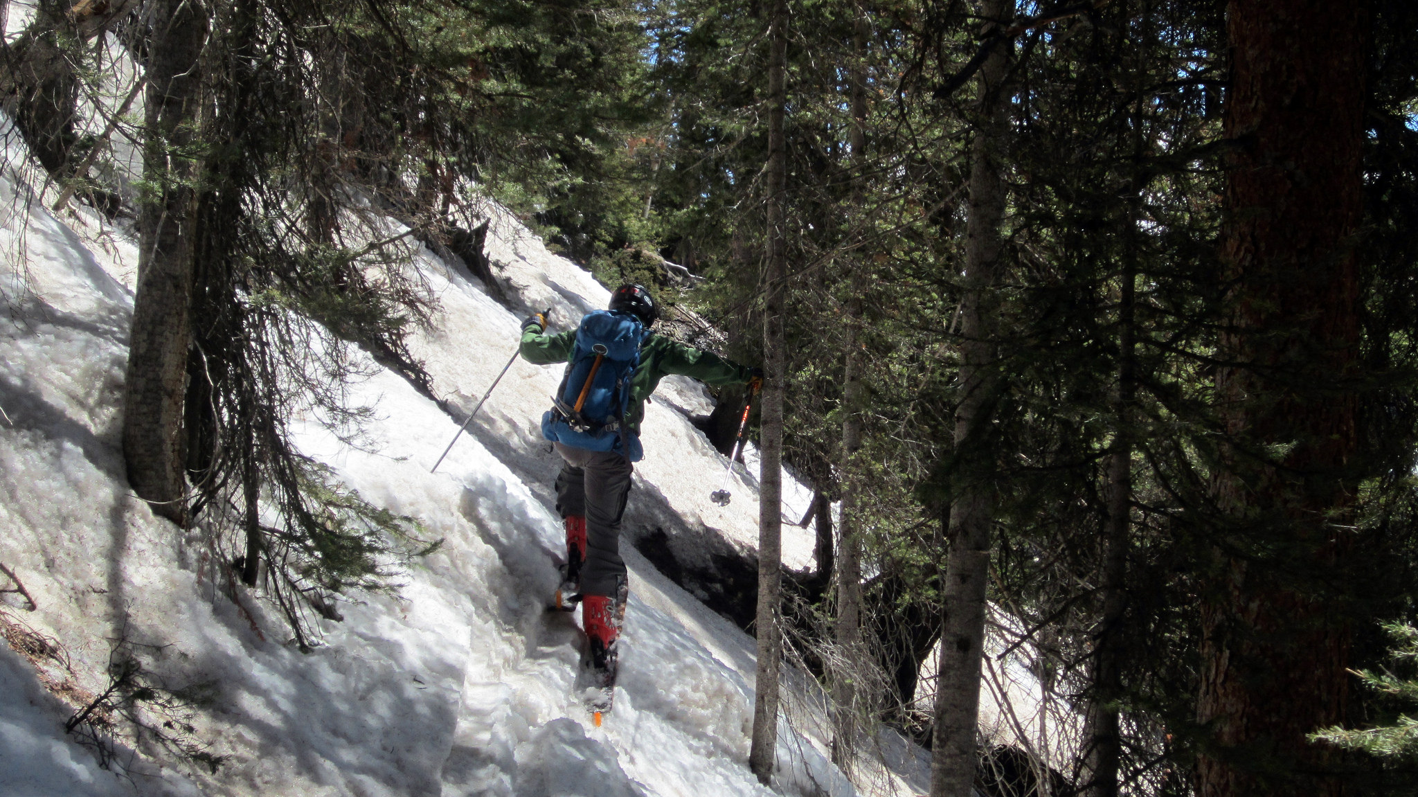
A few hours later after slapping skins on for the third time, we took a climbing traverse through the trees and finally found the trail.
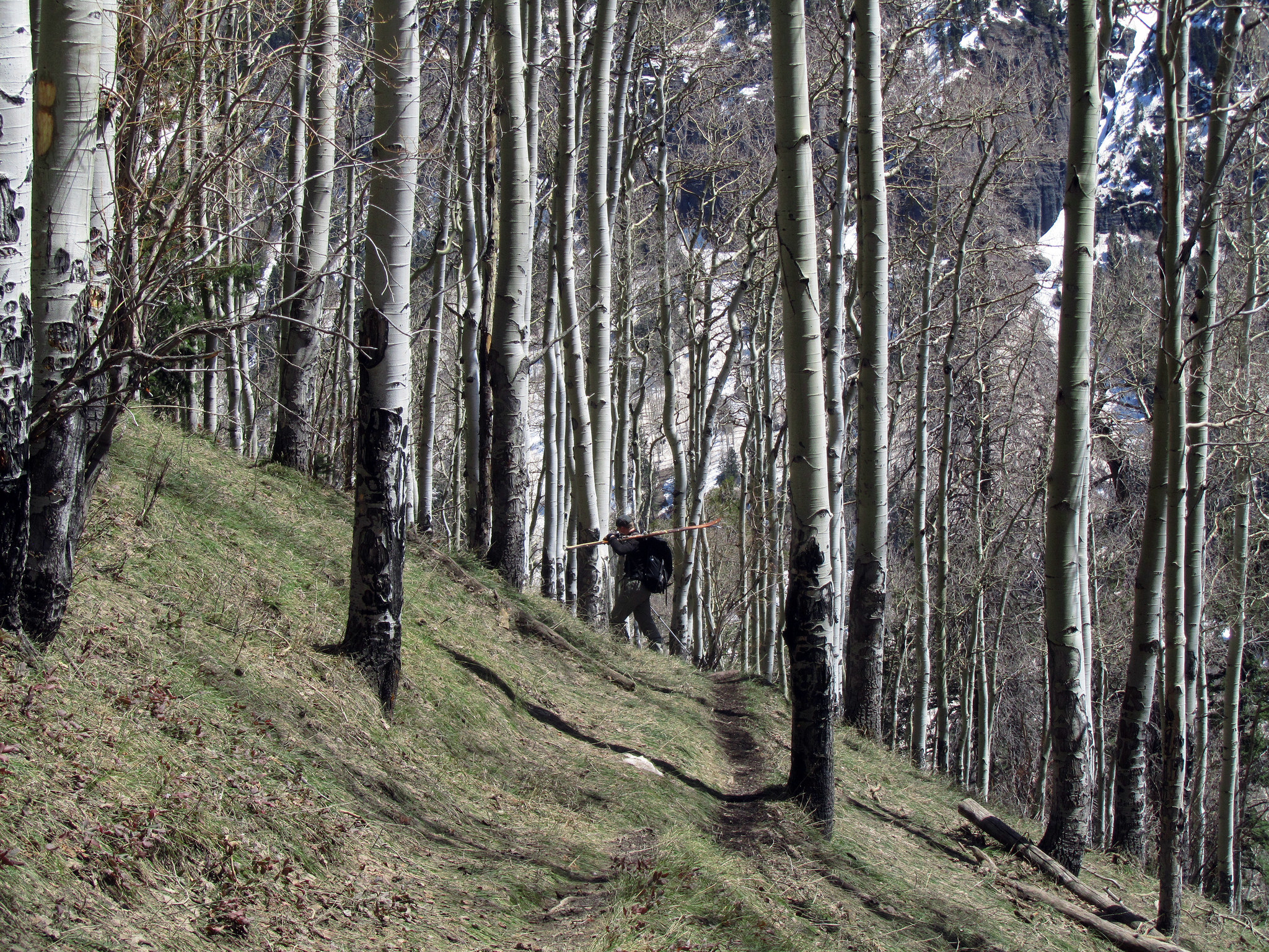
Once finally below snow line we were able to hike along mellow switchbacks the final two miles to the car. Photo by Brian.
All in all, exploring places like this brings me a certain degree of joy not otherwise found on standard routes and in well-documented areas. Our entire trip sort of had an exploratory feel to it, which made it all the more fulfilling in the end.
A great few days in the hills with good friends. Thanks guys, and thank YOU for reading.

Thanks for a great trip report! Lots of great information here. I am looking at heading up Teakettle and Potosi this spring and found all this quite helpful. Zach
Good to hear Zach, thanks for the note! Have fun when you head down there. Potosi was one of the better descents I’ve done to date. I wonder how long the San Juans will be in condition this year, seems like they’re melting out fast.