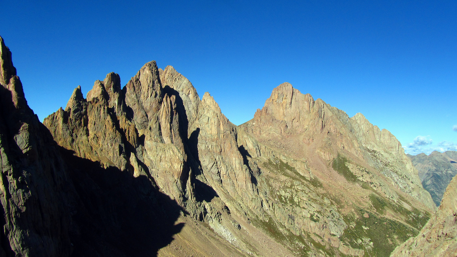
The monarchs of Ruby Basin: Peaks Sixteen, Fifteen, Turret and Pigeon (L to R), taken from Peak Twelve, September 3rd. Photo by Brian.
Partners in Crime:
Brian Miller
Matt Ellis
Rick Thompson
David Yarian
Ben Conners
Mark and Tim Jansen
The Fruits of our Labor (climbed by):
Pigeon Peak/Turret Peak A (All)
Monitor Peak/Peak Thirteen/Animas Mountain (Ben, David, Rick)
Peak Twelve (All)
Peak Fifteen (Ben, Brian)
Jupiter Mountain (Ben, Brian, Mark, Matt, Tim)
Grizzly Peak C (Ben)
McCauley Peak (Ben, Brian)
Introduction and Approach to Ruby Basin 9.1.12
After our return from the PNW in June Brian and I began laying down an itinerary for a summer backpacking trip to the Weminuche. We reached out for partners and established a group of ten highly interested, which would ultimately be reduced to a final list of seven.
None of us had climbed any of the Ruby Basin 13ers previously with the exception of Brian, who headed in a few years ago and hit Pigeon, Turret, and the Animas Group with some fellow 14ers.com members. Matt, Mark, and Tim have been fast at work on the Centennials so their interests in a Pigeon/Turret/Jupiter combo were very high. Brian had mentioned wanting to check out Peaks Twelve and Fifteen for his return, and Zambo and Rick were just looking to get into the Weminuche and enjoy the solitude of a new area.
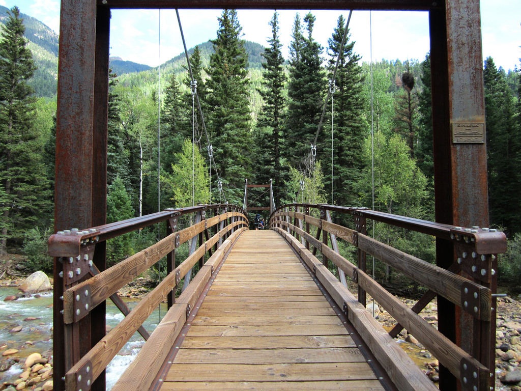
The Needleton bridge crossing, September 1st.
My motivations were more or less a combination of all of the above, along with the added goal of formulating and executing a challenging trip. For years I had salivated over trip reports on multiday excursions to this area in which parties have visited multiple basins and gotten a double digit peak count. Though I’ve been to the Weminuche several times now, my longest previous stay was three nights. I wanted to extend that by at least two nights, and try to complete a transfer between two different basins.
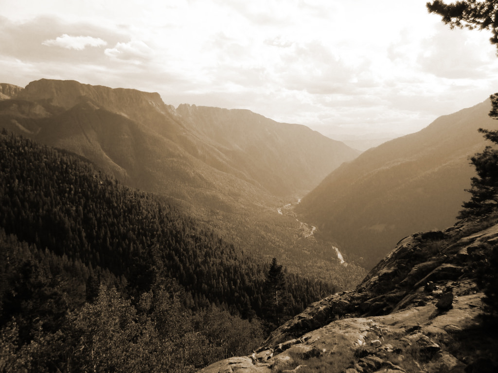
The Animas River Valley seen from the approach to Ruby Basin, September 1st.
Without going into too much more detail, I wholeheartedly feel taking the train from Silverton is the best way to access the Weminuche. The one downside is that you obviously have less time to pack in once the train drops you off, but in virtually every other respect, Silverton to Needleton makes more sense (less time on the train, more drive time from Denver, free parking, and a shorter overall drive, to name a few).
David, Brian, and I caught the 2:45pm train and were on our way across the Needleton bridge by 3:50. This gave us a little over three and a half hours to get to Ruby Lake before dark. Though I did feel the approach into Ruby was difficult, I also found it manageable. We made sure to head straight rather than taking a left just past the creek crossing in North Pigeon, as mentioned in previous TRs. This put us on a steep but direct route straight to the flat spot where the route rolls over the ridge into Ruby Creek. From there we simply tried to stick to the most well defined trail we could find. This wound up working fine for us; we managed to get through to Ruby Lake without making a single routefinding error.
Upon rounding the east side of the lake we caught up with the rest of our group who had come in from Durango earlier in the day. They took their time packing in and then reportedly ran into some routefinding issues which cost them a lot of time. After going at it with Ruby for several hours, we were all ready to get to camp and call it a night. One final bout of steep bushwhacking led us above the headwall to the east of the lake. We pitched camp just inside treeline. After making dinner inside our respective tents (by this point it was raining on us pretty good), we hit the sack.
The Centennials: Pigeon and Turret 9.2.12
The rain continued throughout most of the night, then quit around 4am. Our forecast placed the worst weather at the front of the trip, with each day getting progressively better until the end. We got rolling out of camp around 6am as a group of seven, following the trail up through the willow fields and then across the large, flat meadow that resides at the base of Turret/Peak Fifteen. From the south side of this meadow we picked up a faint climber’s trail that took us up through a series of steep grassy ledges and then to a field of car sized boulders below Pigeon’s East Face. From there it was thirty minutes of easy scree hiking to the saddle.
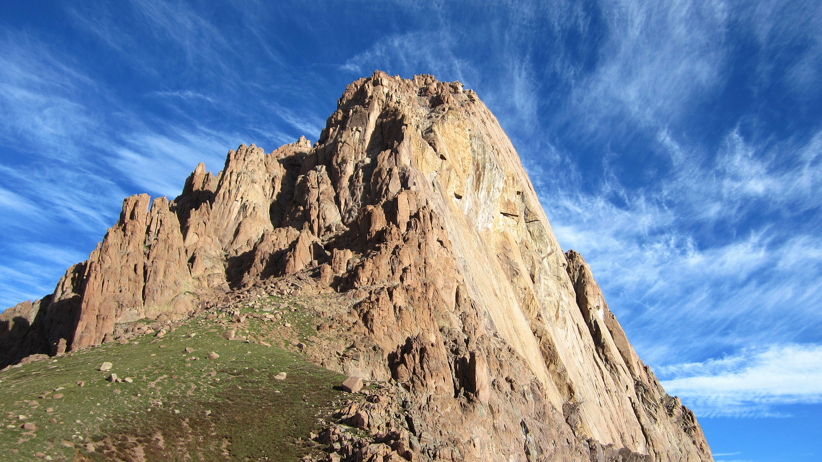
The vertical and imposing East Face of Pigeon as seen from the connecting saddle with Turret, September 2nd.
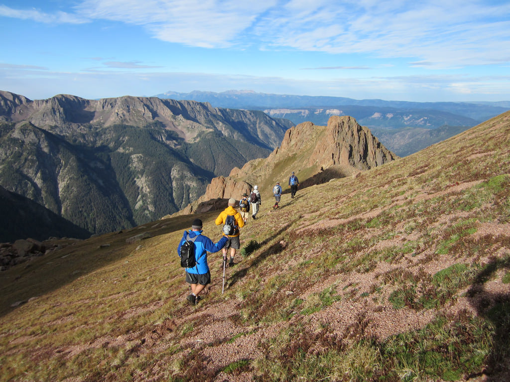
Our group of seven heading down off the Pigeon/Turret saddle towards North Pigeon Creek. The route heads hiker’s right over the small saddle that can be seen in the distance.
Probably the most difficult aspect of climbing Pigeon is the elevation drop and regain. 800′ of descent is required before the route wraps around Pigeon’s South Face and then gains elevation again. Because of this you’re looking at over 7,000′ of elevation gain to climb just Pigeon from Needleton (assuming you climb it from Ruby Basin). If Pigeon is your only objective however, climbing it from North Pigeon Creek would shave off quite a bit of this elevation gain. We ran into a few parties who had hit Pigeon in a day from Needleton via this approach and they had good things to say about their outing.
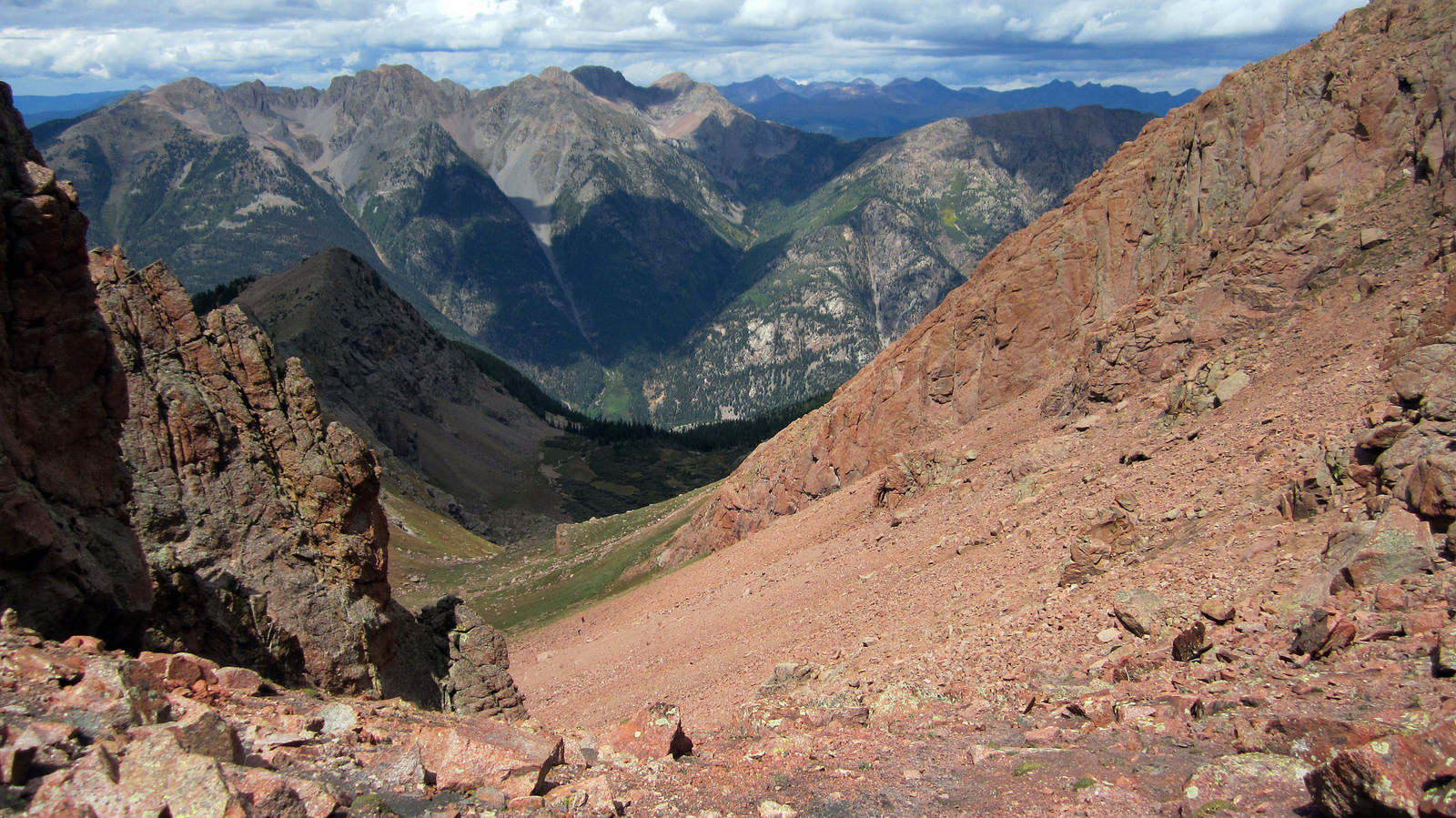
Looking down at North Pigeon Creek and the ascent gully on Pigeon’s west side. From the low point in the basin it’s about 1,600′ to the summit block.
We ascended the gully in about an hour and a half, then hopped up on top of Pigeon which required at most a few class 3 moves. I’m not sure where the class 4 rating comes from to be perfectly honest. On top, we were all pretty elated to have gotten Pigeon. I think upon summiting,the taskmaster mentality finally gave way to simply enjoying the wonders of the Weminuche and realizing how blessed we all were to have made it to the top of such a great peak.
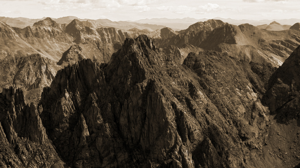
Animas Mountain across the way, taken from Pigeon’s summit.
We reversed the route and regained the 800′ back to the saddle. From there, Turret is a simple 700′ up class 2 terrain. Each member of the group moseyed on up there at varying paces but we all made it eventually, the last of us just before a late morning hail storm moved in from the southwest.
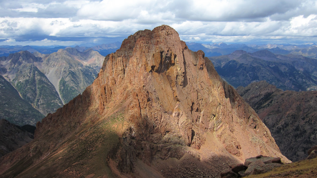
Pigeon’s East Face as seen from Turret. Both drainages, North Pigeon and Ruby, can be seen to the left and right of the peak.
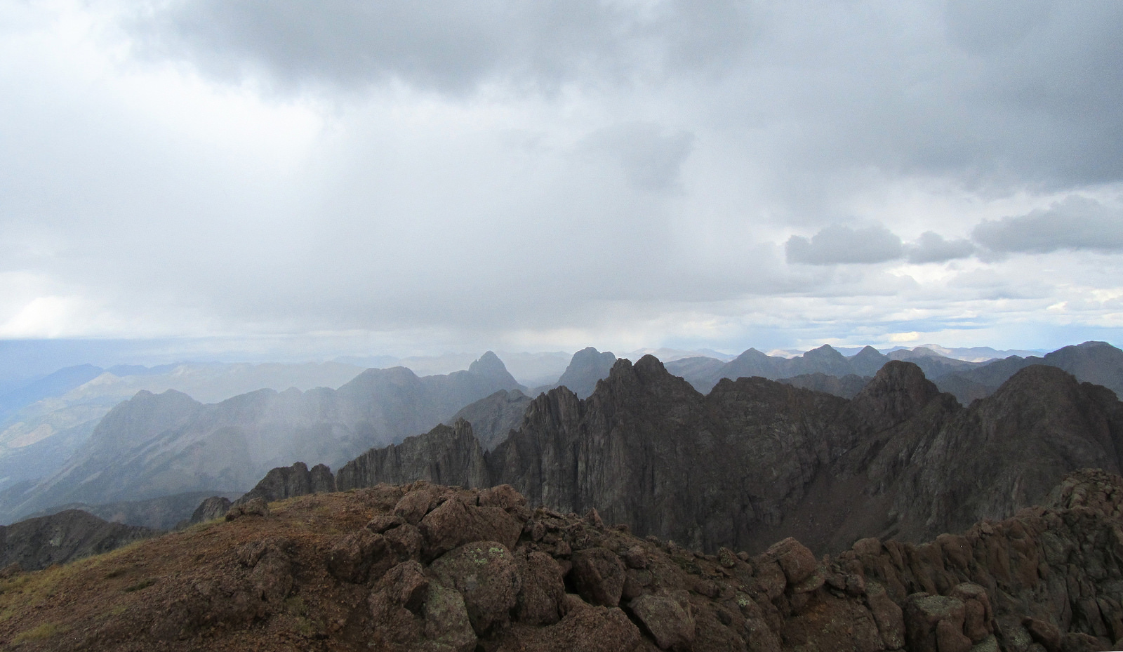
A shot Brian took from the summit of Turret roughly 30 minutes later. Weather’s on its way in, time to get back down to camp…
On the way in the previous day there was a lot of discussion about where to pitch camp. The options we had were: Ruby Lake, above the headwall to the east of the lake just below treeline, or in the large open meadow below Peak Fifteen. The lake, despite boasting some prime real estate on the north side, was not an option due to the number of times we knew we’d be heading into the upper basin from camp in the following days. If you’re heading to Ruby just to do Pigeon and Turret, or even a two day trip hitting another objective on day three, I’d recommend camping at the lake.
Because we had a transfer into Chicago, as well as the Animas Group and Peak Fifteen on the agenda, we decided the lowest we wanted to camp was at treeline. The open meadow options work well except they are more exposed to the elements and to rockfall from the large massif to the south. We chose treeline because it was a decent middle ground and the site we found had ample room for multiple tents and a nice stream flowing straight through the middle of it.
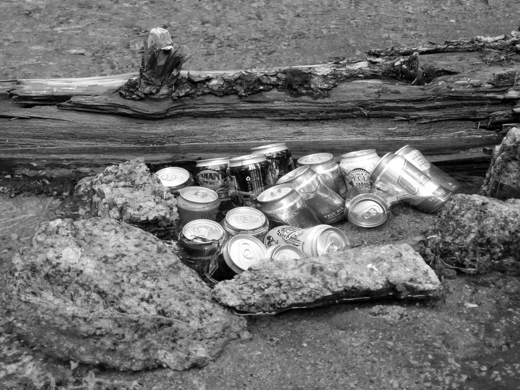
Beer garden. A pain in the butt to pack into Ruby but, depending on your beer tastes, well worth the effort.
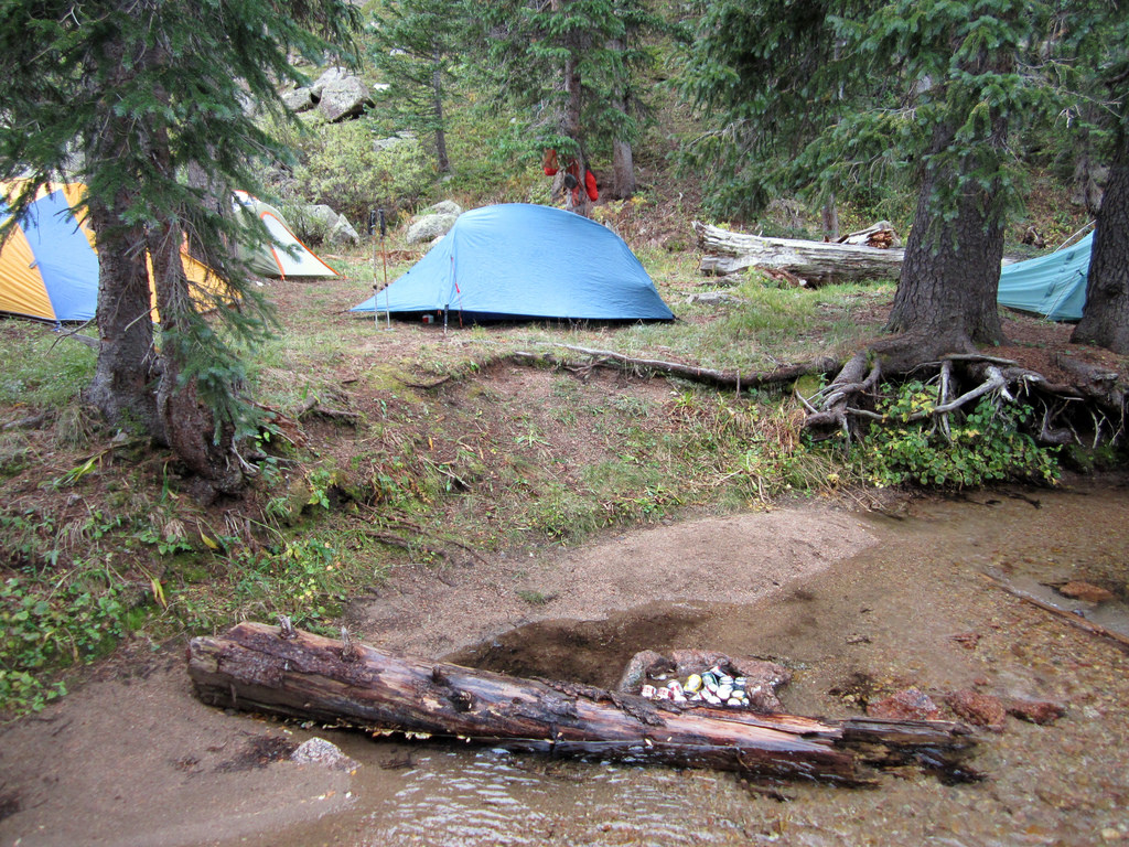
Our camp, just inside treeline to the south of the creek.
Back at camp, some tent time was in order as bouts of light rain moved in and out of the area until about 5pm. After that we dug into the beer garden in celebration of the day’s achievements, and cooked up some grub (the culinary choice award for the trip goes to Brian, who packed in something like twenty two tortillas, a pan, a stick of butter, three pounds of shredded cheese, and a bottle of Tobasco. With a little help from his Jetboil he was able to throw together some of the best looking cheese quesadillas I’ve ever laid eyes upon. By the end of the trip I was literally begging him for one). With more peaks and basin transfers on the agenda for the next day, we hit the sack around 10pm.
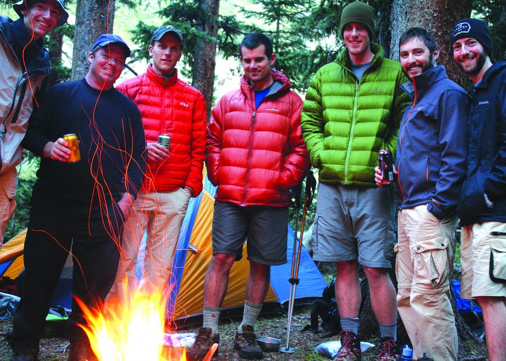
Post-climb festivities back at camp. Photo by Mark.
Animas Group 9.3.12
On day three we split off into three subgroups and went after different objectives. Matt and the Jansen brothers, intent on climbing Jupiter, departed camp around 7am and headed for Chicago Basin. Their goal was to complete the transfer, hit Jupiter on the 4th, and pack out that same day (which they did successfully, giving Matt his 93rd Centennial summit!). Brian, having already done the Animas Group on his prior visit to Ruby, opted for a late start solo of Peak Twelve. I will tell today’s story from my, David, and Rick’s perspective as we went after Monitor, Thirteen, and Animas.
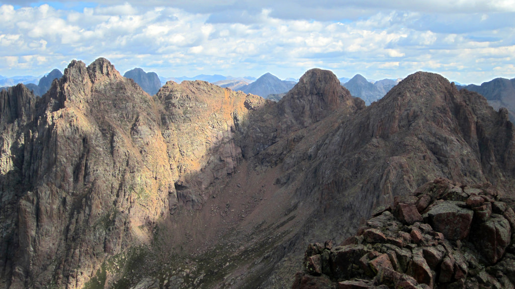
Monitor, Thirteen, and Animas (R to L) as seen from Peak Fifteen’s summit, photo taken September 4th.
The Animas Group, while somewhat overlooked throughout our planning process, was a delightful surprise in my opinion. Technically speaking the scrambling is fairly straightforward, and with the exception of Monitor the rock is relatively solid. My favorite aspect of this group is the views and spectacular positions it lends. Due to it’s location in the Weminuche, this small group of peaks grants front row seats of the Pigeon/Peak Fifteen massif. Noname Basin can be seen far below to the north, as well as Jagged in all it’s glory. Monitor’s summit lends great views of the Eolus Group and Jupiter to the southeast, and finally to the north you have a striking panorama which includes Vestal, Arrow, and the Trinities.
From camp David, Rick, and I were able to make good time into the cirque due south of Peak Thirteen and Monitor. From there, we headed straight for the base of Thirteen and cut from climber’s left to right across an obvious ledge system that leads to the Thirteen/Monitor saddle. From there the route heads southward along the ridge’s west side, crossing over a prominent gully. Once beyond this gully, it heads further south around a rock rib and then southeast up a loose gully to the summit. The entire route is well cairned and, for the most part, fairly obvious.
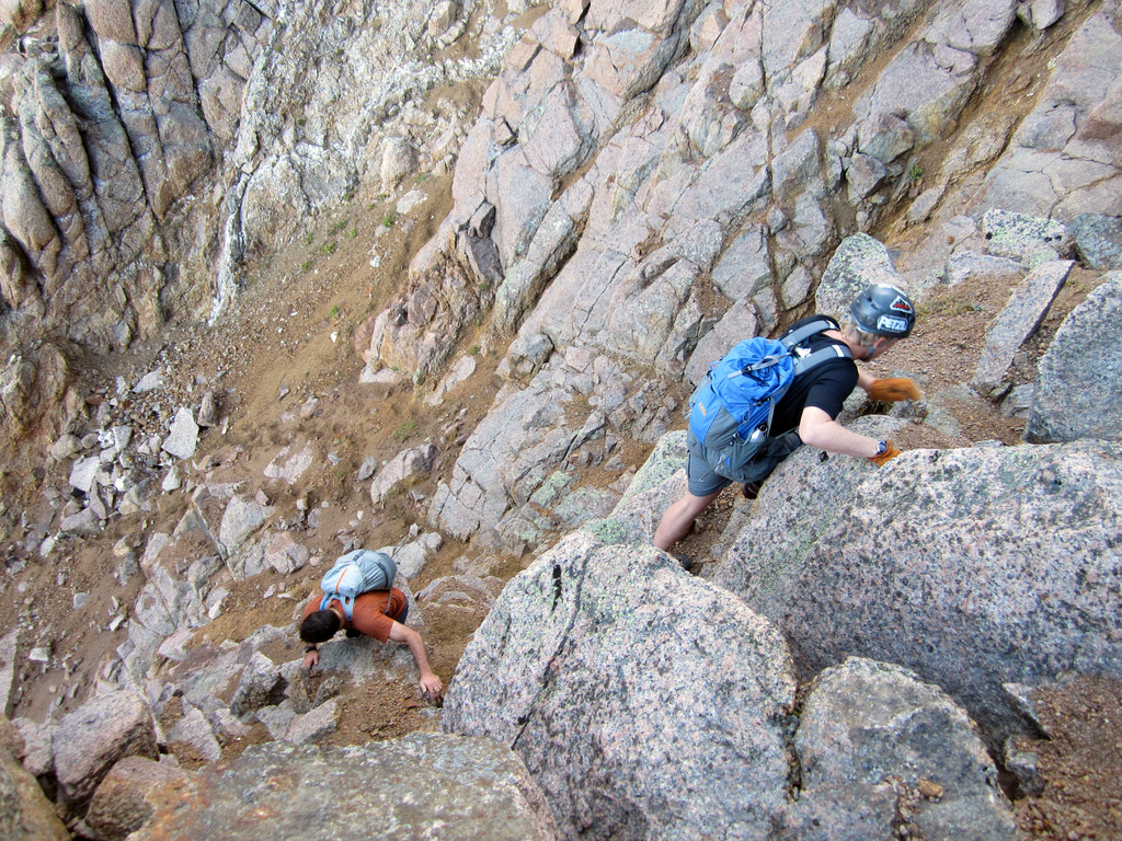
David and Rick crossing the prominent gully. There are cairns marking the entrance and exit.
The ascent of Monitor took us roughly three hours from camp, though we didn’t feel like we were moving particularly fast. We were sharing these peaks with two fellow 14ers.com members, Chris and Omar, whom we met on Pigeon the day prior. We spent some time on Monitor’s summit in an attempt to give them some space ahead of us.
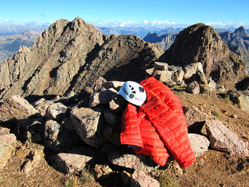
Summit of Monitor, looking northwest at Thirteen and Animas.
After a long summit stay we descended the gully one at a time and scrambled back to the Monitor/Thirteen saddle. From there, we decided to climb up to the obvious ramp looker’s right of the peak proper (this ramp can be clearly seen in the previous photo). From that ramp we wrapped around the east side of the peak and then scrambled back west to the summit up a series of steep, exposed ledges. Climbing Thirteen was without a doubt the most interesting scrambling along the entire traverse IMO.
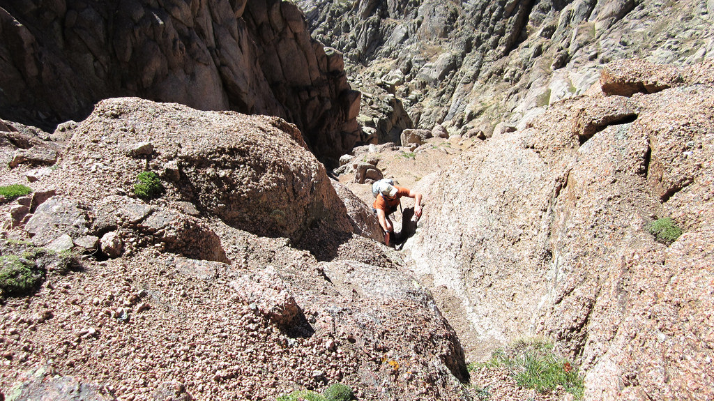
Rick on some low class 5 moves. This section of climbing gets you up on the aforementioned ramp.
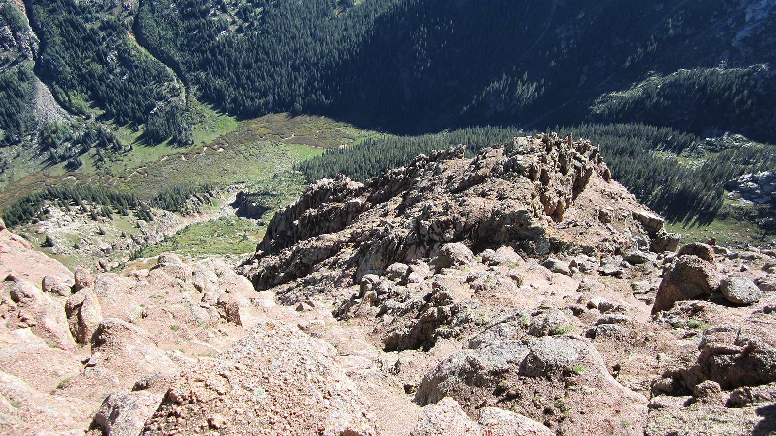
After gaining the ramp, we wrapped around to the east and scrambled up this pitch to the summit. Lower Noname Basin and Noname Creek can be seen far below.
We pretty much walked over the top of Thirteen’s summit without stopping, intent on keeping our momentum up for the last peak of the day. To descend Thirteen, we headed more or less straight towards Animas, trending slightly descender’s right to catch a few ledge systems that put us down onto the saddle. From there, we traversed across a few scree fields before coming to Animas’ summit headwall. Getting to the summit from there required a short class 4 scramble.
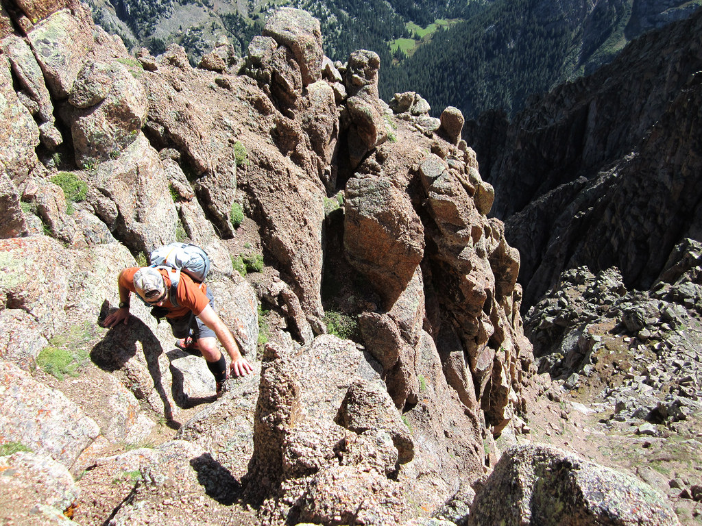
Rick heading up the final pitch to Animas’ summit.
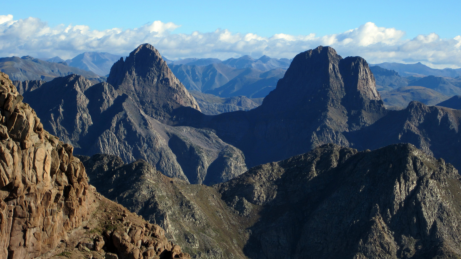
Vestal and Arrow to the north.
On the summit of Animas I was able to get cell reception. I notified my wife and a few others of the success we’d had thus far on the trip, and of the plans to come. Man I loved being out there. There’s just something special about the Weminuche. I later discussed with Brian how I feel as though if I lived in Durango or somewhere that had good access to this area, I wouldn’t appreciate it as much. It’s almost due to the fact that trips to this area are rare for me that makes them so special. It’s like going and visiting an old friend who I’ve been looking forward to seeing all year.
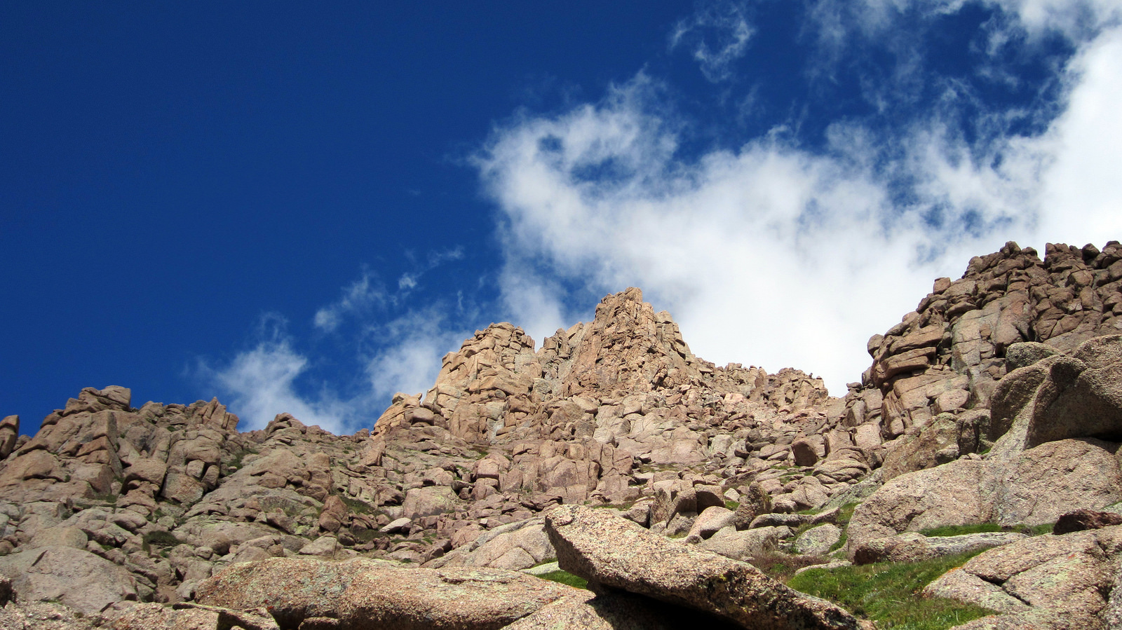
Off the summit of Animas, looking back up at this unique peak.
From the summit we reversed our ascent route down to the Animas/Monitor saddle and descended down a loose scree gully for a thousand feet or so. The scree skiing in this gully was some of the best I’ve ever experienced. Just when thought the gully was going to take us all the way to the valley floor, it ended abruptly in a series of cliff bands. We traversed descender’s right across a grass slope and intersected another gully which provided safe passage through the cliff bands. In no time we were jogging down the grassy slope less than a mile from our campsite, a solid day of scrambling under our belts.
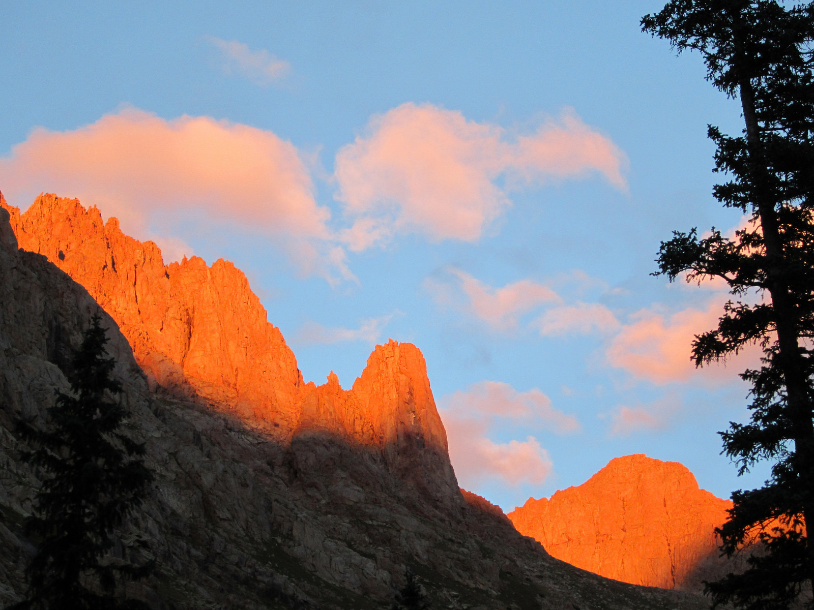
Ruby Basin alpenglow on Monitor and Animas.
Back at camp after Brian returned from his hike up Twelve we enjoyed a long, leisure afternoon of napping, reading, and enjoying the freedom of being out in the middle of nowhere with no time commitments and nothing to do. We even dug some holes and played a few games of wilderness cornhole, you know, just to try it out. Later in the evening we cooked up dinner and headed upstream from our camp to enjoy the dusk alpenglow on Animas. A fire and a few more cold ones from the beer garden rounded out the evening nicely. We hit the sack in preparation for another big one.
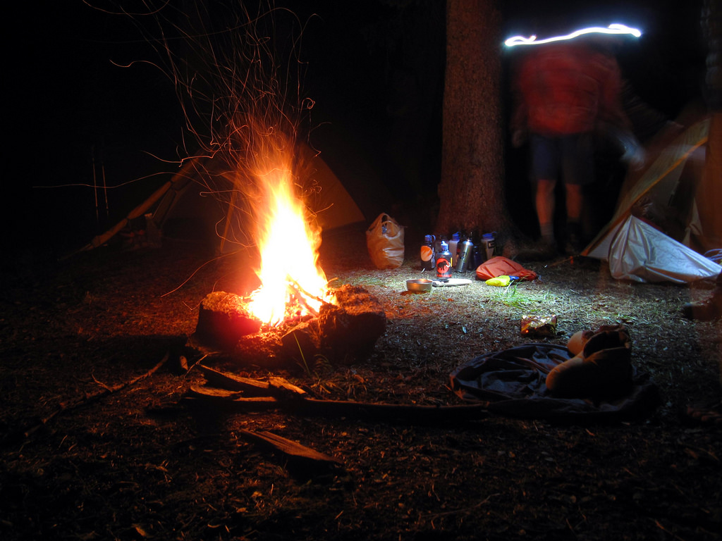
Fires may be outlawed in Chicago Basin, but in Ruby it’s game on.
Fifteen, Twelve, and the Road to Chicago 9.4.12
Brian and I woke up at 3am and got started on what was undoubtedly the largest and most complex day of our trip. We figured we just might have bitten off more than we could chew on this one, but we decided we were gonna give it a shot regardless. The plan was to pack up camp and head for Ruby Pass, drop our packs near the base of Peak Fifteen, climb it, return to the packs, and then head through upper Noname and over Twin Thumbs Pass into Chicago Basin. The biggest piece we needed to fall into place was the weather as we knew we’d likely be heading over the passes in the late afternoon/early evening.
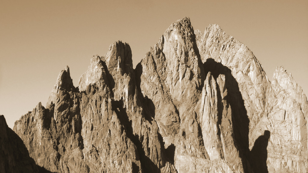
The Turret/Fifteen massif. Peak Fifteen appears to be the highest from this vantage point. Photo taken by Brian from Peak Twelve, September 3rd.
We said a silent goodbye to Rick and David who would be packing out of Ruby and heading back to Denver at dawn, but not before their own morning jaunt up Peak Twelve. After aimlessly bashing our way through a field of willows for an hour, we arrived at the large boulder field below Peak Fifteen right at sunrise. There we hung our packs over a cliff, prepped our day packs which included a 60m rope and a few pieces of webbing and pro, and started the ascent to the saddle east of Little Finger. Even though Brian and I had researched this climb to the best of our abilities, there just isn’t that much info out there. We did however have one extremely valuable source of information with us, and that was Darin Baker’s trip report from early August. Darin put up the single most informative report in existence on this peak, and for that we owe him a few beers. Peak Fifteen is a complex undertaking.
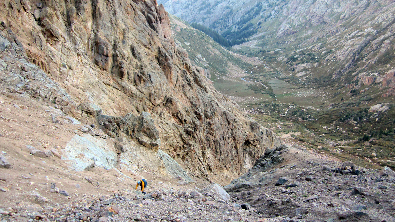
The first obstacle to overcome is an extremely loose, low quality slog up this gully. This leads to the prominent saddle to the east of Little Finger.
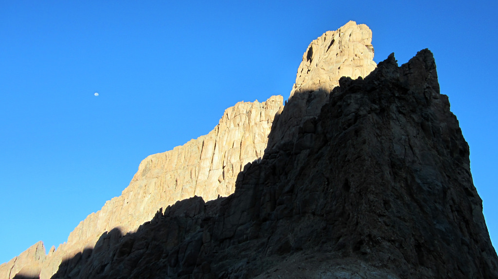
As described in Darin’s TR, the route from the saddle involves a descending westward traverse to the south of Little Finger/Peak Sixteen. The drop is somewhere in the vicinity of 400′ and the traverse distance is maybe 1/2 mile. Eventually we arrived at the obvious (well, obvious when you’re standing directly beneath it) gully which curves up and right towards the Fifteen/Sixteen saddle. There is a large cairn marking the bottom of this gully FYI. Confident we were in the right place, we started on up.
A few hundred feet from the cairn I mentioned, the ascent gully narrows and steepens into what is best described as the deranged long lost brother of the Hourglass on Little Bear. It’s narrower and contains more difficult moves than the Hourglass, but thankfully it’s not as exposed. Any, and I mean ANY rockfall that comes off the south face of Peak Fifteen will without a doubt be funneled through this gully and leave a path of destruction it its wake. This is not a good gully to hang out in for long periods of time, which is not ideal because most parties will want to execute a few rappels in order to get down it on descent. In summary, I’m glad we were the only party on the peak on this day.
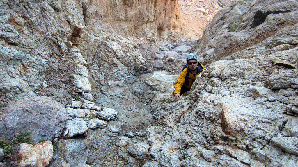
Brian scrambling up wet slabs in the gully, about 1/3 of the way to the Fifteen/Sixteen saddle.
About 2/3 of the way up the gully we hung a left at the base of a large dihedral/headwall which blocked our way. A well cairned ledge system heads climber’s left and then right around this obstruction. Above the headwall, before we reached the Fifteen/Sixteen saddle, we headed left again out onto the south face proper. The difficulty ramped up as we headed west across broken ledges. Before long we reached a large rock horn and the bottom of what appeared to be a class 5 pitch. We slung it with a large loop of webbing, clipped in, and tied into the rope.
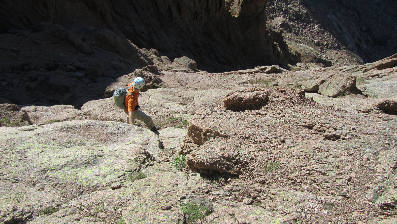
It started to get pretty airy as the ledges became narrower and narrower. Photo by Brian.
Once roped up I took the lead and started climbing the face. Though not vertical, this face lays back at an average angle of seventy degrees. I found it to be very similar to the first pitch of the direct start on the First Flatiron. Protection on this face is scarce and the rock can be crumbly in places. I took it very slow and deliberate, working my way up about 50′ before slinging a large rock horn and looping the rope through a locking caribiner.
From my position I could see another large flake (potentially the same flake Terri climbed to in Darin’s TR) about 100′ above me and to the west. I went for it, smearing on slabby rock with what seemed like very small holds for a 5.2 rating. If I had to rate this pitch I’d call it more like 5.6, and run out too (again I’d compare it to the first pitch of the standard East Face on the First Flatiron, which is also rated 5.6R). Eventually I hit a ledge which I was able to follow up to the flake, marking the end of the only pitch of roped climbing we did on this peak.
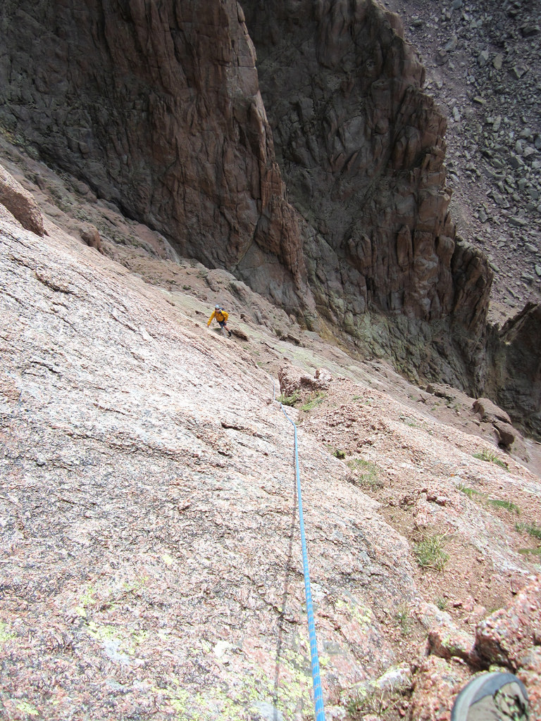
Bringing Brian up just after he reached the ledge I mentioned. The first half of the pitch lies below him and to the right.
From the top of this pitch we stowed the rope and scrambled up to the large grassy bench that lies below the summit block. From this bench we found the cairned gully Darin mentions in his TR and scrambled up large blocks to the summit.
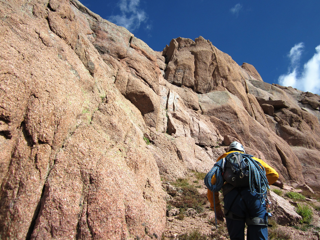
The grass ledge above the class 5 pitch. From here it’s about 200′ to the summit.
Frazzled and tired, we topped out on Fifteen and took a much needed breather. I took a short summit video panorama, which I’ve linked over from Youtube:
From the summit to the bottom of the initial ascent gully we executed five rappels. The first rap took us from the top of the narrow gully we climbed to reach the summit and dropped us back onto the grassy bench at its base. There are a few pieces of webbing marking the top of this rap. Once on the bench we headed east and rigged up two more raps, the second of which dropped us directly onto the Fifteen/Sixteen saddle. From there we downclimbed the gully with care, rapping twice to get past two wet class 4 downclimbs.
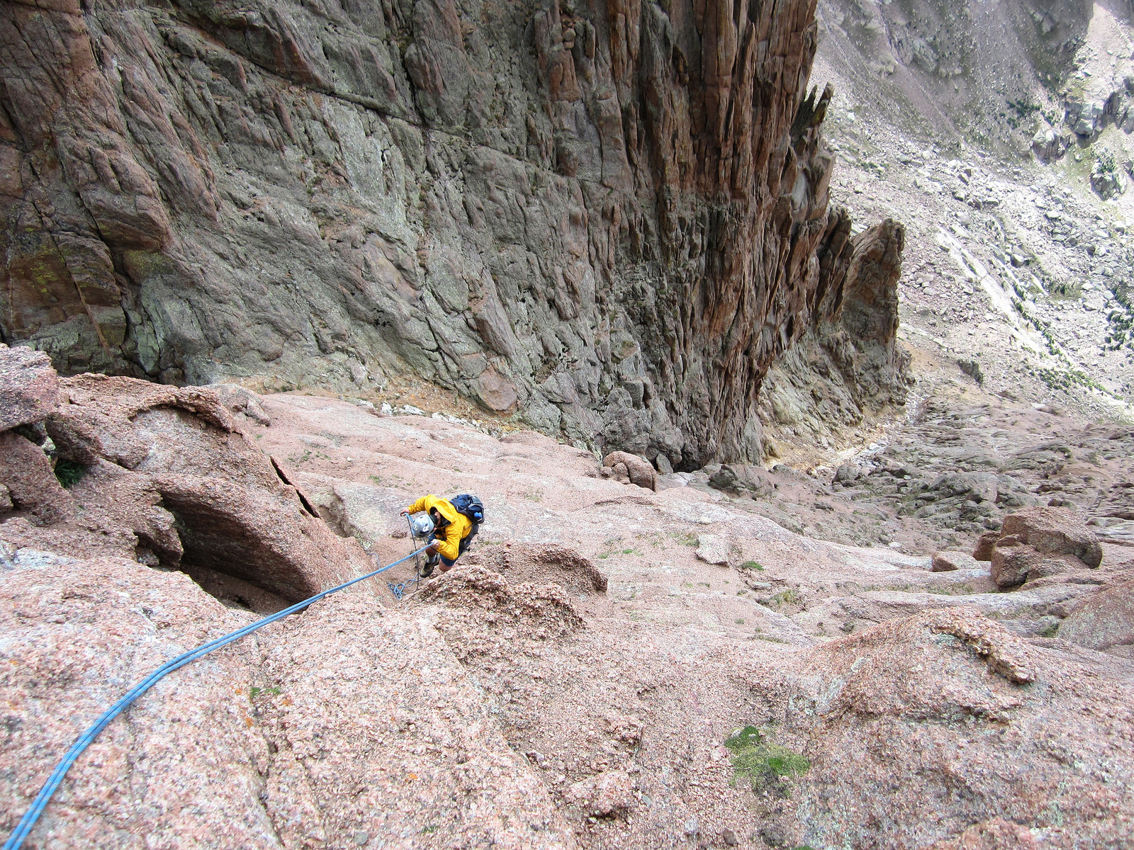
Brian on the second rap. From the bottom we headed north across a ledge to the third rap station.
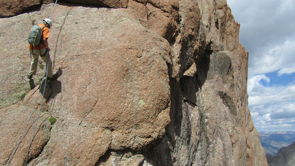
Nearing the bottom of the third rap, this one drops onto the Fifteen/Sixteen Saddle. Photo by Brian.
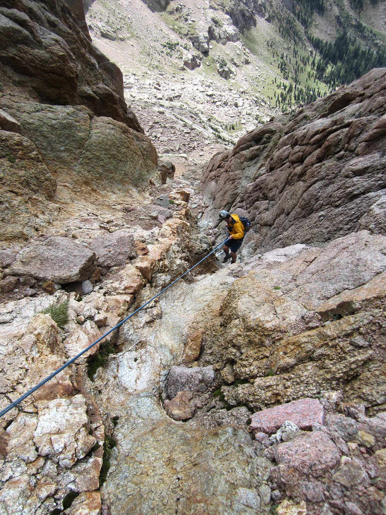
Brian on the fifth and final rap, near the bottom of the gully.
Satisfied with Peak Fifteen all but in the bag, we made our way back to the saddle and descended the scree gully back to our packs in upper Ruby. With the weather holding and nothing but the pack over to Chicago remaining, we filtered some water, pulled out some trail mix, and sat in the grass looking up in awe at the peak we just climbed. Fifteen was the technical challenge of the trip, it felt good to have it out of the way. Eventually we saddled up and started for the Peak Twelve/North Eolus saddle.
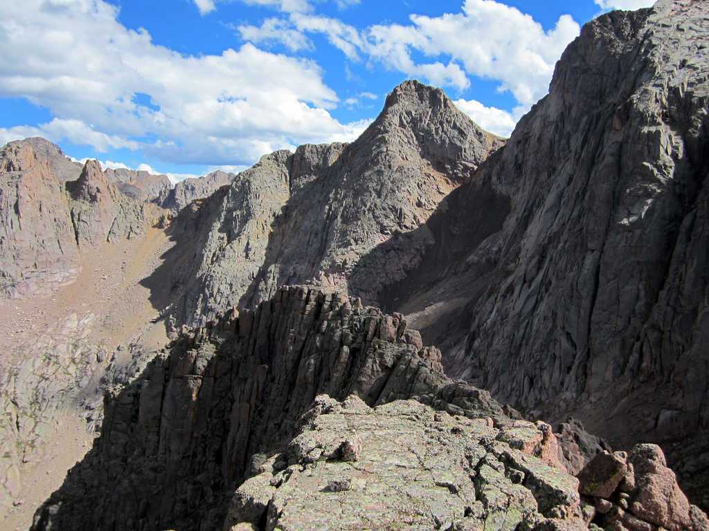
En route to the saddle I dropped my pack and jogged up Twelve, being the last person in our group to summit it. Here’s a shot from the top, looking towards Twin Thumbs Pass.
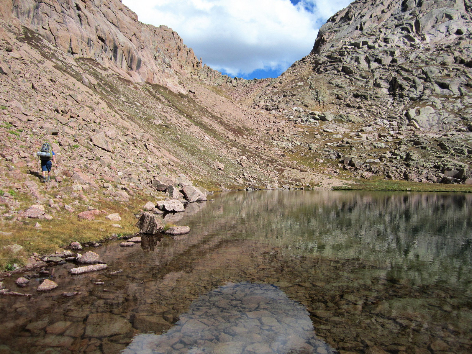
Brian hoofing it towards the Twelve/North Eolus saddle which can be seen above him.
From the top of the saddle (and much to our disappointment) it became apparent that a several hundred foot drop was required before we could safely ascend to Twin Thumbs. Who knew? Though it looked demoralizing we had nothing but time on our hands and decided to just take it slow and steady. A little over an hour later we crested Twin Thumbs Pass and peered down at Twin Lakes and Chicago Basin.
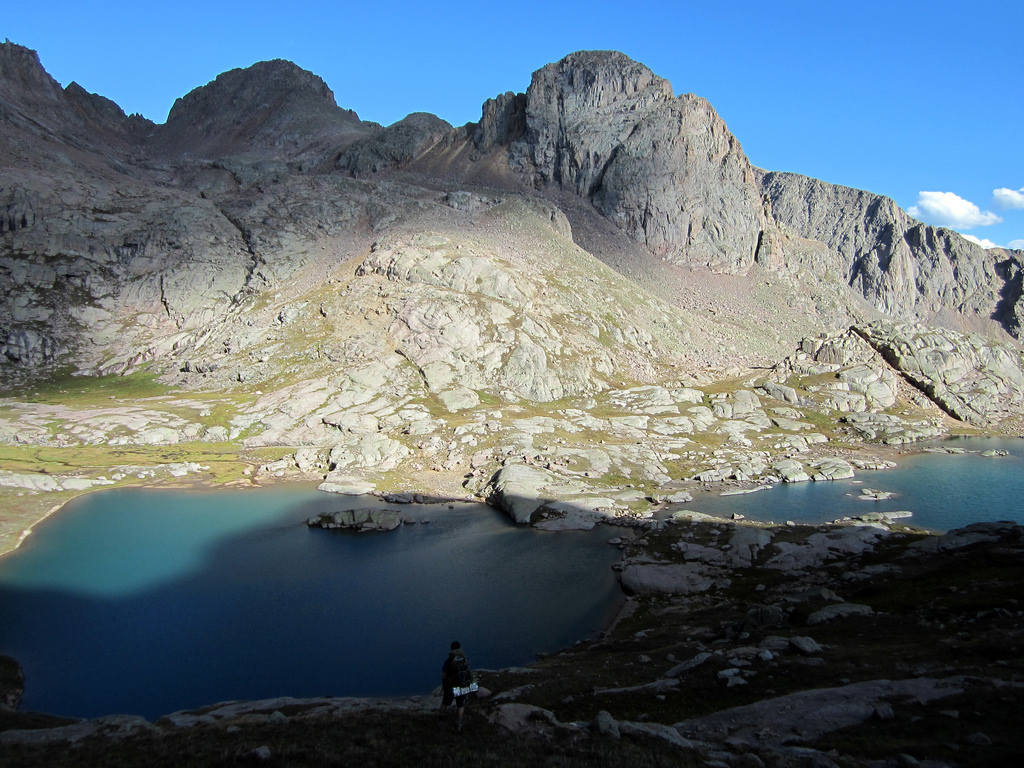
Hello Chicago!
We arrived at Twin Lakes around 5pm and threw our bags down for a much needed rest. A literally perfect day was coming to an end, and it felt great to have pulled off our goal exactly as planned. We each had one final brew left and, given the venue, the gorgeous evening, and the success we’d realized on our trip up to this point, we decided it was time to break them out.
We just sat there enjoying one of the best rounds of beer either of us had ever tasted, munching on gorp, and admiring the sick area that is Twin Lakes. Eventually we descended down below treeline and located a camp site. Brian treated me to half of his quesadilla, after which I promptly passed out. It was the end of a fifteen hour day.
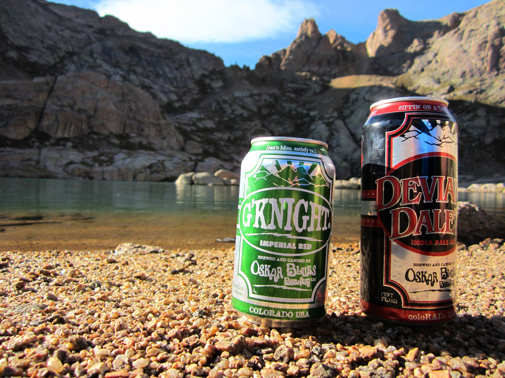
Happy hour at Twin Lakes – Twin cans and Twin Thumbs.
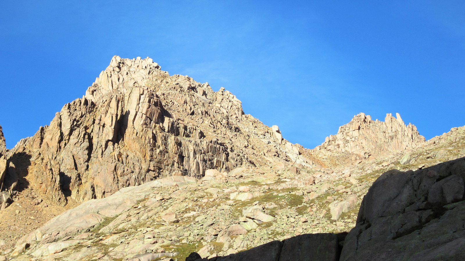
Sunlight and Sunlight Spire as seen from the lakes.
Jupiter et al, and the Deproach to Needleton 9.5.12
After a sleep during which I was literally dead to the world we managed to get going around 6:30am from camp. Though it was nice to camp in a familiar area, it was not nice to have a family of gangly looking goats staring us in the face when we got out of the tent in the morning. We also caught the tail end of the Labor Day weekend crowds, so privacy was nothing more than fleeting thought during our short stay. Maybe it just seemed like a stark contrast after enjoying the solitude of Ruby for the previous three nights.
All that said, Chicago Basin is a pretty sweet place, I’m just giving it a hard time. We left camp and headed for the Columbine Pass trail split at the far east end of the basin, then hung a right.
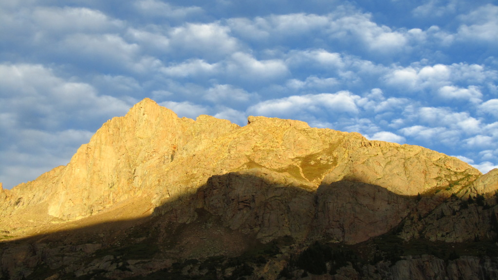
Jupiter’s long West Ridge, taken from upper Chicago Basin, September 4th. Photo by Brian.
At treeline we cut northeast, following a faint climber’s trail towards Jupiter’s broad west slopes. Once on the ridge proper it took us forty five minutes to gain the false summit at the end of the ridge. From there it was a short scramble to the summit.
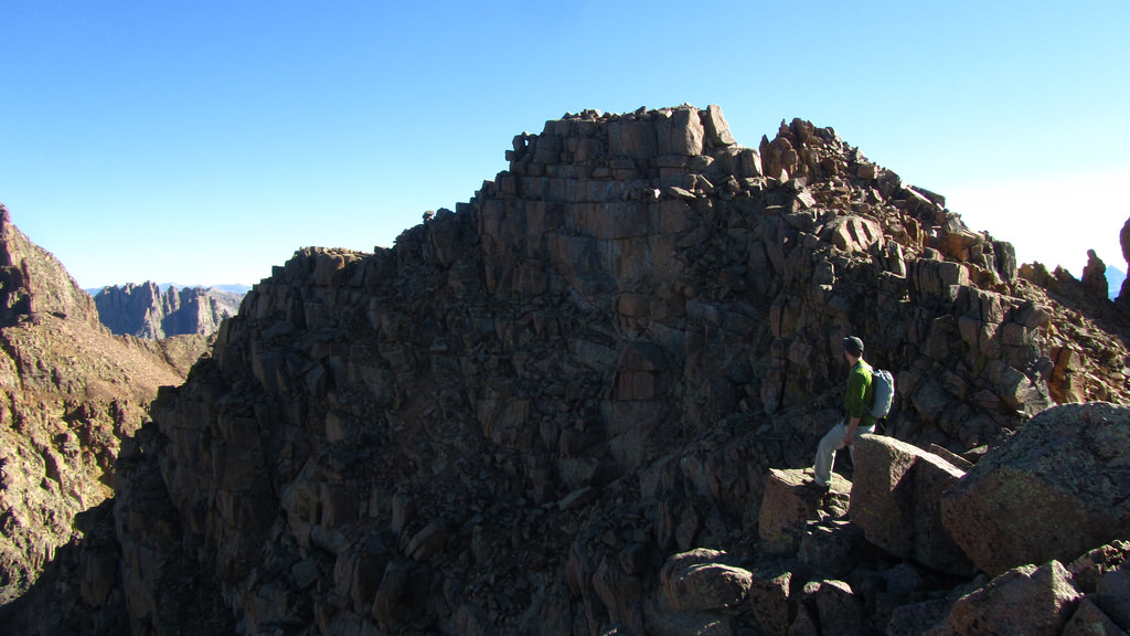
Nearing the end of Jupiter’s West Ridge with the summit in view. Photo by Brian.
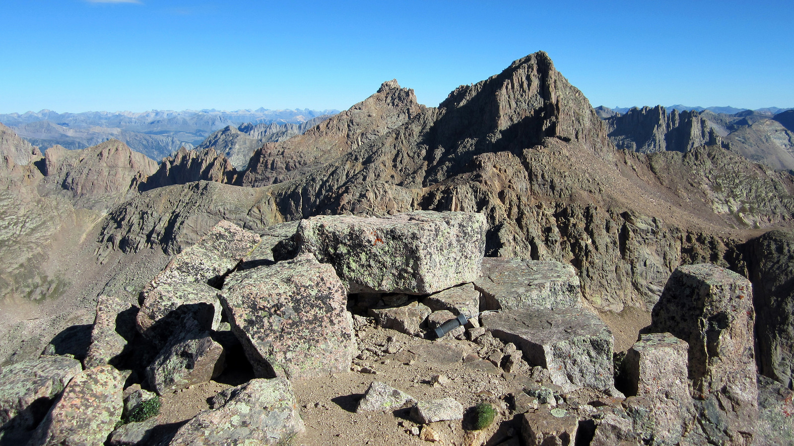
On top of Jupiter, looking north at Windom and Sunlight.
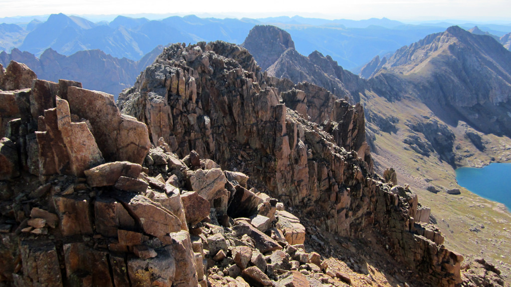
Looking southwest at Grizzly C (left) and McCauley. Later in the day we gained the saddle between the two from Hazel Lake.
We had reserved in the back of our heads that it would be fun to check out Hazel Lake, Grizzly C, and McCauley if we had the time and energy to do so. Well once again the weather looked to be holding fine and we didn’t need to be at Needleton until the following morning, so we figured what the heck. Problem was, we didn’t have much beta on the traverse to Grizzly C. Brian had mentioned that Presto climbed Grizzly C back in the eighties, but he couldn’t recall if she did it via the traverse from Jupiter or from Hazel Lake (any insight Presto?).
We started making our way along the traverse just to test the waters and quickly realized we were in over our heads. From around the first corner we could see what looked to be a nightmare of jagged spires and vertical cliff faces leading towards Grizzly’s summit. After Peak Fifteen the day prior we weren’t really looking to push the envelope off the back side of an already secluded basin, so we elected to forego the traverse and drop down to Hazel Lake. This ended up being a good decision as we were able to find a relatively easy route down the south face of Jupiter and into the basin.
At the lake, Brian decided he wasn’t in for both peaks, just one or the other. Furthermore he indicated to me that he wanted to take a dip in the lake and chill for awhile. Realizing this was an opportunity and an excuse for me to head out on a solo mission to Grizzly, I told him what I was planning to do and headed on out. We agreed to meet either on the Grizzly/McCauley saddle or at the south end of the lake.
I made good time to the saddle and hung a left towards the peak proper. Knowing next to nothing about the route up the peak I quickly learned through trial and error that I wanted to be on the east side of the ridge crest, not the west. Making good time along what seemed to be a viable route, I headed around a corner and got a good view of Grizzly and the remaining terrain to its summit.
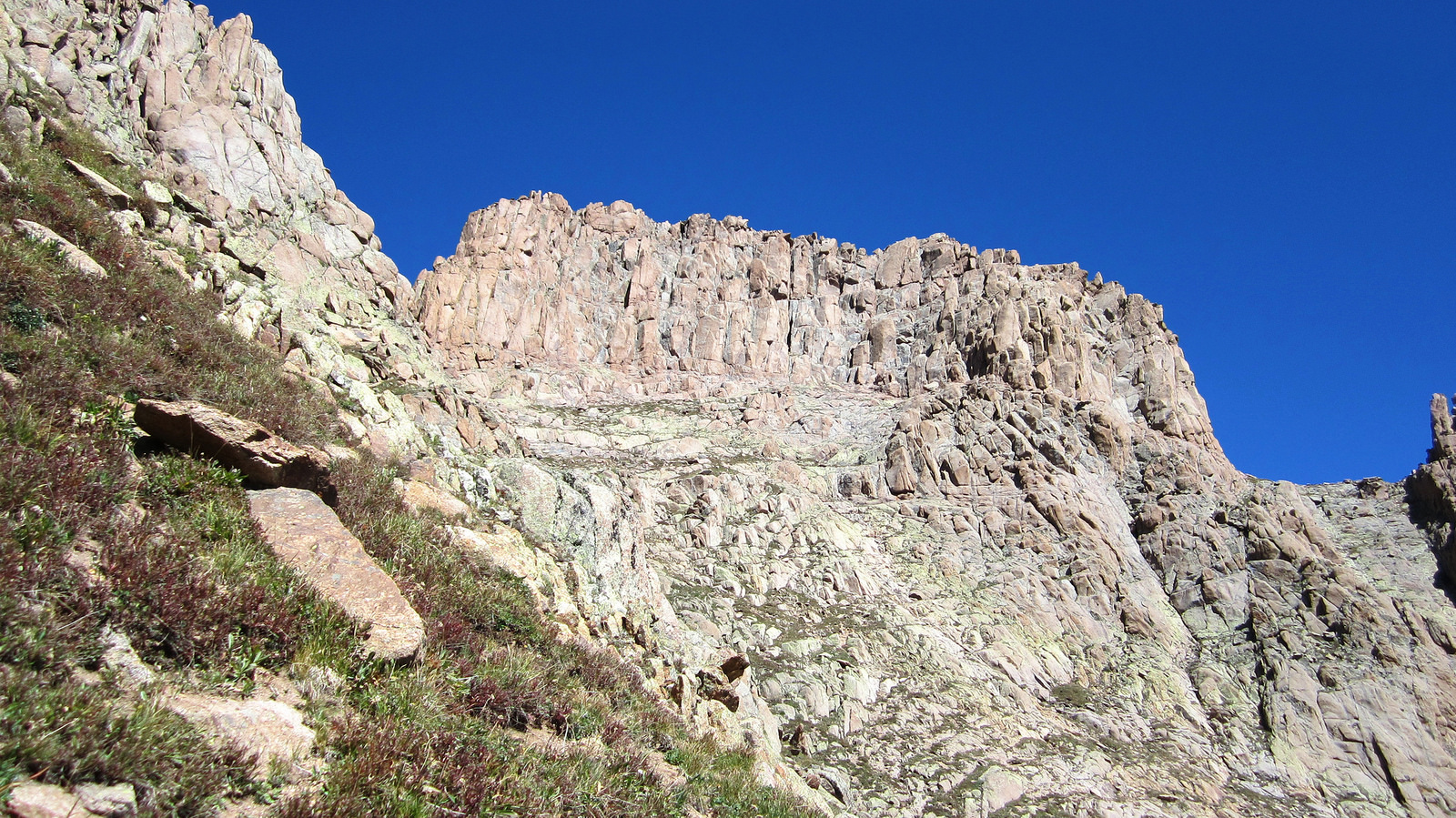
Grizzly C seen from the east side of the ridge. Steep grass slopes make for a precarious traverse through here.
As can be seen in the previous photo, the route I took wraps around to the left and up a loose gully (hidden from view), traverses out of the gully and right across the grass ledge underneath the summit headwall, and then heads up the blocks to the summit from there. I made sure to take my time throughout all of this as I was well aware of my position on the backside of a peak, on the backside of an obscure basin, many miles from civilization. I resolved that if I came upon something that looked too difficult to try solo, I’d turn around. Turns out I never did, though a few spots along the final summit climb got my attention.
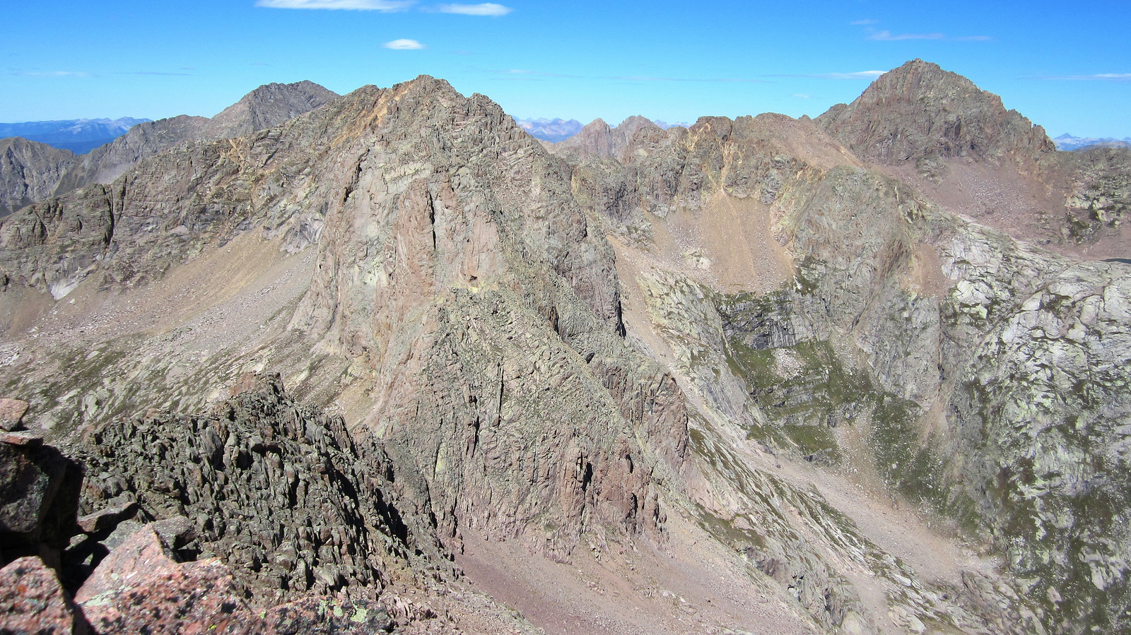
Jupiter, Windom, and Eolus as seen from the summit of Grizzly C.
I spent all of two minutes on the summit, noticing Floyd and Furthermore’s signatures in the register. In truth I wanted off this peak and wouldn’t rest until I made it back to the saddle, which I was able to do without any major issues. I enjoyed the solitude and the novelty of having to “figure it out” as I went along, but in all honesty joining back up with Brian was a comforting moment. We met on the saddle as planned and then hopped up onto McCauley.
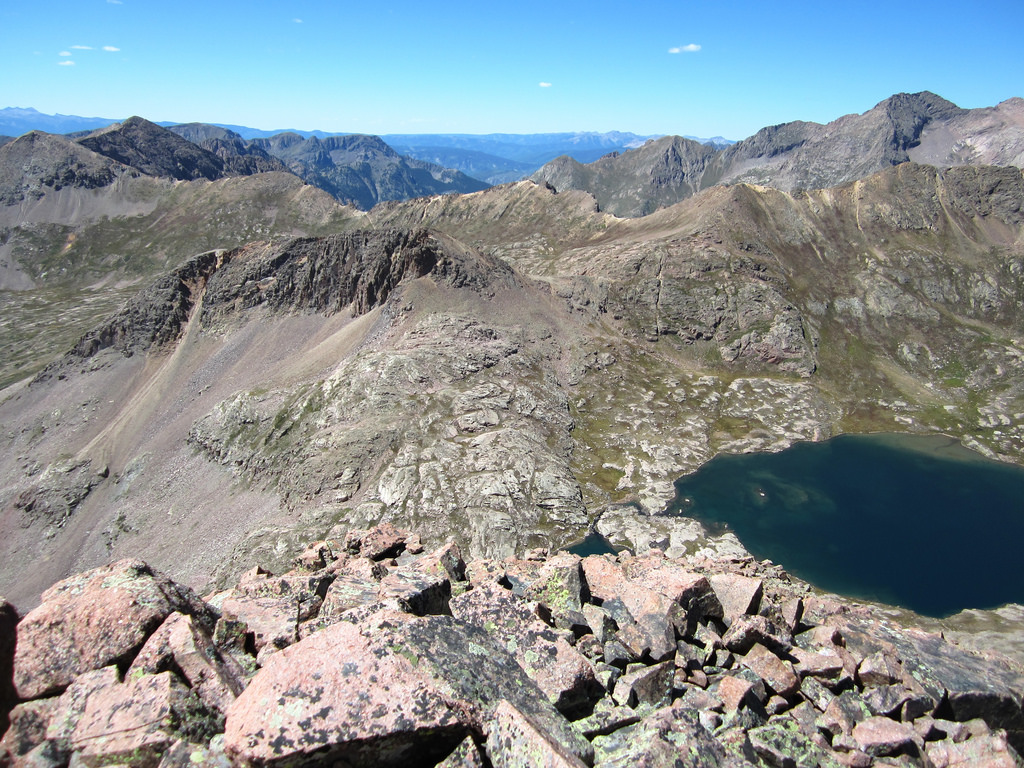
Taken from McCauley’s summit ridge, looking west at Hazel Lake. Columbine Pass, our exit, can be seen at the far end of the next basin over.
With peak number ten under my belt, I felt like counting my blessings and getting out of there. Not that I wouldn’t have spent more time in the Weminuche if I were afforded it, but there’s something to be said for quitting while you’re ahead, ya know? Once at the lake, we decided a dip (the second for Brian) was in order.
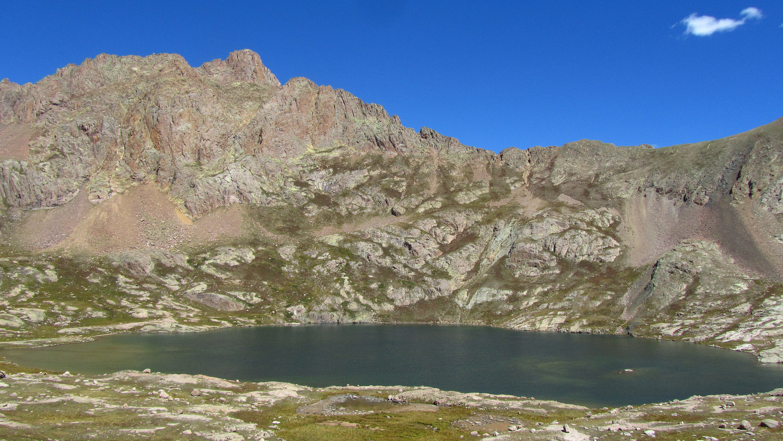
Hazel Lake and Grizzly C, taken from the west side of the basin before we ascended to the first pass due west of the lake. Photo by Brian.
From the first pass we were able to take a high traverse above Columbine Lake and contour around to Columbine Pass without losing any more than 100′ of elevation. We were elated when we discovered the well maintained trail system which made this possible. We were expecting to have to drop all the way down to Columbine Lake before reascending.
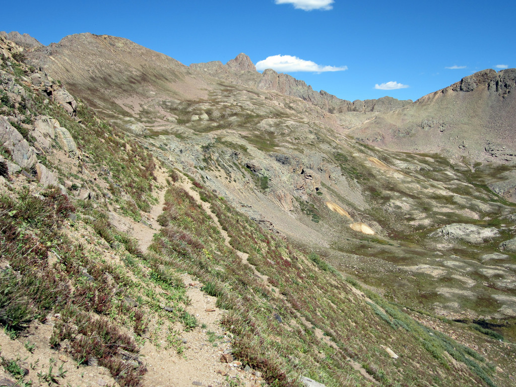
Looking back at the high traverse we used to contour around to Columbine Pass. Grizzly C can be seen in the distance.
From the pass we took note of the spectacular peaks to the south of Johnson Creek. That area of the Weminuche is rarely explored and would make for a fun outing in the future. The descent from the pass back to camp went quickly. Upon arriving, we made the decision to finish off our trip by packing out to Needleton as opposed to camping another night and packing out in the morning. We were inclined to just get the deproach out of the way, but the knowledge that we had a sixer of Modus hidden in the Animas is what really sealed the deal.
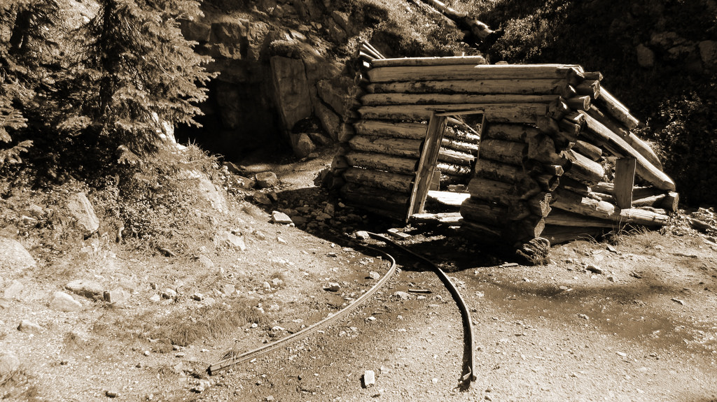
Mining ruins along the Columbine Pass trail.
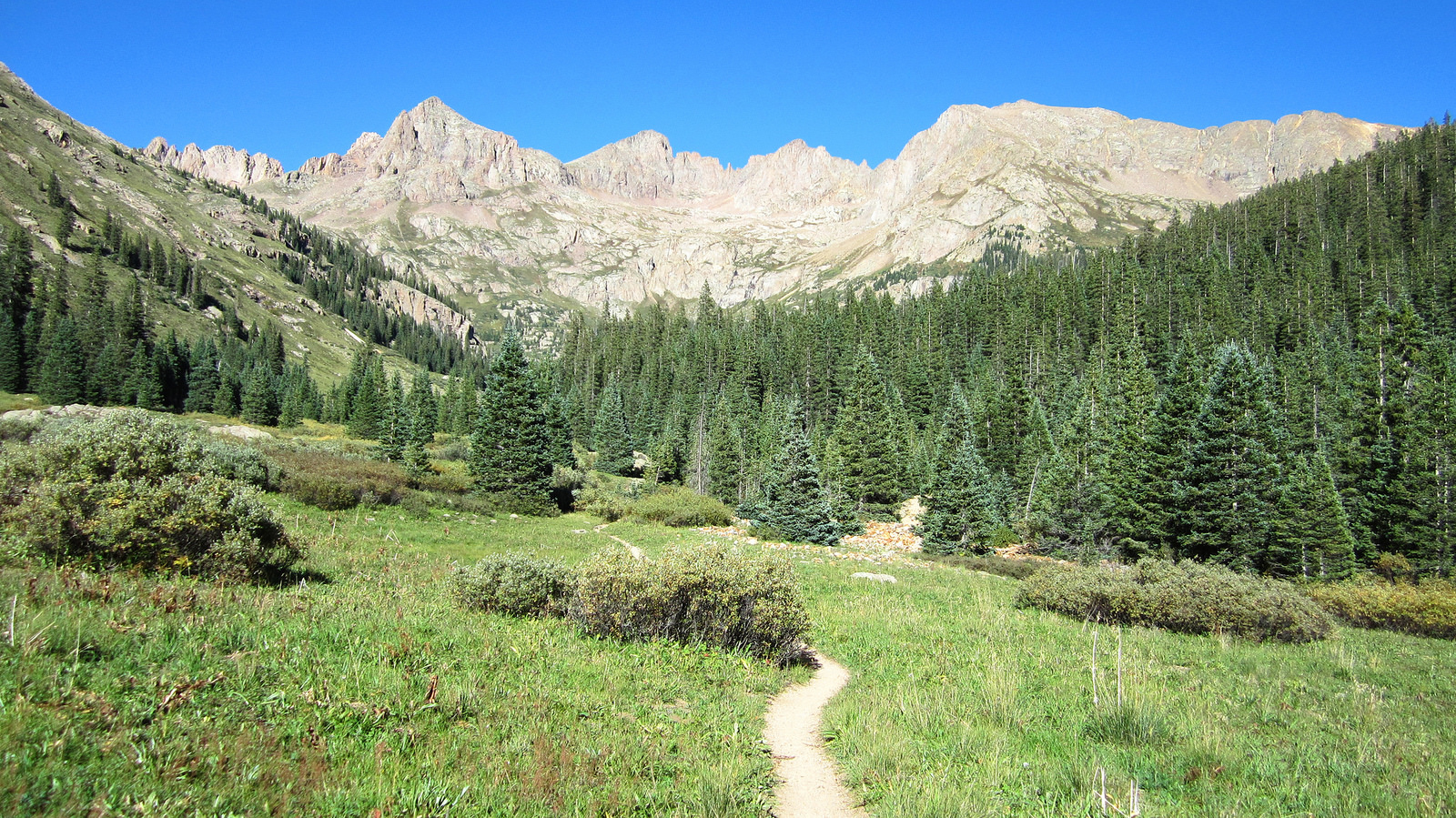
Looking back at Chicago Basin as we packed out under the afternoon sun.
We packed out underneath a gorgeous Weminuche sunset and found a great camp site right next to the river. A quick 1/2 mile jog had us to our beer stash where we realized one of them had been taken and consumed by Zambo and Rick. At first I felt like nerd raging on a nearby tree but then I realized I told them they could have one if they remembered where they were stashed :).
As the sun went down we made a fire, cooked up the last of Brian’s quesadillas in addition to an incredible apple cobbler dessert (courtesy of Backpacker’s pantry), and enjoyed our Modus underneath a sea of stars as we reminisced about the previous days’ triumphs. I won’t forget this night anytime soon. Vintage Weminuche.
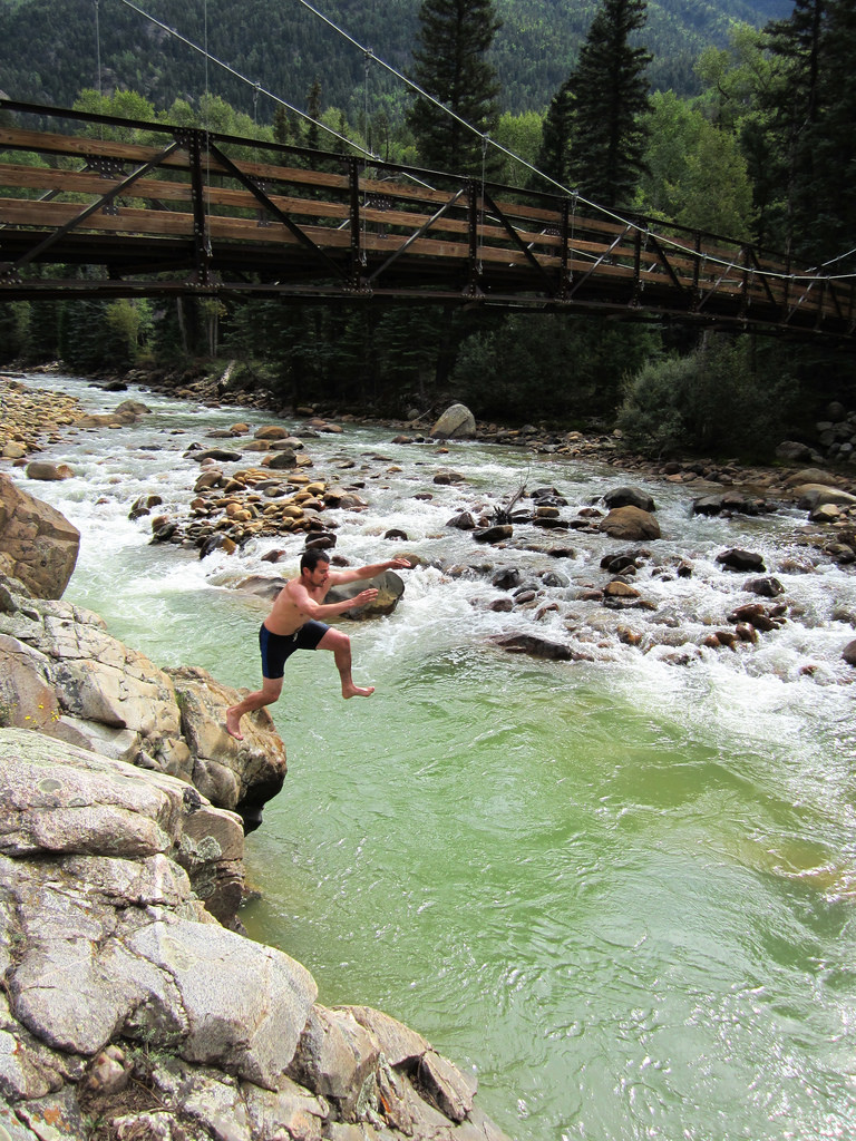
The next day, we had a lot of time to kill waiting for the train at Needleton, September 6th.
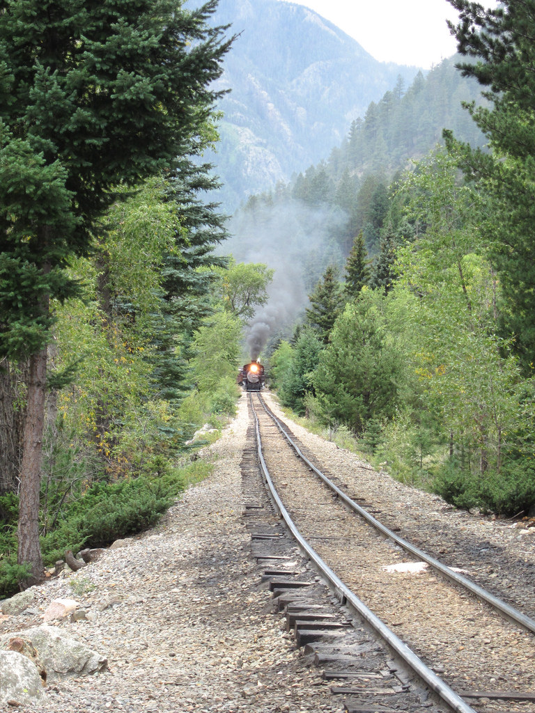
Here comes our ride out.
We slept in and caught the 11:45am train back to Silverton, being sure to enjoy a Steamworks on the ride out. From there we headed to Qdoba in Montrose (there wasn’t a Chipotle in the area, unfortunately) and proceeded to eat enough Mexican food to kill a small horse but not before making an hour long stop at the Wiesbaden Vapor Caves in Ouray. These caves made for a great way to uphold our “Stress Free Approach” as they are ideal for stress relief. Seriously though, I encourage you to check these out sometime if you haven’t already.
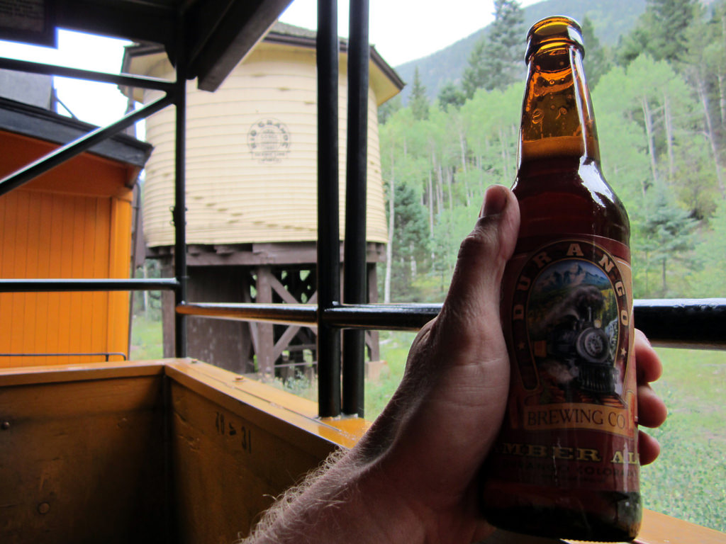
Steamworks.
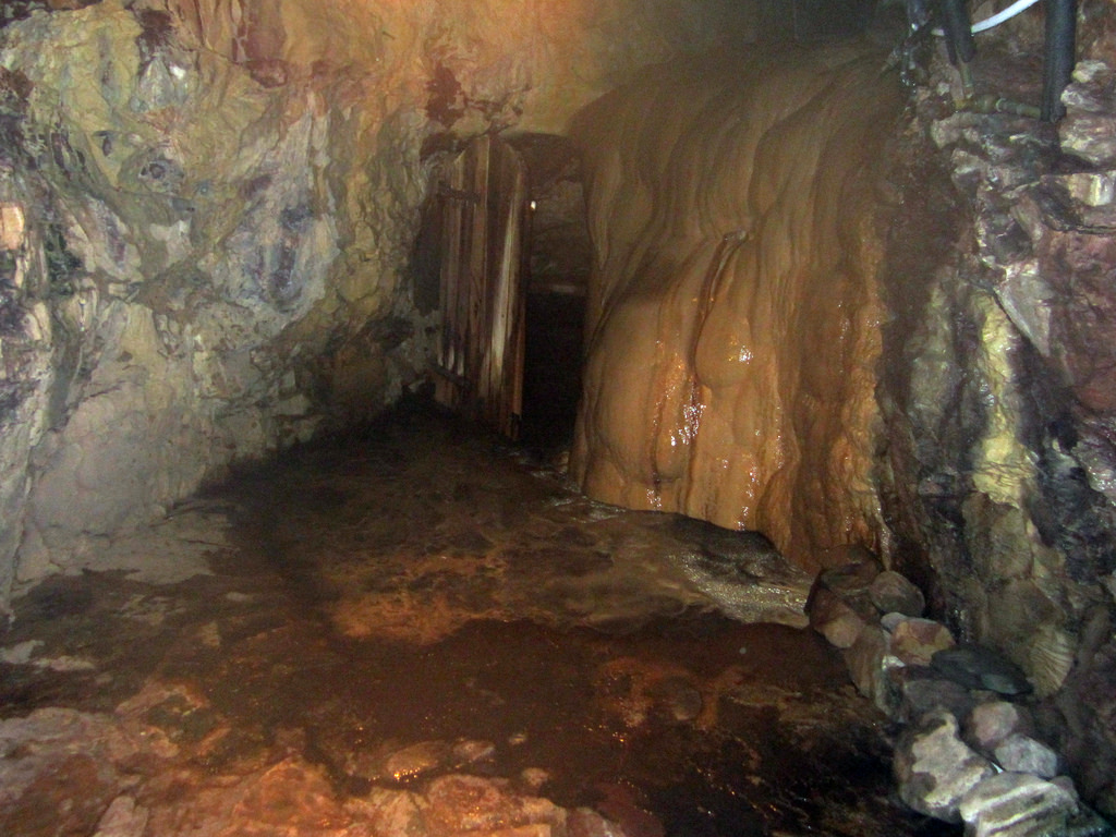
A parting shot of the Wiesbaden Vapor Caves in Ouray.
Looking back on it I can’t really call this anything less than the perfect trip. Great mountains, great people, accomplishments which exceeded expectation, and much, much more all combined into one. I loved every second of being out there, and it wouldn’t be right for me not to thank God for creating such a gorgeous place, as well as for giving me the means to explore it. I’ll look back on this trip with nothing but fond memories for many years to come. Hopefully this TR will help with that, as well as spur others on to similar trips.
Thanks for reading,
Ben
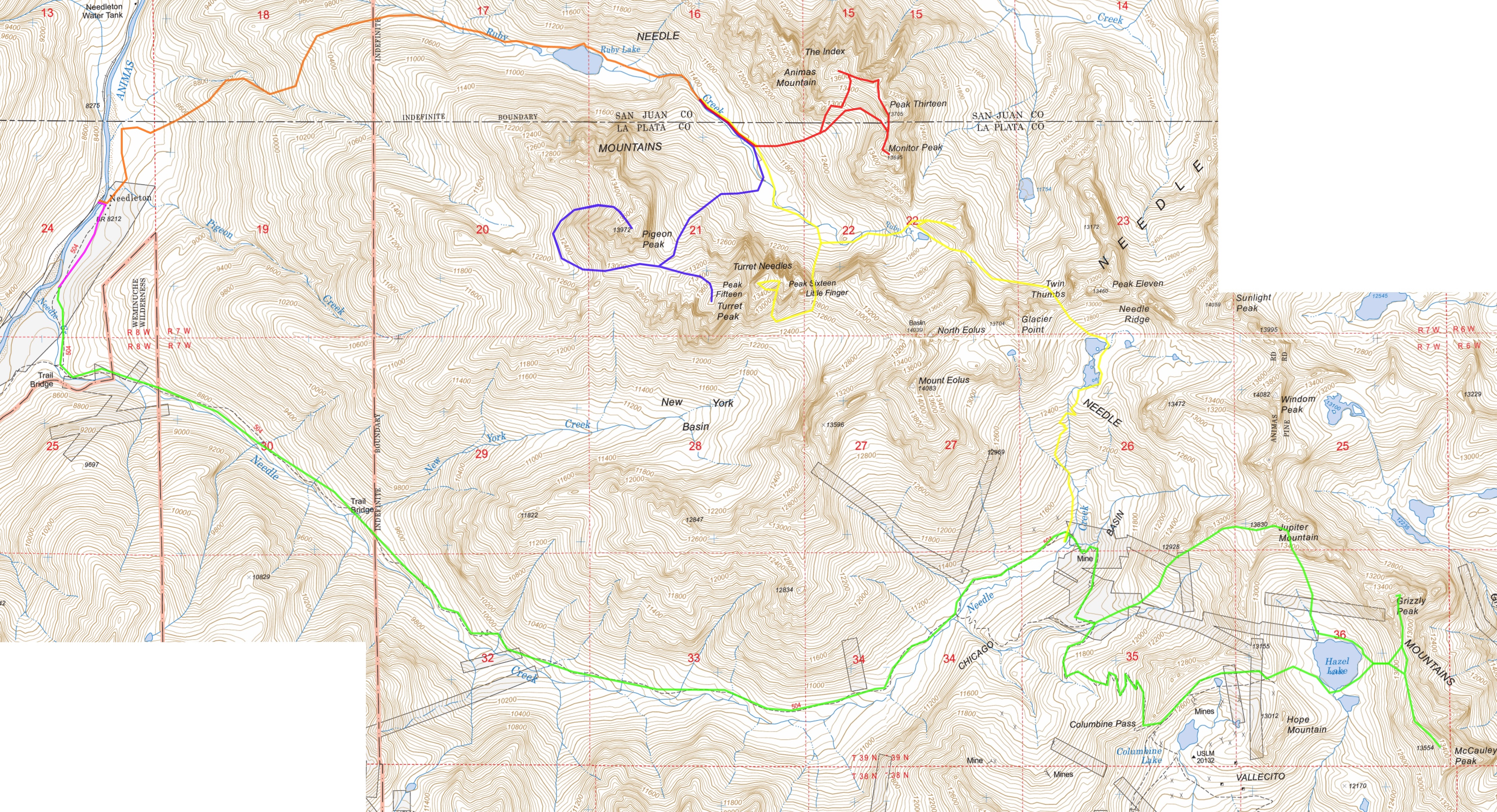
P.s. Below is a map, color coded by day. Total mileage/gain ~ 30 miles, 22,500 ft.

Ben,
What an awesome trip! You guys did an amazing series of peaks…and some tough peaks. Congratulations.
Thanks for posting.
Yup, loved it. If you can’t tell, some of us are looking to head out there in a few weeks!
Thanks for the comments gentlemen! You’ll have a great time up there and Britt, g’luck on P&T!